
 Hiking
Lake Fork River Trail
Hiking
Lake Fork River Trail
South Slope Uinta Mountains
Overview
Unlike many of the other more popular trailheads in the Uintas, the Lake Fork River drainage generally sees lower traffic. The trail ambles up the Lake Fork River for about 13 miles one way before reaching a junction with the Highline Trail. En route, the scenery is good, but the trail doesn't visit any lakes, making it less popular than those trails that have a "destination". It is a good place to go if seeking solitude; the trail seems most used by horse packers. It is also a launching point for longer trips into Ottoson Basin, the Highline, or Brown Duck areas.
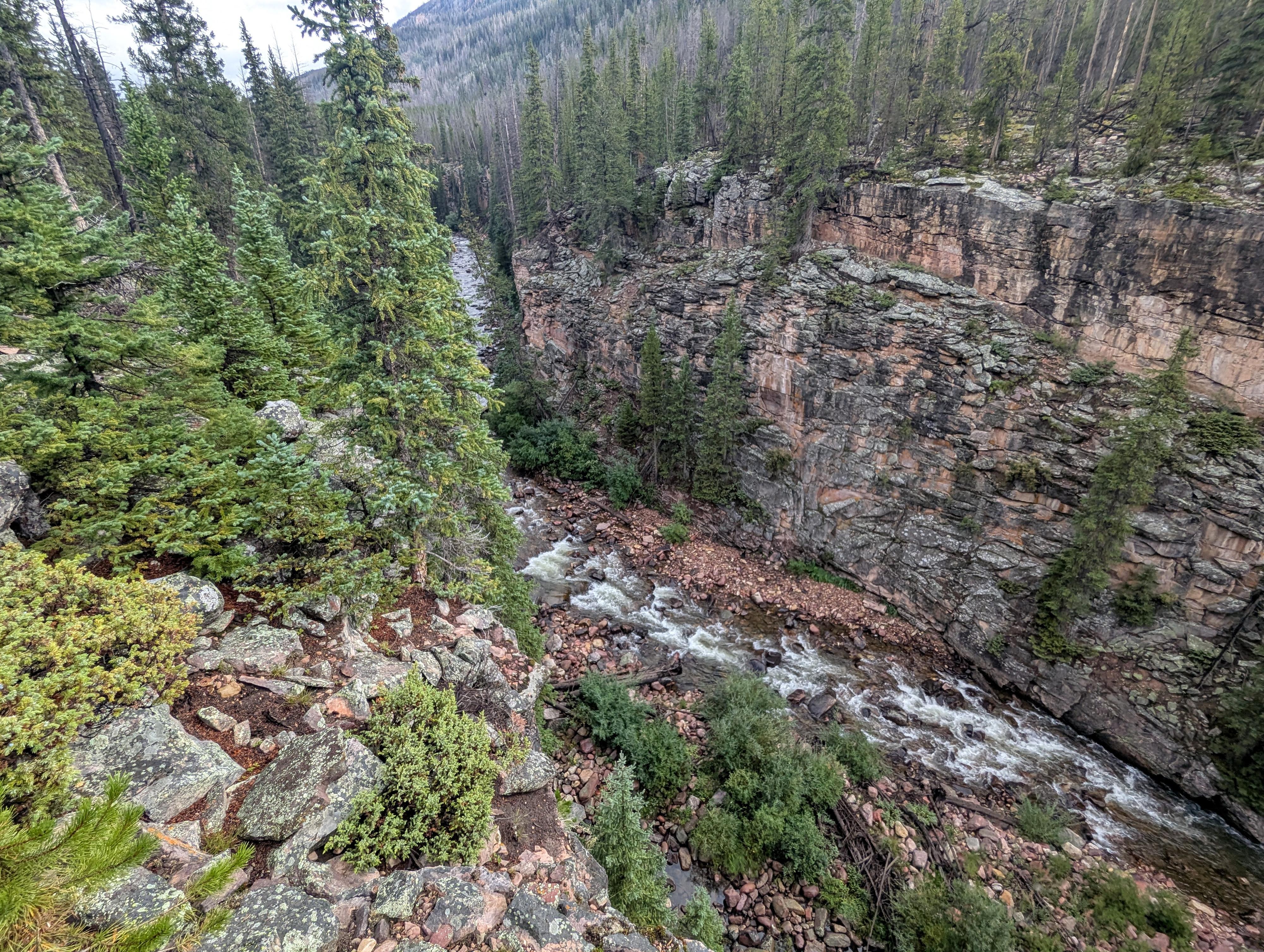
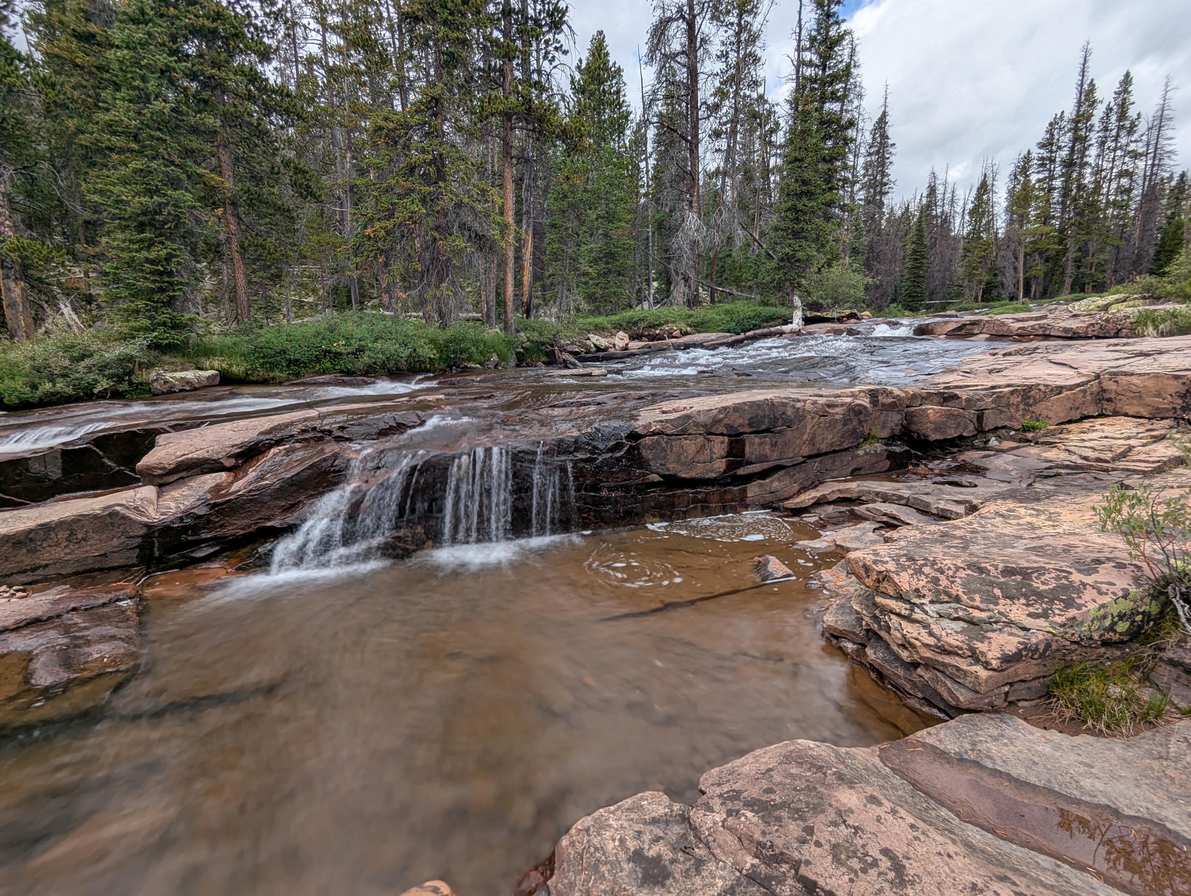
I have mixed feelings about the trail. We found the hiking easy and the gorge that the river has cut beautiful. That being said, I thought the best scenery was fairly high up. Just below the junction with the Highline Trail, the river cascades over large stretches of exposed rock, some of the prettiest cascades I've seen in the Uintas, but it is a long way to reach that area! Once above the Highline Junction, the upper drainage is stunning! My recommendation would be to backpack up to near the Highline Junction, camp there, and spend a day or two in the upper basin before hiking back out. Red Knob Pass is a stunning spot to visit, and some go cross-country to visit Crater Lake as well.
Going up from Moon Lake a few miles to see the lower portion of the gorge would be a good day hike, but to see the best parts, I think it requires a backpack.
Getting There
From downtown Duchesne, turn north on Center Street/UT-87. Follow this for 15.6 miles, then turn left onto the signed Moon Lake Road and reset your odometer.
Follow Moon Lake Road for 3.6 miles to a T-junction. Go right here, then left at 3.8 miles back to heading north.
Continue an additional 14.5 miles to Moon Lake. Once at Moon Lake, continue to just past Moon Lake and just before the campground, where you turn right and drive a short distance to the lake and a parking area. This is the trailhead.
Route Description
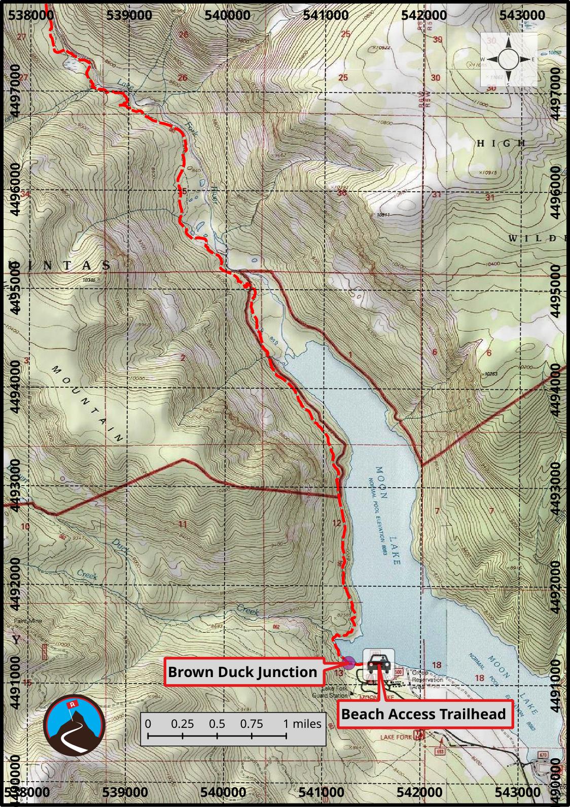
From the trailhead at the edge of Moon Lake, follow the trail as it heads north along the lake. There is a junction right before the trail crosses Brown Duck Creek, with the left going up Brown Duck Basin. Go right instead, which crosses Brown Duck Creek and continues along Moon Lake, though from here the trail moves up higher from the lake shore.
From the trailhead it is about 2.3 miles to the top of Moon Lake, where the trail enters the trees more. The Lake Fork River Gorge is visible in spots to the right. It is an impressive gorge and worth walking over to once in a while when the trail is close to peek in.
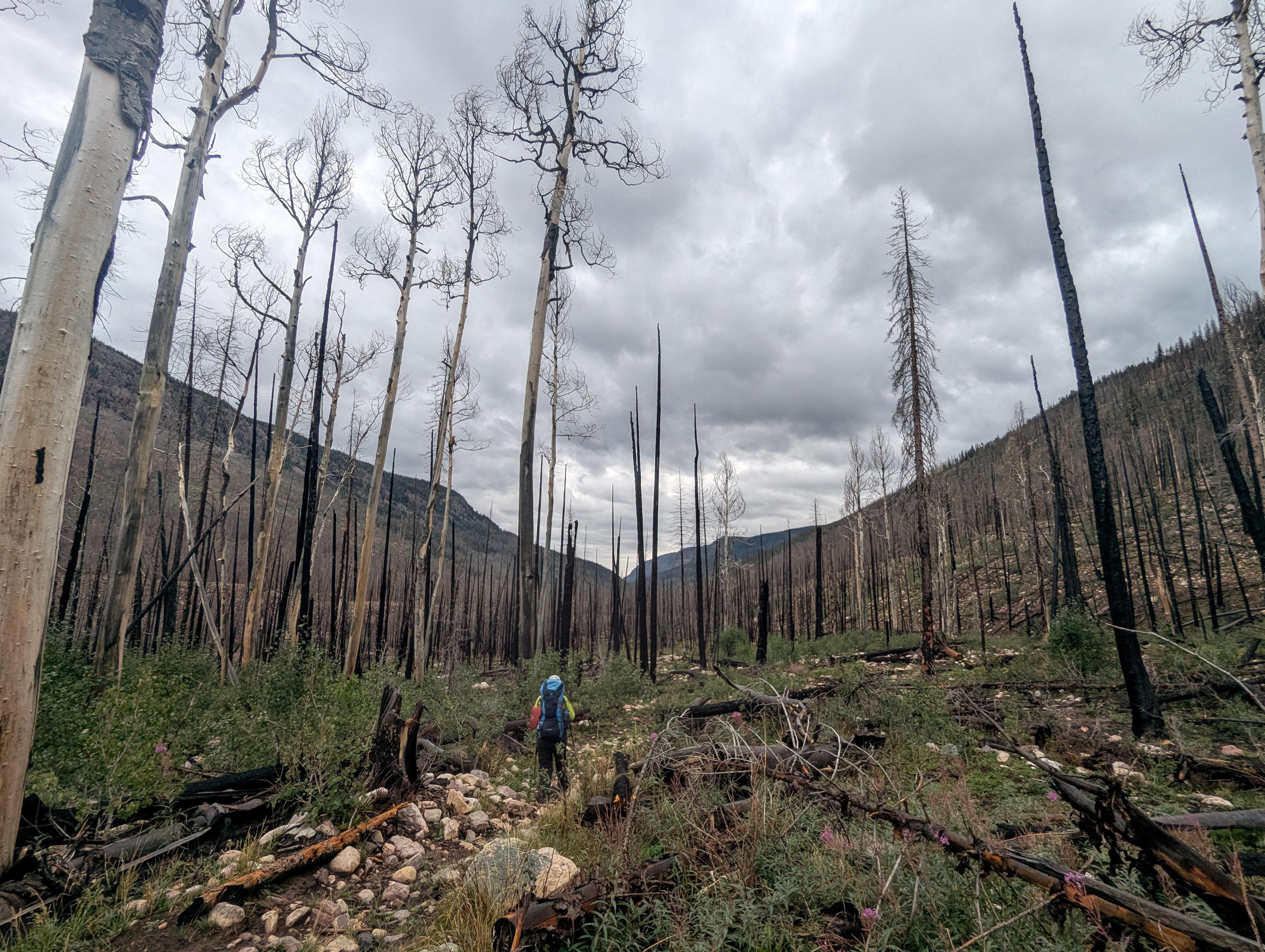
About 3.5 miles from the trailhead the trail passes through the burn scar of the East Fork fire that occurred in 2020. The vegetation is growing back, but it is a bit eerie with all the burned trees.
9.3 miles up Lake River Fork is the junction with Ottoson Basin. Stay right here. Not far above this junction, after crossing a bridge, we found a good campsite next to a grassy area on the right. Campsites become easier to come by above here.
About 13.5 miles from the trailhead is the junction with the Highline Trail. There are quite a few good campsites just below this junction with lovely cascades nearby.
At the Highline Junction, right goes east up to Lambert Meadow and Lambert Lake in about 2 miles and 700 or so feet of elevation gain. It is a pretty area to visit with good camping near Lambert Lake or the small ponds around it.
If you continue left from the Highline Trail junction on the Highline Trail, the trail climbs to the top of the basin and Red Knob Pass. It is about 3.5 miles from the junction to the top of the pass. It is about 2 miles from the junction to tree line. I've camped just above tree line near some springs, and it is a beautiful place to see a sunset or sunrise. Red Knob Pass is also, to me, one of the most beautiful spots in the Uintas. There are plenty of springs in the upper basin, but as always, be sure to filter. They do run sheep in the area in the summer. Some also use the upper basin to go cross country to Crater Lake.
Photos
Maps
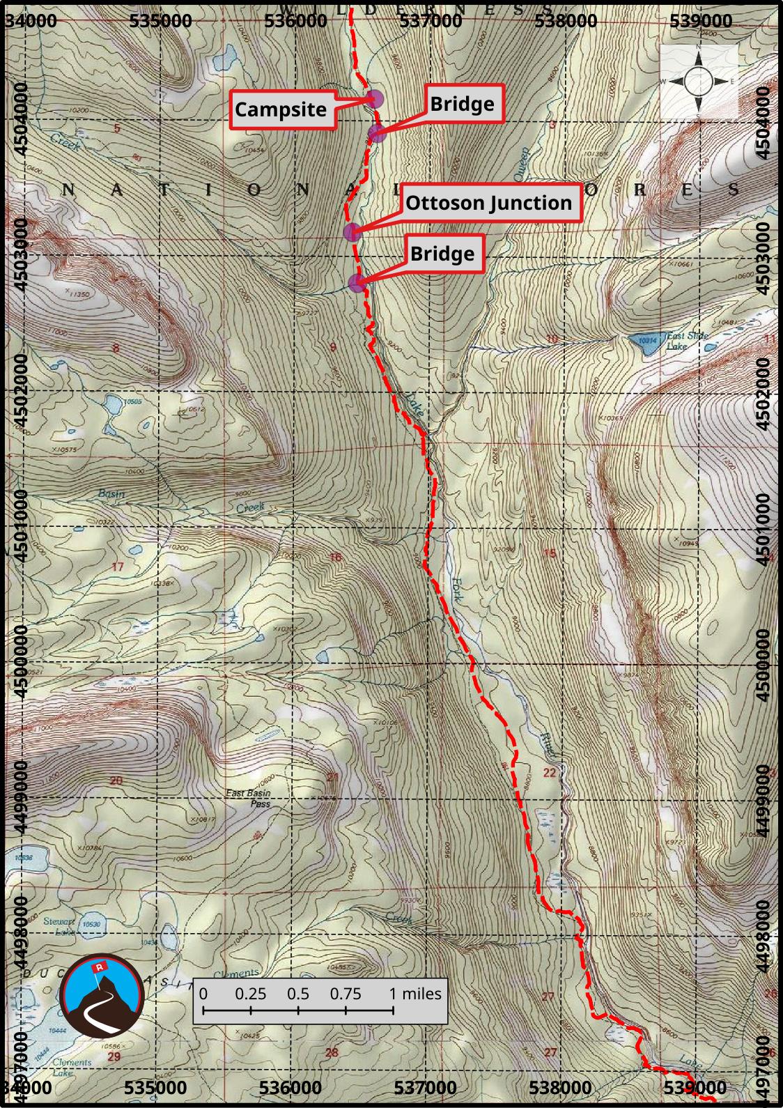
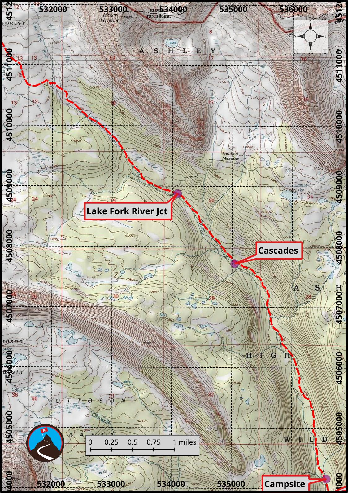
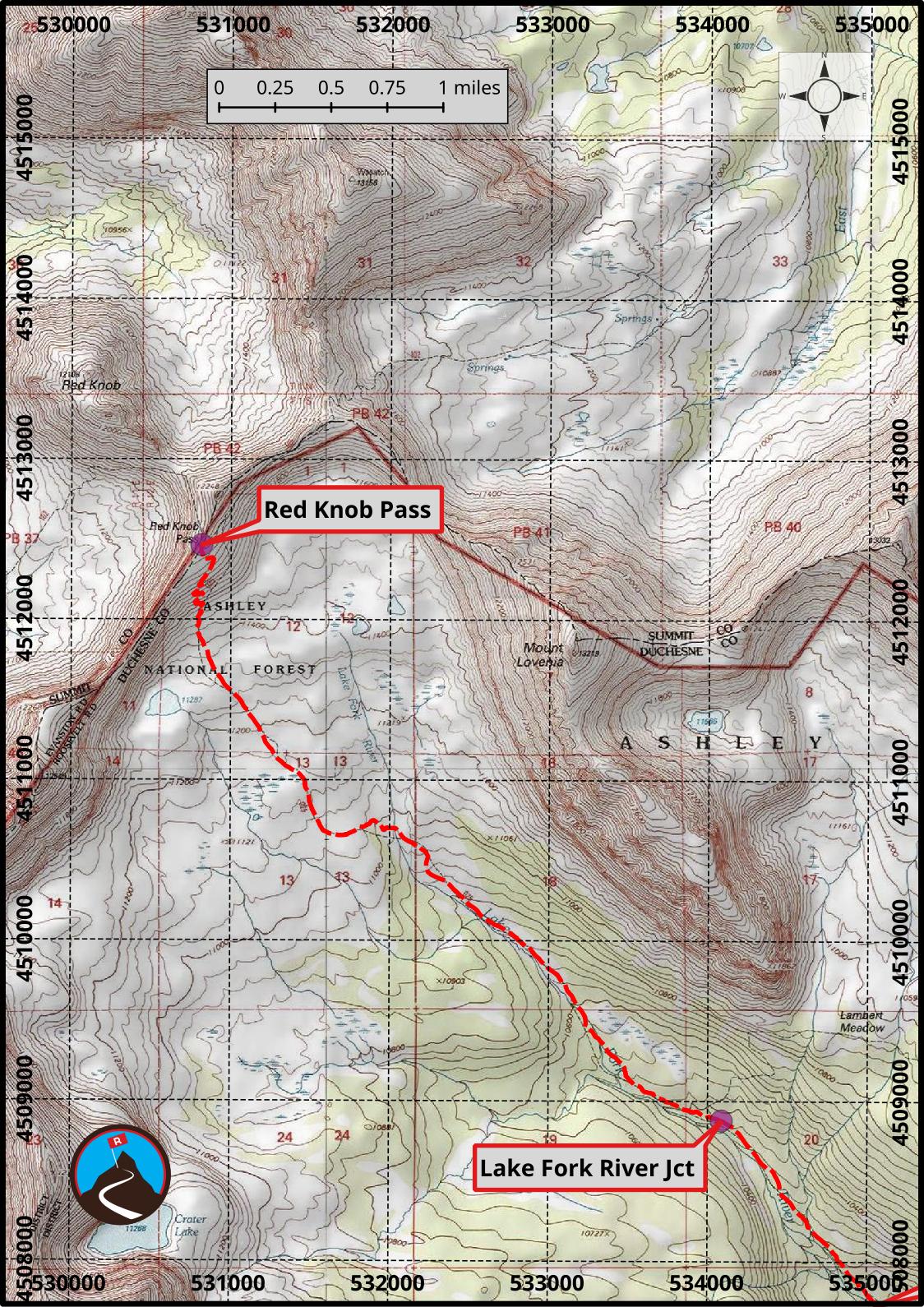
12T 541577E 4491205N
40°34'14"N 110°30'32"W
12T 541269E 4491216N
40°34'15"N 110°30'45"W
12T 536468E 4502801N
40°40'31"N 110°34'07"W
12T 536431E 4503176N
40°40'43"N 110°34'08"W
12T 536609E 4503908N
40°41'07"N 110°34'00"W
12T 536587E 4504160N
40°41'15"N 110°34'01"W
12T 535045E 4507721N
40°43'11"N 110°35'06"W
12T 534088E 4508877N
40°43'48"N 110°35'47"W
12T 530816E 4512464N
40°45'45"N 110°38'06"W