 Roadside Attraction
Cottonwood Wash Spring Panel
Roadside Attraction
Cottonwood Wash Spring Panel
Eastern Reef
Overview
Mon

105°
|
70°
Tue
104°
|
69°
Wed
103°
|
68°
Thu
103°
|
67°
Fri
105°
|
69°
RATING:
Easy Hiking
LENGTH:
Less than an hour (0.2 mile)
MAPS:
Crows Nest Spring, UT;
SEASON:
Any, hot in the summer
WATER:
None.
Mon
105°
|
70°
Tue
104°
|
69°
Wed
103°
|
68°
Thu
103°
|
67°
Fri
105°
|
69°
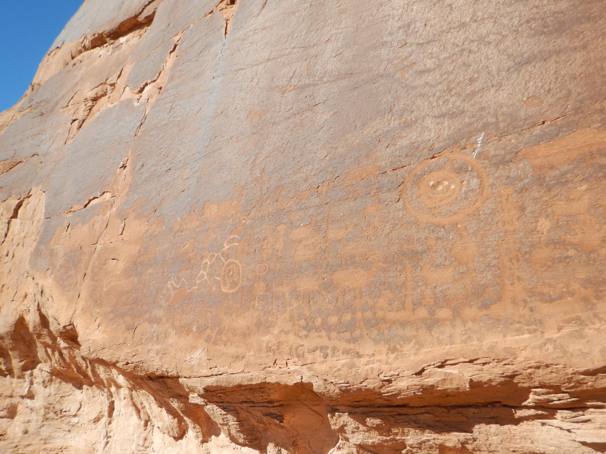
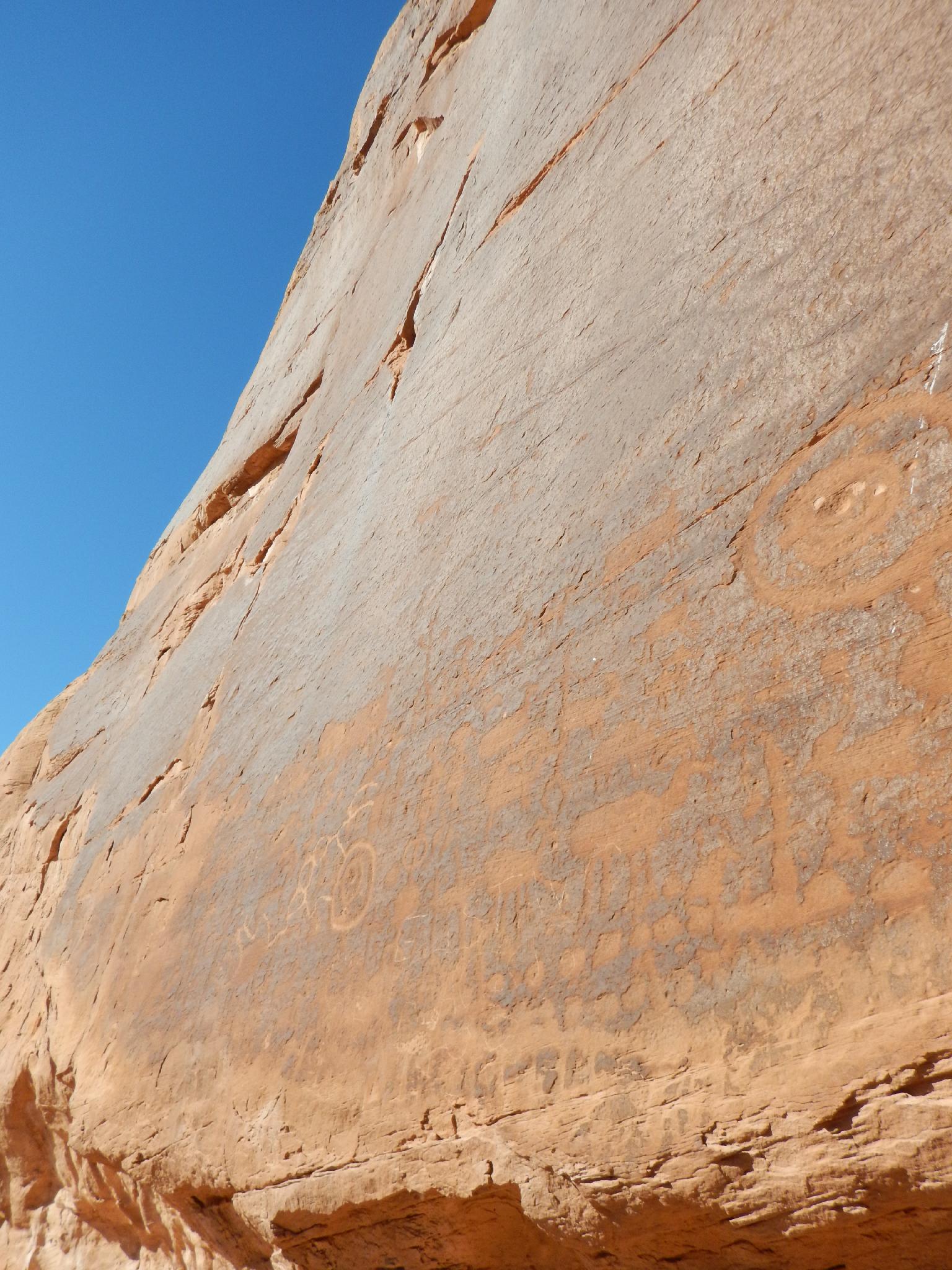
This small panel is downstream from the Cottonwood Wash hike, though makes for a long hike if done as one loop. Visiting each separately is recommended. The panel is ok, but there are many other better panels in the Swell the visit. Save this one for a short visit if you happen to be in the area.
Access Note: The road to the Cottonwood Wash Ruins hike continues and can be used to access this hike, but is very rough in one dugway section near the spring. Not recommended except for 4x4s. The approach road in this description has a couple of rough spots, but should be passable by most high clearance vehicles if carefully driven in a couple of spots.
Getting There
Reaching the trailhead starts by getting to mile post 145.7 on UT-24. If coming from I-70, this is about 15 miles south after taking exit 149 from I-70. If coming from Hanksville, this is about 30 miles north of Hanksville.
Turn off highway and reset odometer.
12S 546546E 4288674N
/
38°44'44"N 110°27'52"W
0.9 miles - Stay left on main dirt road.
12S 547947E 4288239N
/
38°44'30"N 110°26'54"W
4.1 miles - Stay right.
12S 551158E 4284669N
/
38°42'33"N 110°24'42"W
5.5 miles - Stay left. The road begins descending into Cottonwood Wash
12S 552451E 4282789N
/
38°41'32"N 110°23'49"W
5.6 miles - Small road on the right. Take it. This can be walked if needed.
12S 552555E 4282593N
/
38°41'25"N 110°23'45"W
6.1 miles - Trailhead. Park at the fence.
12S 552260E 4282037N
/
38°41'07"N 110°23'57"W
Route Description
Rock Art and Historic Site Etiquette
Rock art and historic sites are fragile, non-renewable cultural resources that, once damaged, can never be replaced. To ensure they are protected, please:
Rock art and historic sites are fragile, non-renewable cultural resources that, once damaged, can never be replaced. To ensure they are protected, please:
- Avoid Touching the Petroglyphs: Look and observe, BUT DO NOT TOUCH!
- Stay on the Trails: Stay on the most used trails when visiting sites, and don't create new trails or trample vegetation.
- Photography and Sketching is Allowed: Do not introduce any foreign substance to enhance the carved and pecked images for photographic or drawing purposes. Altering, defacing, or damaging the petroglyphs is against the law -- even if the damage is unintentional.
- Pets: Keep pets on a leash and clean up after them.
- Artifacts: If you happen to come across sherds (broken pottery) or lithics (flakes of stone tools), leave them where you see them. Once they are moved or removed, a piece of the past is forever lost.
From the trailhead, cross the fence and follow a side trail up to the cliff along the edge of the wash. The panel is here.
Maps
Printable Maps:


Trailhead
12S 552260E 4282037N
38°41'07"N 110°23'57"W
Panel
12S 552195E 4281990N
38°41'06"N 110°23'60"W