 Roadside Attraction
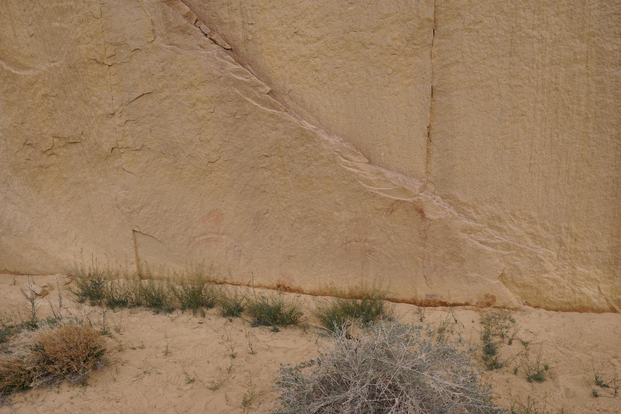
Lone Warrior Pictograph
Roadside Attraction
Lone Warrior Pictograph
Central Swell
Overview
Lone Warrior Pictograph is one of my favorite pictograph panels in the Swell. I will admit to generally having tastes that lean toward minimalistic design. This single red warrior with its shield, spear, and other intricacies stands out in the sea of sandstone that surrounds it. In my opinion, it is a stunning work of art. My compliments go to its creator! I would love to know if the artist was a warrior, or perhaps the partner of a warrior, or aspiring warrior?
With easy access, good camping nearby, and terrific scenery, this is a panel I highly recommend. If visiting, be sure to checkout Swaseys Cabin and Dutchman Arch/Locomotive Point. All are within a few minutes drive of the panel and can round out a day or weekend trip to the area.
Getting There
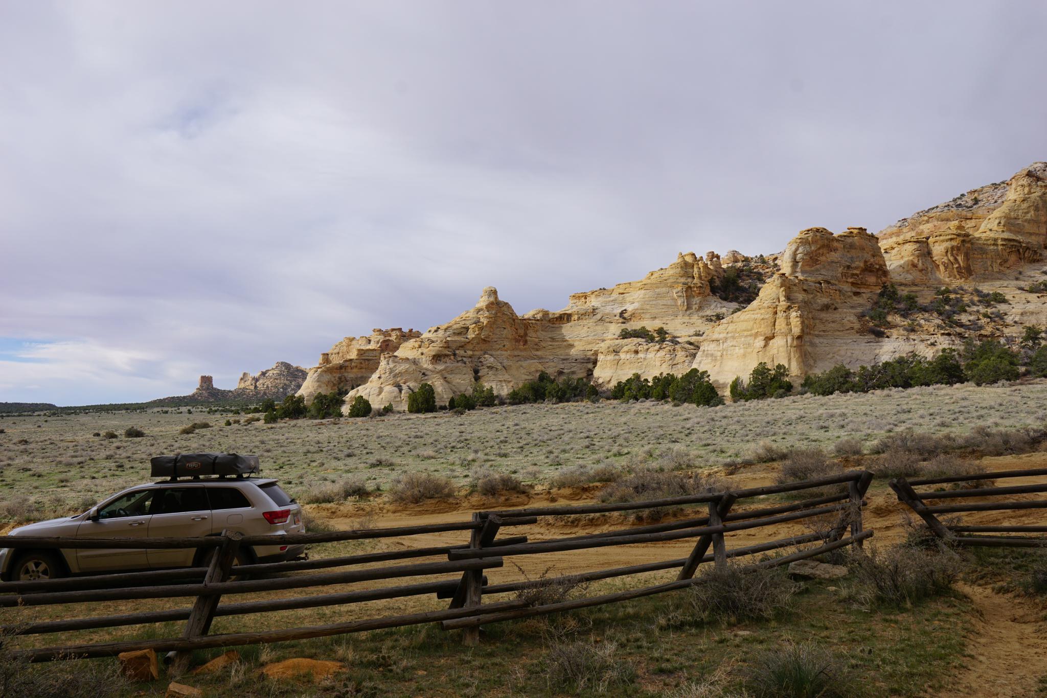
Take exit 131 from I-70 (about 30 miles west of Green River). Go south off the freeway.
Route Description
Rock art and historic sites are fragile, non-renewable cultural resources that, once damaged, can never be replaced. To ensure they are protected, please:
- Avoid Touching the Petroglyphs: Look and observe, BUT DO NOT TOUCH!
- Stay on the Trails: Stay on the most used trails when visiting sites, and don't create new trails or trample vegetation.
- Photography and Sketching is Allowed: Do not introduce any foreign substance to enhance the carved and pecked images for photographic or drawing purposes. Altering, defacing, or damaging the petroglyphs is against the law -- even if the damage is unintentional.
- Pets: Keep pets on a leash and clean up after them.
- Artifacts: If you happen to come across sherds (broken pottery) or lithics (flakes of stone tools), leave them where you see them. Once they are moved or removed, a piece of the past is forever lost.
From the trailhead, the first fenced off area surrounds a very faint petroglyph. It is worth the 1-minute side trip it takes to visit, but in my opinion not particularly interesting.
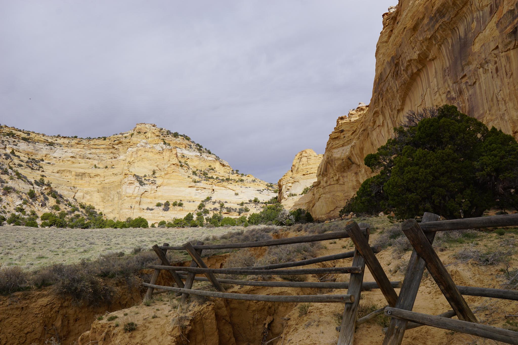
To visit the Lone Warrior, follow the now blocked off road west along the cliff base to the next fenced off area. The Lone Warrior is in this second fenced off area. It is generally south facing and has had good light every time I have visited, though I think morning light is a bit better.
Maps

12S 517720E 4300188N
38°51'01"N 110°47'45"W
12S 517120E 4300454N
38°51'10"N 110°48'10"W
12S 517131E 4300465N
38°51'10"N 110°48'09"W
12S 517020E 4300515N
38°51'12"N 110°48'14"W