Swasey's Cabin | Central Swell

Roadside Attraction Swasey's Cabin - Central Swell Roadside Attraction Swasey's Cabin

Central Swell

Overview

RATING: Roadside Attraction
LENGTH: 1+ hours
MAPS: SAN RAFAEL KNOB, UT

Sun

Sunny, with a high near 81. Southwest wind 6 to 17 mph.

81 | 58

Mon

Sunny, with a high near 84.

84 | 60

Tue

Mostly sunny, with a high near 83.

83 | 63

Wed

A slight chance of showers and thunderstorms after noon. Mostly sunny, with a high near 82.

82 | 61

Thu

A chance of showers and thunderstorms after noon. Mostly sunny, with a high near 78.

78 | 60

View Full Weather Details
SEASON: Any, though summers can be hot. Roads can be impassable if there is much snow.
WATER: None

Sun

Sunny, with a high near 81. Southwest wind 6 to 17 mph.

81 | 58

Mon

Sunny, with a high near 84.

84 | 60

Tue

Mostly sunny, with a high near 83.

83 | 63

Wed

A slight chance of showers and thunderstorms after noon. Mostly sunny, with a high near 82.

82 | 61

Thu

A chance of showers and thunderstorms after noon. Mostly sunny, with a high near 78.

78 | 60

View Full Weather Details
Abby checking out the cabin

Abby checking out the cabin

The Swasey brothers, Joe, Sid, Charley, and Rod, were some of the early cattlemen that explored the San Rafael Swell while running cattle there in the late 1800s and early 1900s. You find their names on many features in the Swell such as Sid and Charley Tower, Joe and His Dog, Sid's Leap, etc. The stories and places they have roamed have given them a larger than life persona in my mind. It is hard to imagine wandering the Swell when it was so remote and little known.

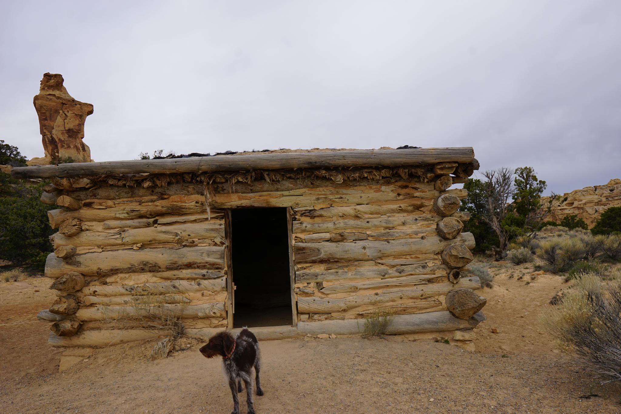
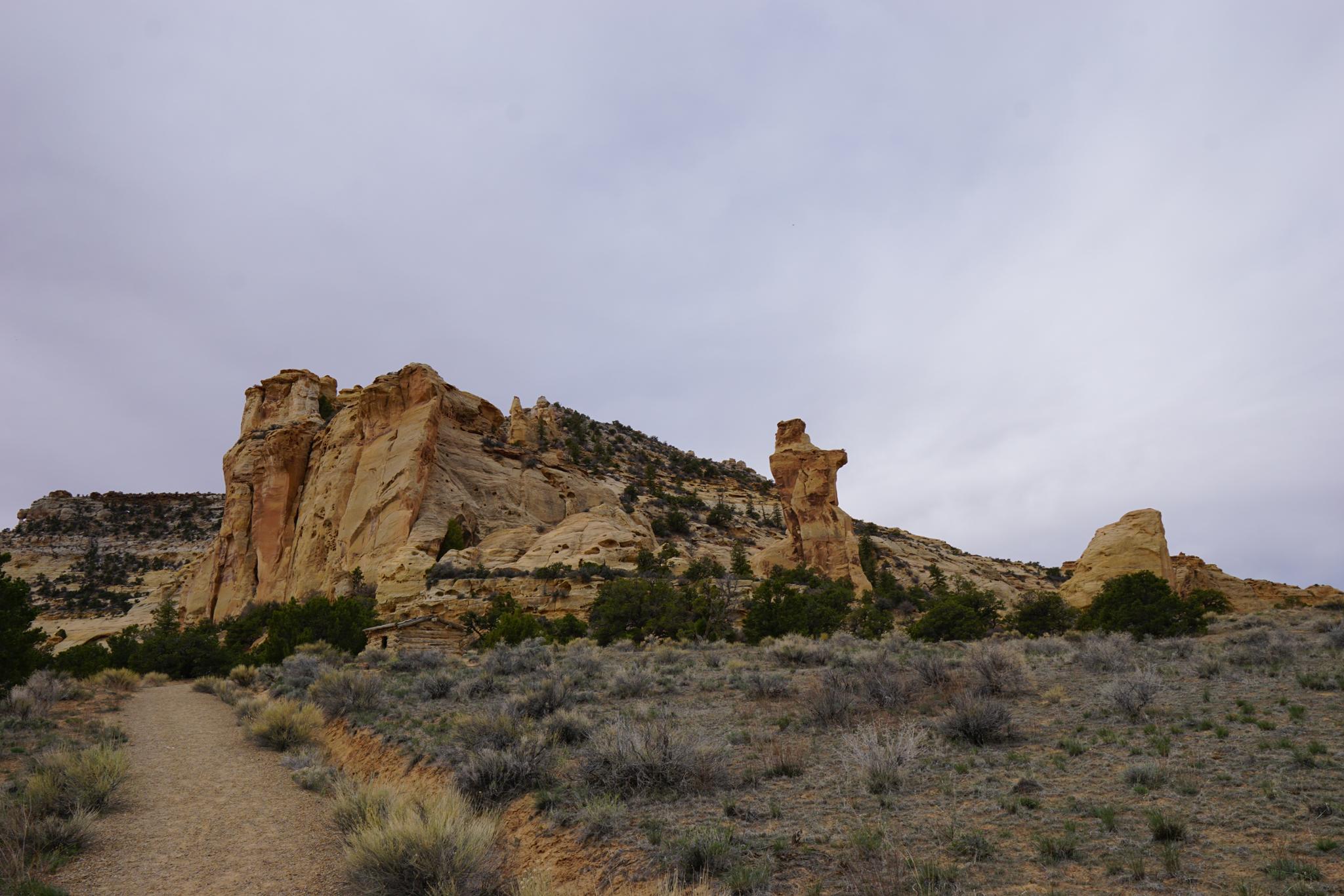
In 1921, Joe Swasey built what is known as Swasey's Cabin in the heart of the Swell. The cabin was to be used as shelter by the Swasey's and other cowboys when running cattle in the area. Almost 100 years later, the cabin still stands in its picturesque spot near Broken Cross Tower. It is a fascinating historical place to visit.

The picturesque setting of Swasey's Cabin

The picturesque setting of Swasey's Cabin

Getting There

Take exit 131 from I-70 (about 30 miles west of Green River). Go south off the freeway.

  • Reset your odometer at the cattleguard after getting off I-70. ( 12S 529653E 4303574N / 38°52'50"N 110°39'29"W )
  • 3.95 miles - Turn right. Signed Swasey Cabin. ( 12S 525563E 4299464N / 38°50'37"N 110°42'20"W )
  • 5.0 miles - T-Junction, go right. ( 12S 524103E 4298697N / 38°50'12"N 110°43'20"W )
  • 6.7 miles - Good side road on the left. STAY RIGHT. ( 12S 521720E 4299944N / 38°50'53"N 110°44'59"W )
  • 7.65 Miles - Junction - Stay right. ( 12S 520577E 4300717N / 38°51'18"N 110°45'46"W )
  • 8.5 miles - Junction - Stay left. Right goes to Dutchman Arch/Locomotive Point. ( 12S 519543E 4301501N / 38°51'44"N 110°46'29"W )
  • 10.0 miles - Side road on the right to Lone Warrior Pictograph. Stay left for Swasey Cabin. ( 12S 517721E 4300189N / 38°51'01"N 110°47'45"W )
  • 10.7 miles - Jct, go right. ( 12S 517774E 4298971N / 38°50'22"N 110°47'43"W )
  • 11.4 miles - Swasey Cabin ( 12S 516761E 4298620N / 38°50'10"N 110°48'25"W )
The icebox trail. Joe's Office is visible as the alcove area on the right.

The icebox trail. Joe's Office is visible as the alcove area on the right.

Route

From the parking area and pit toilet, the cabin is visible a short distance down the trail. Behind the cabin is Broken Cross Tower.

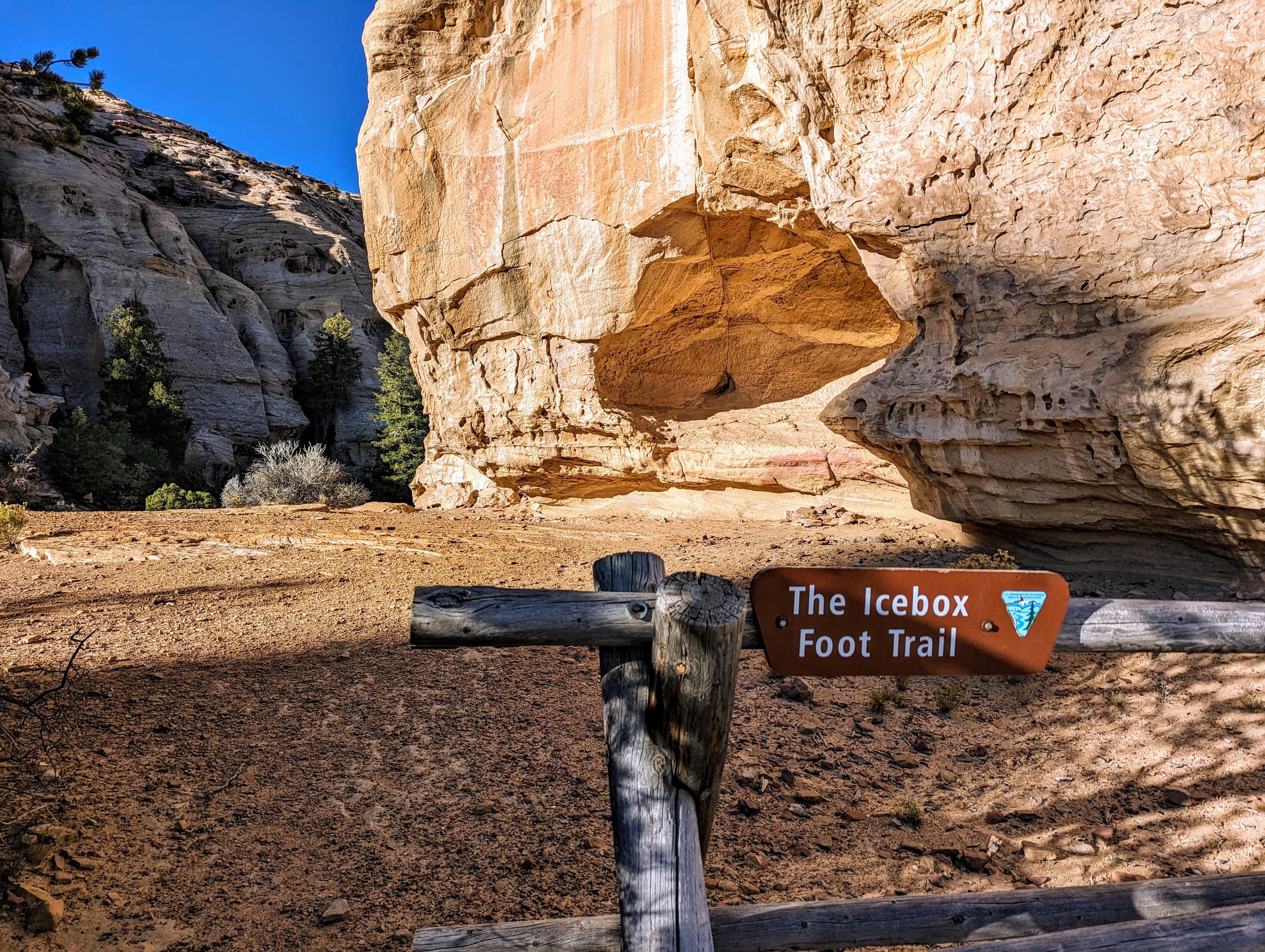
No visit to Swasey's Cabin is complete, in my opinion, without visiting the Ice Box, especially if it is a hot day. From the cabin, head west on the well-defined trail. It passed Broken Cross Tower, then intersects the jeep road that goes into Eagle Canyon. Go left on the jeep road about 2 minutes (0.1 miles) to a log fence trailhead signed the Icebox Trail. The sandstone dome that marks the trailhead has a small cave on the east side that you walk by. Joe Swasey, at one point, had a floor built in there, and it was known as Joe's Office before the cabin was built.

Take the Icebox trail a short distance. It passes an old fence and trough. Just beyond the trough is a narrow canyon ("cave") that is interesting to squeeze up into. From the first "cave", the social trail goes west a very short distance around the corner to another "cave". I am unsure which one, or maybe both, are referred to as the Icebox. An interesting place to visit!


Maps

Printable Maps:

Trailhead

12S 516748E 4298618N

38°50'10"N 110°48'25"W

Cabin

12S 516722E 4298549N

38°50'08"N 110°48'26"W

Icebox Trailhead

12S 516477E 4298552N

38°50'08"N 110°48'37"W

Comments

Want to make a comment? Login and let yourself be heard.