 Canyoneering
Seagers Window Canyon
Canyoneering
Seagers Window Canyon
Southern Swell
Overview
This is a canyon that the few people that I knew to have done it had left me with the impression that it would be a dud; not worth the time or energy. So, when I visited, I had fairly low expectations. As often happens in life I suppose, having low expectations led me to be very pleasantly surprised!
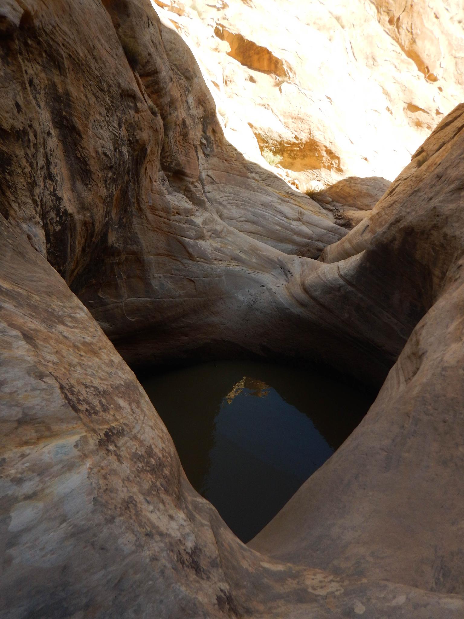
Seager's Window Canyon, though not nearly as narrow as its neighbor Seager's Hole/The Squeeze, has larger and much more ominous keeper potholes. The difficult potholes are passable with interesting climbing around the sides. If the canyon were as narrow as the Squeeze, without the climb arounds, the keeper potholes would pose one of the more difficult pothole canyons in the Swell!! The potholes are immense and interesting. Attacking the potholes directly would be a very difficult endeavor without much to work with for anchors or throws.
All-in-all I found the canyon charming. I would recommend this canyon only to advanced canyoneers with some climbing experience. None of the climbing is particularly difficult but there are some exposed moves and a fair bit of route finding/anchor building work required.
Also, anchors seem to be worn, so bring extra webbing. Especially the final anchor rubs on edge and will need to be replaced often requiring quite a bit of webbing.
Getting There
From Hanksville, go west on UT-24 toward Torrey/Capitol Reef about 10.5 miles to between mile post 105 and 106. Turn north here, on the well maintained Factory Butte Road (labeled 6650 East).
Route Description
Approach (4.5 miles / 2-4 hours greatly depending on fitness and route finding from the rim to canyon floor)
From the trailhead, head up along Muddy Creek. Staying on the left bank, you can keep your feet dry for the entire approach. Once at the base of the Moroni Slopes, look for a social trail heading up.
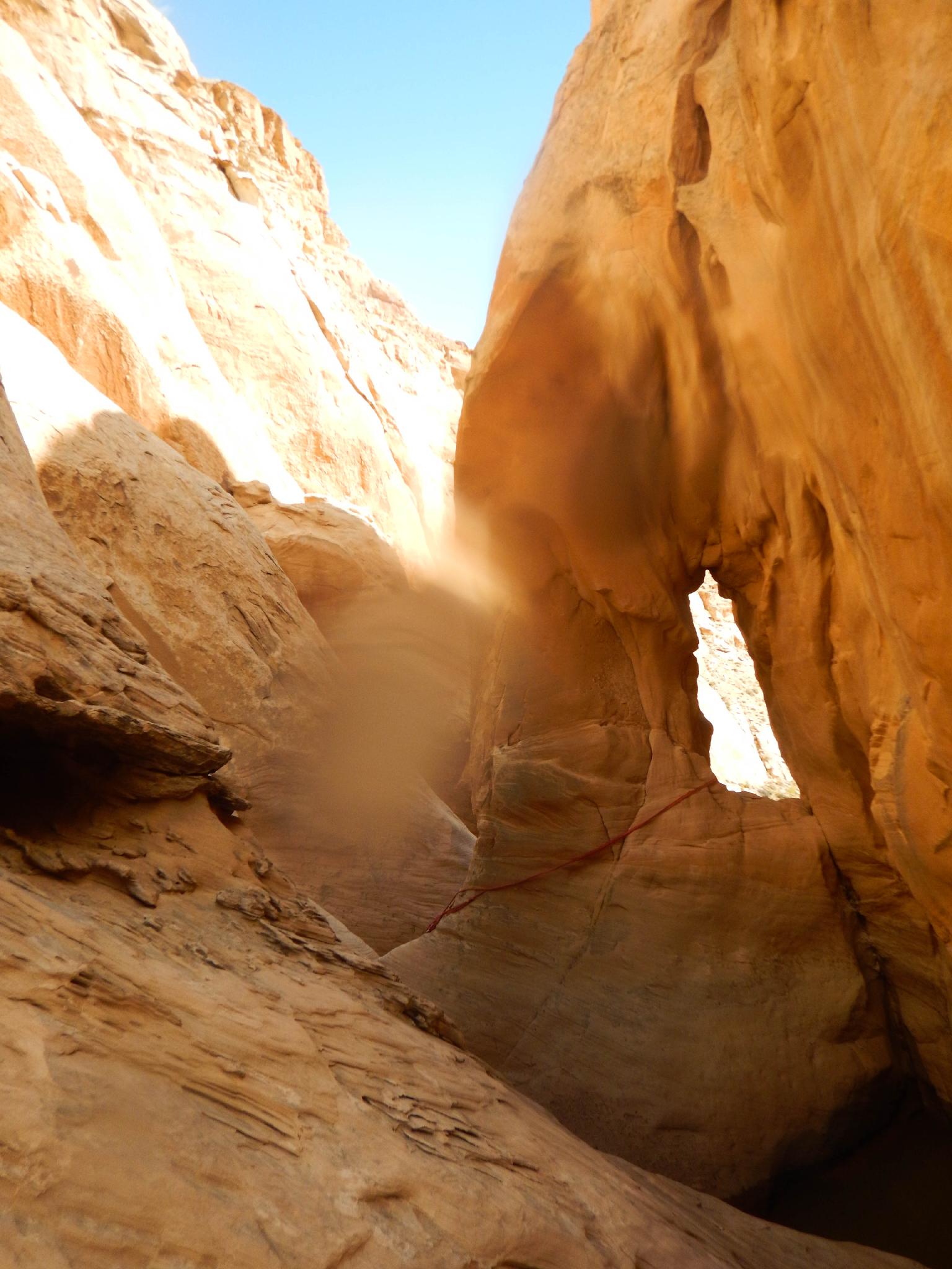
There are a couple of trails; both are fairly well defined, and easy to spot if you look for them. Either works fine. The trails climb steeply for 5-10 minutes, then eases up a bit and continues a slow and steady march up the Moroni Slopes. The trails coalesce part way up and continue to near the edge of Seagers Window, then up to a narrow ridge separating Seagers Window (on the left) from the Squeeze (on the right).
Follow the ridge out to a point, where it overlooks a slickrock dome a short distance ahead. The entrance for Seagers Window is just below the dome. Go back a minute on the ridge, drop off the north side (The Squeeze Canyon side), and follow the social trail around to the saddle between the ridge and the slickrock dome.
From the saddle, there were a couple of different sets of cairns. I assume either set of cairns works, but I chose the up canyon route described here.
Down Canyon (1 mile / 2-3 hours)
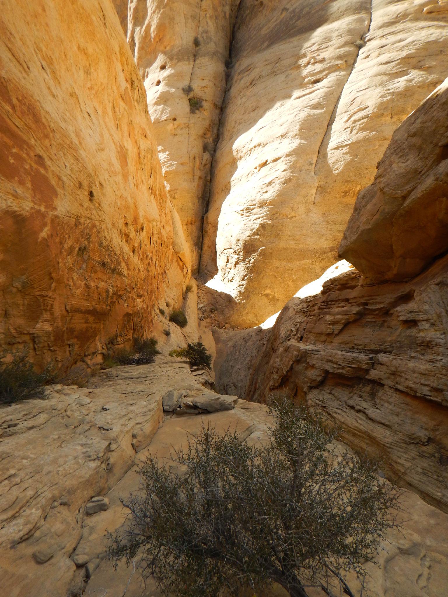
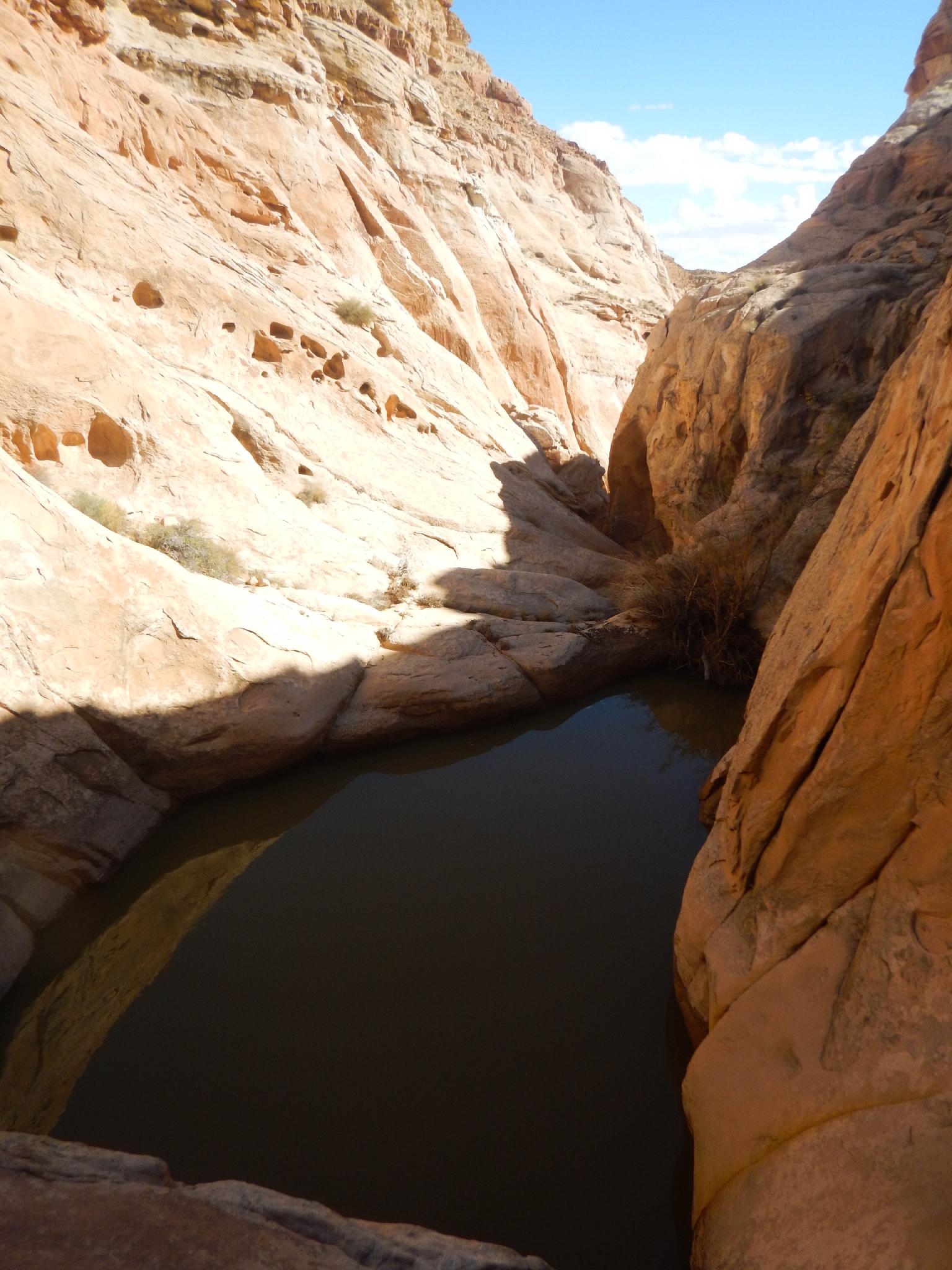
From the entrance, as you head down the canyon, a delightful narrow section leads to a much more open area. This first section had pools to knee deep when I visited and didn't appear to hold much more water than that.
Continuing down is easy going until a drop into a pool is encountered that looks just big enough to deter most from downclimbing. Depending on water level and group skill, this short drop can be partner assisted or rappelled. Either way, this marks the start of the technical section. Suit up at the first major pool you encounter.
Rappel 1 - (10 m ( 33 ft. )) Just beyond this first obstacle is a drop into a pool. A slightly slabby traverse on the left leads to several anchor possibilities for a short rappel down to the pool. This one is not a keeper.
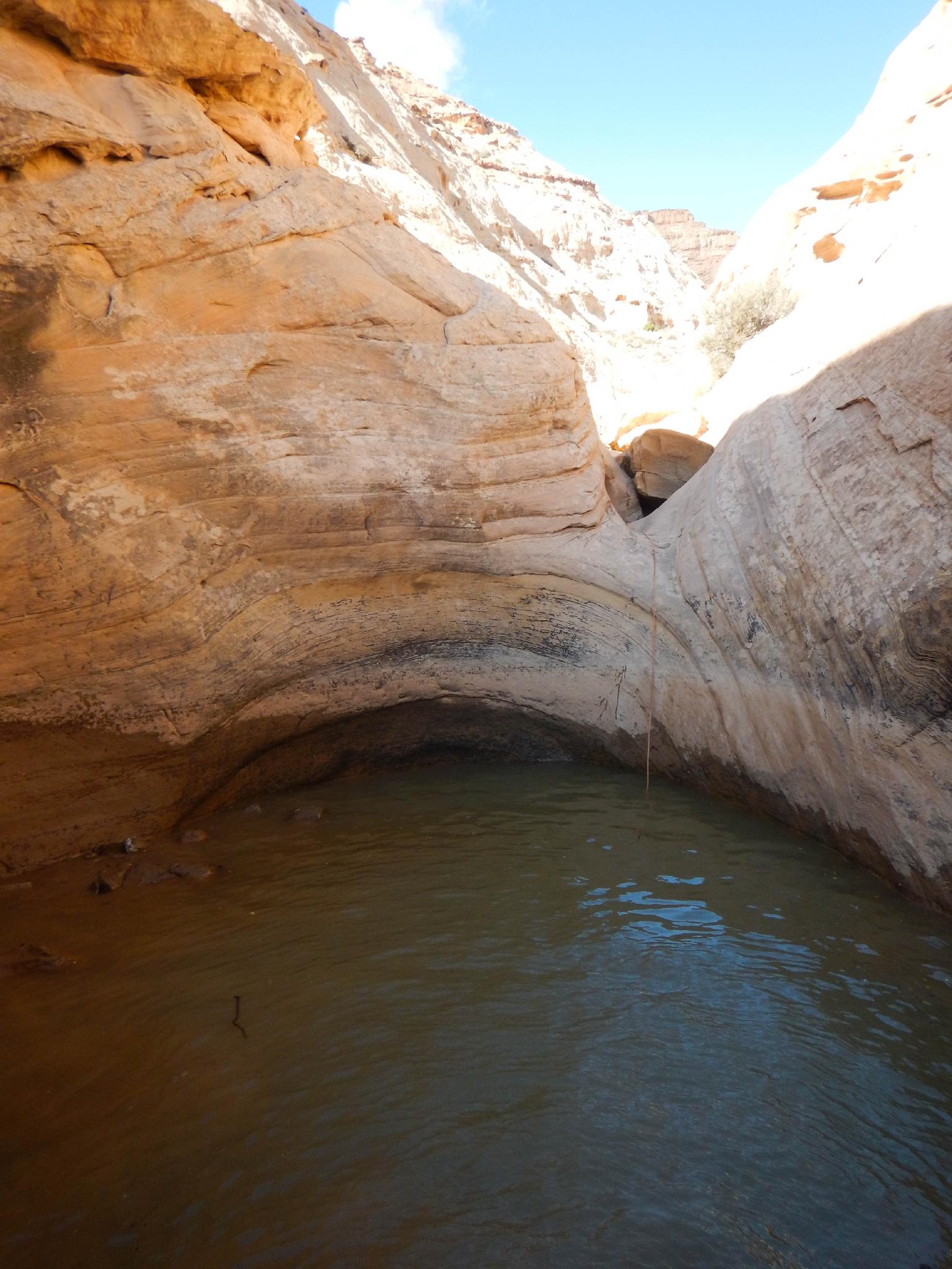
Rappel 2 - (25 m ( 83 ft. )) The first true keeper is the obvious next huge pool. Instead of going in, climb on the crack/gully on the right. This is a fairly easy scramble. Follow it up, then down the other side. You may want to rappel off the bush at the apex.
The second rappel deposits you either in the pool or on the edge of the pool in the watercourse. A slabby traverse can be used to avoid the pool altogether. The traverse was my route and seemed pretty reasonable.
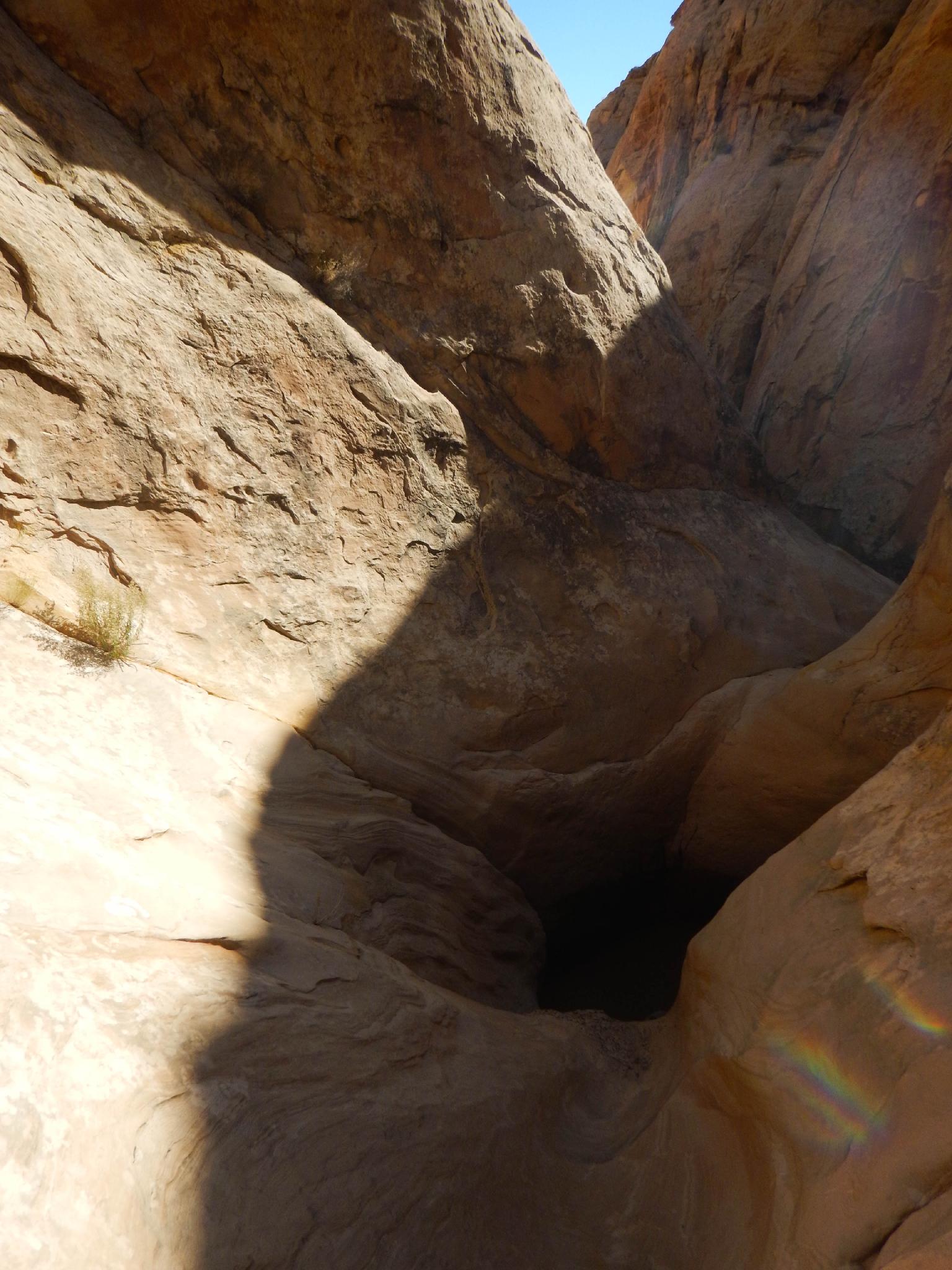
Rappel 3 (15 m ( 50 ft. )) - A straight section leads to the quite pretty 3rd rappel. Just after rappel #3 is another keeper.
Rappel 4 (25 m ( 83 ft. )) - Again, climb up and right to avoid the keeper, then rappel in just below it. On my trip, the anchor for this rappel was a wedged chockstone. Inspect it carefully, then rappel down to the edge of a semi-keeper (on the downstream side, no escape needed), then continue all the way to the canyon floor.
Rappel 5 - (10 m ( 33 ft. )) This is a short rap into an immense pool just before the final rappel. This (as of 2016) has a large tamarisk and some logs washed up at the far end that makes the escape from the pool very easy.
Rappel 6 - (55 m ( 181 ft. ) total) This rappel is at Seager's Window and drops to an immense pothole. A convenient ledge on the left allows for easy escape. Continue the rappel another 10 m ( 33 ft. ) to the bottom.
Exit (3.7 miles / 1.5 hours)
Technical section is over, take off wetsuits and harnesses here. Heading down the canyon, several minor keeper potholes and pools dot the path, but are all easy to bypass on one side or the other. Once through the Navajo layer, the canyon drops down an interesting rock slab and is easy walking to Salt Wash. At the wash, go left to return to Muddy Creek, then down Muddy Creek and back to the trailhead.
Maps

12S 508486E 4264628N
38°31'48"N 110°54'09"W
12S 505742E 4265047N
38°32'02"N 110°56'03"W
12S 503322E 4265571N
38°32'19"N 110°57'43"W
12S 504294E 4264697N
38°31'50"N 110°57'03"W