 Hiking
Lookout Peak
Hiking
Lookout Peak
Emigration Canyon
Overview
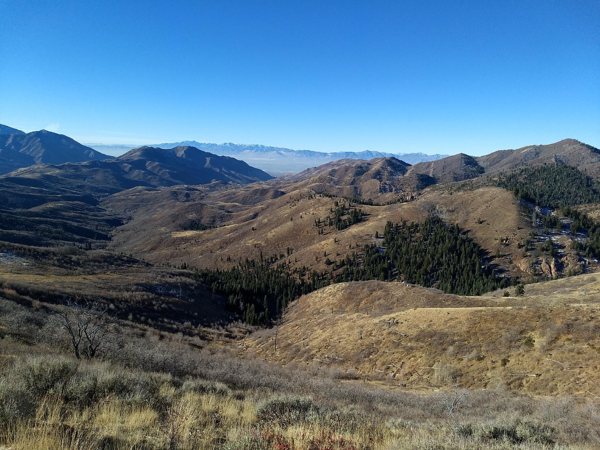
Lookout Peak overlooks Emigration and City Creek Canyons. The Lookout Peak hike is a moderately strenuous hike, with about 2700 feet of elevation gain to the summit, but much of the hike has outstanding views of the Salt Lake Valley and surrounding mountains. If you like ridge hikes with expansive views, I highly recommend this one.
The route is commonly done from either Killyon or Affleck Park. The Affleck Park route is shorter than the Killyon approach, and in my opinion quite a bit better. It is a quick climb to the ridge and start of the excellent views. The downside to Affleck Park is dogs are not allowed in Mountain Dell Canyon, and thus not on that section of trail. The Killyon Canyon approach is longer and has more of a grunt to the ridge where it and the Affleck Park routes join, but since it is not in a watershed, dogs are allowed from the Killyon Canyon approach.
Either way, this is an excellent spring or fall hike. The south and west facing slopes will be passable earlier in spring, and later into the fall when other higher elevation hikes around the Wasatch are still muddy or snow covered. It is also routinely done in the winter from Killyon Canyon.
Getting There
Killyon Trailhead
The trailhead is up Emigration Canyon on the east side of Salt Lake. From downtown Salt Lake, travel east on 800 S. This becomes Sunnyside Avenue. Follow Sunnyside Avenue which turns into Emigration Canyon Road at the mouth of Emigration Canyon.
From the mouth of Emigration Canyon, continue up the canyon for 6 miles. When the canyon makes a sweeping bend to the right, stay straight on Pinecrest Canyon Road. 0.3 miles after turning onto Pinecrest Canyon Road, a small parking area on the right is the trailhead. This is currently signed Killyon Trailhead Parking. If you reach a juction in the road, you have gone 0.1 miles too far.
Affleck Park Trailhead
From Salt Lake City, travel east about 6 miles on I-80 to exit 134 (East Canyon / Little Dell). From exit 134, travel north on UT-65 for 5.3 miles to Affleck Park on the left.
Route Description
Killyon Canyon Approach to 4-Way Intersection (about 2 miles)
From the parking area, follow the road up the canyon. In just a couple of minutes, at the junction, go right on Killyon Road. It turns to dirt after a few minutes as it winds its way through a neighborhood. About 0.5 miles from the parking area, the road ends, and the trail begins.
About 0.6 miles from the end of the road, a signed junction is reached. Left goes to the Left Fork of Killyon. Stay right at the intersection, on the marked path toward the ridge.
From the Left Fork junction, the trail begins climbing a bit more steeply, then turns east and rises steeply through aspen to a 4-way intersection on the ridge.
Affleck Park Approach to 4-Way Intersection (about 1.2 miles)
From the gate, walk down into the campground. Follow the road across the stream, then turn right and continue along the campground road to a pit toilet and gated road on the left. The gated road is the trail you want.
Follow the trail as it climbs up, past Birch Spring, and to a 4-way intersection on the ridge.
Both Routes From the 4-way Intersection (about 3 miles)
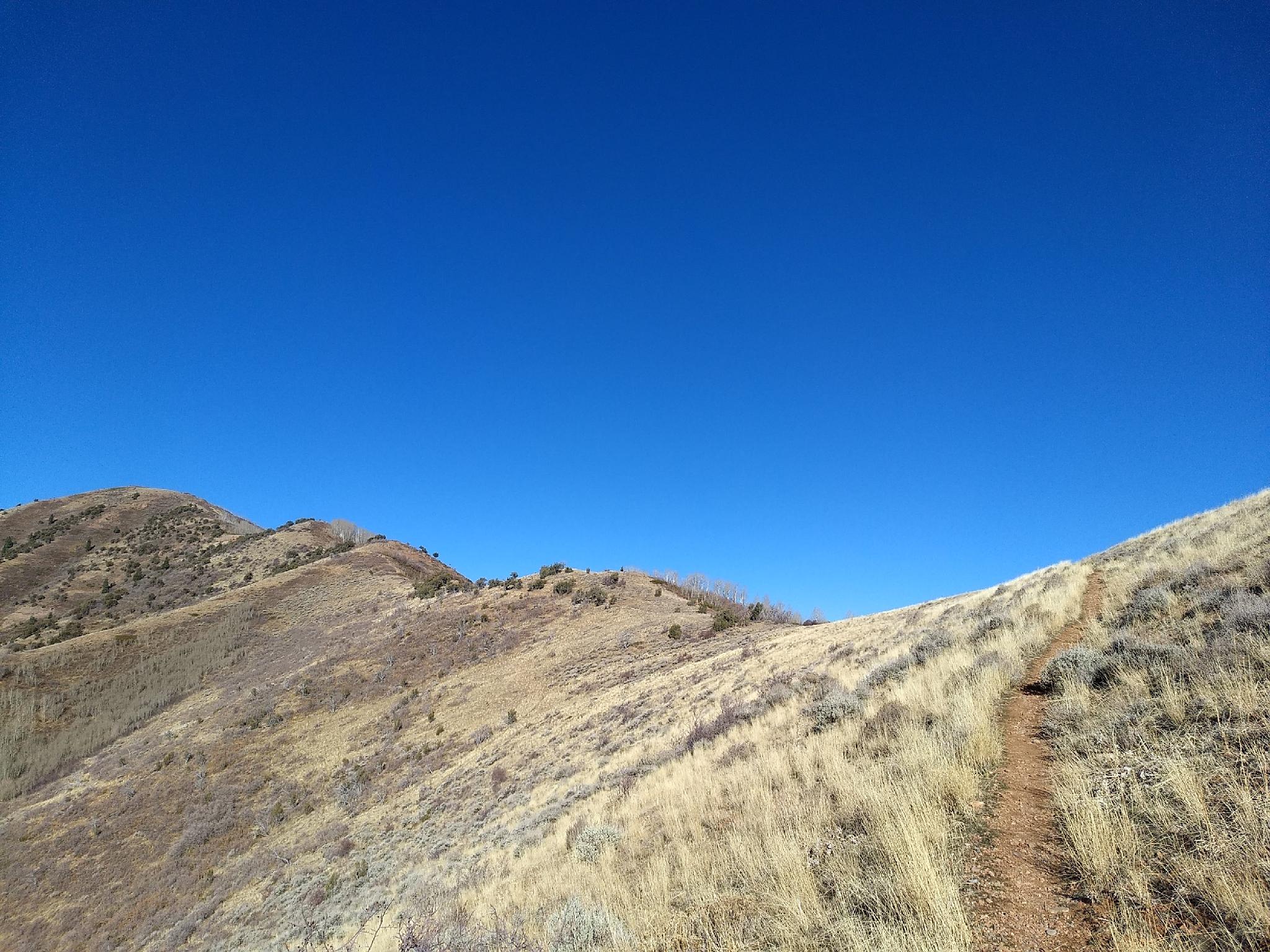
Go north along the ridgeline. The path is easy to follow and climbs somewhat steeply to the ridge. When the trail reaches the high ridge, a short side trail to the right offers excellent views.
Catch your breath, and continue up along the ridge. At the next junction, stay left. Right goes over to the Great Western Trail. After this final junction, the trail climbs steeply to a summit, then continues over a minor summit to the true high point of Lookout Peak.
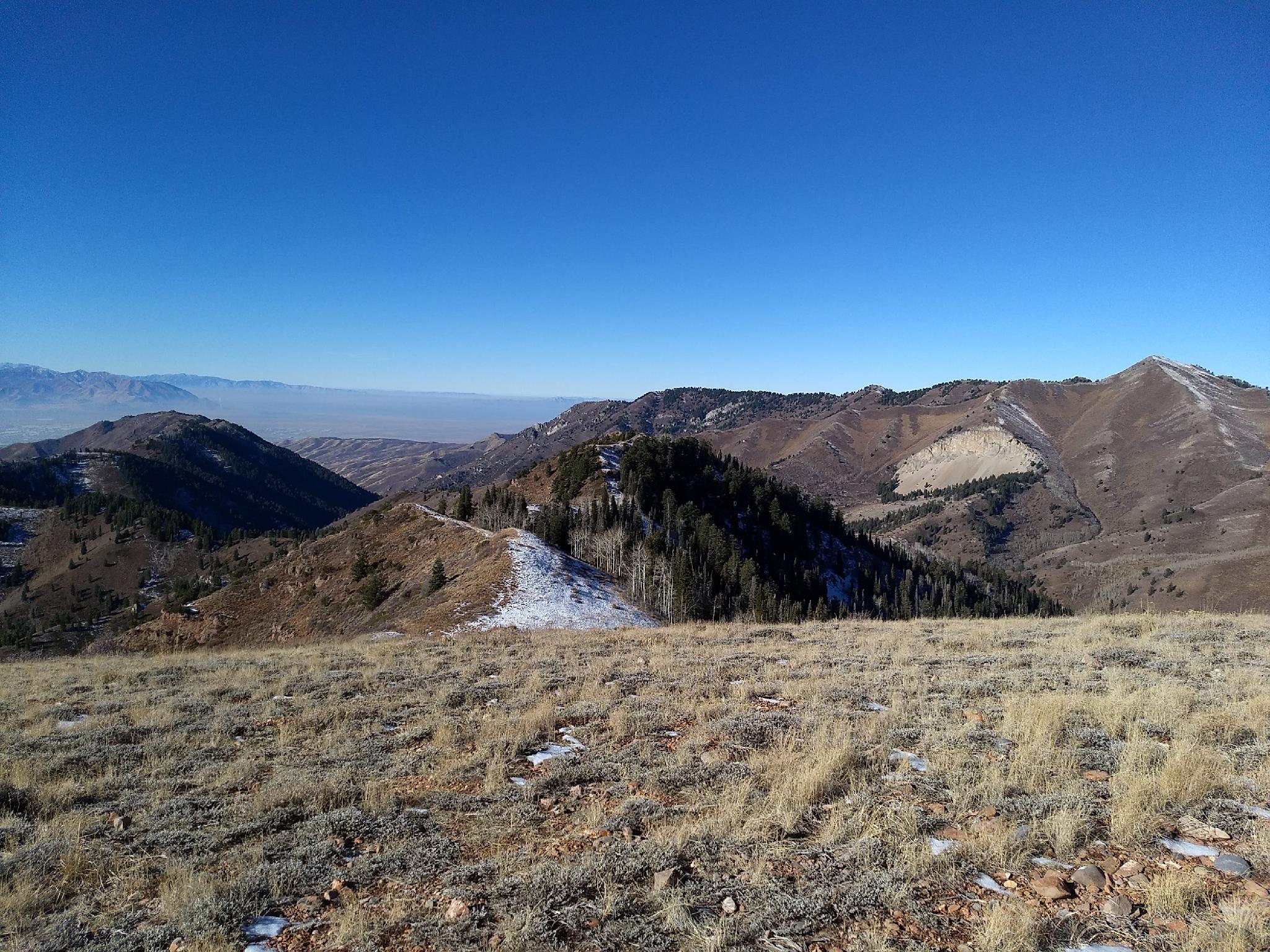
The views are excellent, overlooking City Creek Canyon, Emigration Canyon, and the Salt Lake Valley. The hillside to the north with a cliff and talus slope is the seldom visited Grandview Peak, the high point of the Sessions Mountains that is part of the ridgeline of upper City Creek Canyon.
Photos
Maps

12T 442801E 4517833N
40°48'34"N 111°40'41"W
12T 442597E 4518325N
40°48'50"N 111°40'50"W
12T 441730E 4518015N
40°48'40"N 111°41'27"W
12T 441619E 4519561N
40°49'30"N 111°41'32"W
12T 440721E 4520123N
40°49'48"N 111°42'11"W
12T 439501E 4520625N
40°50'04"N 111°43'03"W
12T 439827E 4515753N
40°47'26"N 111°42'48"W
12T 440088E 4516565N
40°47'52"N 111°42'37"W
12T 440685E 4517311N
40°48'17"N 111°42'12"W