 Hiking
Little Black Mountain
Hiking
Little Black Mountain
Salt Lake City
Overview
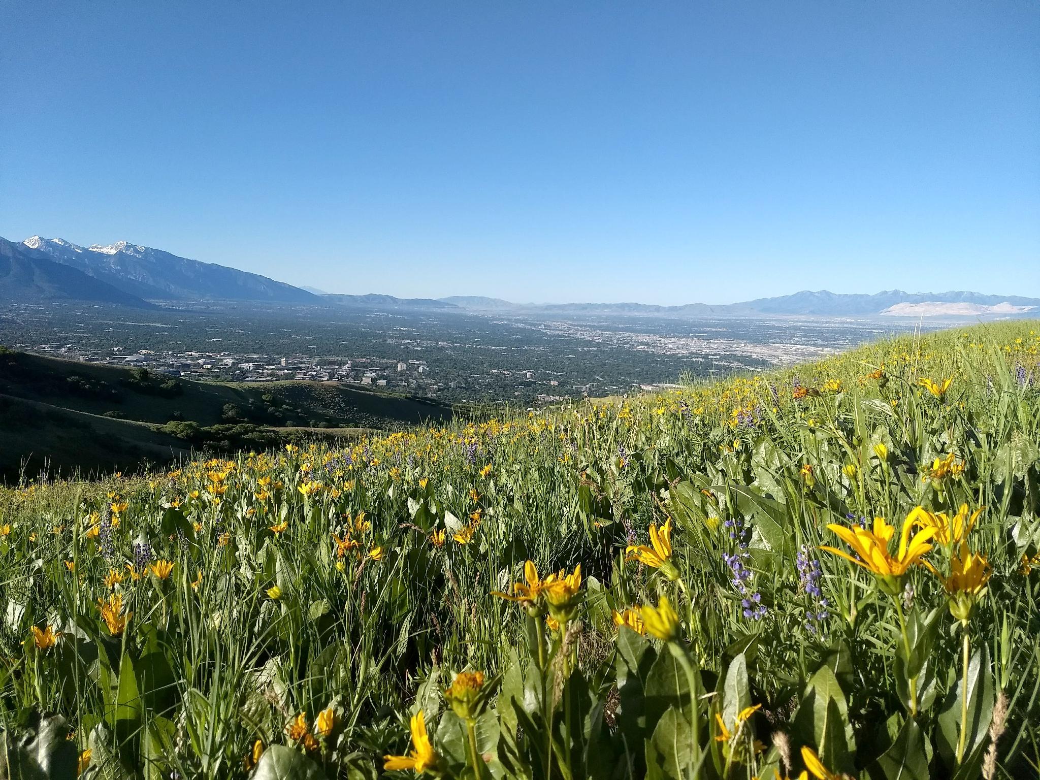
A few short minutes from downtown Salt Lake City, Little Black Mountain is an excellent spring or fall day hike. The trail ascends an endless ridge with views of both the metropolitan, but also the pastoral. Spring, in particular, can be magical. The ridge leading up to Little Black Mountain is usually covered in wild flowers in late spring and early summer. Arrowleaf Balsamroot, a yellow flower in the sunflower tribe, is particularly prolific.
Many groups stop at the first (false) summit of Little Black Mountain. This makes for a 7.5 mile or so round trip and a great outing. Continuing to the true summit makes for an almost 9 mile day with a bit of route finding along a rocky ridge. This last section can be tough for dogs and has a bit of exposure for dogs and humans alike.
Getting There
The trailhead is at the top of the Avenues neighborhood in Salt Lake at the Terrace Hills Trailhead.
From downtown SLC, go west on West Temple to I Street. Go north up I Street to 13th Avenue. Turn right on 13th Avenue and follow it Terrace Hills Drive. Go left on Terrace Hills Drive and follow it as it meanders up to its terminus at the end of a cul-de-sac. There are a couple of trails that leave from here. The trailhead you want is the most obvious one on the right (east) side of the cul-de-sac.
Route Description
From the trailhead, follow the main trail as it ascends Valleyview Canyon. There are a few small spur trails, simply always stay on the main, wide path. At 0.3 miles, a 4 way junction is reached. Stay straight, still on the obvious main path.
About 0.8 miles (30 minutes) from the trailhead, the trail comes to a major 5-way junction at a small pass to City Creek Canyon. Go straight here, on the steep single track that angles up and right from the junction. It quickly reaches the ridgeline and becomes more mellow.
Follow the ridgeline, staying left (on the ridge line) at the next junction. Continuing along the ridgeline, the main trail next turns south to head for the Avenues Twin Peak. Go left here, saving a bit of elevation gain, as the trail traverses the hill side to the ridge heading north east to Little Black Mountain.
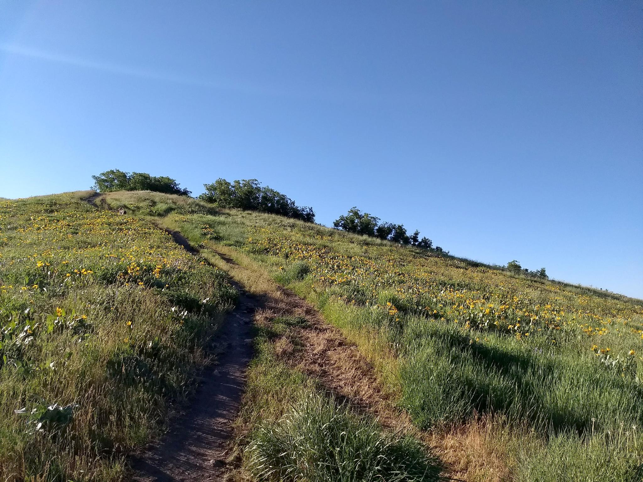
The long sweeping ridge is easy hiking with nice views into City Creek and the foothills around Salt Lake City. Near Little Black Mountain, the trail begins a very steep ascent up Little Black Mountain. At the top of the first step section is a small false summit and turn around for many group.
To continue to the main summit, follow the slightly less used trail as it continues along the ridgeline. There are several rocky sections along here, with social trails on one side of the ridge or the other to keep the difficulty low. The last section to the true summit, however, is fairly steep an exposed.
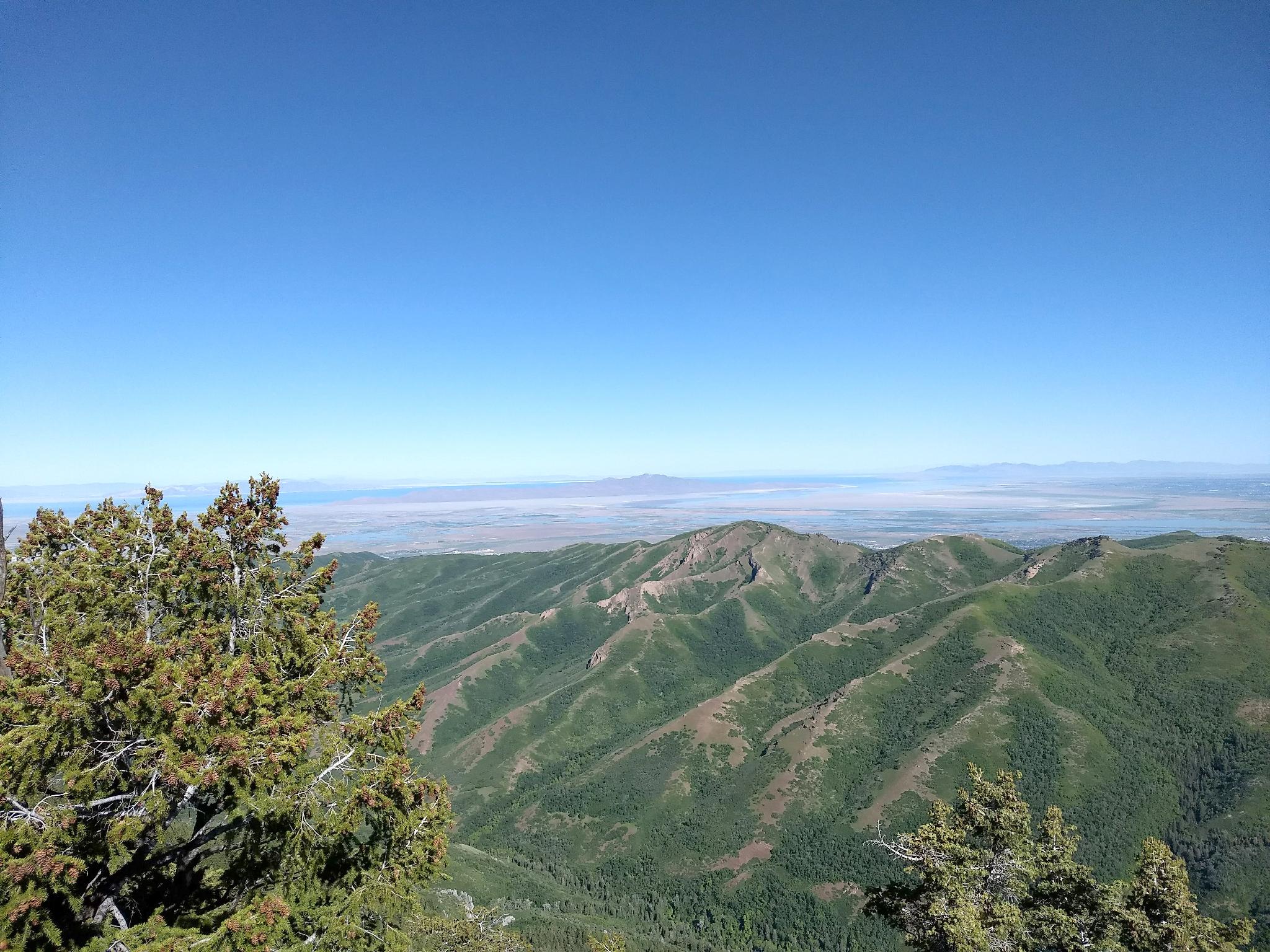
The summit has excellent views of Upper City Creek, Grandview Peak to the north east, and Salt Lake City. Return the same way.
Maps

12T 427189E 4515943N
40°47'29"N 111°51'47"W
12T 427610E 4516107N
40°47'34"N 111°51'29"W
12T 427976E 4516643N
40°47'51"N 111°51'14"W
12T 429076E 4516542N
40°47'49"N 111°50'27"W
12T 431858E 4517787N
40°48'30"N 111°48'28"W
12T 432677E 4518329N
40°48'48"N 111°47'54"W