 Hiking
Hidden Canyon
Hiking
Hidden Canyon
Zion Main Canyon
Overview

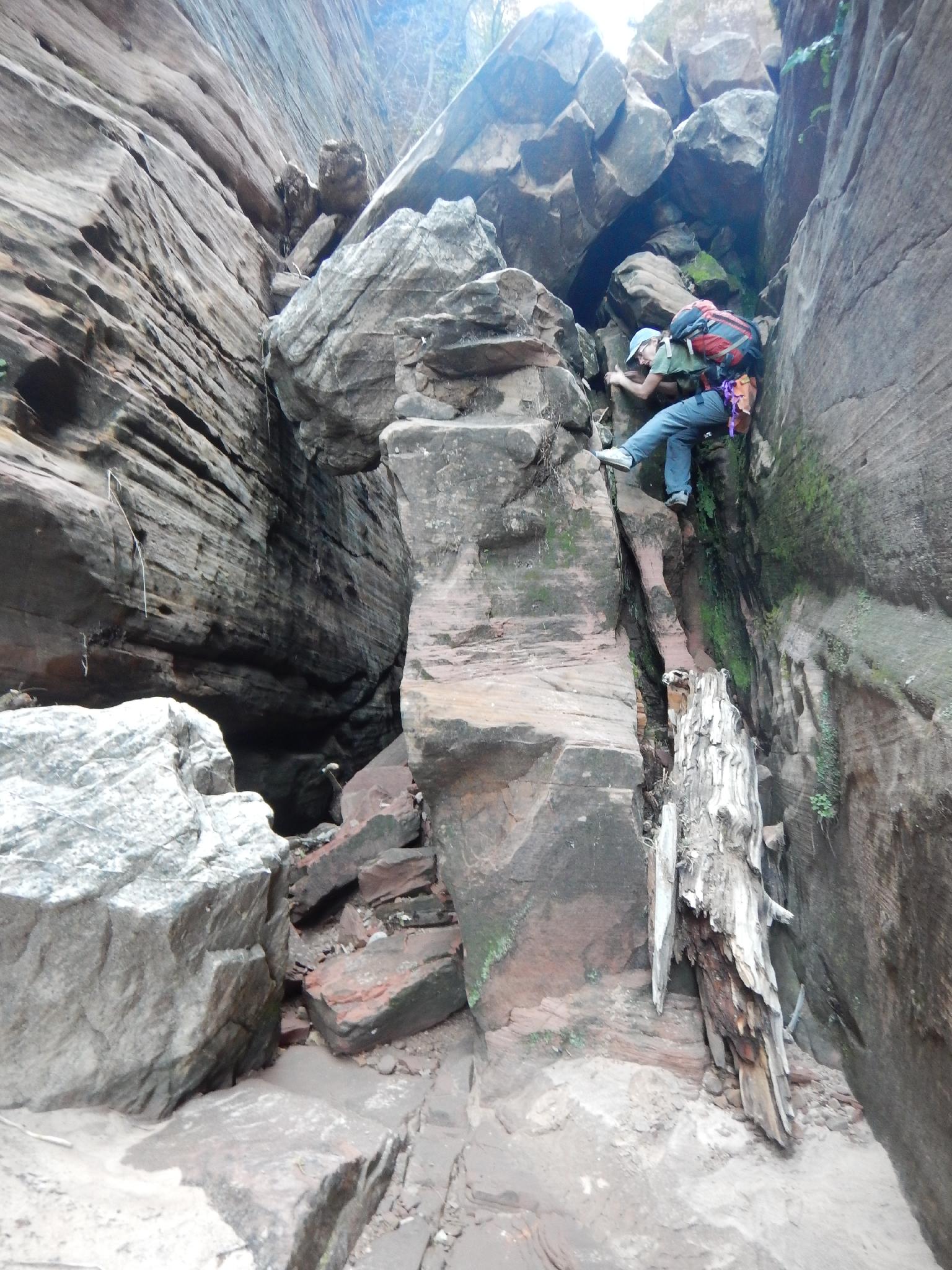
For the adventurous hiker, Hidden Canyon offers a plethora of fun and challenging obstacles to overcome. Many groups turn around at the arch, but adventure awaits above with numerous obstacles that can be defeated with a bit of teamwork or good route finding until the difficulties become insurmountable. If working up canyon above the arch, be sure you can safely get down any of the many obstacles you climb up!
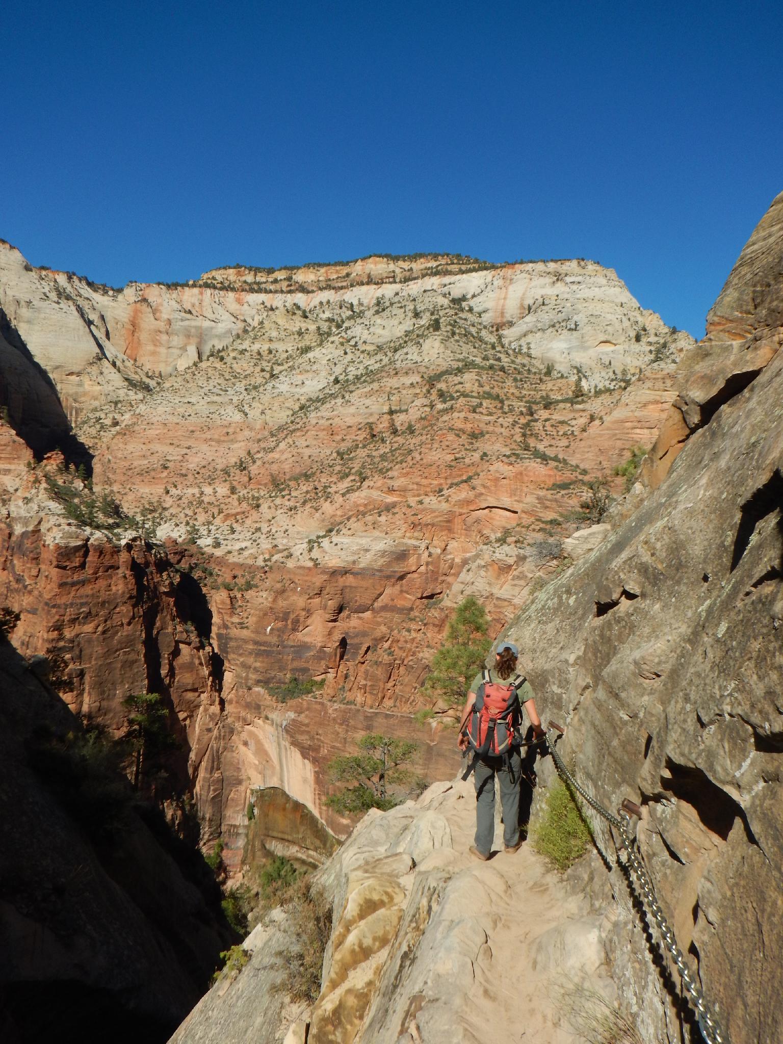
For the less adventurous hiker, Hidden Canyon offers a nice stroll with big views and even an arch to visit, this is a hike with a little something for everyone. The hike offers a bit of exposure on the traverse into Hidden Canyon, so not recommended for those afraid of heights.
The 1200' of gain in less than a mile puts this at a moderately strenuous hike. The hike stays shaded most of the day, so makes a good outing even in the heat of the summer with a morning start. Avoid this hike in the winter if there is snow on the ground, the trail would be dangerous if covered in snow or ice.
Getting There
The trailhead is the Weeping Rock Shuttle stop in the main Zion canyon. During summer months, the Zion shuttle is the only way to access the trailhead.
Route Description
From the trailhead, follow the trail as it crosses the bridge and small stream of Weeping Rock and begins its steep and winding ascent up the hillside. Most groups take about 20-30 minutes to reach the first major junction. Left continues its steep ascent to Echo Canyon and eventually Observation Point. Go right instead, signed Hidden Canyon.
The trail eases a bit from here and ascends to an outstanding viewpoint of the main canyon. From the viewpoint, the trail narrows and traverses around a side canyon before finally entering Hidden Canyon proper. The exposure in this section is fantastic, with fixed chains in place to offer a hand rail. Once in Hidden Canyon, it is a short hike (5-10 minutes) to a small arch on the right side of the canyon at ground level. For the unadventurous, this makes a great break and turn around spot.
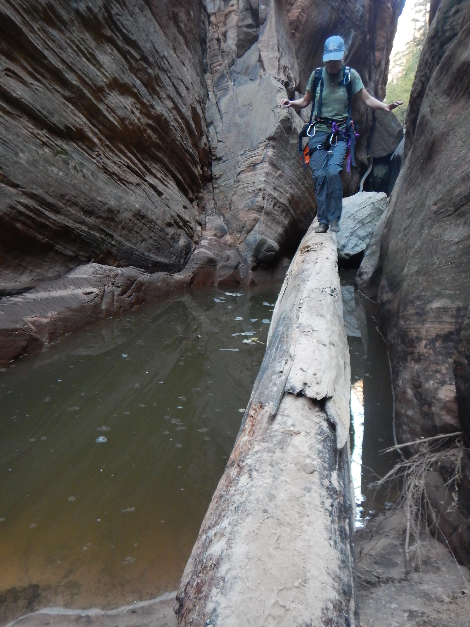
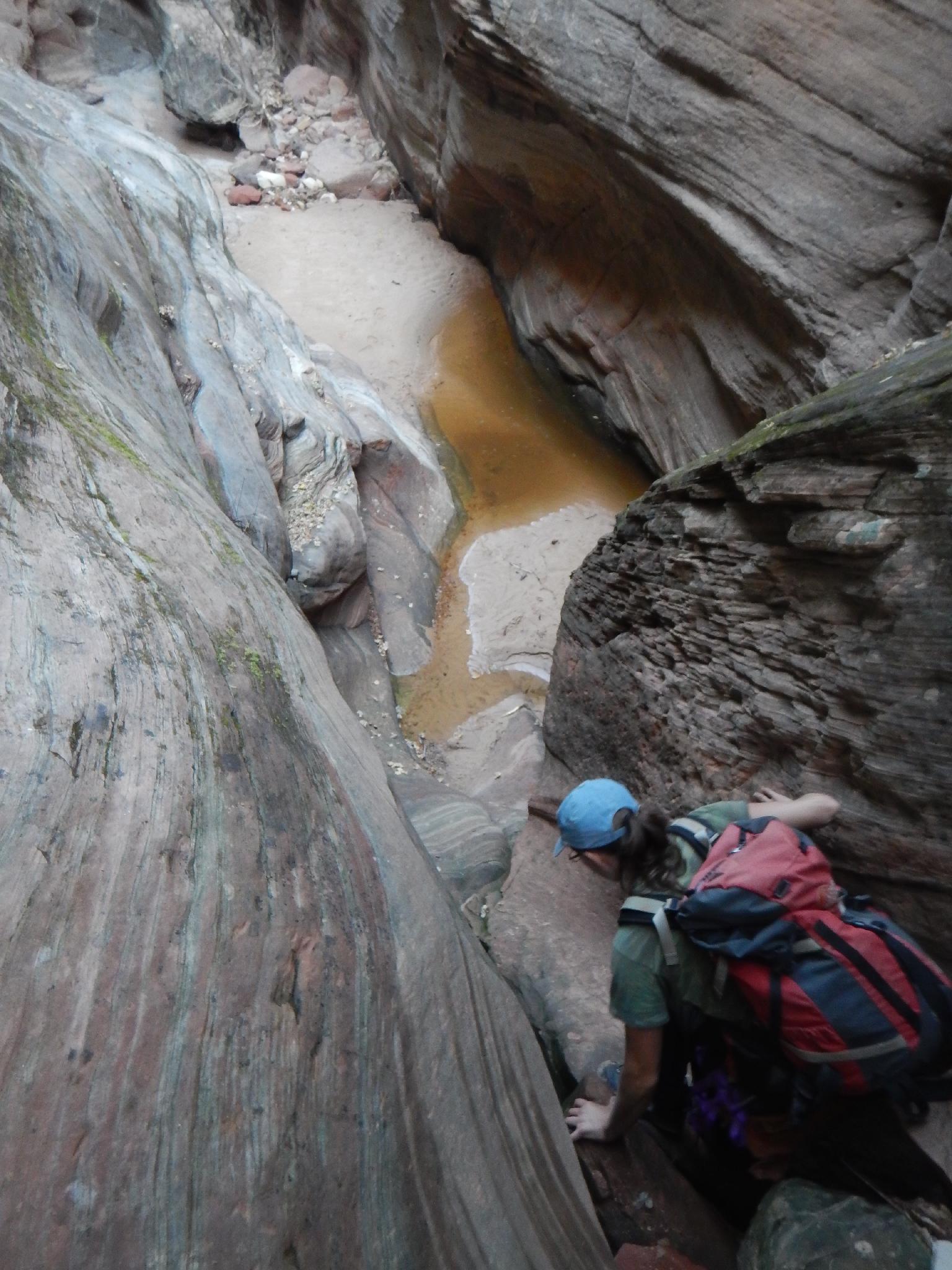
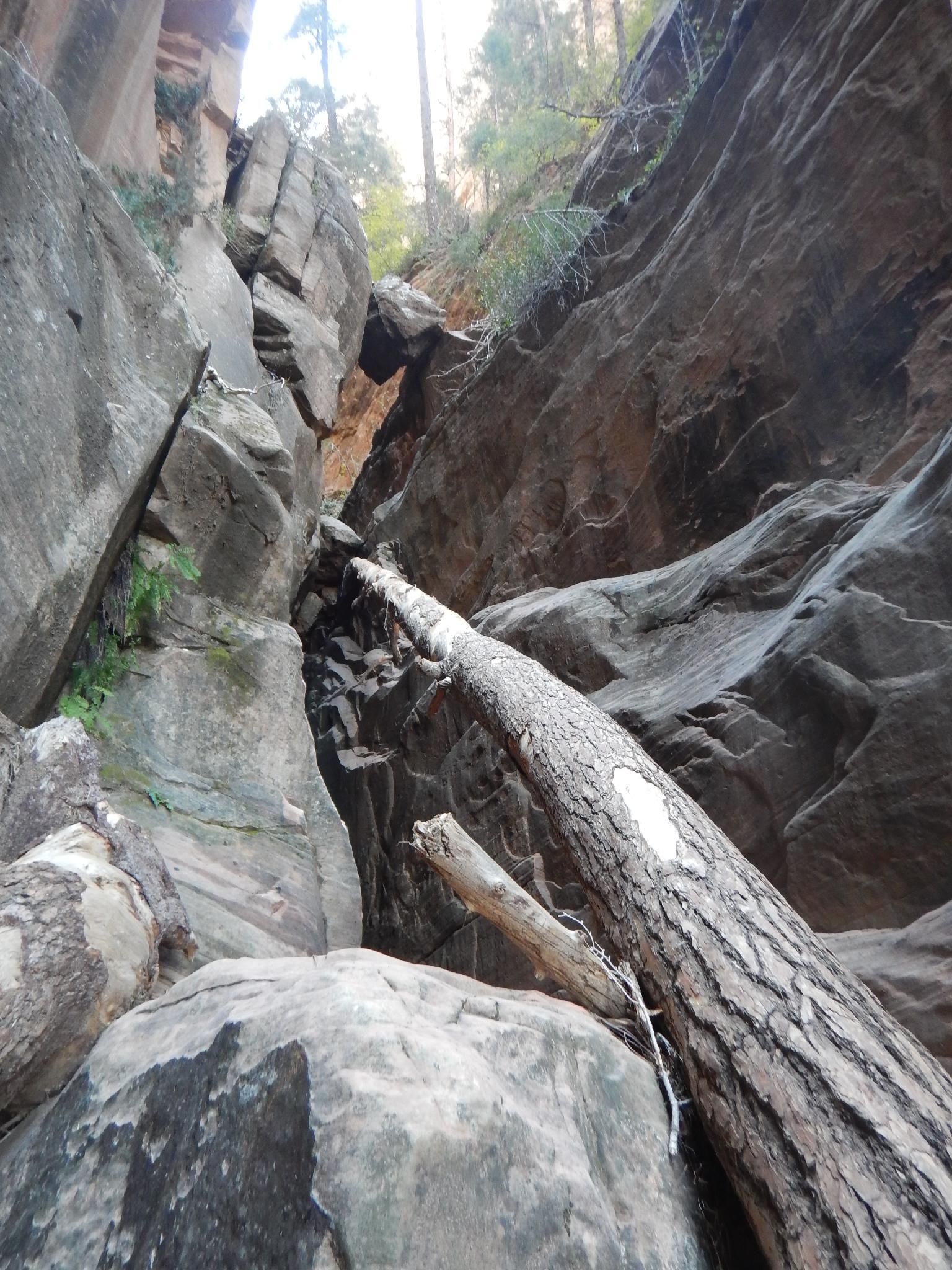
Feeling adventurous? Continuing up Hidden Canyon quickly comes to a small dryfall. The rhythm from here is dryfall obstacle with a bit of easy walking to the next dryfall obstacle. The obstacles become harder and taller the further up canyon you get. Return the same way when the obstacles become overwhelming.
Maps

12S 328130E 4126678N
37°16'15"N 112°56'18"W
12S 328284E 4126459N
37°16'08"N 112°56'12"W
12S 328111E 4126356N
37°16'05"N 112°56'19"W
12S 328239E 4126438N
37°16'07"N 112°56'14"W