 Hiking
Farmington Canyon Trail Waterfall
Hiking
Farmington Canyon Trail Waterfall
Farmington
Overview
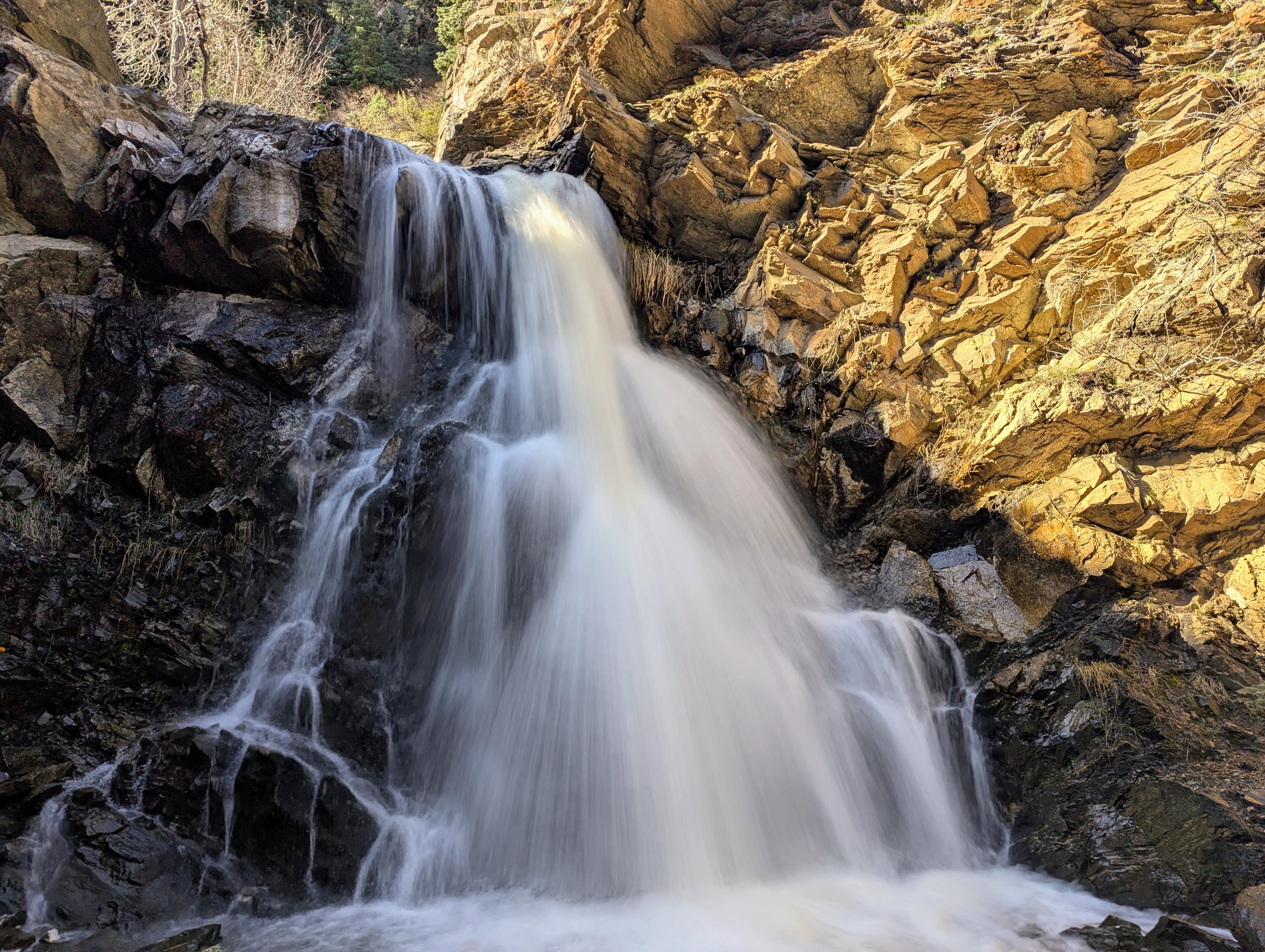
Farmington Creek Falls is a lovely hike that seems to have gained a fair bit in popularity in recent years. The hike ambles up, above Farmington Creek, to the 13 m falls. En route are big views and several old cars that rolled off the Farmington Creek Road high above the trail. It is a fun hike that our 8-year-old loved, and we saw many other families on the trail of all ages.
The last section down to the falls used to be a steep, loose, hand-over-hand knotted-rope type affair, but this has been improved to have a steep switchback trail now. The new switchback section makes the route much more accessible, though it is still steep enough to keep a watchful eye on kids and beginners.
Getting There
If heading north on I-15 from Salt Lake City, use the right lane to take Exit 324 (US-89 N) toward I-84 E / South Ogden. Merge onto Park Lane, and keep right at Exit 395, following signs for UT-225 E / Farmington. Merge onto UT-225 E (Park Lane).
Turn right onto Main Street and go for 0.3 miles.
Turn left onto N 100 E / Farmington Canyon Rd. Follow this road for just under a mile; the Lower Trailhead will be on the right here with a parking area and dirt road that continues heading south. This is just before a gate on the Farmington Canyon Road.
Standard Trailhead
If the road is open, continue up the paved Farmington Canyon road for 0.8 mile to where it turns to dirt at a switchback. There is a small parking area on the right that is the standard trailhead.
Upper Trailhead
The upper trailhead requires driving on some washboard dirt road. Medium clearance is recommended but usually not required. The upper trailhead is an additional 3.6 miles above the standard trailhead. There is a small pullout here on the right that fits several cars. This used to be the Sunset Campground, but it is now closed and reclaimed.
Route Description
Lower Trailhead to Trailhead (0.9 mile)
If parking at the lower trailhead, walk up the Farmington Canyon road for just under a mile to where the paved road turns to dirt on the first major switchback. There is a small dirt parking area on the right. This is the trailhead.
Trailhead to Falls (1.5 miles)
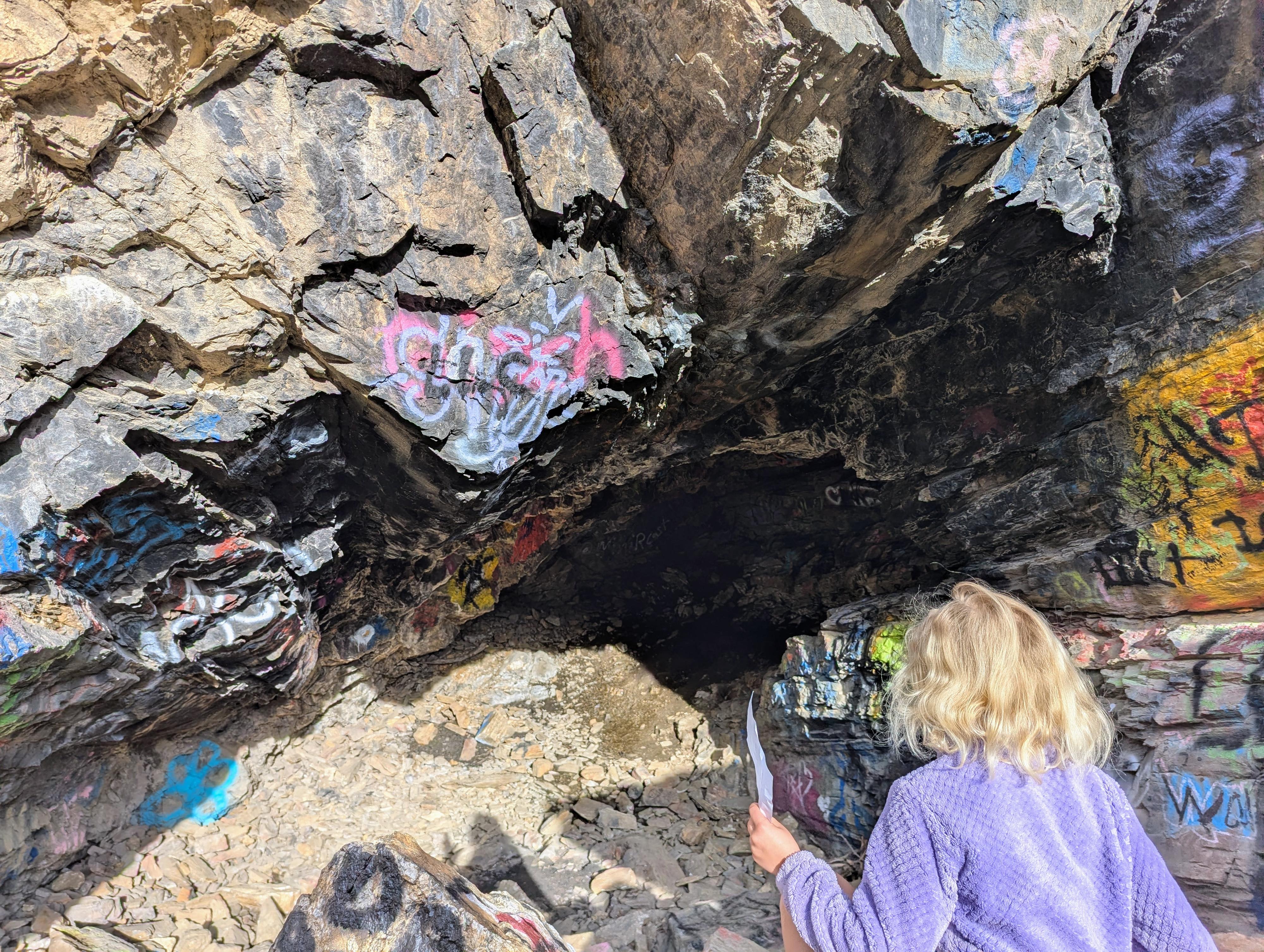
The signed trail leaves this small parking area, climbs steeply for a minute, then heads up Farmington Canyon. Within just a few minutes of leaving the trailhead, there is a cave on the left side of the trail that is full of graffiti.
The trail, high on the slope, has great views down into Farmington Creek and the Great Salt Lake to the west. From the trailhead, after about 0.7 miles, you will reach a junction with the Aqueduct Trail. Stay left here.
About 0.9 miles from the trailhead, the trail crosses a small side stream and continues angling up Farmington Canyon. There are a couple of old tires here, but no cars that I saw.
About 1.3 miles from the trailhead, you will pass the first old wrecked car of the hike that presumably rolled down from the Farmington Canyon road high above. There are 2 more before reaching the falls.
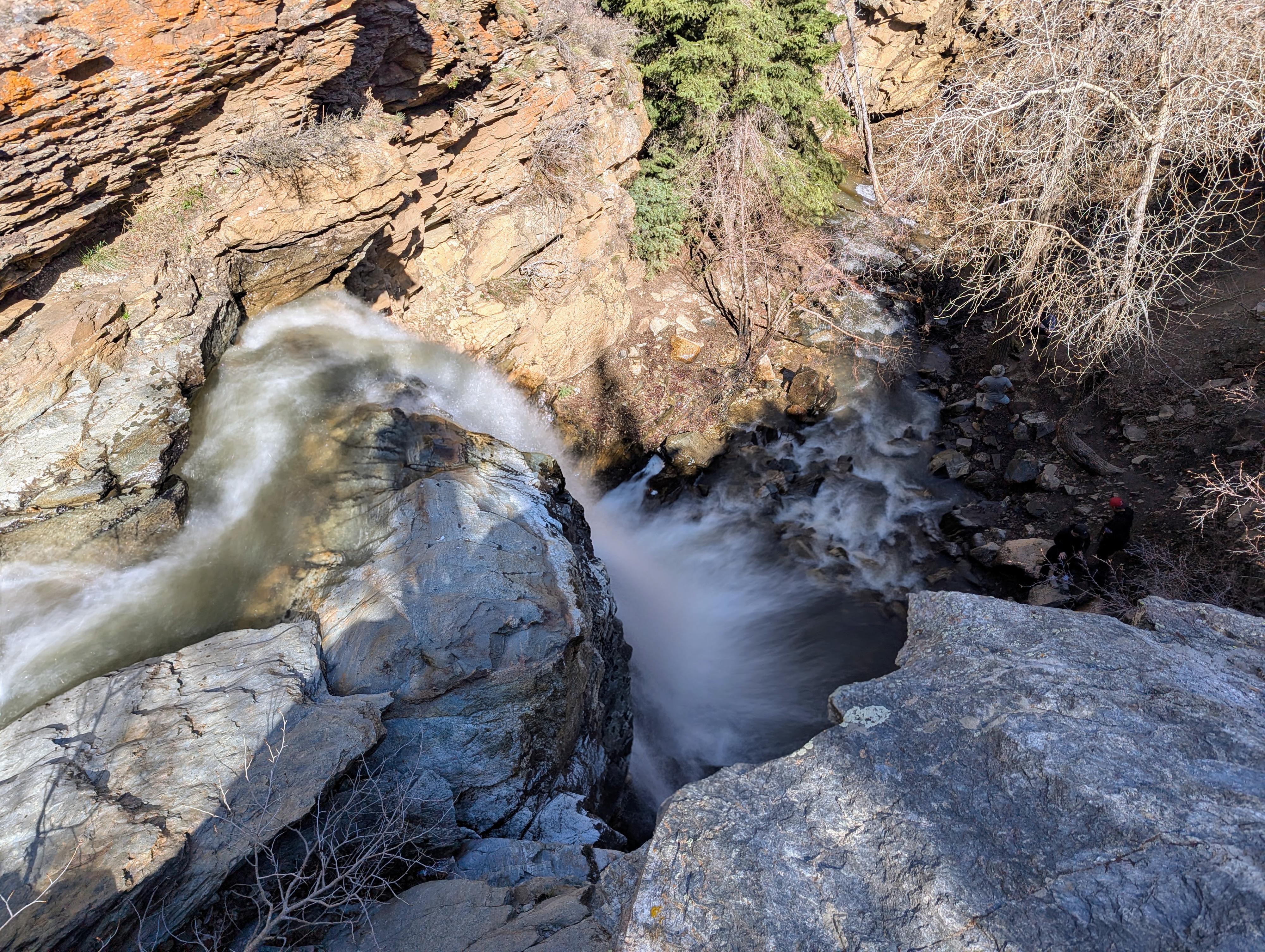
At about 1.5 miles from the trailhead, a side trail zigzags a short distance down to the falls.
The 13 m ( 43 ft. ) falls are quite stunning, especially in high spring flows!
Upper Trailhead (0.5 mile from the falls side trail)
From the falls side trail, you can continue up the main trail a couple of minutes (600 feet) to a trail junction. Go left here to climb to an old campground (now closed and reclaimed) and the Farmington Canyon road. It is about 1/2 mile one way from the falls side trail to the Upper Trailhead and the Farmington Canyon Road. If you want a shorter route to the falls, you can start from the Upper Trailhead and return the same way.
Photos
Maps

12T 426044E 4539098N
40°59'59"N 111°52'46"W
12T 427138E 4539161N
41°00'01"N 111°51'59"W
12T 427198E 4539203N
41°00'03"N 111°51'56"W
12T 428056E 4539255N
41°00'05"N 111°51'20"W
12T 428821E 4539192N
41°00'03"N 111°50'47"W
12T 429028E 4539255N
41°00'05"N 111°50'38"W
12T 429091E 4539262N
41°00'05"N 111°50'35"W
12T 429080E 4539201N
41°00'03"N 111°50'36"W
12T 429083E 4539140N
41°00'01"N 111°50'36"W
12T 429215E 4539118N
41°00'01"N 111°50'30"W
12T 429360E 4539476N
41°00'12"N 111°50'24"W