 Canyoneering
Birch Hollow
Canyoneering
Birch Hollow
Zion East Side
Overview
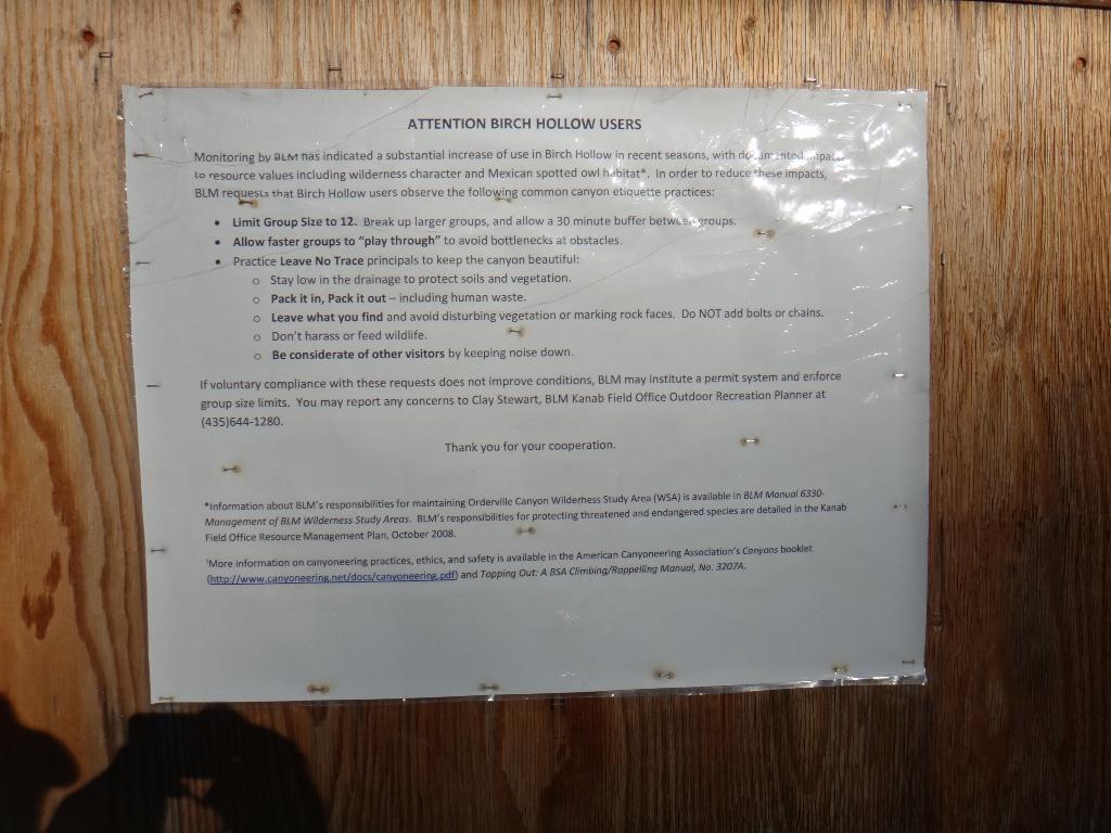
Birch Hollow, being just outside of the Zion National Park boundary, has become one of the most popular canyons in the area. The fact that it doesn't require a permit has made it a favorite destination of recreation canyoneers as well as local guides. During my last trip through we saw 3 different groups, all from local guide companies. Don't expect solitude or a wilderness experience here. Play nice and allow faster groups to pass. The BLM has a large info sign at the trailhead giving good guidelines for insuring the canyon doesn't become a permit required canyon due to over traffic.
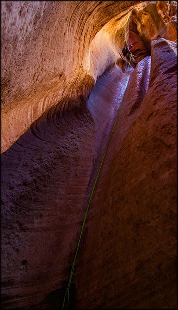
Traffic not withstanding, Birch is a charming canyon with 2 amazing rappels in a stunning slot section. The last two rappels are often photographed, and you see them in magazines and other advertisements frequently. The downside is the goods only last a few minutes and are over all too soon before the exit.
Finally, with one car you can exit up Wild Wind Hollow, making a circle trip. This used to be a bit of a thrash, but has gotten better over the years with use.
Getting There
The trailhead is off the North Fork road, which starts 2.2 miles east of the east entrance of Zion National Park on highway 9. It is signed.
Route Description
From the trailhead, follow the obvious and well traveled trail to the bottom of Birch and head down canyon.
In 30 minutes or so, a dryfall is reached. This falls is particularly loose, and easily bypassed via a trail just to the left. Some rappel, but the bypass is recommended. The canyon begins to deepen and narrow.
Rappel 1 is about 18 m ( 60 ft. ) and is overhanging.
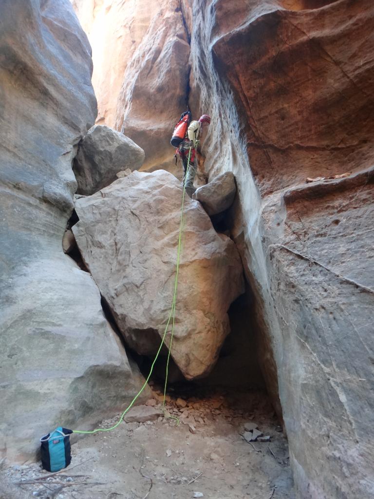
Rappel 2 and 3 are about 8 m ( 27 ft. ). A downclimb before rappel 2 may be rappelled by beginners, but is fairly straight foward.
Rappel 4 is about 32 m ( 105 ft. ) is the biggest in the canyon and marks the start of the best section. Be sure your rope reaches. An easy trick is to bring a 60 m ( 197 ft. ) rope and 10 m ( 33 ft. ) of webbing. Rappel single strand and use the webbing to extend the pull side as needed.
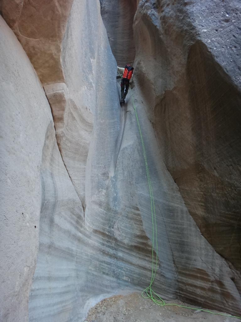
The final rappels come in quick succession. Rappel 5 and 6 are both about 9 m ( 30 ft. ), and rappels 7 and 8 are both about 18 m ( 60 ft. ). The bottom of rappel 8 is the confluence of Orderville and Birch.
Orderville Exit (Recommended)
Head up Orderville, following the use trail. It turns into an old road that is followed back to the North Fork Road and exit trailhead. Expect about and hour or a little more from Birch to the exit trailhead.
Wild Wind Hollow Exit
Head up Orderville about 10 minutes until a wide canyon comes in on the right. This is Wild Wind Hollow. Follow a cow trail up it on the right side above the canyon floor. It works up and within 10 minute climbs steeply out of the Hollow. This is where it gets tricky. There are a myriad of trails. Follow the most used one you can find south/slightly southwest to a ridgeline, then work up the ridgeline and south east to the road. On our attempt, we did well for about the first half, then lost the primary trail and ended up on a mix of game trails. Expect an hour for this exit, a bit less with good route finding.
Photos
Videos
Birch Hollow Full Video

Birch Hollow
Birch Hollow (A Muddy Adventure) April 2024

Birch Hollow with Orderville Exit
Birch Hollow June 2025
Maps

12S 335483E 4130833N
37°18'35"N 112°51'23"W
12S 334253E 4131450N
37°18'54"N 112°52'14"W
12S 333900E 4131850N
37°19'07"N 112°52'28"W
12S 334269E 4132486N
37°19'27"N 112°52'14"W
12S 337582E 4133645N
37°20'07"N 112°50'00"W