 Hiking
Enepitsi Trail
Hiking
Enepitsi Trail
Santa Clara
Overview
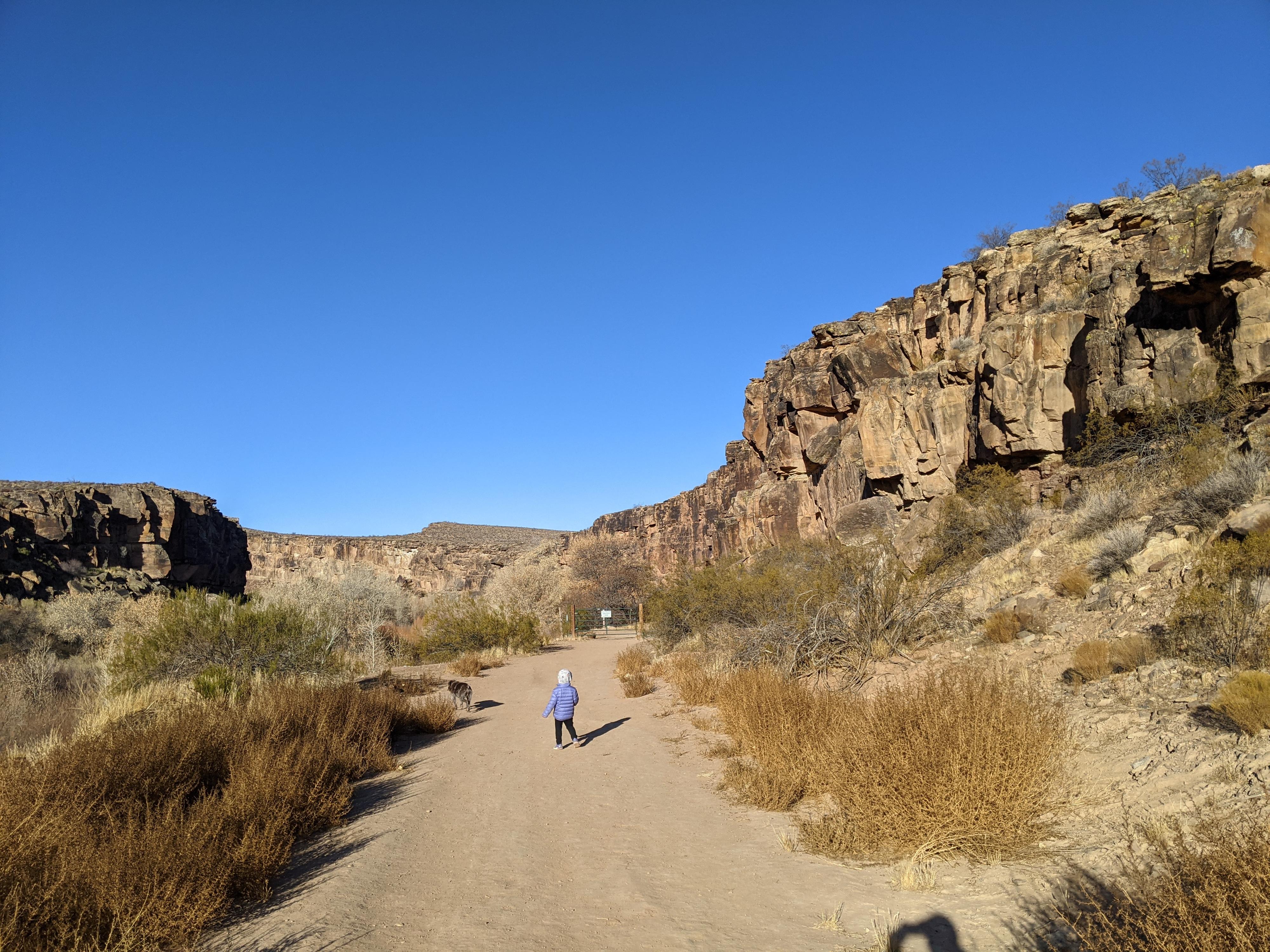
Enepitsi (Ghost) Trail is one of our family's favorite trails in the St. George area. Excellent scenery combined with rock art, easy access, and a trail my preschooler could run and play on make this an absolute gem. The trail mostly follows dirt road, now closed to motor vehicles. It follows the Santa Clara River as it cuts through low hills before reaching the town of Santa Clara. If you have done the Anasazi Ridge Petroglyphs hike, then you have stood on the hills south of the gorge and looked down on this trail.
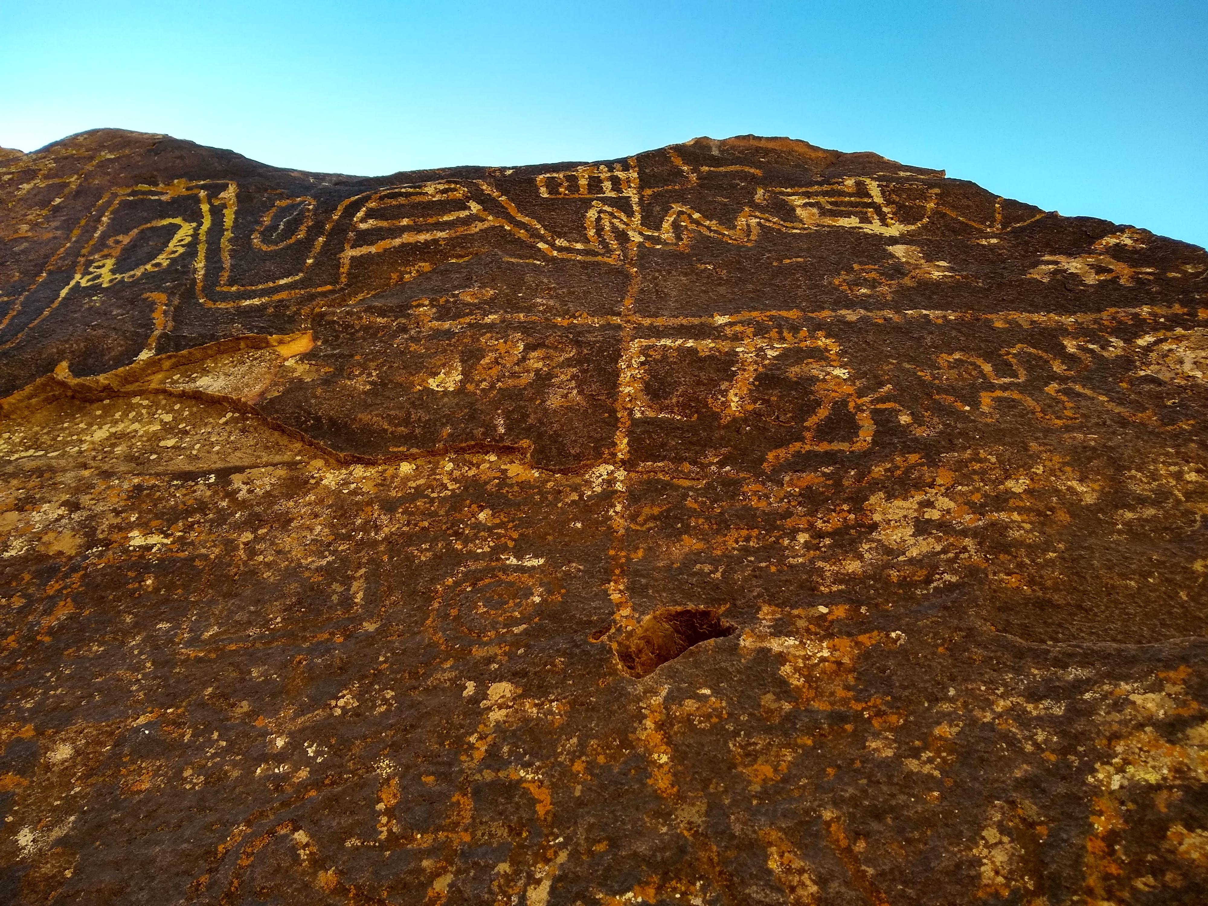
A lovely afternoon, I recommend binoculars for this hike. Several of the panels are high on the rim of the canyon and difficult to see well from the trail. Several panels are closer and easy seen/photographed. Bring a sharp eye, we a handful of interesting panels, but likely missed some.
Getting There
The trailhead is on the north side of Santa Clara. From St. George, take Bluff Street north to its junction with Sunset Blvd. Turn west onto Sunset Blvd and follow it for 4.1 miles to Graveyard Wash Road on the left. This road is easy to miss, and is at mile marker 2.85, just after a bend. Follow Graveyard Wash Road to the trailhead 0.5 miles.
Route Description
Rock art and historic sites are fragile, non-renewable cultural resources that, once damaged, can never be replaced. To ensure they are protected, please:
- Avoid Touching the Petroglyphs: Look and observe, BUT DO NOT TOUCH!
- Stay on the Trails: Stay on the most used trails when visiting sites, and don't create new trails or trample vegetation.
- Photography and Sketching is Allowed: Do not introduce any foreign substance to enhance the carved and pecked images for photographic or drawing purposes. Altering, defacing, or damaging the petroglyphs is against the law -- even if the damage is unintentional.
- Pets: Keep pets on a leash and clean up after them.
- Artifacts: If you happen to come across sherds (broken pottery) or lithics (flakes of stone tools), leave them where you see them. Once they are moved or removed, a piece of the past is forever lost.
From the Tukupetsi Trailhead, cross through the fence and take an immediate left. The trail follows along the fence line. At a second junction, go left again, quickly reaching the closed road just beyond the gate.
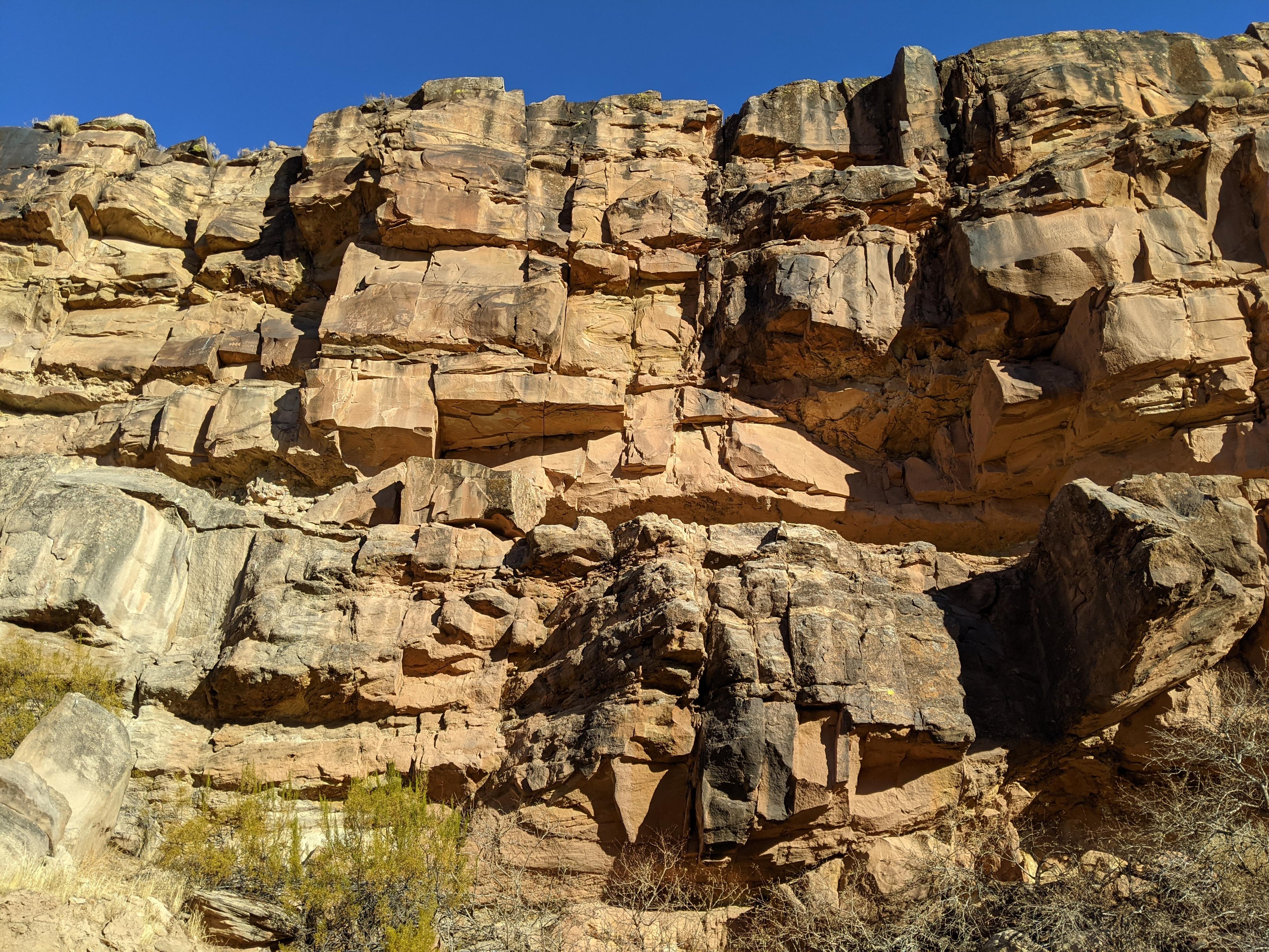
Follow the road as it descends the hill and reaches the Santa Clara River. The black walls of the small canyon the river cuts through the hills rises immediately. Be on the lookout for rock art. There are several excellent panels along the road, but also visible high on the cliff just below the rim.
As an out-and-back, turn around is dictated by motivation. We continued through the canyon to where the road forks. By this point the canyon is wide. If you make it to this junction, keep an eye out on your return. There is a boulder on the right (river) side of the road just a minute or two down from the junction that has a bit of rock art on it.
Photos
Maps

12S 262676E 4113241N
37°08'08"N 113°40'18"W
12S 262624E 4113247N
37°08'08"N 113°40'20"W
12S 262443E 4113270N
37°08'08"N 113°40'28"W
12S 262361E 4113235N
37°08'07"N 113°40'31"W
12S 262069E 4113403N
37°08'12"N 113°40'43"W
12S 261702E 4113497N
37°08'15"N 113°40'58"W
12S 260559E 4113834N
37°08'25"N 113°41'45"W