Mammoth Cave | Markagunt Plateau

Caving Mammoth Cave - Markagunt Plateau Caving Mammoth Cave

Markagunt Plateau

Overview

RATING: Easy Caving
MAPS: ASAY BENCH, UT

Mon

A slight chance of showers and thunderstorms after noon. Mostly sunny, with a high near 86. Northwest wind around 5 mph. Chance of precipitation is 20%.

86 | 58

Tue

A slight chance of showers and thunderstorms after noon. Sunny, with a high near 85. Chance of precipitation is 20%.

85 | 59

Wed

A slight chance of showers and thunderstorms after noon. Sunny, with a high near 83.

83 | 55

Thu

A chance of showers and thunderstorms after noon. Mostly sunny, with a high near 81.

81 | 53

Fri

A slight chance of rain showers before noon, then a chance of showers and thunderstorms. Partly sunny, with a high near 81.

81 | 54

View Full Weather Details
SEASON: Spring, Summer, Fall
GEAR: Standard Caving Gear (Headlamps, helmet)
WATER: None

Mon

A slight chance of showers and thunderstorms after noon. Mostly sunny, with a high near 86. Northwest wind around 5 mph. Chance of precipitation is 20%.

86 | 58

Tue

A slight chance of showers and thunderstorms after noon. Sunny, with a high near 85. Chance of precipitation is 20%.

85 | 59

Wed

A slight chance of showers and thunderstorms after noon. Sunny, with a high near 83.

83 | 55

Thu

A chance of showers and thunderstorms after noon. Mostly sunny, with a high near 81.

81 | 53

Fri

A slight chance of rain showers before noon, then a chance of showers and thunderstorms. Partly sunny, with a high near 81.

81 | 54

View Full Weather Details
Near the main entrance.

Near the main entrance.

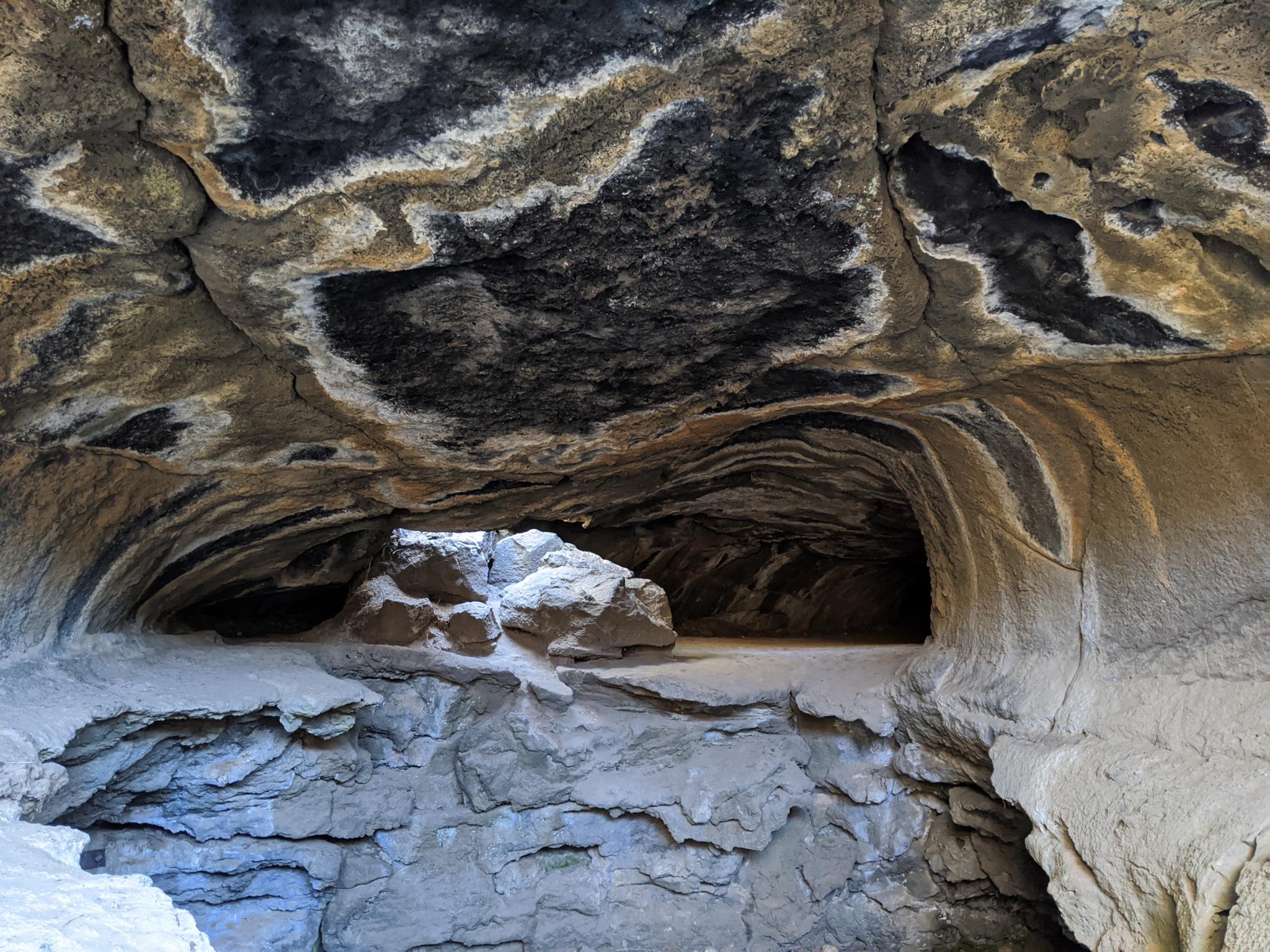
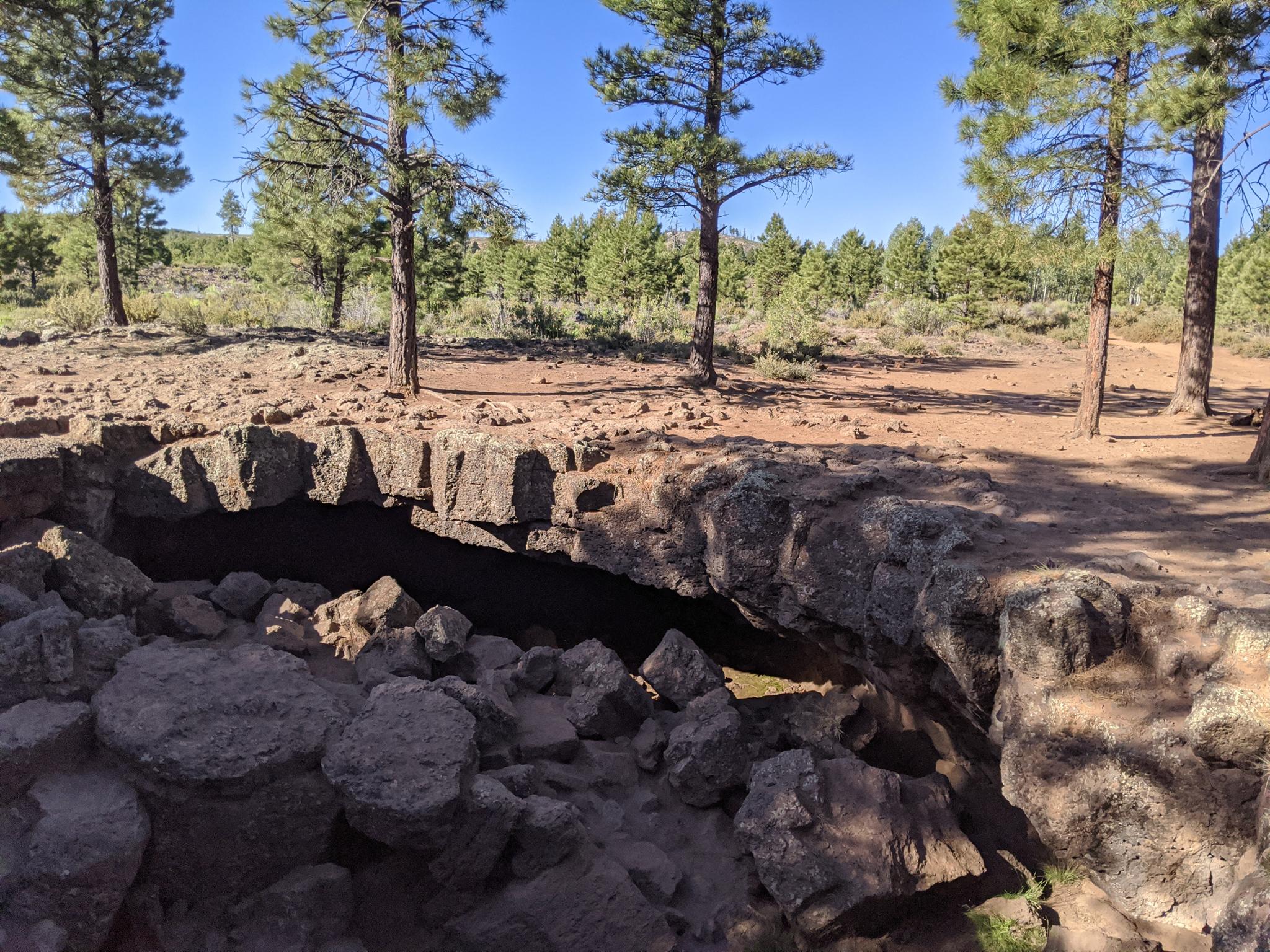
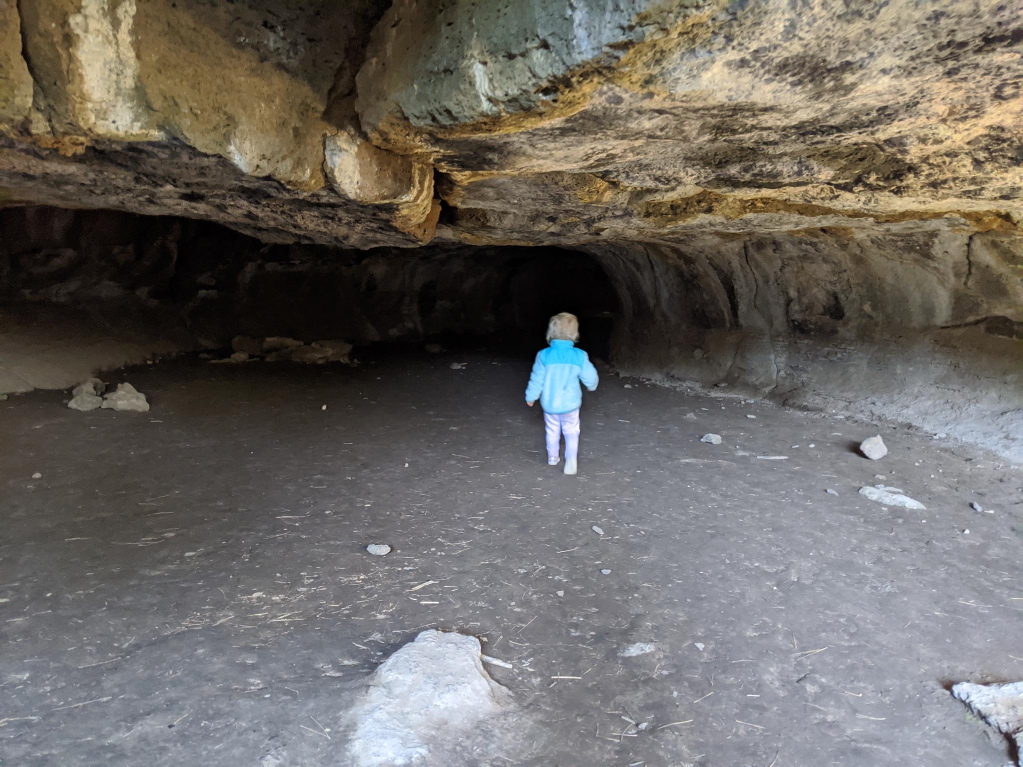
Mammoth Cave is likely the longest lava tube in Utah. The cave boasts over 2100 feet of passages, with 5 entrances and several different chambers. This is a lovely family friendly adventure. Most of the passages are large enough to easily move through with a little stooping, though some are small enough to require a bit of crawling. Bring a few headlamps and a helmet and make a day of it. Pit toilet and picnic tables at the trailhead make this a popular gathering spot for groups.

Note: The largest chamber is home to several species of bats. To protect the Townsend's big-eared bats that hibernate here during the winter, that section of the cave is gated and closed between September 30th and late May each year when the bats leave. When closed, there are still other sections that are open and worth visiting.
Main Entrance

Main Entrance

Getting There

From the north end of Cedar Breaks National Monument, at the junction of SR-143 and SR-148, go right (east) toward Panguitch on SR-143 for 9.6 miles to FH 050 on the right. FH 050 is paved and connects SR-143 on the north with SR-14 on the south. Follow this road for 9.3 miles. At 9.3 miles a sign for Mammoth Cave marks a side road on the left.

  • Turn off pavement and reset your odometer. ( 12S 357831E 4160054N / 37°34'36"N 112°36'36"W )
  • 1.4 miles - Turn Left ( 12S 358921E 4158502N / 37°33'46"N 112°35'51"W )
  • 2.1 miles - Turn right. ( 12S 359317E 4159545N / 37°34'20"N 112°35'35"W )
  • 2.45 miles - Trailhead ( 12S 359742E 4159177N / 37°34'08"N 112°35'18"W )
Heading into one of the tunnels.

Heading into one of the tunnels.

Route

From the trailhead, follow the wide, worn trail south. It reaches the main entrance to the cave just a few hundred feet from the parking area. The main entrance is a large collapsed area that is easy to climb in and out of.

Once in the entrance, the tunnel heading south is a good introduction. This tunnel bends enough that for a section, you cannot see light from either entrance. If you continue, a little crawling and you can pop-out not too far south from the main entrance.

The largest chamber heads the opposite direction from the main entrance. This chamber is closed seasonally, and the longest of the chambers at Mammoth.

Another section of tunnel also leaves from the main entrance and heads back north but is smaller than the main chamber and exits out a small hole close to the main chamber exit.

An incredibly fun place to spend a day!


Maps

Printable Maps:

Trailhead

12S 359742E 4159178N

37°34'08"N 112°35'18"W

Main Entrance

12S 359757E 4159102N

37°34'06"N 112°35'17"W

Entrance/Exit 1

12S 359698E 4159040N

37°34'04"N 112°35'19"W

Entrance/Exit 2

12S 359829E 4159192N

37°34'09"N 112°35'14"W

Entrance/Exit 3

12S 359857E 4159217N

37°34'10"N 112°35'13"W

Comments

Want to make a comment? Login and let yourself be heard.