 Hiking
Taylor Creek
Hiking
Taylor Creek
Kolob Canyon Area
Overview
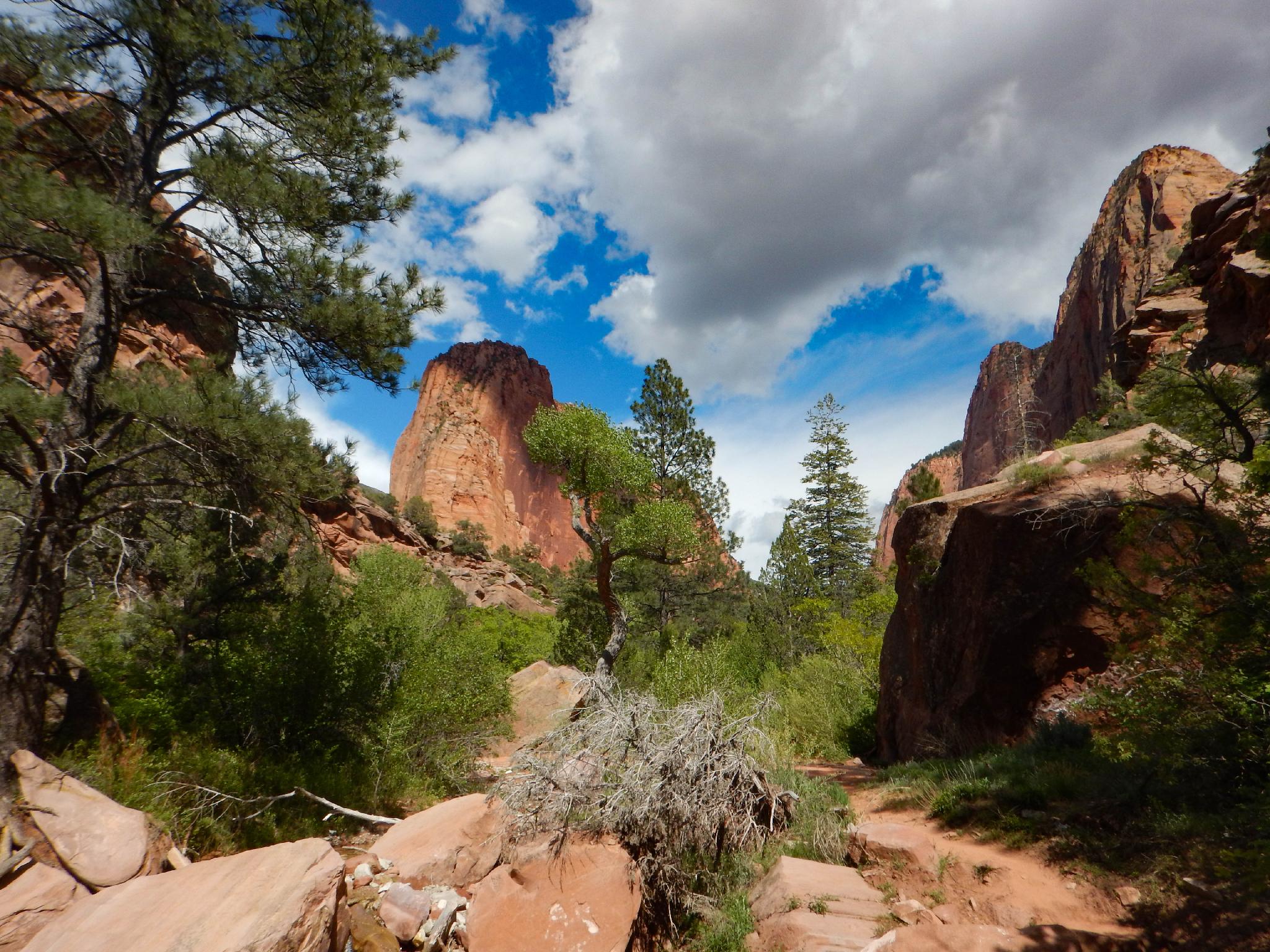
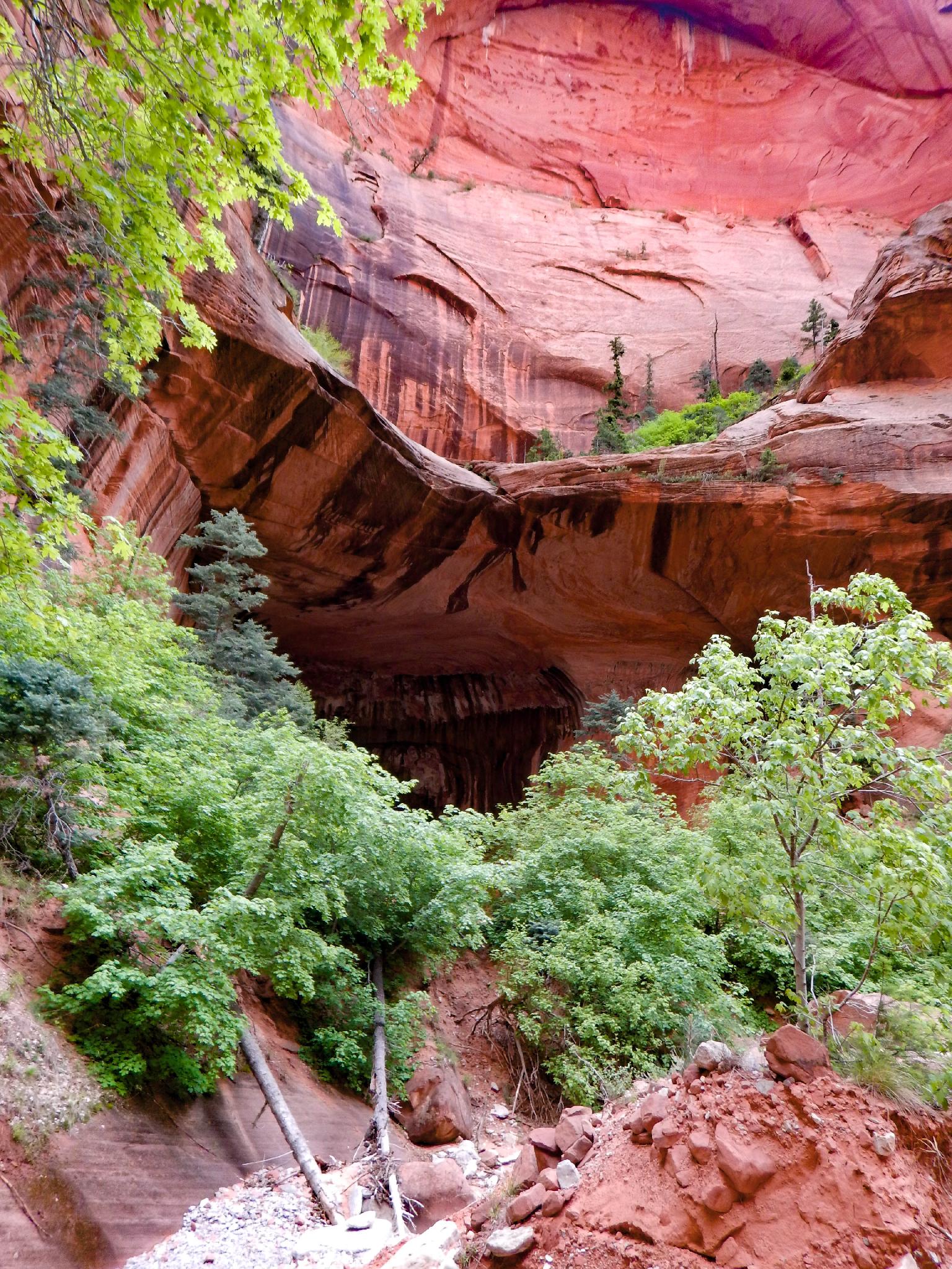
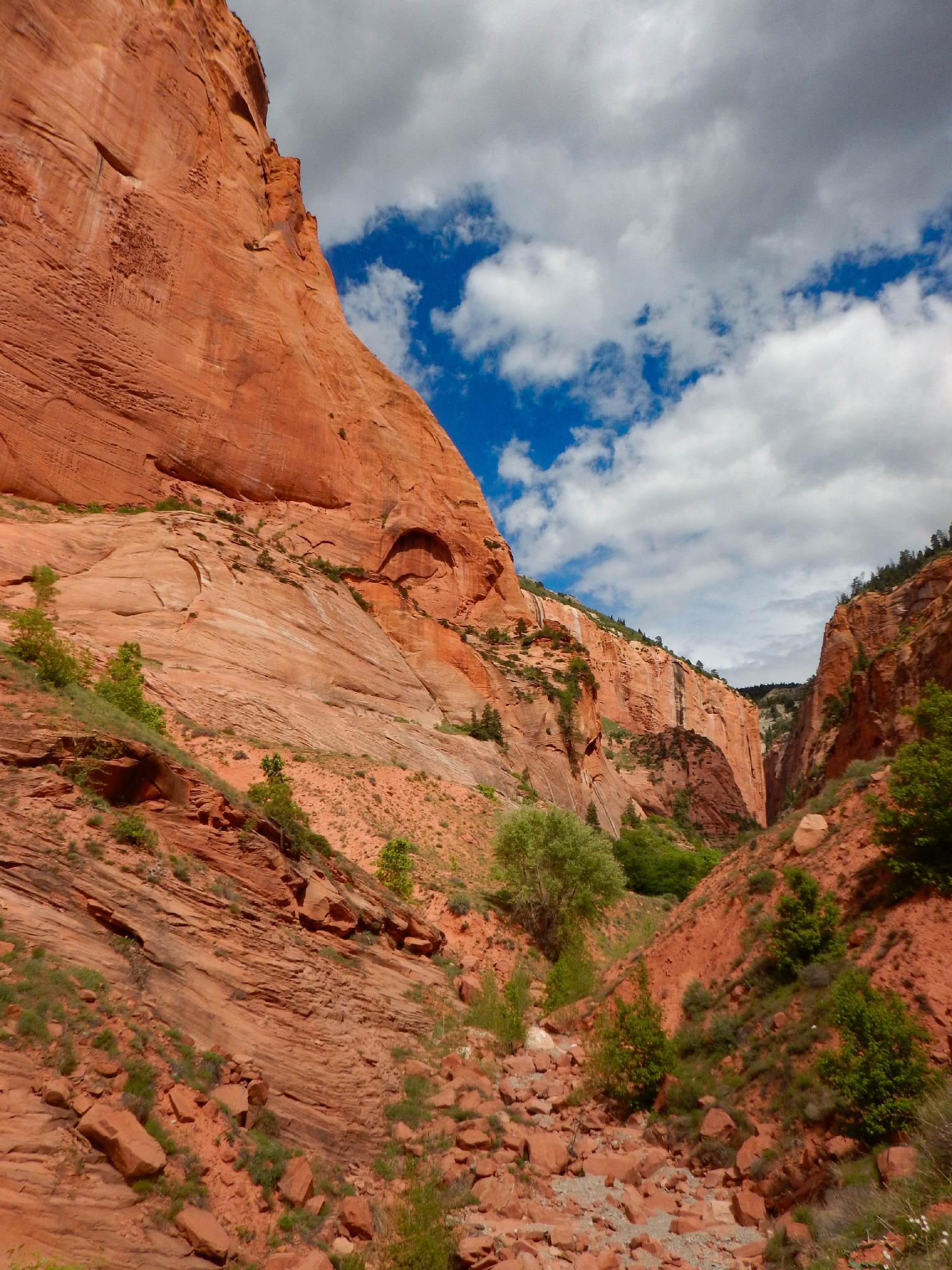
Taylor Creek, or Middle Taylor Creek as it is also called, is a very scenic hike in the Kolob Section of Zion National Park. The hike visits two historic cabins, as well as an exquisite deep walled canyon. Though the hike ends at Double Arch Alcove, don't be fooled like I was. In this case, arch means closed arch, not a true open arch. Even with the deceptive naming, this is a good hike, and highly recommended.
The hike is very exposed to the full sun to the first cabin, then gets a bit more shaded. In full summer, the first section can be very hot. Be sure to take plenty of water!
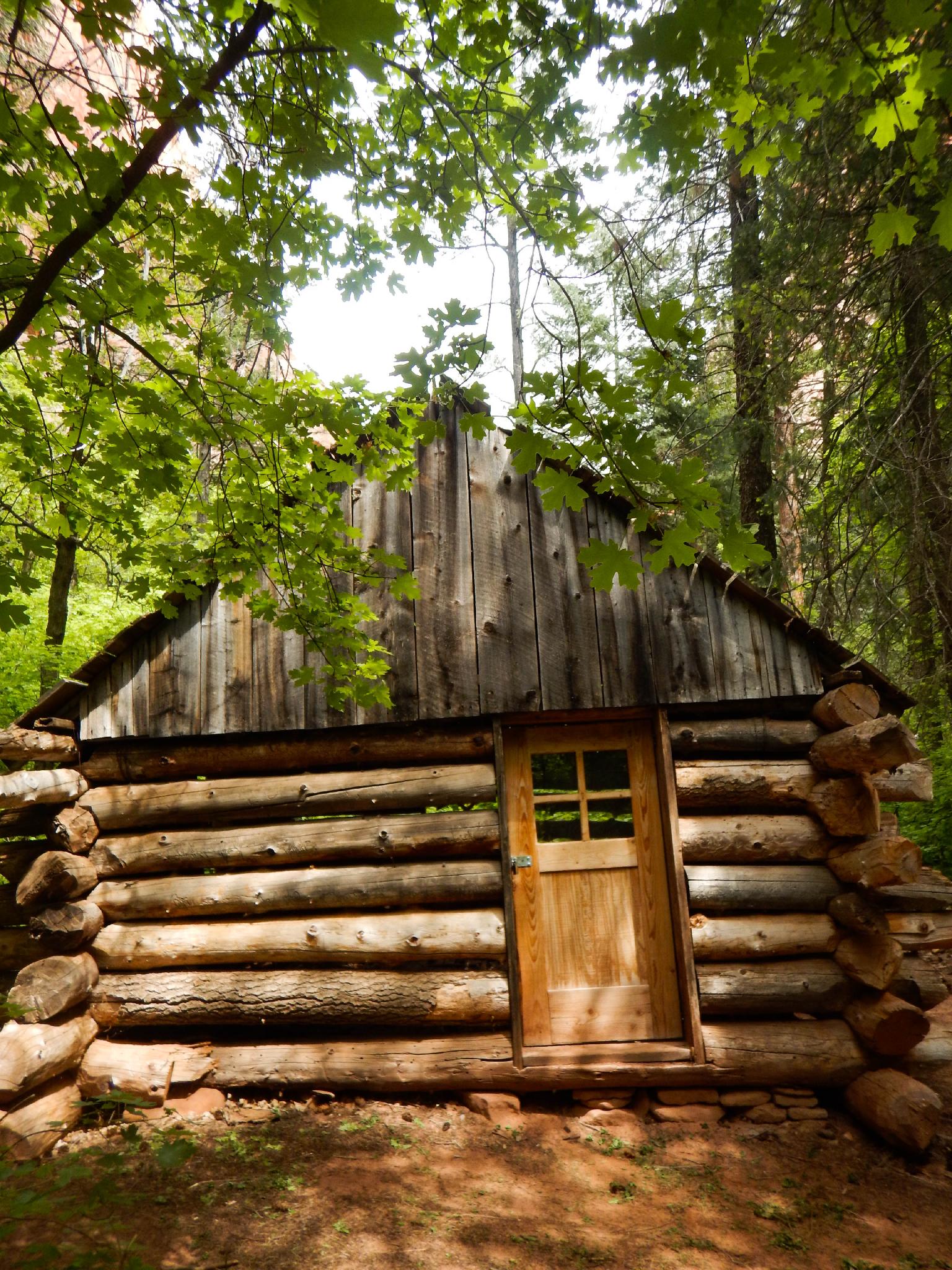
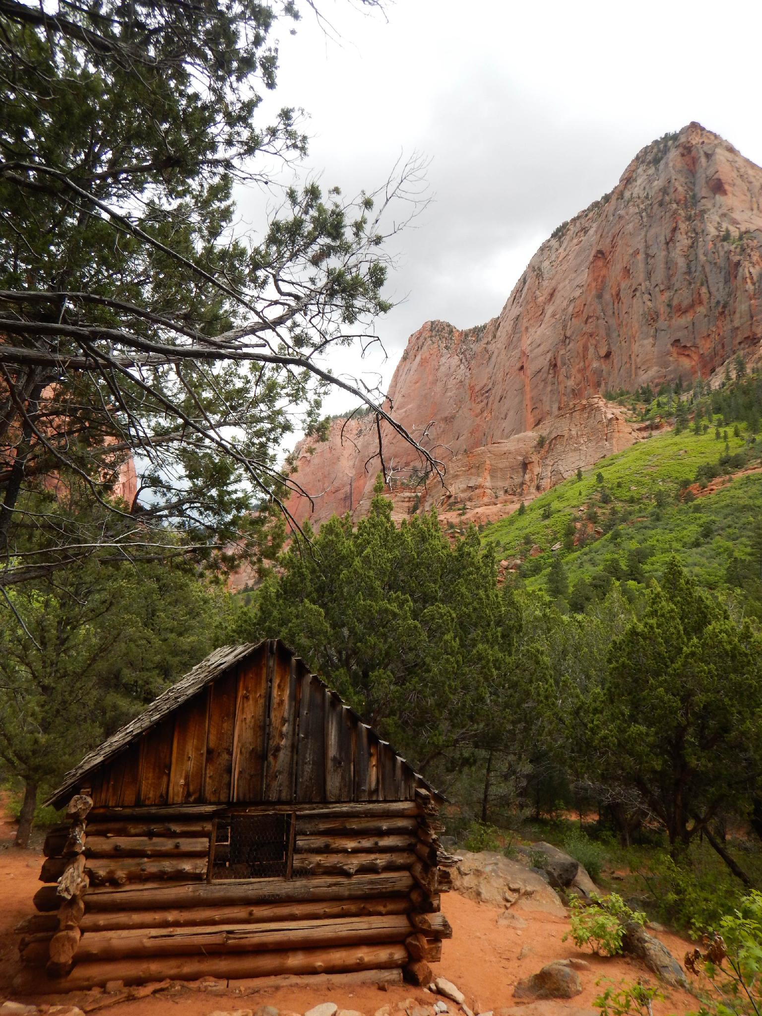
By the mid-1930's, Fife left the area and his claim. Larson left his claim from 1936 to 1939 to serve as President of the Swedish Mission for the LDS Church. When he returned, he found his claimed had been declared part of the new Kolob National Monument. The cabins are in a wilderness area, but the park service does some upkeep to preserve them for historical reasons.
Getting There
This canyon is in the Kolob Canyons area of Zion National Park, which is just off of exit 40 on I-15. This is about 20 miles south of Cedar City Utah. If coming from the main part of the park, go west on highway 9 about 17 miles to the town of La Verkin, then go north on UT-17 about 5 miles to I-15. Follow I-15 north for 12 miles to exit 40.
From the visitor center just off the highway, go into the park on the scenic drive for 2.1 miles to the signed Taylor Creek trailhead on the left. This is a large parking area.
Route Description
From the trailhead, follow the trail down to the stream bed, then upstream as it meanders along the stream. The trail crosses the stream numerous times, but with a few strategic rock hops, you are unlikely to get your feet wet.
The first landmark is Larson Cabin on the left, about 20-30 minutes from the trailhead. From here, the trail begins entering the soaring walls of Taylor Creek. From the Larson Cabin, it is about another 20-30 minutes to the Fife Cabin. Of the two, I think Fife had the nicer spot....
Continuing up the canyon from the Fife Cabin, Double Alcove Arch and the usual end of the trail comes in about 10-15 minutes. The alcove makes a great place to hang out in the shade on a hot day.
Most return from here. If continuing, the trail gets less traveled, but staying in the watercourse will reach a dryfall (or small waterfall depending on the season) a few minutes up the canyon from Double Alcove Arch. This makes a good turnaround spot as well. Continuing requires hiking up the steep sand slope to the right of the dryfall. From the top of the dryfall, you can see the headwall of the canyon a short distance upstream.
Return the same way.
Maps

12S 305443E 4148380N
37°27'43"N 113°11'59"W
12S 306668E 4148329N
37°27'42"N 113°11'10"W
12S 308141E 4148077N
37°27'35"N 113°10'09"W
12S 308749E 4147801N
37°27'26"N 113°09'44"W