 Hiking The Vortex
Gunlock
Overview
|
Sat 97 | 66 |
Sun 98 | 67 |
Mon 95 | 66 |
Tue 95 | 67 |
Wed 95 | 65 |
| View Full Weather Details | ||||
|
Sat 97 | 66 |
Sun 98 | 67 |
Mon 95 | 66 |
Tue 95 | 67 |
Wed 95 | 65 |
| View Full Weather Details | ||||
Mini vortex
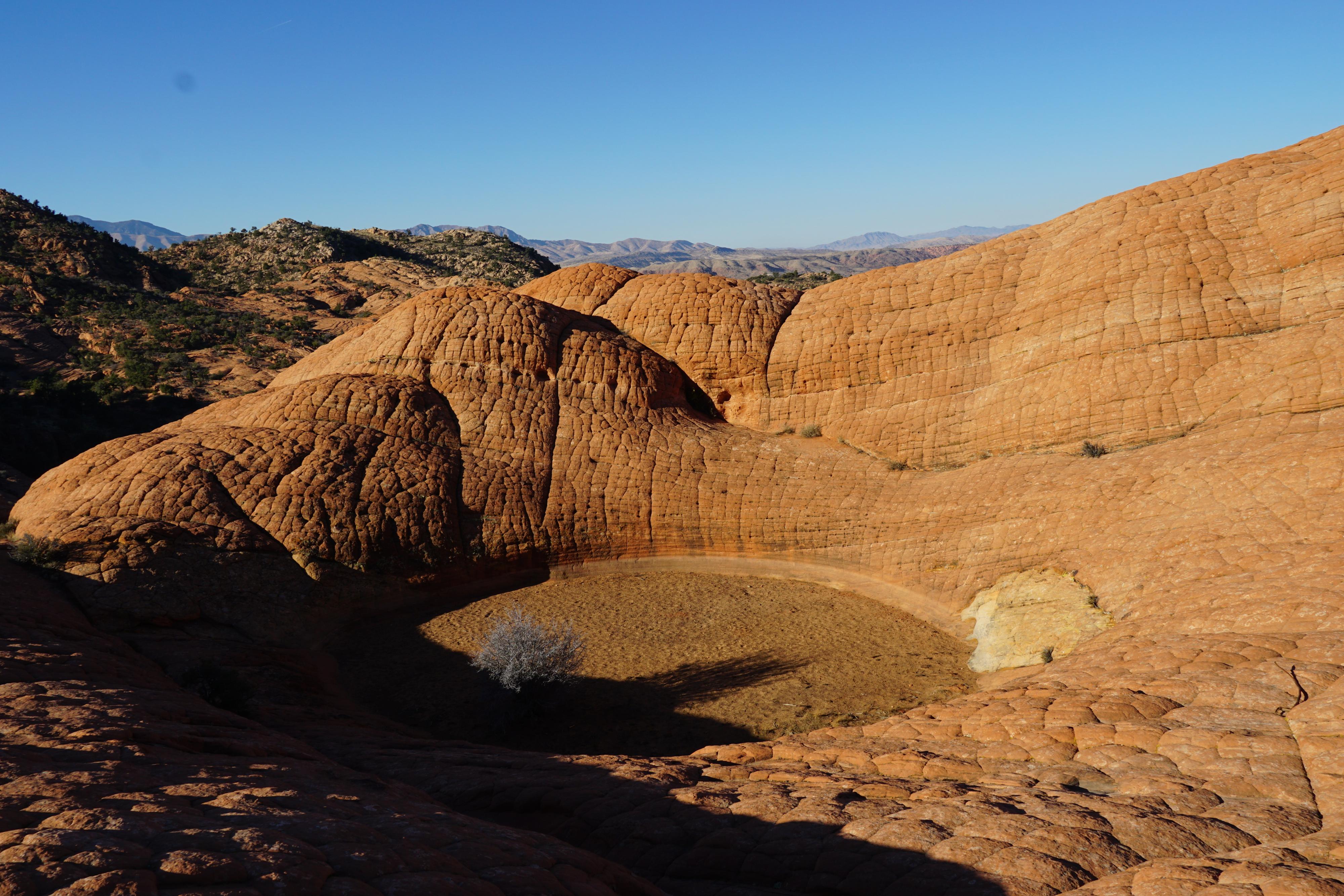
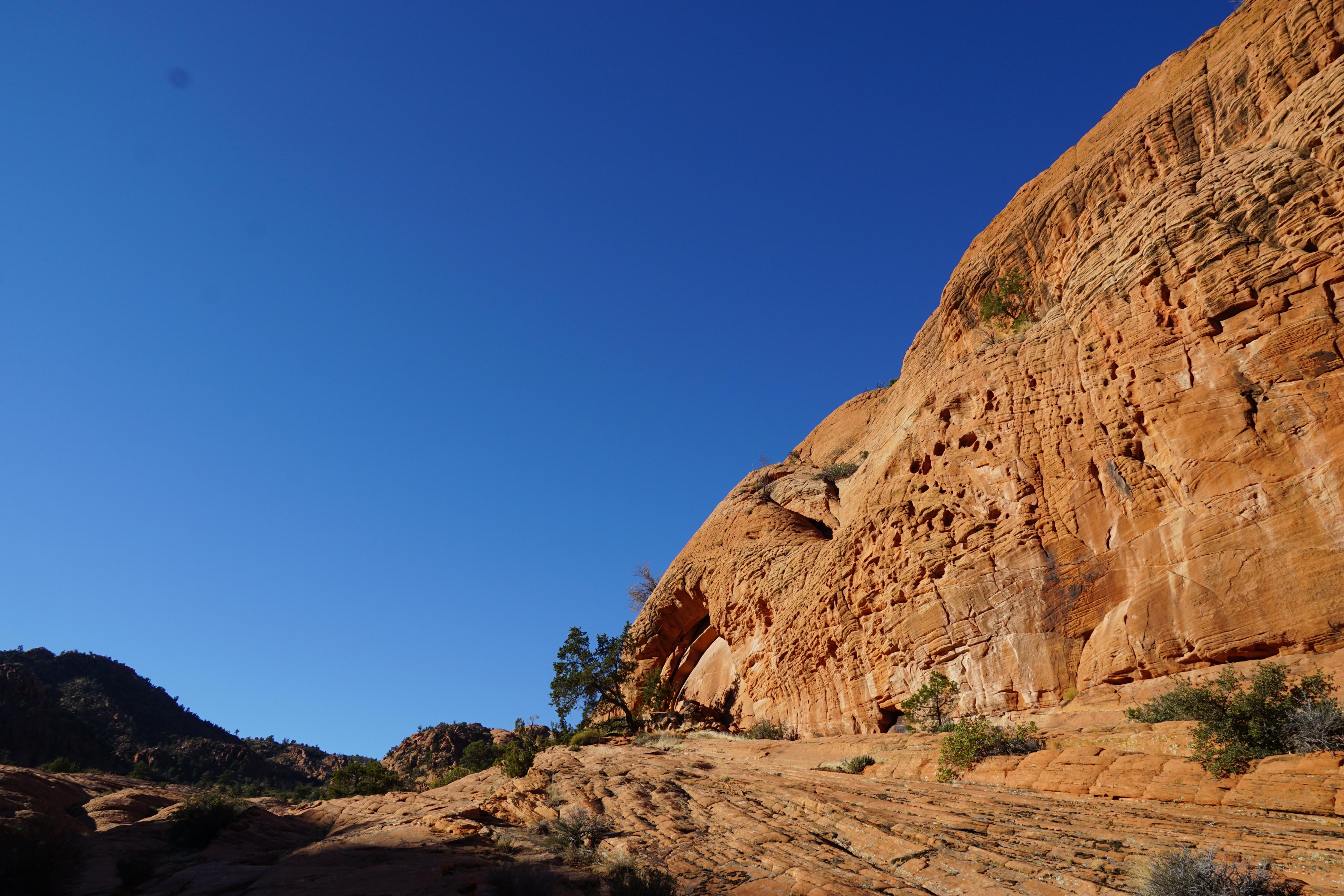
The Vortex, a deep sandstone pothole above Gunlock, is an interesting site that has been drawing people to visit for a long time. The deep pothole has names people have carved into the slickrock, some dated over a hundred years ago. Although the main Vortex is interesting, a couple of shallower potholes nearby are, to my eye, equally stunning. Being relatively close to St. George, this is a popular hike. Some love the Vortex, I enjoyed the Vortex, but though the hike in was the highlight of the day. Dramatic white and red slickrock makes up the views which get better and better as you ascend to the Vortex.
Great colors on the approach hike.
Getting There
The trailhead is just south of the town of Gunlock. To get there from St. George, follow Old Hwy 91 about 33 miles. At mile post 17.4, just before the road crosses the Santa Clara River and enters the town of Gunlock, turn right on Lower Sand Cove road, and reset your odometer.
Stay on the main Lower Sand Cove road as it winds its way up to the mesa above and heads east. Follow it for 3 miles, to where it crosses a small stream. Just across the small stream, turn right. This last couple of hundred feet of road is very rough, but can be walked if needed. Park at the large parking area.
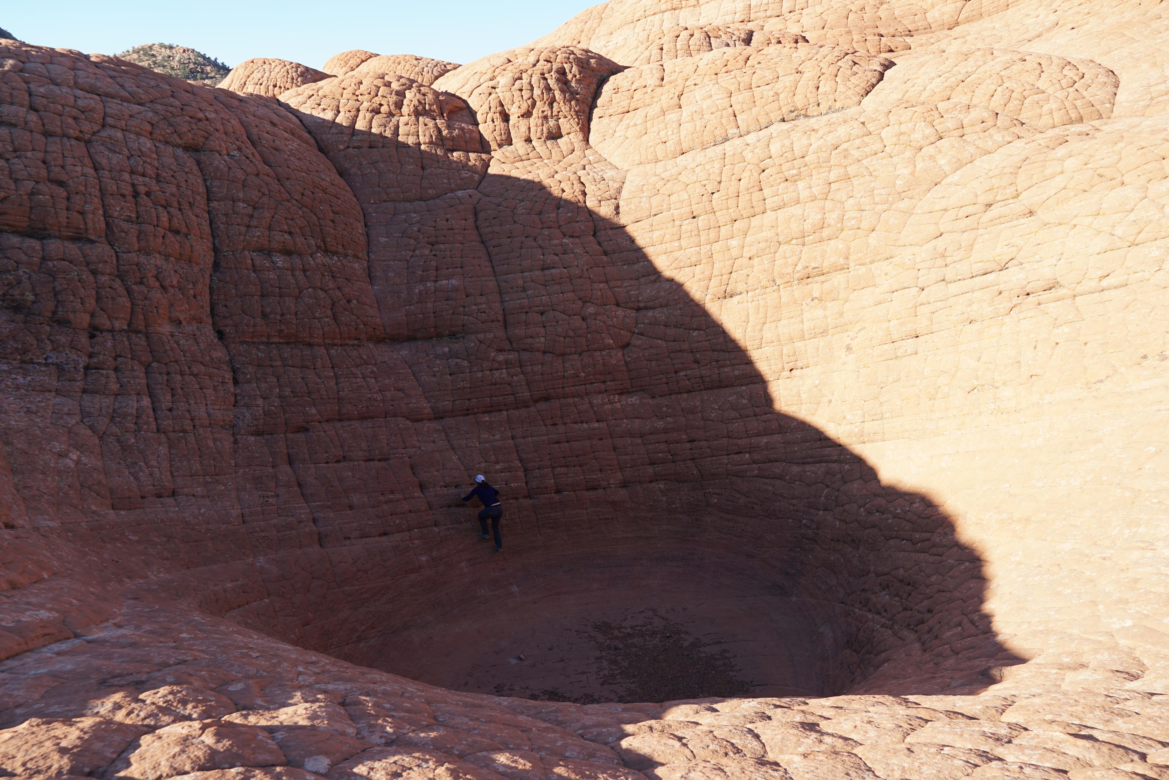
Diane checking out the vortex up close.
Route
Before leaving the trailhead, it is a good spot to get orientated. Looking south there are 2 large white domes, with a separate reddish dome to the west. The two sandstone formations are separated by a wide drainage. The drainage is where the hike goes. There are two white bumps in the far distance south. These are a little bit right of the Vortex.
From the trailhead, walk west on a rougher section of road for a minute to a well-used side trail heading down the boulder strewn slope. Follow the trail as it descends to and crosses the wash. The biggest opportunity for route finding problems is here. Make sure after crossing the wash, you head up the first drainage just a few minutes to the west. This drainage is wide, with white sandstone on the left, and the red dome on the right. Heading up the drainage, on slickrock, cairns begin appearing. Follow cairns and occasional social trails south up to the ridge. The drainage stays wide the entire way, with the trail trending a bit right toward the top.
At the ridge, there is a large area of cairns to the south, an apparent rest stop for many! Instead of going south, go right, up the slickrock. Follow the ridge a few minutes to the Vortex and impressive views all around!
Return the same way.
Advanced Return (for experienced hikers only)
To make a loop hike, head northwest from the Vortex to the two white peaks. A ramp allows for easy, yet exposed, descent to the gap between the two peaks. Continue north from the gap, descending steep slickrock.
Once down the slickrock, continue north on slickrock to a side drainage. Stay on the right side of the drainage, along the white sandstone wall. A ramp allows for easier than expected descend along this wall all the way down to the base. Once at the base turn right. It is a few minutes to the approach trail.
Photos
Maps

| Trailhead |
12S 257209E 4129457N 37°16'48"N 113°44'19"W |
| Drainage |
12S 256825E 4128997N 37°16'33"N 113°44'34"W |
| Cairn Town |
12S 256285E 4128331N 37°16'11"N 113°44'55"W |
| The Vortex |
12S 256381E 4128502N 37°16'17"N 113°44'51"W |
| Ridge |
12S 256356E 4128366N 37°16'12"N 113°44'52"W |
| Advanced Route Down |
12S 256429E 4128697N 37°16'23"N 113°44'49"W |
| Ramp Down |
12S 256494E 4128886N 37°16'29"N 113°44'47"W |