 Hiking Porcupine Falls
Bighorn Mountains
Overview
|
Sun 65 | 46 |
Mon 68 | 47 |
Tue 67 | 48 |
Wed 61 | 45 |
Thu 63 | 43 |
| View Full Weather Details | ||||
|
Sun 65 | 46 |
Mon 68 | 47 |
Tue 67 | 48 |
Wed 61 | 45 |
Thu 63 | 43 |
| View Full Weather Details | ||||
Porcupine Falls - Bighorn Mountains
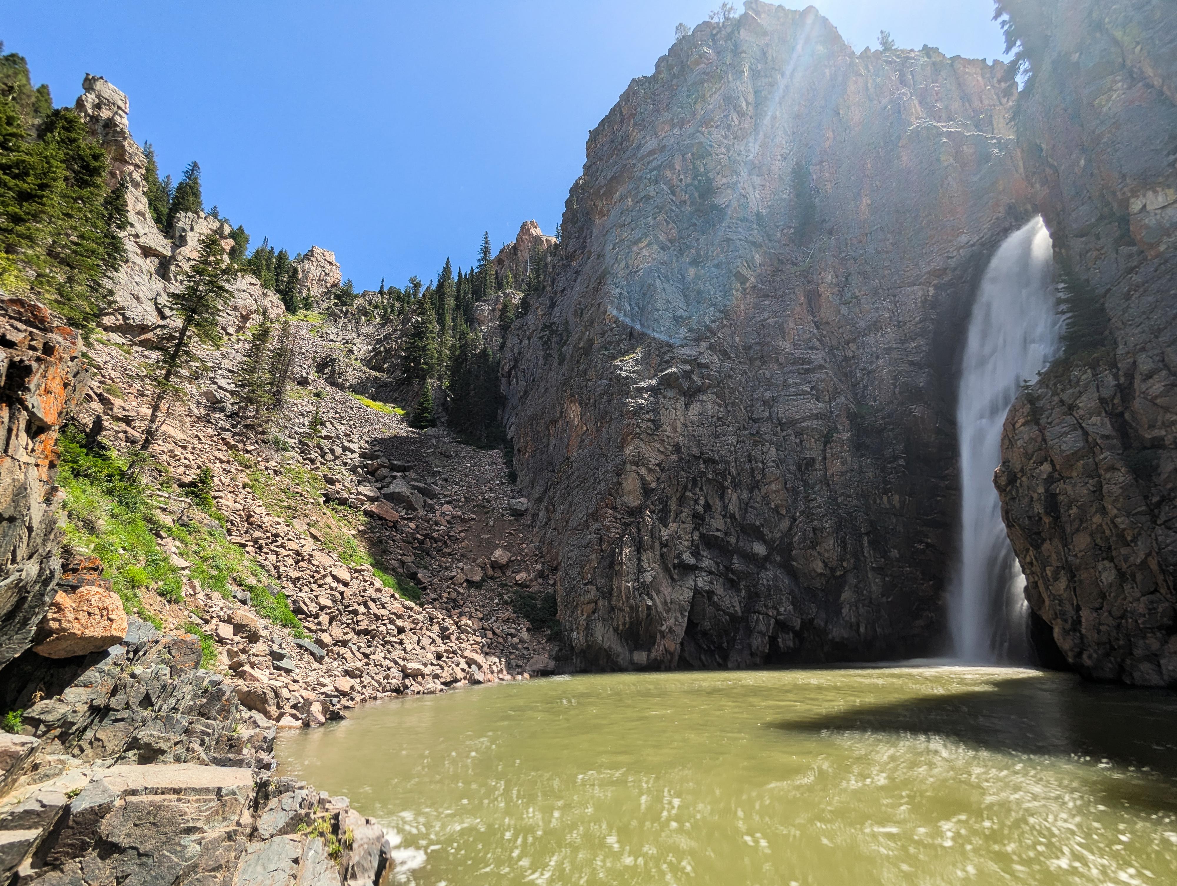
Porcupine Falls is a stunning 75-ish foot waterfall nestled in the Bighorn Mountains of north-central Wyoming, within the Bighorn National Forest. It's one of the more accessible and picturesque waterfalls in the area and makes for a great short hike and swim spot.
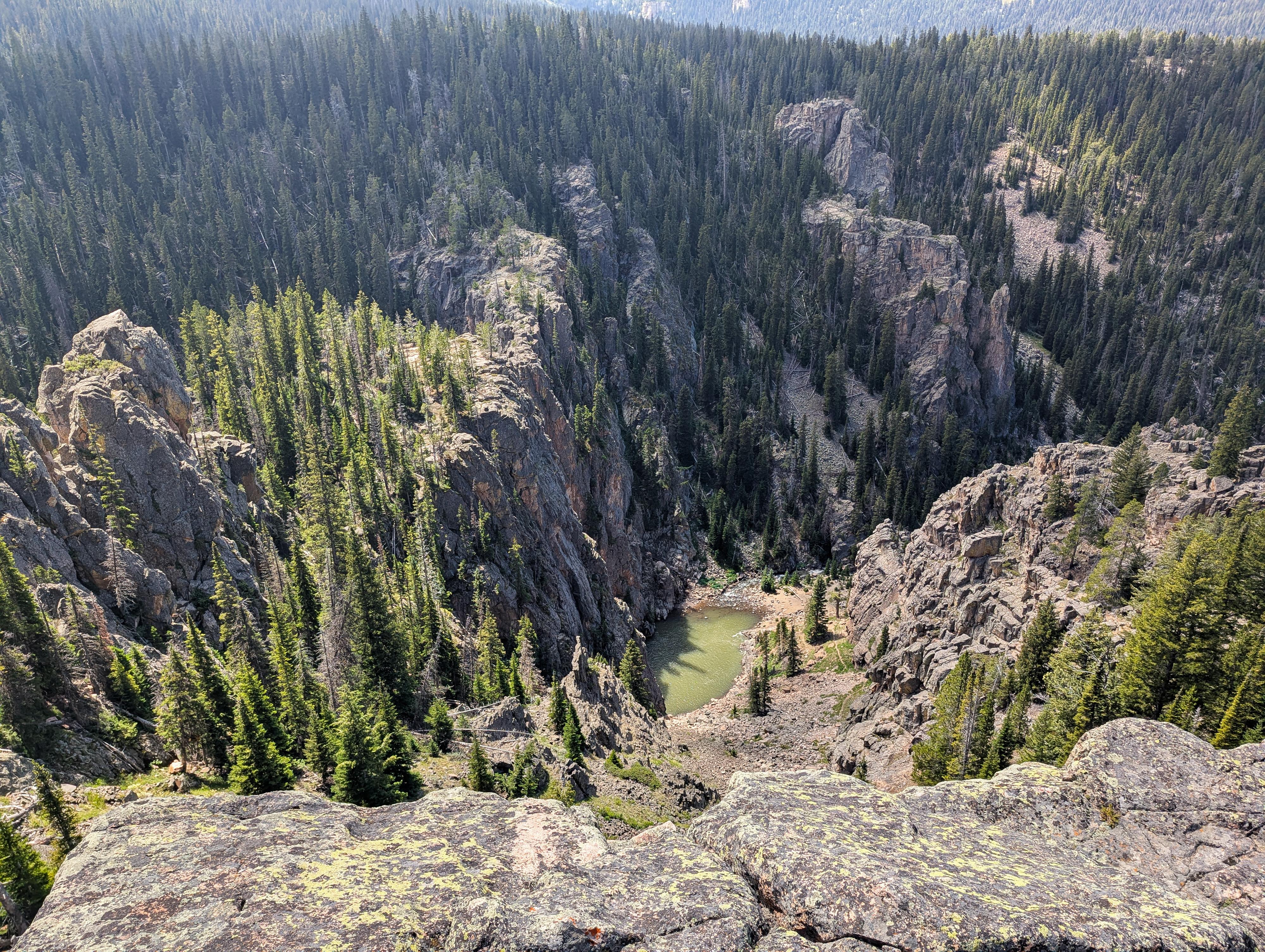
The trail to Porcupine Falls descends steeply from a trailhead at the end of a gravel road. It’s a short but steep hike down a series of switchbacks. Many families were visiting the falls on our visit, and our 8-year-old found the hike fun as long as we took quite a few breaks on the way out! Once you reach the bottom, you're rewarded with a postcard-worthy view: a tall, narrow waterfall spilling into a deep, crystal-clear pool. The water can be cold, but it’s popular for cliff-jumping and wading. Be sure to check the depth if jumping. Usually the water is clear, but on our visit, after a recent rain storm, it was quite cloudy and difficult to check depth.
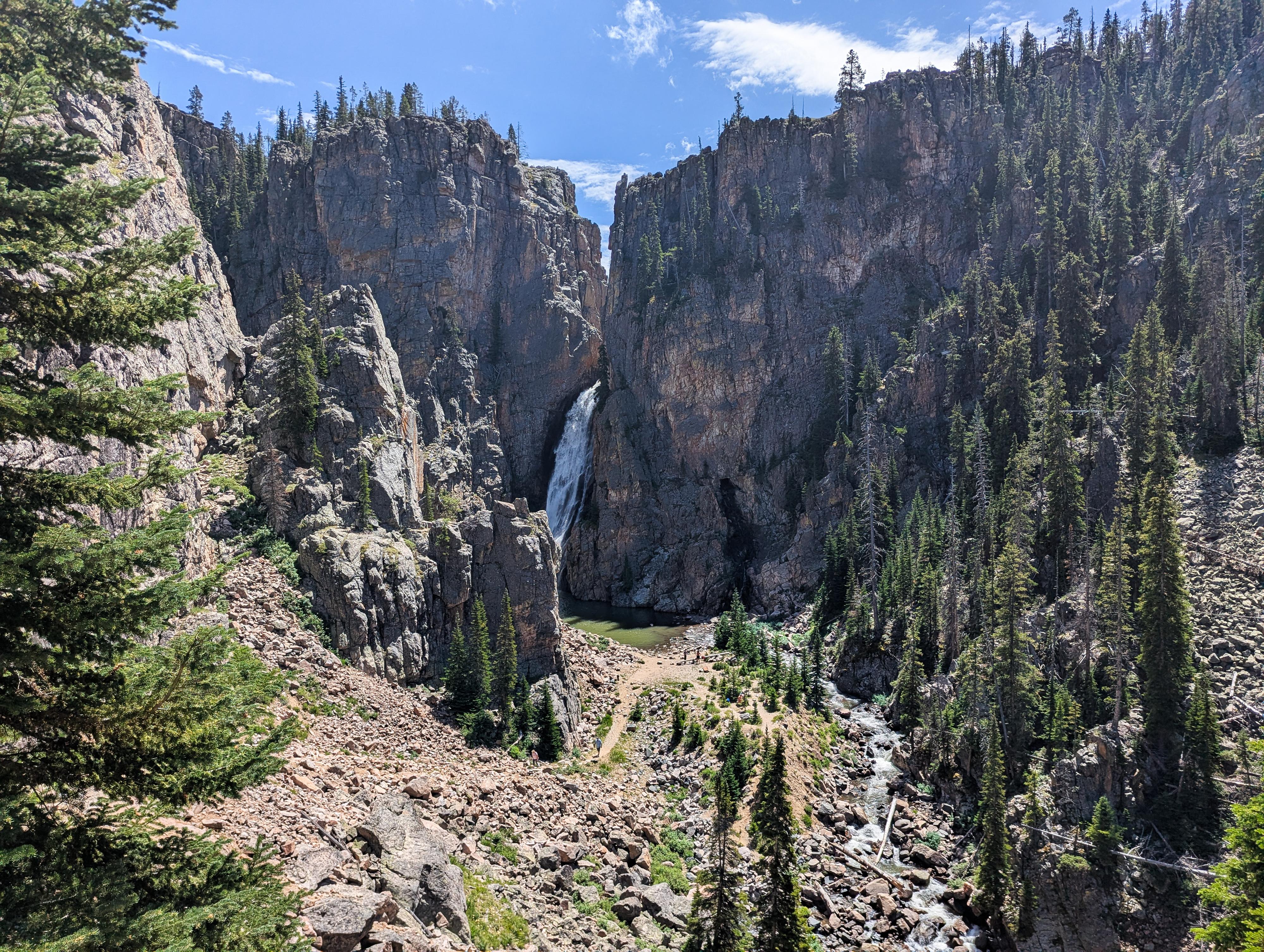
Porcupine Falls coming into view on the hike down. Stunning!
Getting There
The Medicine Wheel trailhead is off of US-14, which runs over the Bighorn Mountains from Lovell on the west side to Dayton/Sheridan on the east side.
From Lovell, head east, taking US-14 at the junction on the east side of town. Follow US-14 for 33.7 miles to a side road on the left (north) side of the road. This is just after entering Sheridan County, and signed Devil's Canyon.
- Turn north off the highway onto the good dirt road. This is the Devil's Canyon Rd/Sheep Mountain Rd. Reset your odometer as you turn off the highway. There are many side roads, but stay on the main dirt road as it initially heads north. ( 13T 276355E 4964944N / 44°48'10"N 107°49'40"W )
- 3.0 miles - Major 4-way junction. Go straight here, heading west. ( 13T 275995E 4969156N / 44°50'26"N 107°50'03"W )
- 7.4 miles - Spur road on the left. This spur road goes to the trailhead. It is a little rougher than the main road, but not terrible. It should be passable by most when dry. ( 13T 270172E 4971570N / 44°51'38"N 107°54'32"W )
- 7.7 miles - The road ends at the trailhead in a fairly large parking area. ( 13T 269859E 4971270N / 44°51'28"N 107°54'46"W )
View from the overlook down to Porcupine Falls
Route
The trail to Porcupine Falls leaves on the west side of the parking lot. It descends steeply down the hillside with steps, and a few switchbacks en route. The last section to the river is particularly steep.
The falls are stunning! To the right of the falls, across the river, is an old cave or mine that, on our trip, had water flowing out of it as well.
Photos
Maps

| Trailhead |
13T 269849E 4971270N 44°51'28"N 107°54'47"W |
| Overlook |
13T 269831E 4971165N 44°51'24"N 107°54'47"W |
| Porcupine Falls |
13T 269672E 4971056N 44°51'21"N 107°54'54"W |