
 Sinks Canyon State Park
Lander
Overview
|
Thu 68 | 45 |
Fri 72 | 48 |
Sat 72 | 53 |
Sun 71 | 52 |
Mon 71 | 49 |
| View Full Weather Details | ||||
|
Thu 68 | 45 |
Fri 72 | 48 |
Sat 72 | 53 |
Sun 71 | 52 |
Mon 71 | 49 |
| View Full Weather Details | ||||
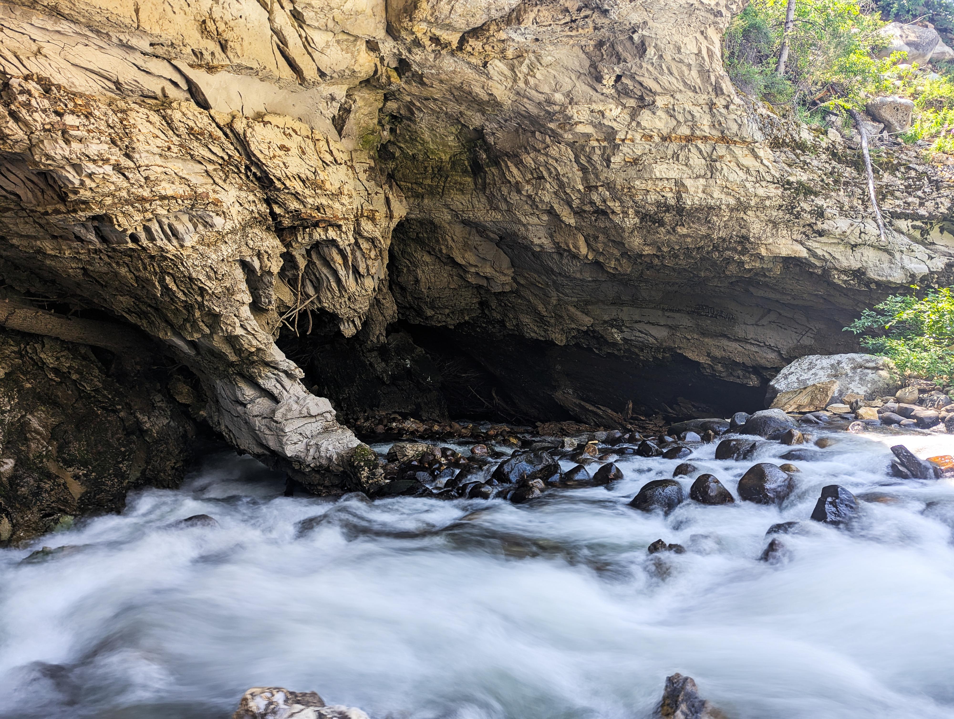
The Popo Agie entering The Sinks.
Tucked into the eastern slopes of the Wind River Mountains, Sinks Canyon State Park in Wyoming is a hidden gem. Just six miles southwest of Lander, this unique canyon is named for the remarkable natural phenomenon where the Middle Fork of the Popo Agie River disappears underground into a limestone cavern - known as "The Sinks" - only to reemerge a quarter mile downstream at "The Rise."
Sinks Canyon offers a wealth of outdoor activities for visitors of all skill levels and interests. Hikers can explore a network of trails, including routes that traverse alpine meadows, pine forests, and rocky outcroppings with sweeping views of the canyon below. Rock climbers flock to the area’s towering limestone walls, while anglers cast lines in the river's crystal-clear waters. In winter, snowshoeing and cross-country skiing offer a peaceful way to explore the park’s quieter, snow-covered side. With well-maintained facilities, educational exhibits at the visitor center, and nearby camping options, the park is a great family destination.
Beyond its natural allure, Sinks Canyon has deep cultural roots. The area has long been a travel corridor for Indigenous peoples, trappers, and early settlers. On our visit, we were surprised to even find pictographs and petroglyphs near the mouth of the canyon on the north side of the canyon a stones throw from the road. The park does not give out locations to the sites, but there are said to be a few sites.
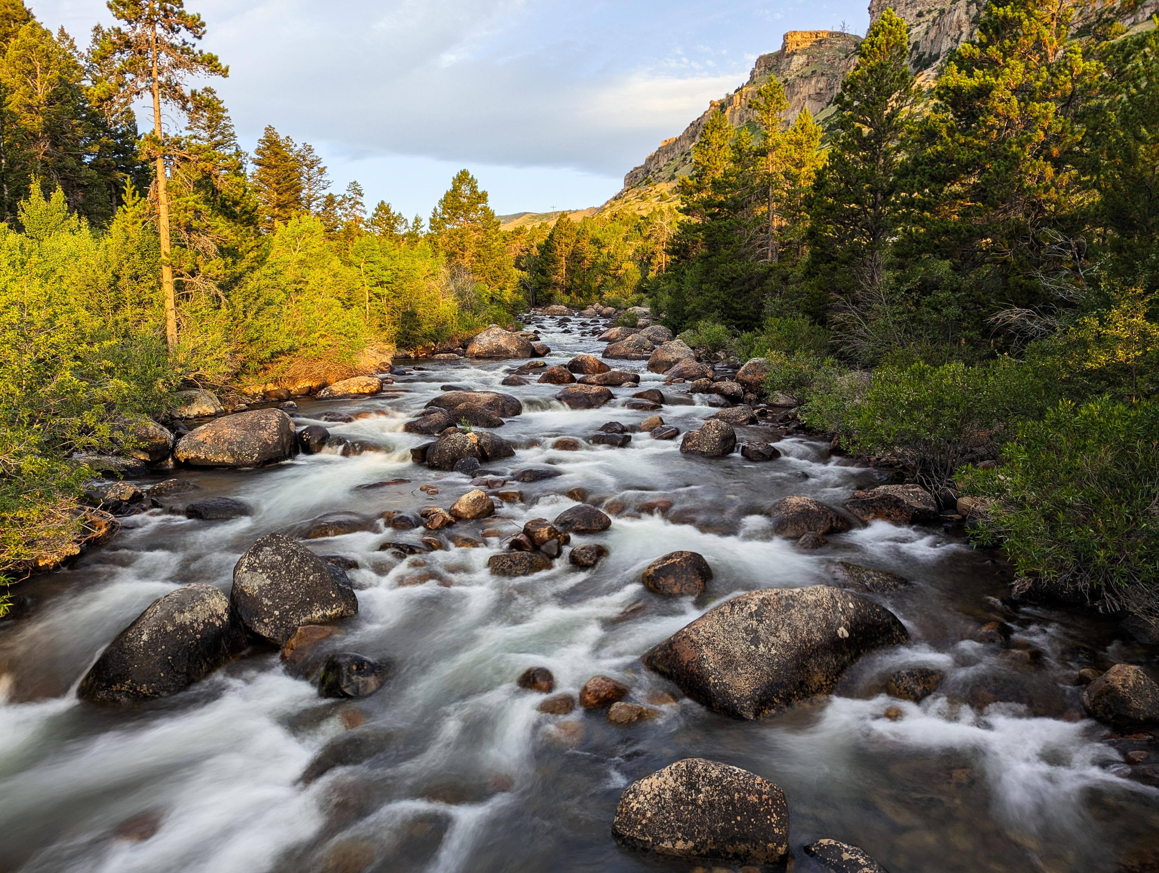
Morning light on the Popo Agie at the Nature Trail
Getting There
From downtown Lander, turn south on WY-131 S / 5th St. Follow this for about 0.7 mile to where it comes to a T-intersection.
Turn right here and follow WY-131 as it winds up to Sinks Canyon State Park. At 6.1 miles, the Sawmill Campground is on the left, and the rest of Sinks Canyon, including Popo Agie Campground, is in the following couple of miles.
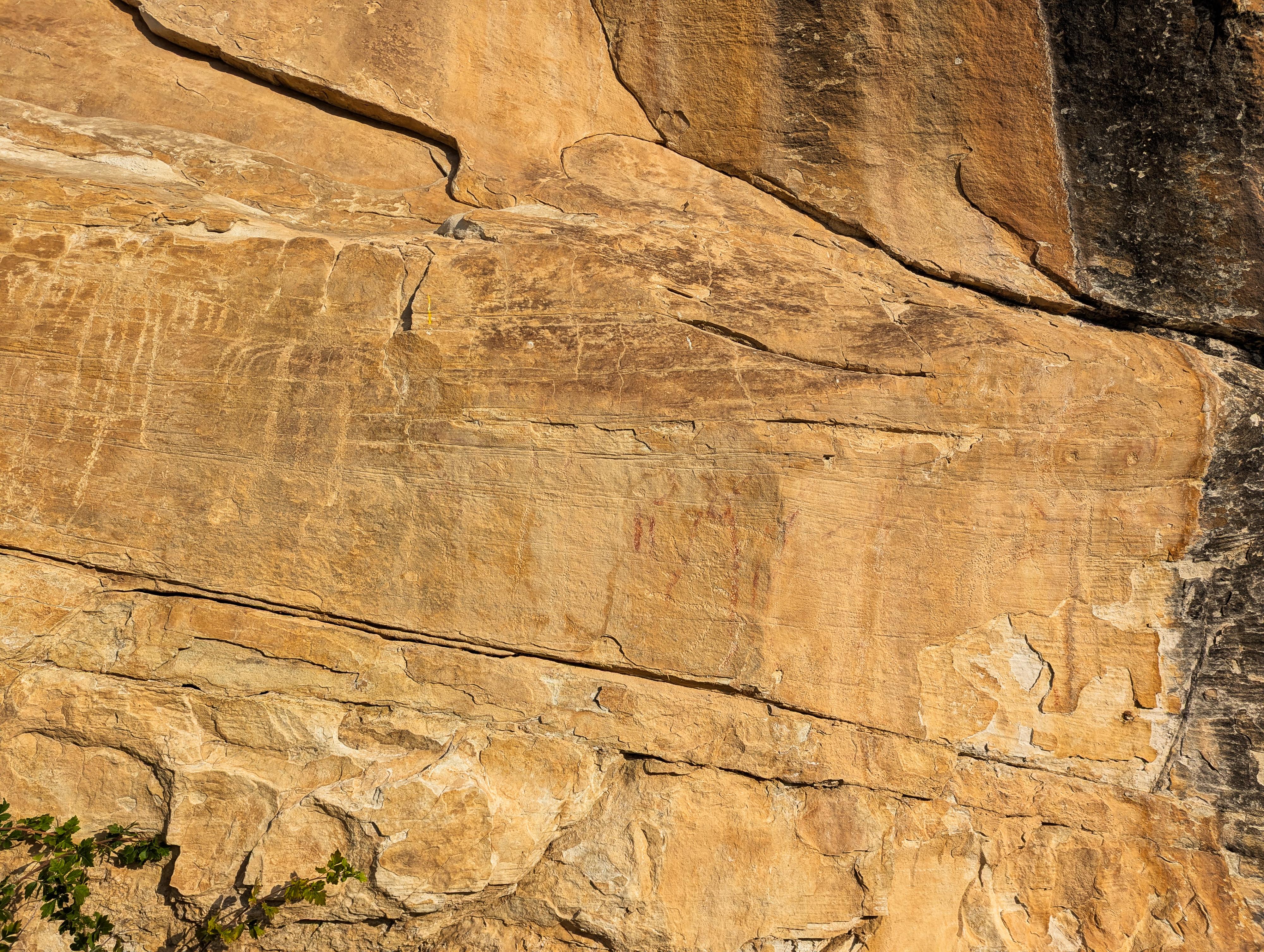
A rock art site low in the canyon.
Route
Rock art and historic sites are fragile, non-renewable cultural resources that, once damaged, can never be replaced. To ensure they are protected, please:
- Avoid Touching the Petroglyphs: Look and observe, BUT DO NOT TOUCH!
- Stay on the Trails: Stay on the most used trails when visiting sites, and don't create new trails or trample vegetation.
- Photography and Sketching is Allowed: Do not introduce any foreign substance to enhance the carved and pecked images for photographic or drawing purposes. Altering, defacing, or damaging the petroglyphs is against the law -- even if the damage is unintentional.
- Pets: Keep pets on a leash and clean up after them.
- Artifacts: If you happen to come across sherds (broken pottery) or lithics (flakes of stone tools), leave them where you see them. Once they are moved or removed, a piece of the past is forever lost.
There are a few things to visit in the park.
The Sinks (short walk)
Probably the main attraction, and where the visitor center is located. It is a short walk beyond the visitor center to an overlook of the The Sinks, where the Popo Agie goes underground into an enourmous cave. You can also take a short, rougher trail from the overlook down to the cave proper. Be very cautious if water levels are high not to get too close.
Visiting the visitor center is worth the time as well. They have programs at certains times, and an excellent exhibit about the animals in the area including information on the Black-Footed Ferret.
The Rise (short walk)
About 1/4 mile down canyon from The Sinks is The Rise. It is here the water that has entered the sinks reappears. It is interesting to note that tests showed it took 2 HOURS for the water to reappear. The route underground must be quite the maze! There is a large pool at The Rise where the water comes up that is full of some of the largest trout I have seen!
From the Informational sign:
THE RISE OF THE SINKS
The Rise of the Sinks is a large spring where the water of the middle fork of the Popo Agie River reappears after flowing into a limestone cavern called the Sinks, located a quarter of a mile upstream.
The water flows underground following an unknown path. Geologists speculate the water travels through many cracks and fissures located in the water-soluble limestone until it rises to the surface in this calm pool.
The Rise is an active geologic formation that changes from year to year. Erosion in the river and underground alters the water pathways and changes the amount of water flowing into the Pool. Some years the stream is almost gone and some years it takes up part of the bank near the fishes.
Shaped by ice-age glaciers and the power of the river, Sinks Canyon has served as a natural travel corridor for wildlife and people for thousands of years. Known to Native Americans for centuries, the river flowed through the area and reappeared (or surfaced). The name Popo Agie (pronounced po - po shuh) is a Crow Indian word which means Grass River.
The Rise was donated to the City of Lander in 1969 by Pacific Power and Light Company. The site is now part of Sinks Canyon State Park administered by Wyoming State Parks and Historic Sites.
Nature Trail (short hike)
From the Popo Agie Campground, there is a parking area in the middle of the campground where the Nature Trail leaves, crosses the river on a swinging bridge, and makes about a mile loop. We did this hike in the early morning, and seeing the sun light up the cliffs was a treat. Highly recommended.
Canyon Loop Trail (longer hike)
This is the longest trail in the park and makes a loop down one side of the river, across to The Sinks and The Rise, then back via a trail along the north (right when heading up) side of the canyon road. We, unfortunately, didn't have an opportunity to hike this trail but the sections we saw seemed lovely.
Photos
Maps

| Sinks Canyon State Park |
12T 680110E 4736253N 42°45'28"N 108°47'56"W |
| Sawmill Campground |
12T 680111E 4736199N 42°45'26"N 108°47'56"W |
| The Rise |
12T 679583E 4735700N 42°45'10"N 108°48'20"W |
| Visitor Center |
12T 679257E 4735166N 42°44'53"N 108°48'35"W |
| The Sinks |
12T 679284E 4735088N 42°44'51"N 108°48'34"W |
| Popo Agie Campground |
12T 678422E 4734545N 42°44'34"N 108°49'12"W |
| Nature Trail Trailhead |
12T 678148E 4734390N 42°44'29"N 108°49'25"W |