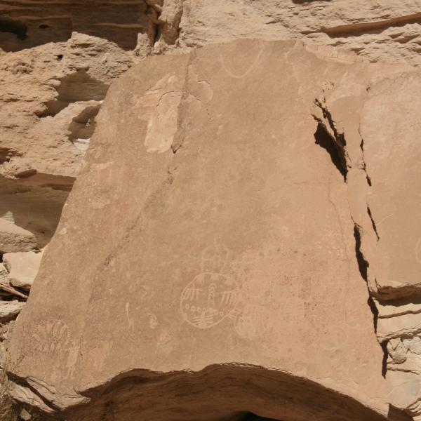
War Shield Canyon in Nevada (also known as Dead Man's Wash) has a number of petroglyph panels that are an easy 1.3 mile round trip hike. It is called War Shield as the carvings seem to be mostly war shields. To get there take I-15 towards Las Vegas and Exit at Glendale taking Hwy 168 North approximately 15.85 miles to a dirt road at GPS Coordinates N36° 46.703' W114° 48.662'. Turn South (left) follow road about 6 miles going in between two mesas. You will need a high clearance vehicle, I never used 4 wheel drive but it is rough in some places. When road splits stay left along the butte. Follow to parking lot at N36° 44.950' W114° 48.616' be prepared for some racing stripes on your vehicle. The first panel is behind the big sand dune at GPS coordinates N36° 44.965' W114° 48.489'.
The second and third panels are in the canyon directly across from the first to the South. You can find small trails to follow through the sticks. We just made for the cliff and followed it around to the sites. The second site is at GPS coordinate 36°44'47.84"N 114°48'29.40"W. The last panel was down the canyon at GPS coordinates N36° 44.748' W114° 48.665'. Once back to the parking lost you can follow the road in farther to the dam which also leads to Arrow Canyon. We chose to go in from the other end. Arrow Canyon also has a number of petroglyph sites as well a real narrow canyon to hike through. Contact me for coordinates for the panels here.
All in all an easy hike and a chance to see petroglyphs that are different than those we typically see.