 Floating
Green River
Floating
Green River
Flaming Gorge
Overview
The Green River, below Flaming Gorge Dam, likely needs no introduction if you are an avid fisherman. This section of the Green River is one of the most popular sections in Utah with fisherman. The river is divided into three distinct sections, named Section A, Section B, and Section C.
Each section has a very different character than the others, and each can be done individually if looking for a shorter trip.
A few important details:
- Life preservers are required to be worn while on the river.
- Currently, no permit is needed for floating, but camping reservations/fees are required in Section B.
- Bugs can be a problem, especially on the lower slower sections. Bug spray recommended.
- Flows can vary a lot during the day, depending on dam release.
- Ramps can be very busy, be prepared to get on/off the river quickly to not block the ramps.
Getting There
The put-ins / take-outs are listed from the dam downstream. A shuttle company is highly recommended to make the trip much faster and easier than trying to do the shuttle on your own.
Dam Put-in
The Dam put-in is reached from the east side of Flaming Gorge Dam. From Dutch John, UT; go west on US 191 for about 2 miles to the signed FR 219/Spillway Boat Launch Rd on the south. Follow this to its end in 1.4 miles. The ramp and parking area are quite a ways apart. Have raft ready to launch before proceeding to the busy ramp.
Little Hole Put-In (Easy Shuttle)
From Dutch John, UT, go west on Center Street until you can reach W Little Hole Rd. Follow this road 4.8 miles to its end at the river and Little Hole Recreation Area.
Indian Crossing Campground (Longer Shuttle)
From Dutch John, go EAST on US-191 for about 9 miles to Browns Park Rd on the right (east). Follow Browns Park Rd 20.5 miles to a junction. Go right at the junction, staying on the main road for an additional 2 miles and the Indian Crossing Campground.
Swallow Canyon Access (Very Long Shuttle)
From Dutch John, go EAST on US-191 for about 9 miles to Browns Park Rd on the right (east). Follow Browns Park Rd 25.3 miles to a junction. Go right at the junction, staying on the most used road for an additional 2 miles and the Swallow Canyon access point. There is no good camping here.
Route Description
Section A - Where the action is! (3-4 hours / ~ 7 miles)
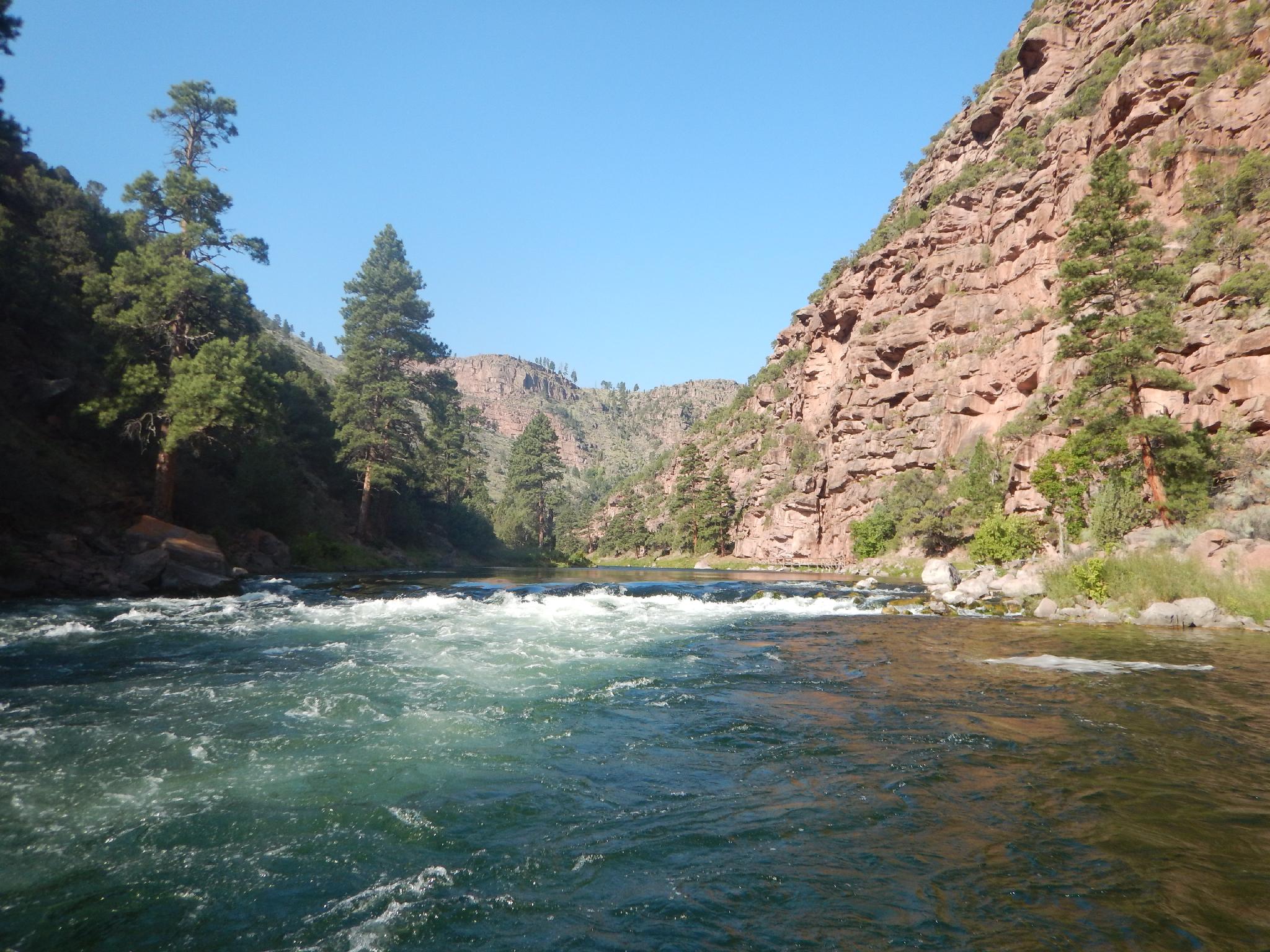
Section A starts just below the dam and continues down to Little Hole through Red Canyon. This section is the most popular and most fished. The crystal clear water is said to contain 11,000-15,000 fish per MILE. Not a fisherman? Section A also contains the most rapids, with a seemingly endless supply of Class II rapids to play in. Most are beginner friendly but keeps an eye out, there are plenty of boulders to wrap a raft on and ruin your day.
The action starts from the get-go. Keep an eye out for Mother-In-Law Rapid, which has a sign on the right before it. At maybe Class II+, this rapid is likely the most difficult in this section, but not particularly hard.
There is no camping allowed in Section A.
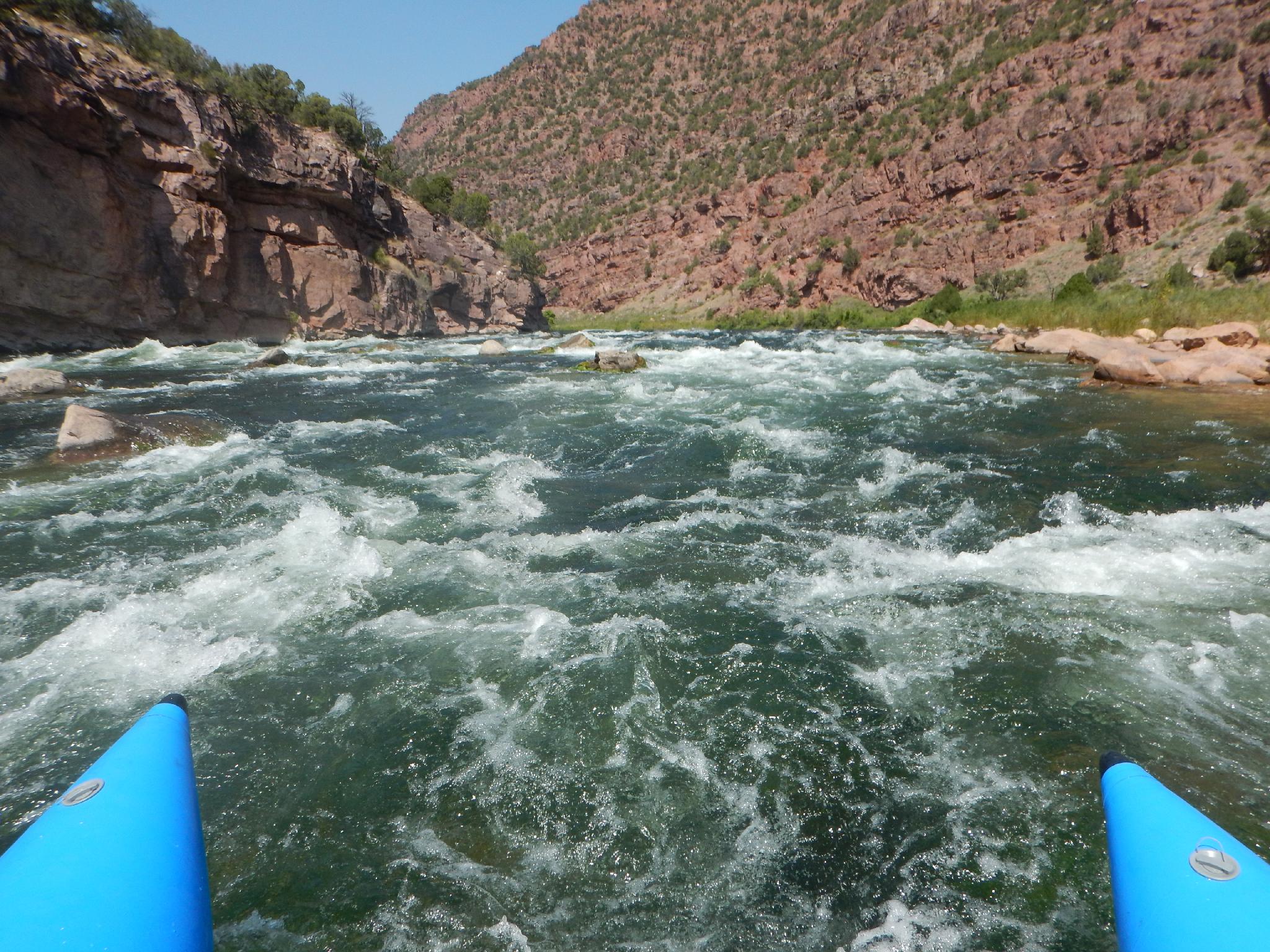
Section B - The biggest rapid of the area! (3-4 hours / ~ 8 miles)
Section B starts at Little Hole and continues down to Indian Crossing. The river is much more mellow in this section and quite calm until Red Creek Rapid. Red Creek Rapid marks the biggest rapid in the area, Class III, and a chance to test your mettle. Though class III, the rapid is short and easily scouted. Not for rank beginners, but most rafters won't have much difficulty. Stay left is my advice. After the rapid, the river lazily meanders past many excellent campsites before reaching Indian Crossing.
Camping is allowed in designated sites, reserve in advance online or at the Little Hole Boat Ramp. This section has better camping than Section C (in my opinion). Expect 3-4 hours to float this section.
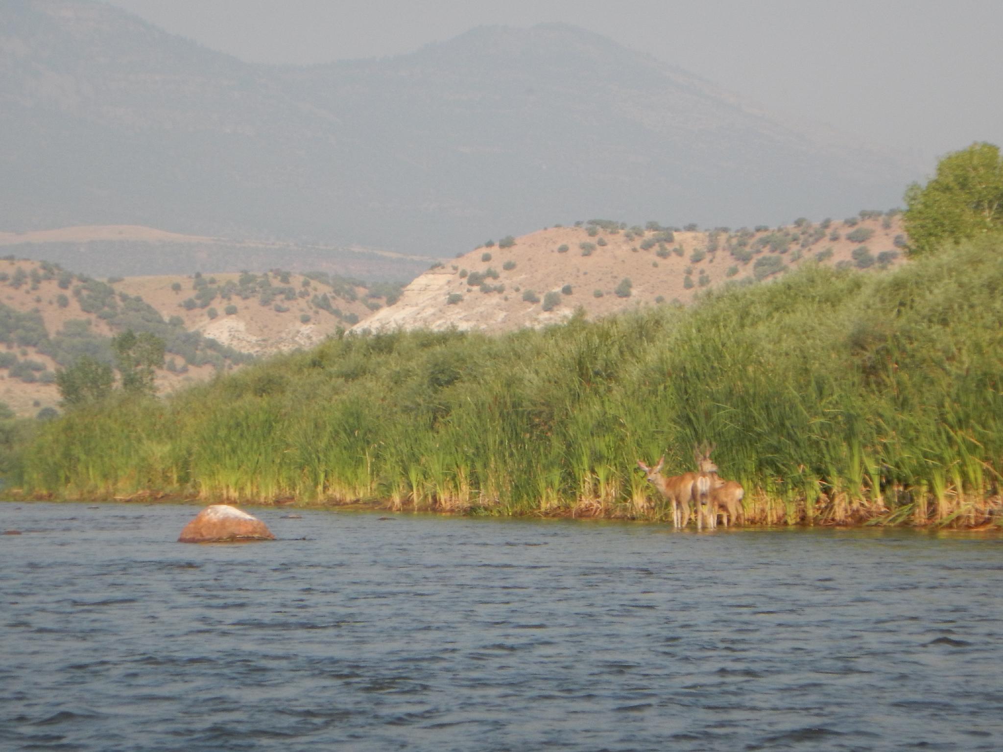
Section C - The biggest fish in the area?!?! (5-6 hours / ~ 11.5 miles)
Section C starts at Indian Crossing and continues down to Swallow Canyon Ramp or Swinging Bridge. This section is mellow and slow. It is rumored to have bigger fish than Section A or B, but they are hard to catch. Though slow, I recommend this section to those up for a lazy section of river. Swallow Canyon, in particular, is pretty and well worth the time to float.
Camping is allowed in designated sites, but dispersed camping is also allowed. The campsites, for the most part, seemed a bit weedy and overgrown, but do include picnic tables and fire rings. The scenery for camping is better in Section B. This section is slower and may take 4-6 hours to float depending on flows and how much rowing you’re willing to do. One of the nicest looking areas to camp is on river left just before entering Swallow Canyon.
The Swallow Boat ramp is on the left just after leaving the towering walls of Swallow Canyon. I would recommend exiting here, as the float down to Swinging Bridge is very slow and not as interesting as the upper sections.
Photos
Maps


12T 632868E 4529823N
40°54'31"N 109°25'20"W
12T 638712E 4528986N
40°54'01"N 109°21'11"W
12T 641890E 4530218N
40°54'39"N 109°18'55"W
12T 647302E 4529588N
40°54'15"N 109°15'04"W
12T 652860E 4528910N
40°53'49"N 109°11'07"W
12T 661657E 4523239N
40°50'39"N 109°04'57"W