 Hiking
Lower Black Box
Hiking
Lower Black Box
San Rafael Swell
Overview
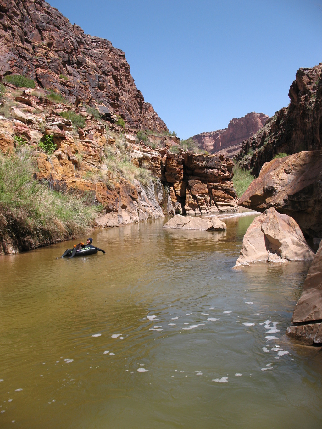
The Lower Black Box is one of the classic San Rafael adventures. The hike combines expansive views, with an amazing canyon. Although a classic adventure, it requires skills and good judgment to descend. Even on the hottest days, hypothermia is a real danger. You will be wading and swimming in the river for several hours. For the prepared, this is a magical adventure not to be missed, for the unprepared, it can be a miserably cold experience or worse. Several groups have had very close calls, and lives have been lost in the canyon in accidents in the past. Be prepared!
Check for recent heavy rains upstream as well. This is a big drainage, and a flood upstream may take a day or so to reach the Box. You wouldn't want to be caught in the Box when a flash flood comes down stream.
Getting There
Travel to exit 131 on Interstate I-70. This is about 30 miles west of Green River.
Route Description
From the trailhead, follow the old road past the gate as it heads down to the San Rafael River. As it nears the river, you will reach a junction. Go right, the road quickly drops into a wash. Follow the wash to the river. Where the wash meets the river is the exit point on your return, so take note.
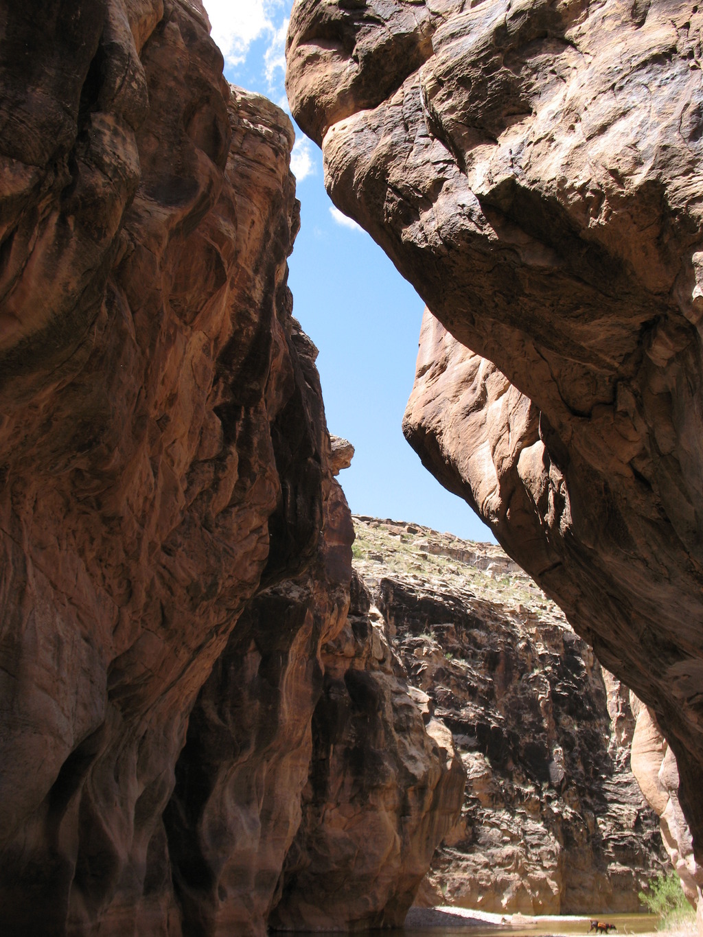
Cross the river, it is normally about knee deep. If it seems exceptionally high, now is the time to turn back. After crossing the river, work your way north and west on the bench above the river. There are many cow trails in the area. Commandeer one that is heading in the direction you want to go. You should be paralleling the San Rafael River. As you follow the river upstream, the cow trails tend to merge and become more unified. It takes an hour to 90 minutes from the crossing to Swasey's Leap. It is easy to recognize Swasey's Leap, as your very near Mexican Mountain, at the entrance to the Lower Black Box. It is impressive how it goes from an open river to a deep canyon in such a short distance.
History Swasey's Leap is named after Sid Swasey. Legend has it that Sid bet his brother, for a herd of livestock, that he could jump this narrow spot on his horse. The leap is likely less that 10 feet across at this point, but as you visit this spot, ponder the take off and landings and make your determination of the legends validity. There was an old sheep bridge at this point, the Hanson sheep bridge, that was build in the early 1900's. Unfortunately it finally succumb to gravity and the elements and collapsed in the late 1990's.
Begin the watery journey
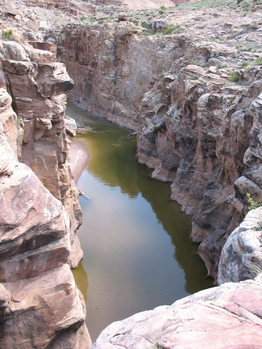
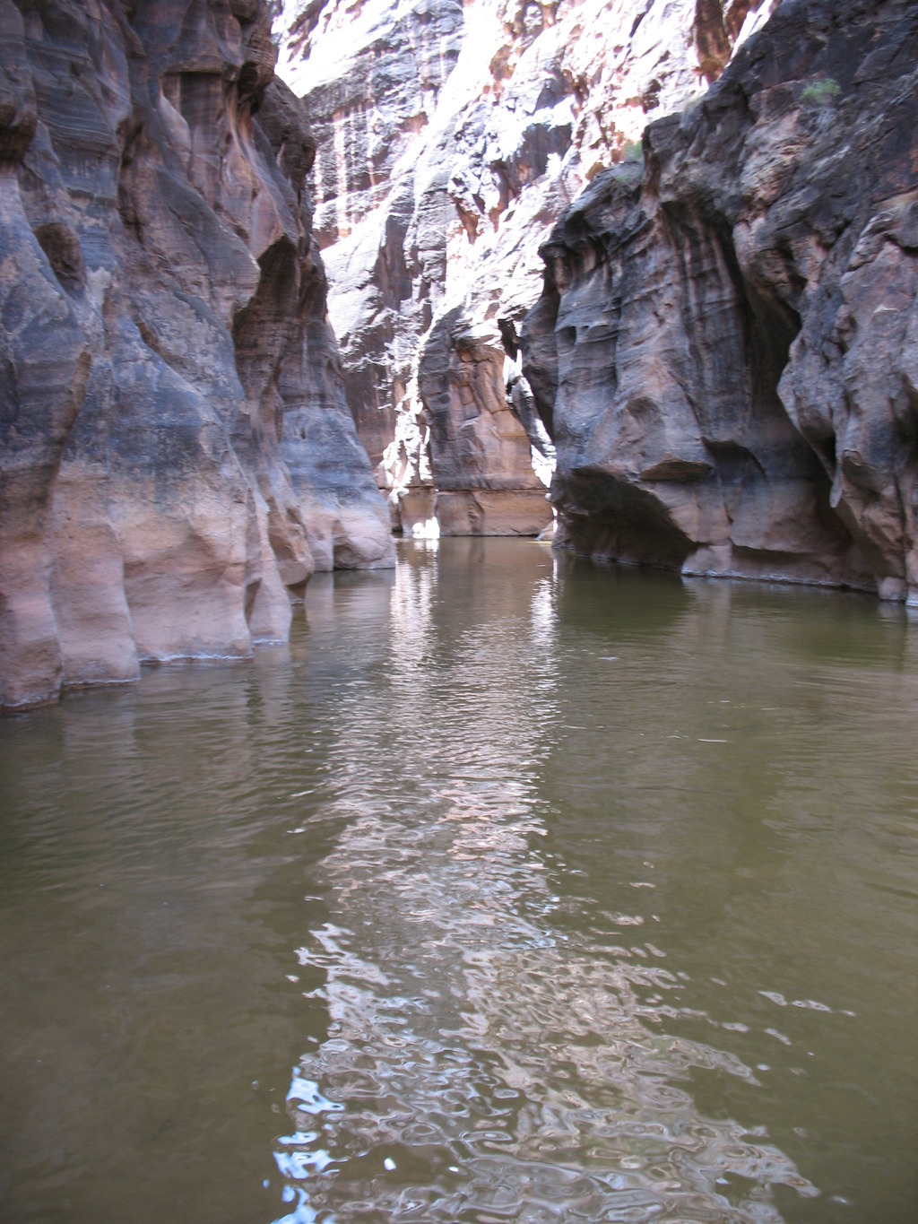
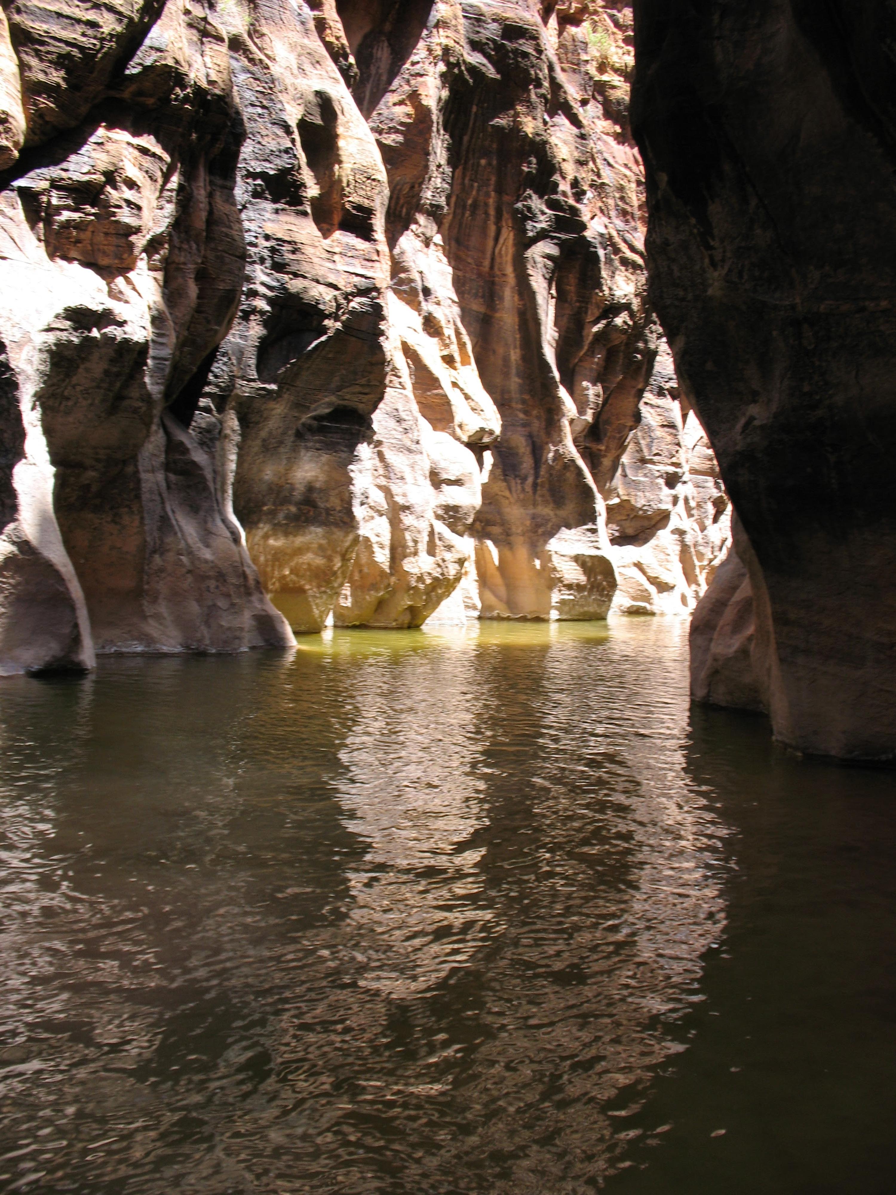
Now is your last chance to change your mind. Be sure the flow is reasonable at this point. Once you start into the Black Box, it's difficult to reverse if the flow is high, and escape options out the canyon walls are few or none. As you start into the canyon, it generally has several deep pools and swims right from the get go, as it narrows and goes under Swasey's Leap. For the next 30-45 minutes, work your way down the canyon, finding ways around or through several large boulder piles. This section is narrow, dark, and exquisite.
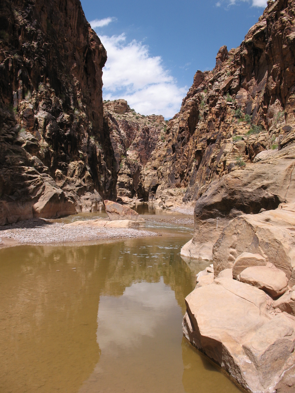
About 45 minutes or so from the start, the canyon eases a bit. A few more boulders present obstacles, but overall it is much easier. The canyon also opens and deepens through here, with more options for getting out on sandy benches on the sides to walk out of the cold water. Simply continue down the canyon. It will take 3 hours or so before the canyon walls begin to subside as the canyon opens. The last section, before it opens, has fantastic dripping springs on the walls and vibrant colors. Once the smell of sulfur permeates the air, you know you close to your exit. Exit on the right, where you crossed the river on the approach and follow the approach back to the trailhead.
Photos
Maps

12S 546332E 4315999N
38°59'30"N 110°27'54"W
12S 545904E 4313110N
38°57'57"N 110°28'12"W
12S 548121E 4313823N
38°58'19"N 110°26'40"W