 Hiking
Lower Spring Canyon
Hiking
Lower Spring Canyon
Capitol Reef
Overview
If there is a heart of Capitol Reef, this hike surely visits it. At about 10-11 miles in length, the Lower Spring Canyon hike has enough length to keep the crowds away and feel isolated and remote, yet both trailheads are easily accessible from highway 24 and the route offers easy hiking with few obstacles. I can't recommend this enough to fit hikers looking for a full day deep in the heart of Capitol Reef. This, in my opinion, is one of the very best ways to experience the magic of the area. The start of the hike offers big views, while the final three quarters or so of the day involve meandering through seemingly endlessly towering walls and domes. It is a wonder that such a long section of canyon offers such easy passage.
This hike requires a car shuttle and crossing the Fremont River at the end of the day. Normally the river is less than knee deep, but it can be difficult/dangerous to cross for a few weeks during spring run-off or after very heavy rains. It is prudent to eyeball the river before setting out. It would be a harsh surprise to hike the 11 miles only to find the river too dangerous to cross.
Finally, there is no water on the hike until near middle/end. Bring all that you need, and visit during spring or fall when the temperatures are reasonable. Winter would be a great time to visit as well if there is no snow on the ground and the thought of wading the ice cold Fremont River doesn't cause you to cower in fear. Having crossed the Fremont River several times in December over the years I can attest that it is cold, but do-able.
Getting There
Start Trailhead
The hike starts at the Chimney Rock trailhead. This is west on highway 24 out of the visitor center about 3 miles. The Chimney Rock trailhead is well signed on the right side of the road. (This is at milepost 76.4.)
Exit Trailhead
From the visitor center, head east on highway 24 about 4 miles to mile post 83. There is a parking/pullout out area on either side of the road here. Spring Canyon enters from the north a minutes walk east of this parking area.
Route Description
To Spring Canyon (3-4 miles / 1.5-2 hours)
Start up the Chimney Rock trail. It climbs steeply up to a trail junction. Here you have two options, left or right. Both will end up in the same place. Right is about 1 mile longer, offers better views, and is my recommendation. Left is about a mile shorter than the right and doesn't offer quite as good of scenery, but gets you into the backcountry quicker.
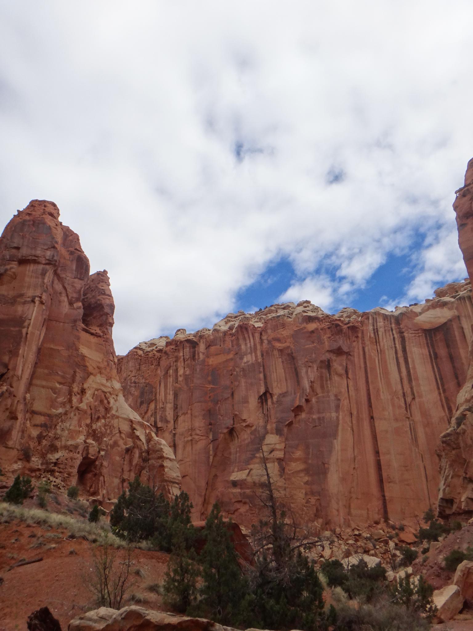
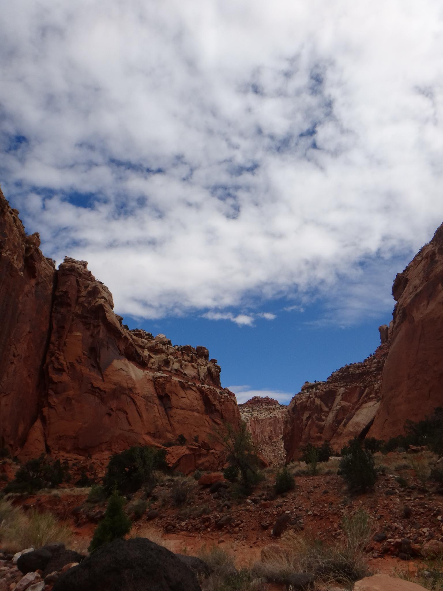
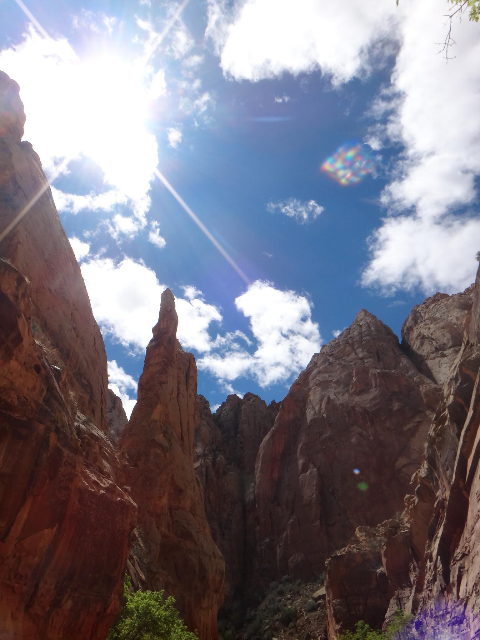
Both trails join up before descending Chimney Canyon. The canyon is deep walled and stunning, with vibrant colors and a few impressive side canyons coming in. The junction with Spring Canyon is signed, and would be tough to miss, the confluence is big and open.
Down Spring Canyon (7.5 miles / 3-4 hours)
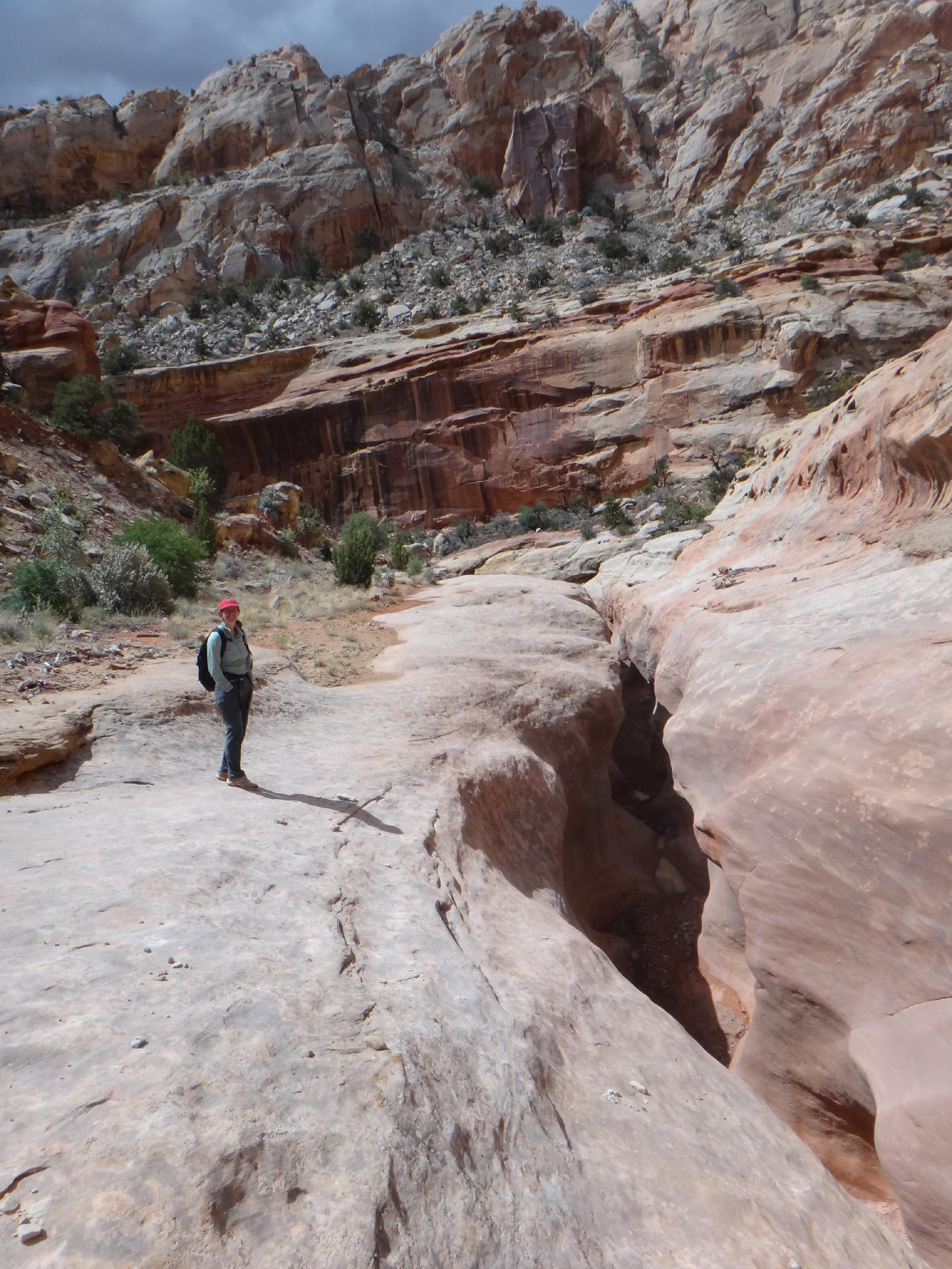
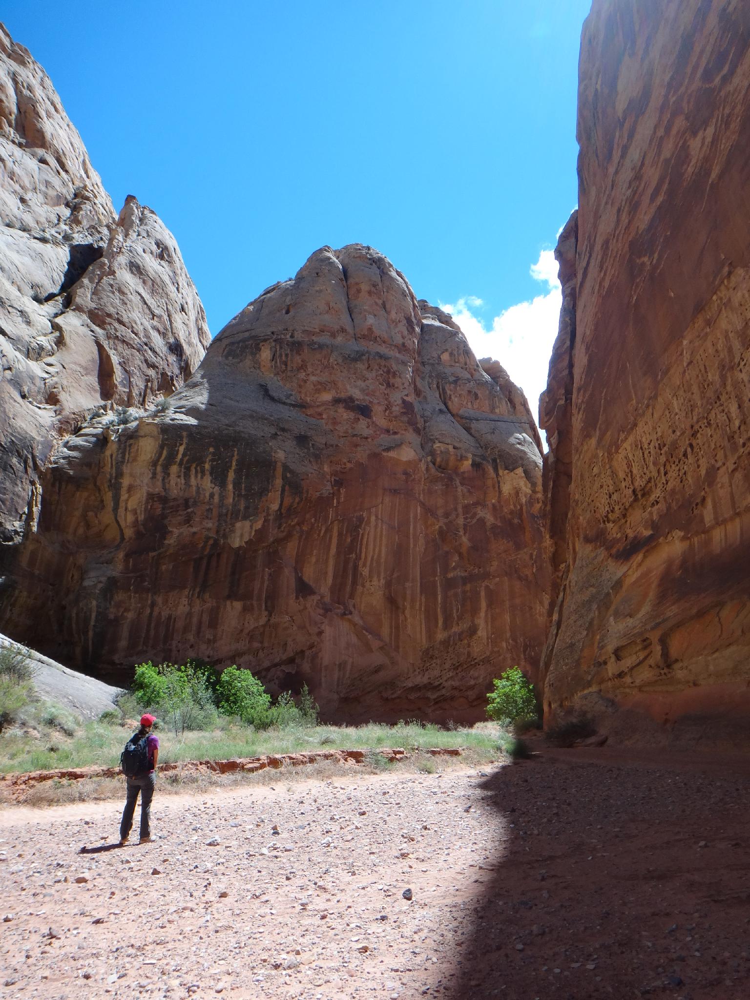
Head right, down spring canyon. The views of the walls and domes dotting the skyline are impressive. The canyon is easy going before a short slot section is encountered. The slot contains a couple of short drops that are impassable without a rope. Instead, follow the cairned bypass on the left. It offers good views into the slot before finally re-joining the canyon floor after the difficulties. Motivated hikers can hike down and/or up the slot to visit virtually all of it.
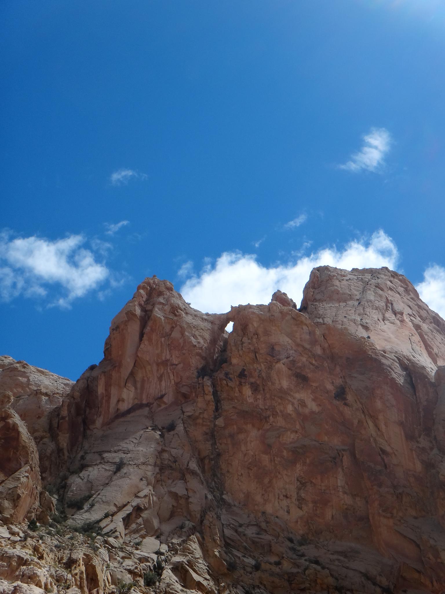
Continuing down, the canyon settles into a winding rhythm; turn a bend, see an amazing big view of domes or walls, turn another bend, repeat. I hate to admit it, but near the end, I was beginning to tire of the rhythm! Keep an eye out on the skyline on the left about mid-way through for a fairly impressive arch. Unnamed, and not marked on the map.
When water starts to flow, your more than half way. The water bubbles up, flows along lazily for awhile, then goes back under ground only to repeat the same cycle again and again before reaching the Fremont River. This final spring section is a great place to hang out on a sunny afternoon.
As Spring Canyon abruptly empties in the Fremont River, go up stream a couple of minutes to (hopefully if it is a cool day) find a couple of logs that barely allow for passage across without getting your feet wet. The highway and trailhead are a minute to the south.
Photos
Maps


12S 473425E 4240881N
38°18'56"N 111°18'14"W
12S 473926E 4241087N
38°19'03"N 111°17'54"W
12S 475099E 4241073N
38°19'03"N 111°17'05"W
12S 476927E 4241826N
38°19'27"N 111°15'50"W
12S 478139E 4241211N
38°19'08"N 111°15'00"W
12S 479375E 4240600N
38°18'48"N 111°14'09"W
12S 480107E 4240020N
38°18'29"N 111°13'39"W
12S 482559E 4237292N
38°17'01"N 111°11'58"W