 Hiking
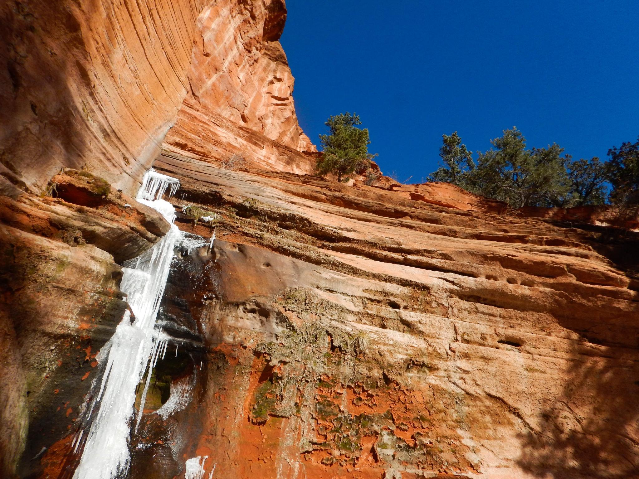
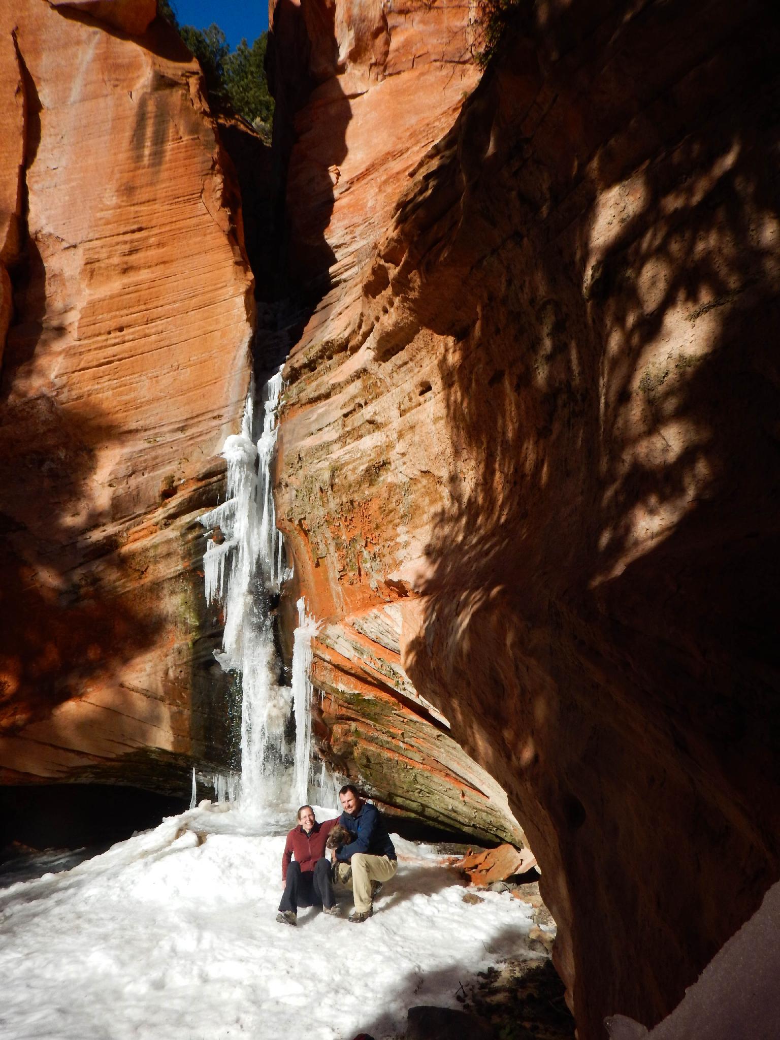
Sand Creek Falls
Hiking
Sand Creek Falls
Torrey
Overview
I have heard Sand Creek Falls compared to Calf Creek Falls in its beauty. This, in my opinion, is a pretty big stretch! The falls are short and beautiful but don't even come close to the stunning Lower Calf Creek Falls. Sand Creek Falls, on the other hand, sees very few visitors and offers an off the beaten path feel that you will certainly never encounter at Calf Creek!
The falls hike can be done year around, though would be difficult with much snow on the ground, and can be blistering hot during peak summer season. The pictures in this description are from a Thanksgiving trip. The ice and plunge pool at the bottom of the falls were an exquisite treat.
Getting There
On the west side of the town of Torrey, turn north onto Sand Creek road. This is well signed. Reset your odometer as you turn onto Sand Creek Road off of highway 24. (The main road through Torrey)
Route Description
From the trailhead, follow the trail as it almost immediately crosses Sand Creek. This was clearly an old road at some point but has washed out badly in sections. Follow the trail as it meanders up along Sand Creek. The trail is deeply rutted in several sections; it was likely used (or is still used) to move livestock from the valley up to Thousand Lake Mountains.
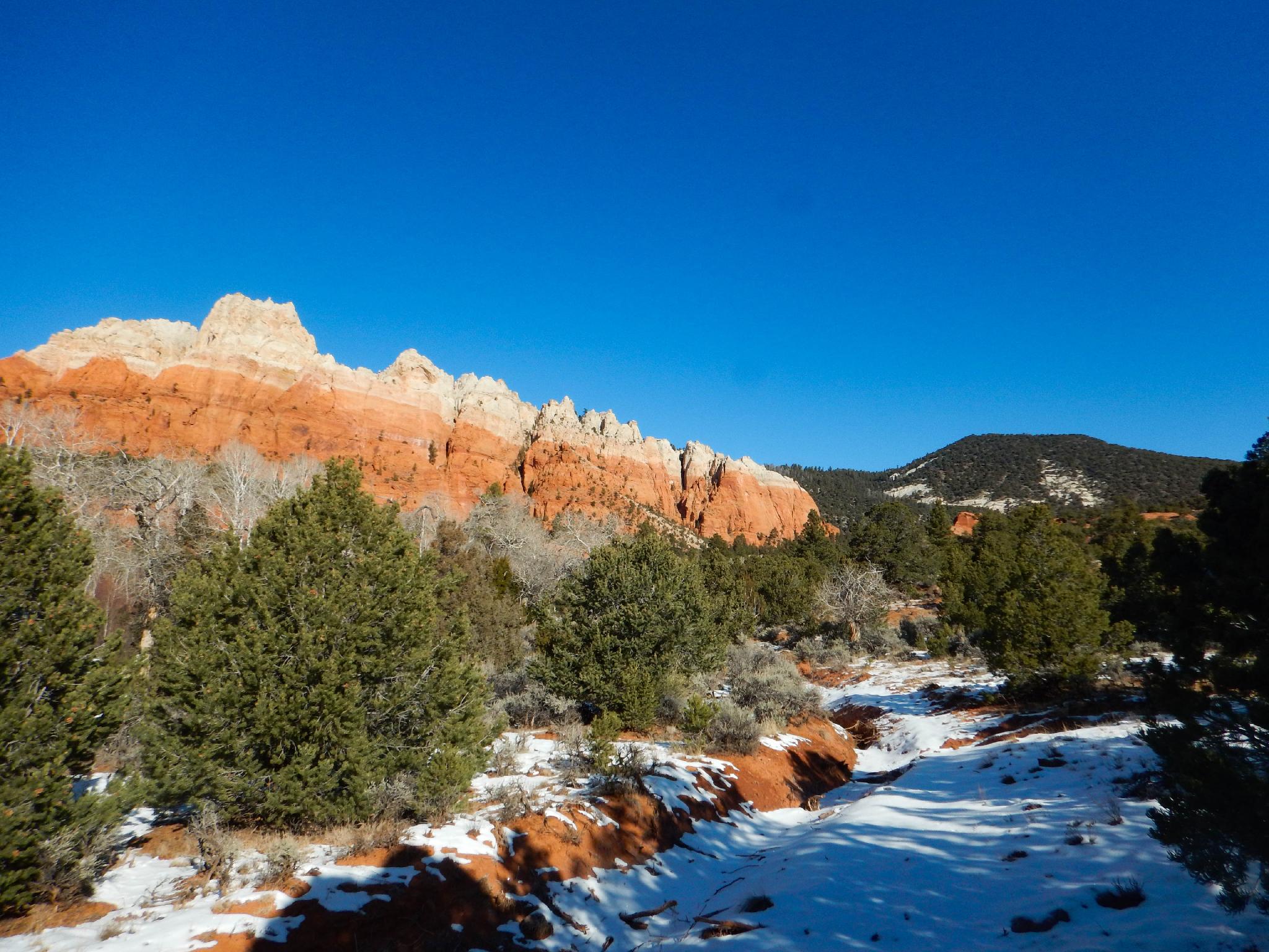
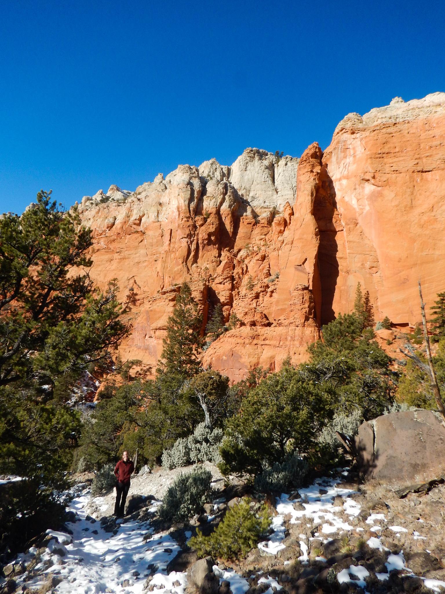
The red and white cliff ahead to the left is stunning and dramatic. For orientation, the falls are on the far right side of this cliff band, just at the top of the red (Wingate) sandstone layer.
The trail steepens, and passes through an old fence at about 1.2 miles. This is an important landmark. About 0.1 miles past the fence (a few minutes) begin looking for a cairned side trail on the left. This is also the point you should be able to hear the falls and even catch a glimpse of them.
There were (as of 2016) two side trails here. Both are steep and a mix of human and animal prints. Pick either one and follow it as it descends to Sand Creek. The falls are visible at several points on the way down. A little bushwacking may be required to get to the base of the falls, depending on which social trail you chose!
Maps


12S 459187E 4245387N
38°21'21"N 111°28'02"W
12S 459554E 4246964N
38°22'12"N 111°27'47"W
12S 459632E 4247080N
38°22'16"N 111°27'44"W
12S 459509E 4247136N
38°22'17"N 111°27'49"W