Coke Ovens | East Carbon

Roadside Attraction Coke Ovens - East Carbon Roadside Attraction Coke Ovens

East Carbon

Overview

RATING: Roadside Attraction
LENGTH: 1+ hours
MAPS: SUNNYSIDE, UT

Wed

Patchy smoke before noon, then isolated thunderstorms. Sunny. High near 91, with temperatures falling to around 89 in the afternoon. Southwest wind 2 to 10 mph. Chance of precipitation is 30%.

91 | 69

Thu

A slight chance of showers and thunderstorms after noon. Sunny, with a high near 89. West southwest wind 2 to 9 mph. Chance of precipitation is 20%.

89 | 68

Fri

A chance of showers and thunderstorms after noon. Partly sunny, with a high near 86.

86 | 71

Sat

A chance of showers and thunderstorms after noon. Mostly sunny, with a high near 86.

86 | 67

Sun

A slight chance of showers and thunderstorms after noon. Mostly sunny, with a high near 88.

88 | 68

View Full Weather Details
SEASON: Any, hot in summers.
WATER: None

Wed

Patchy smoke before noon, then isolated thunderstorms. Sunny. High near 91, with temperatures falling to around 89 in the afternoon. Southwest wind 2 to 10 mph. Chance of precipitation is 30%.

91 | 69

Thu

A slight chance of showers and thunderstorms after noon. Sunny, with a high near 89. West southwest wind 2 to 9 mph. Chance of precipitation is 20%.

89 | 68

Fri

A chance of showers and thunderstorms after noon. Partly sunny, with a high near 86.

86 | 71

Sat

A chance of showers and thunderstorms after noon. Mostly sunny, with a high near 86.

86 | 67

Sun

A slight chance of showers and thunderstorms after noon. Mostly sunny, with a high near 88.

88 | 68

View Full Weather Details
The old Coke Ovens.

The old Coke Ovens.

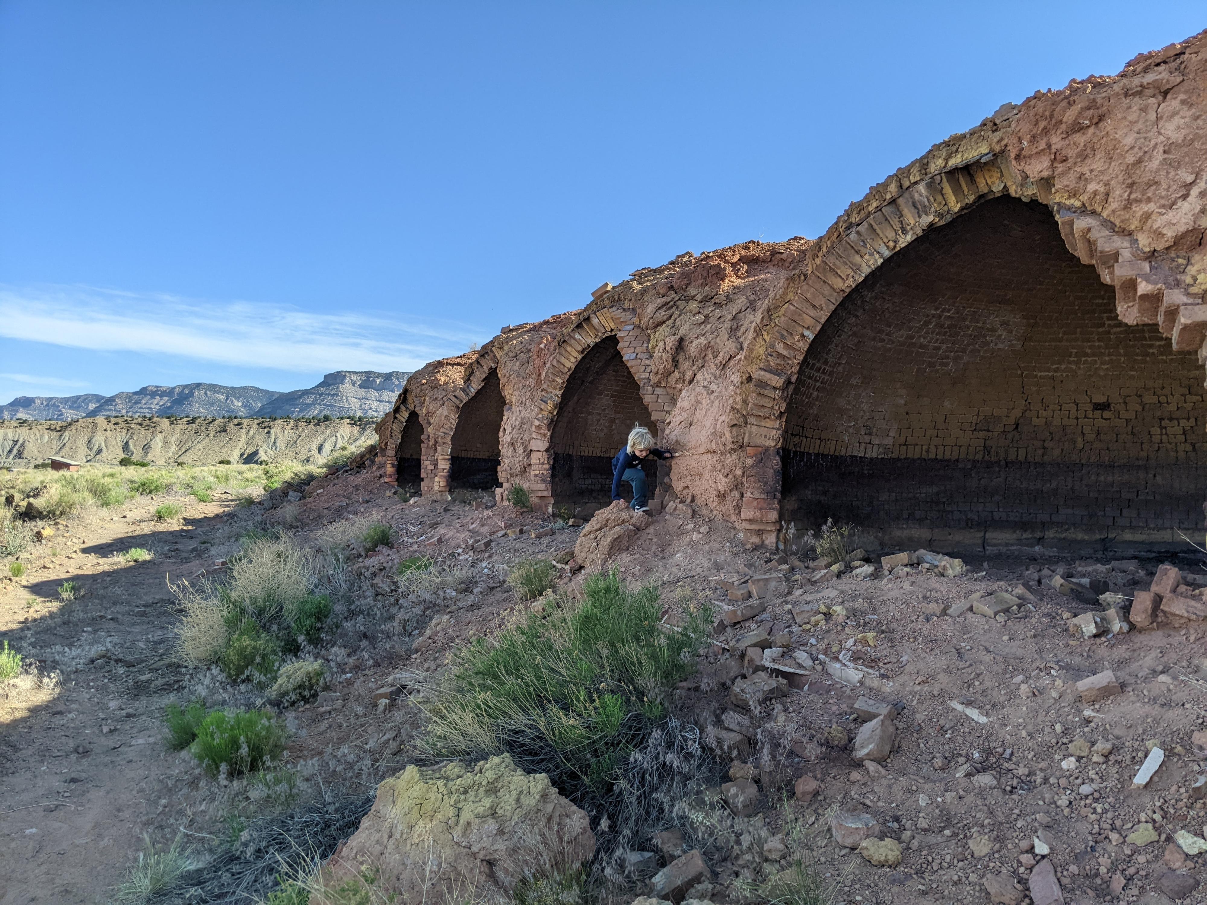
Carbon County is rich with mining history. A great place to explore that history is at the Coke Ovens near the small town of East Carbon. The area around Sunnyside and East Carbon was once home to hundreds of Coke Ovens. Most have been buried or otherwise destroyed over the years, but this site contains a fair number of them and is fascinating to visit.

What is a coke oven? Coal, when first mined, is full of impurities. A coke oven is a large brick “oven” structure that is used to heat the raw coal in order to burn off impurities. The result of the baking of the coal, called coke, is a more energy dense, cleaner form of fuel. Coke, with impurities removed, was above half the weight of the original coal, making it much more energy dense and easier to ship and use.

How did it work? The coke ovens were covered in dirt, with a railway track on top of them. A train, loaded with coal, would travel on top of the ovens, stopping to deposit coal from the train into the ovens via the hole in the top of each oven. The coal was then “baked”. After baking, it was a manual process to remove the coke from the bottom of the oven, separating it from the ashes during the process, and put it on another train for transport out of the region.

Note: This is a great family roadside attraction. The old building and coke ovens fascinated my daughter. There is a small, primitive campground at near the site of the coke ovens, as well as a pit toilet and playground. There is no water available.
Very large old building.

Very large old building.

Getting There

From Price Utah, head south on highway 6 toward I-70/Green River for about 14.4 miles to the junction with SR-123 signed East Carbon/Sunnyside.

Go east on SR-123 for 8.7 miles to the small town of East Carbon. Turn right (south) on SR-124.

  • Reset your odometer as you turn onto SR-123. This route is well signed, so mileage shouldn't really be needed. ( 12S 550302E 4377215N / 39°32'35"N 110°24'53"W )
  • 1.1 miles - Left onto dirt road signed to Coke Ovens / Range Creek Trailhead ( 12S 551302E 4376173N / 39°32'01"N 110°24'11"W )
  • 1.4 miles - Right toward old building. ( 12S 551681E 4376260N / 39°32'04"N 110°23'55"W )
  • Trailhead ( 12S 551738E 4376203N / 39°32'02"N 110°23'53"W )
A great view!

A great view!

Route

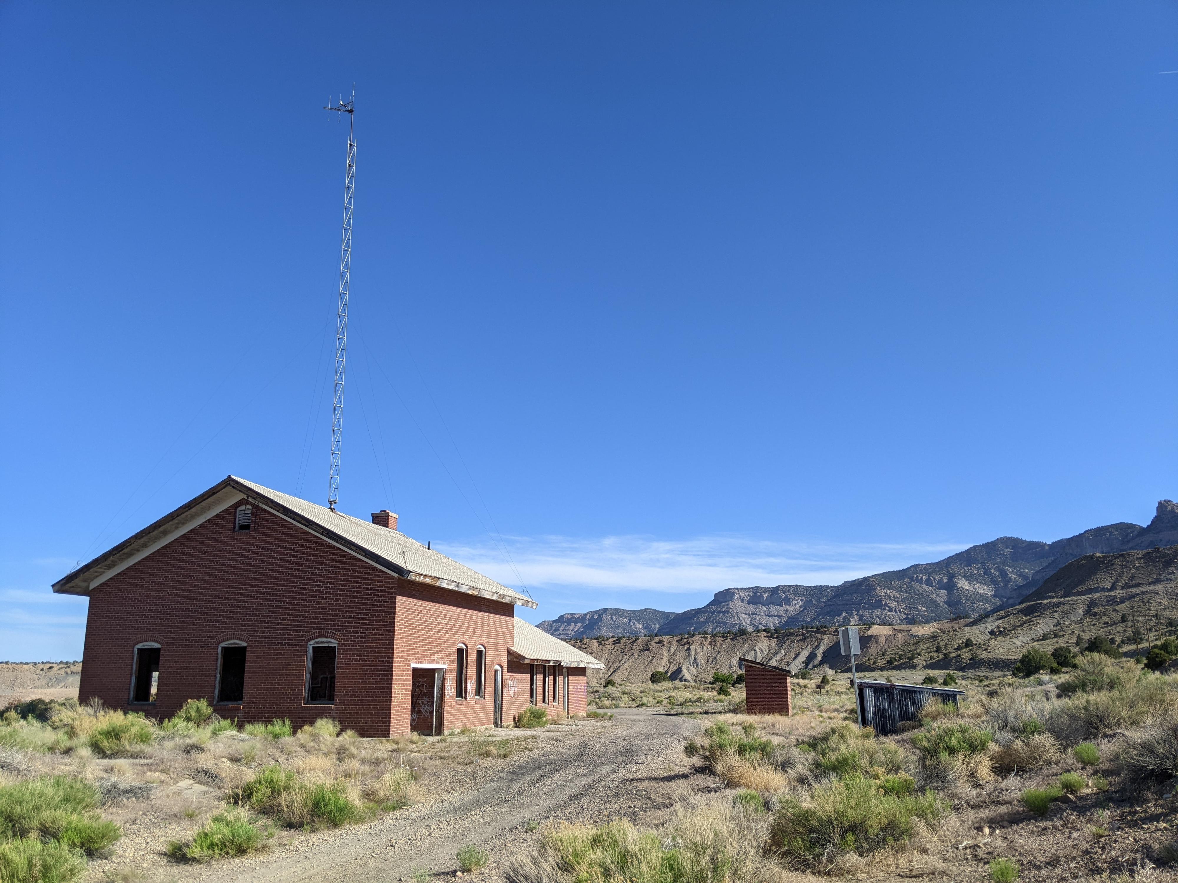
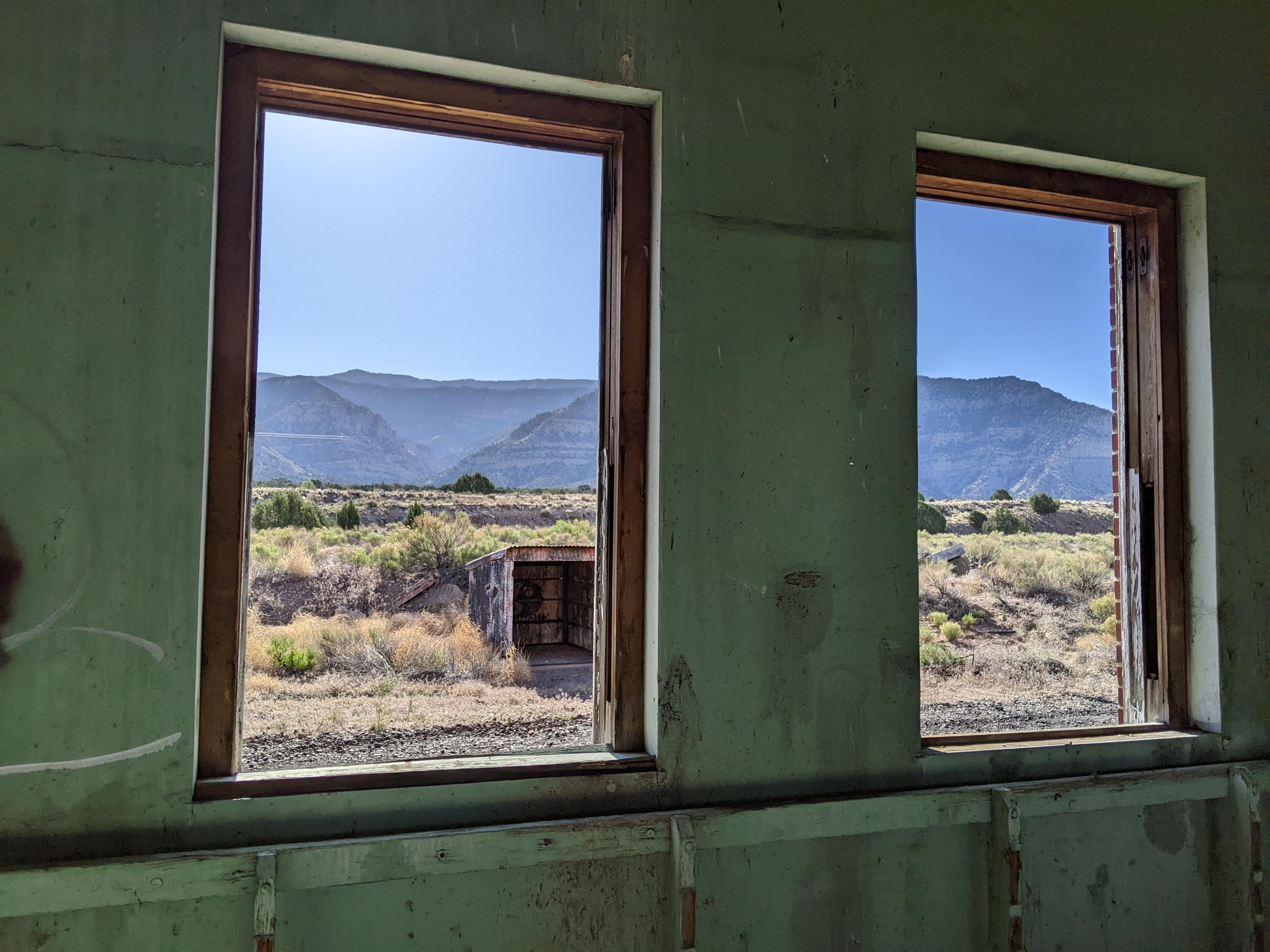
From the parking area is a large abandoned building that was the office space for the coke oven process. It, though quite dilapidated, is very interesting to walk around and look into, along with a couple of smaller outbuildings. There are two long rows of coke ovens south and east of the old building.

The playground is to the south/southwest, with the small primitive campground just to the west of the playground.


Maps

Printable Maps:

Trailhead

12S 551738E 4376203N

39°32'02"N 110°23'53"W

Campground

12S 551600E 4375984N

39°31'55"N 110°23'58"W

Old Building

12S 551742E 4376173N

39°32'01"N 110°23'52"W

Coke Ovens

12S 551822E 4376080N

39°31'58"N 110°23'49"W

Comments

Want to make a comment? Login and let yourself be heard.