Frog Canyon |

Burr Trail

Hiking Frog Canyon - Burr Trail Hiking Frog Canyon

Burr Trail

Overview

RATING: Easy/Moderate Hike
MAPS: PIONEER MESA, UT

Wed

Sunny, with a high near 64. West northwest wind 2 to 6 mph.

64 | 35

Thu

Sunny, with a high near 66.

66 | 36

Fri

Sunny, with a high near 66.

66 | 39

Sat

Sunny, with a high near 63.

63 | 40

Sun

A chance of rain and snow. Partly sunny, with a high near 55.

55 | 37

View Full Weather Details
SEASON: Spring, Summer, Fall (Hot in summer)
GEAR: Standard Hiking Gear
WATER: Generally little or none except. after recent rains where there may be shallow wading.
FLASHFLOOD: Low/Moderate
NOTES: The trailhead is generally reachable by all vehicles, but can be a little rough in spots at times. High clearance recommended, though probably not required. Recent rains/floods can make the road much more difficult.

Wed

Sunny, with a high near 64. West northwest wind 2 to 6 mph.

64 | 35

Thu

Sunny, with a high near 66.

66 | 36

Fri

Sunny, with a high near 66.

66 | 39

Sat

Sunny, with a high near 63.

63 | 40

Sun

A chance of rain and snow. Partly sunny, with a high near 55.

55 | 37

View Full Weather Details
Sculpted Frog Canyon

Sculpted Frog Canyon

Minor obstacle in Frog Canyon

Minor obstacle in Frog Canyon

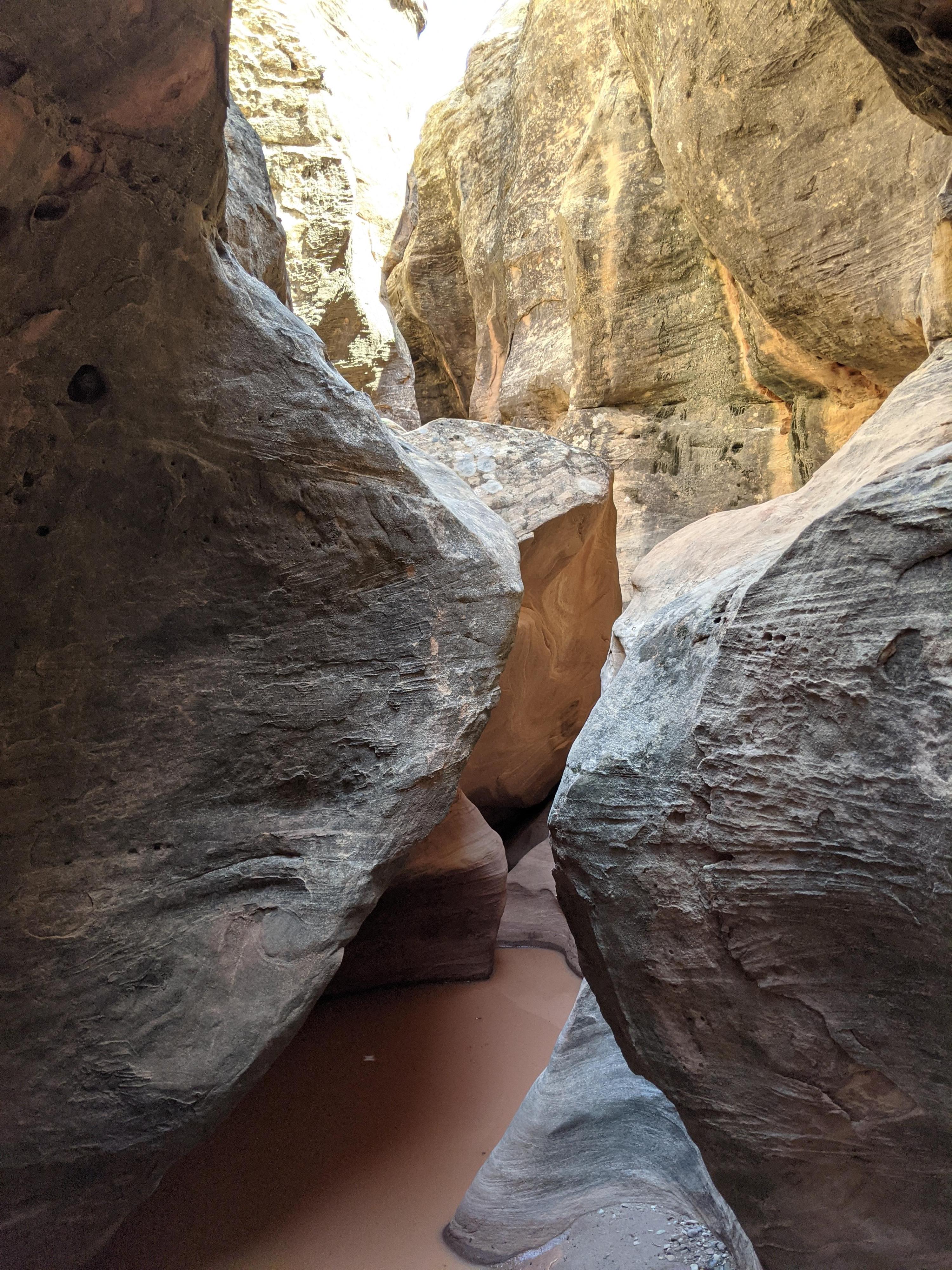
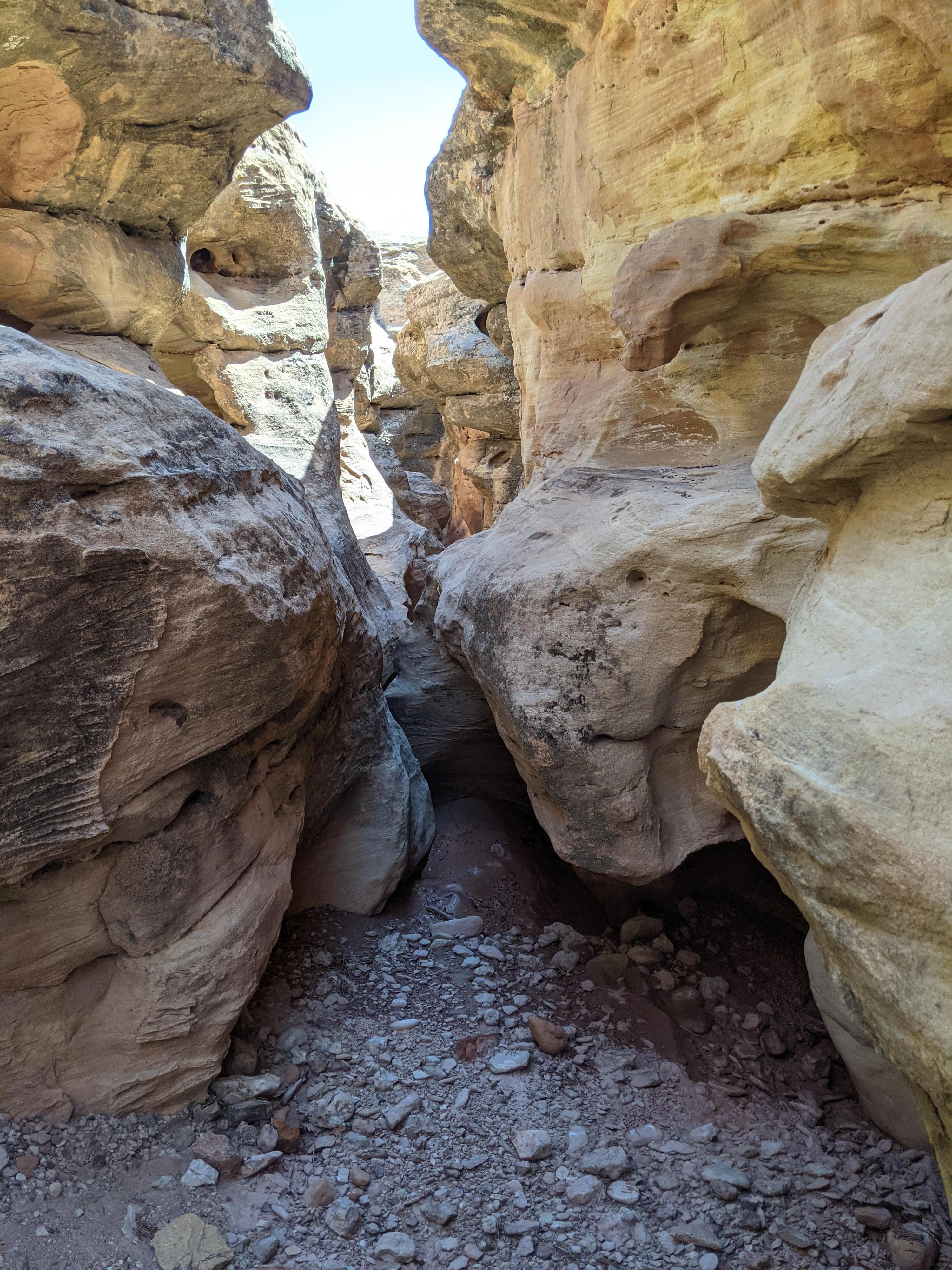
Driving the Wolverine Loop Road, it is hard to miss the large rock slope that the road skirts and climbs around. The narrow crack that parallels the road looked too inviting on my drive, so I had to stop and check it out! The crack, Frog Canyon, turns out to be shallow, usually only 10-20 ft deep, but incredibly sinuous and sculpted. This is not a canyon I would make the long trek out to visit on its own, but coupled with something else in the area, it is an absolute treat!

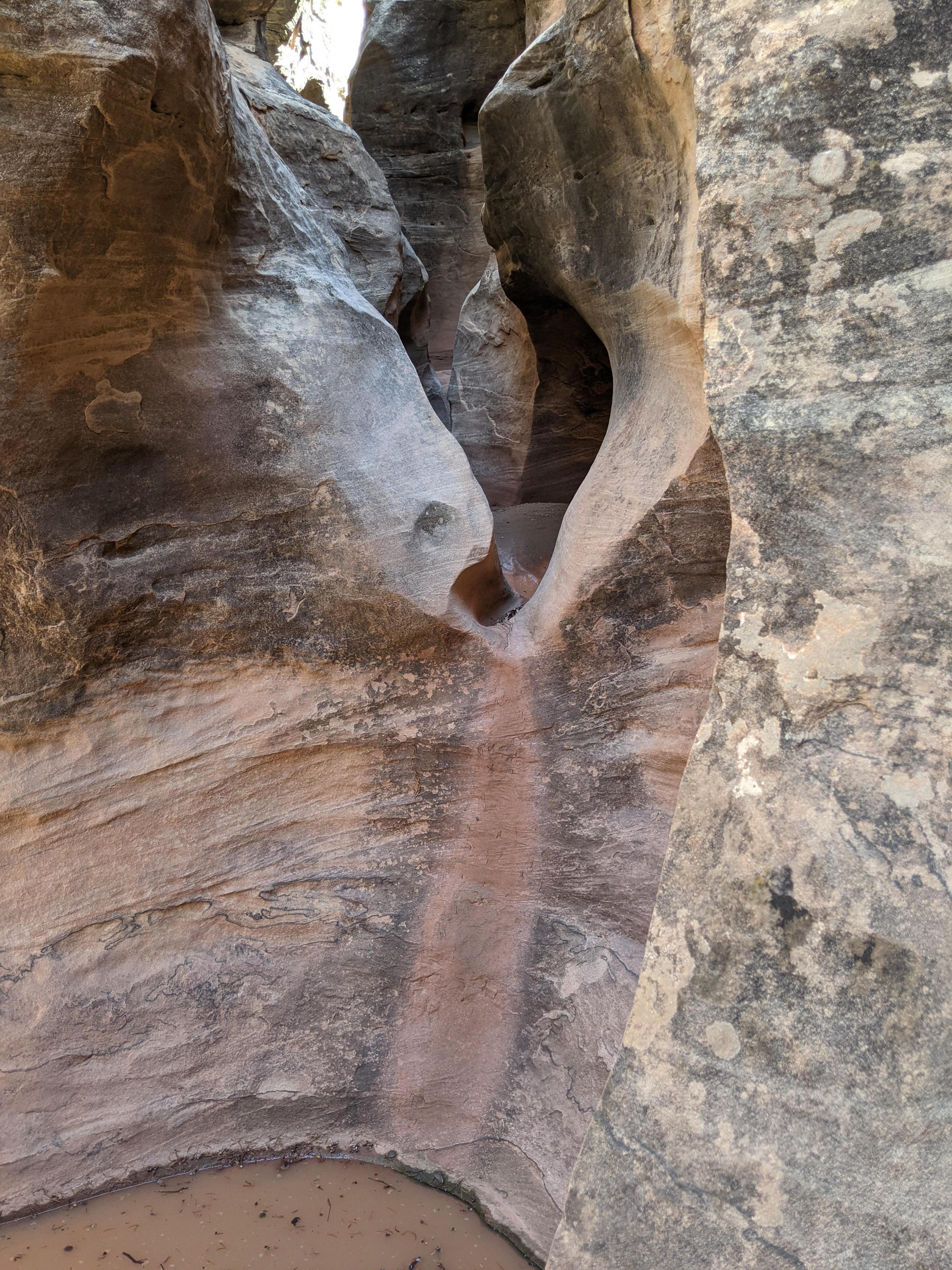
The canyon can be ascended or descended, but for my money, ascending it is more fun. There are numerous small obstacles to climb and several tight squeezes to surmount. Quite a few exists make it easy to exit when you have had enough. Frog Canyon turned out to be a fun outing.

Note: The canyon does not show up on topo maps, and I could not find a reference to a name. I called it Frog Canyon, because on my visit it was teaming with frogs and tadpoles. The canyon is not one I would have guessed would be good frog habitat, but every pool of water was hopping with them! Pun intended.
One of the more open areas in Frog Canyon

One of the more open areas in Frog Canyon

Lodged logs in Frog Canyon

Lodged logs in Frog Canyon

Getting There

From Boulder Utah, take the Burr trail east. The road is paved and starts on the south side of town.

  • Reset your odometer as you turn off highway 12 on to the Burr Trail. Stay on the main Burr Trail road, passing many side roads as you pass through Boulder. ( 12S 462640mE 4194941mN / N37° 54' 04" W111° 25' 30" )
  • 6.2 miles - Deer Creek Trailhead and Campground ( 12S 468739mE 4189767mN / N37° 51' 17" W111° 21' 19" )
  • 10.0 miles - The Lower Gulch Trailhead on the right ( 12S 472327mE 4189249mN / N37° 51' 01" W111° 18' 52" )
  • 10.7 miles - The Upper Gulch Pullout/Trailhead on the left. ( 12S 472775mE 4189975mN / N37° 51' 25" W111° 18' 34" )
  • 11.5 miles - Signing canyon with a pullout on the left. An excellent short side hike visits this impressive canyon from the bottom. ( 12S 473569mE 4190861mN / N37° 51' 53" W111° 18' 02" )
  • 18.4 miles - Signed dirt road on the right indicates Little Death Hollow. (This is the Wolverine Loop Road.) Reset your odometer as you turn onto this usually good dirt road. ( 12S 480604mE 4197435mN / N37° 55' 27" W111° 13' 14" )
  • 5.5 miles - A side road goes off on the right, this goes down Horse Canyon. Stay left on the Wolverine Road ( 12S 480329mE 4189257mN / N37° 51' 02" W111° 13' 25" )
  • 9.9 miles - Wolverine Petrified Wood / Canyon Trailhead on the right. ( 12S 481830mE 4184096mN / N37° 48' 15" W111° 12' 23" )
  • 10.45 miles - Small side road to a parking area on the right. This is the Frog Canyon trailhead. ( 12S 482485mE 4183928mN / N37° 48' 09" W111° 11' 56" )
Frog Canyon - Burr Trail

Frog Canyon - Burr Trail

Interesting log and light in Frog Canyon

Interesting log and light in Frog Canyon

Route

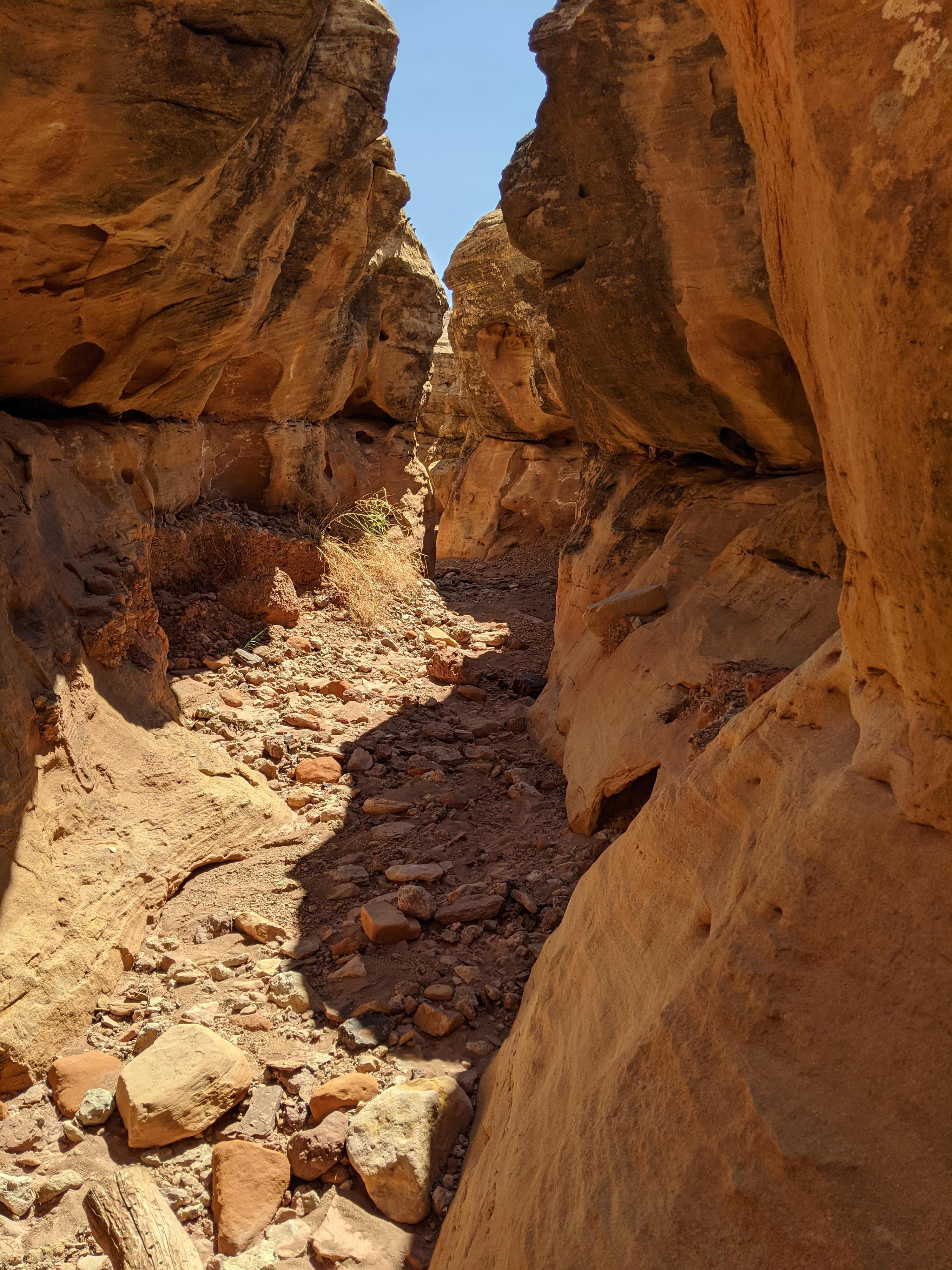
From the trailhead, walk down the road a minute to where a side wash leaves on the right. Go down this wash as it begins cutting into the Shinarump Member of the Chinle Formation. A couple of minor downclimbs in here are an excellent warmup. You reach the main canyon shortly.

You can go down the main canyon for a couple of minutes to a drop where the Shinarump layer gives way. This short drop is a bit wide, and makes a hard down climb or short rappel. The canyon opens immediately after it, so I would recommend not continuing down canyon, but rather start heading up the main canyon.

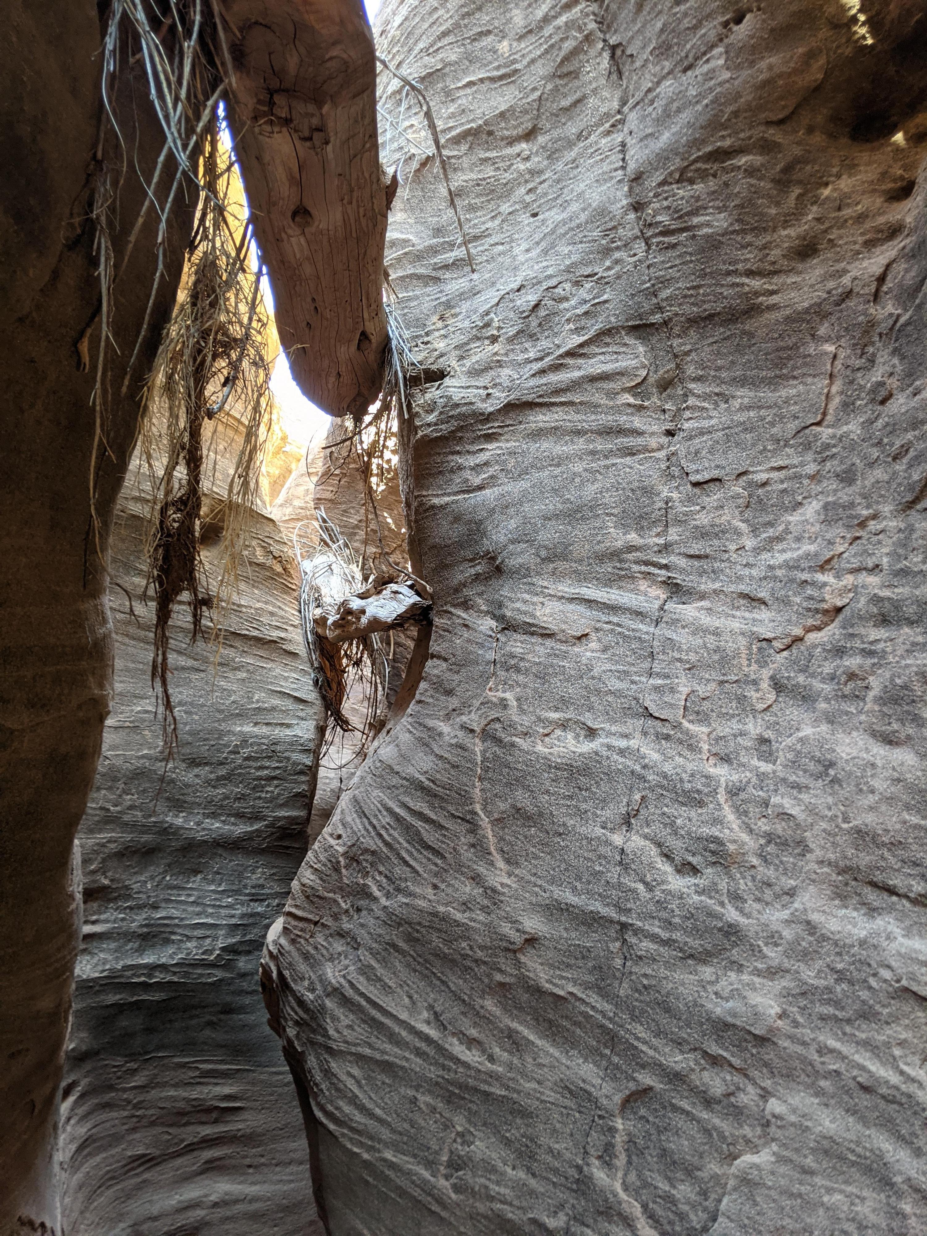
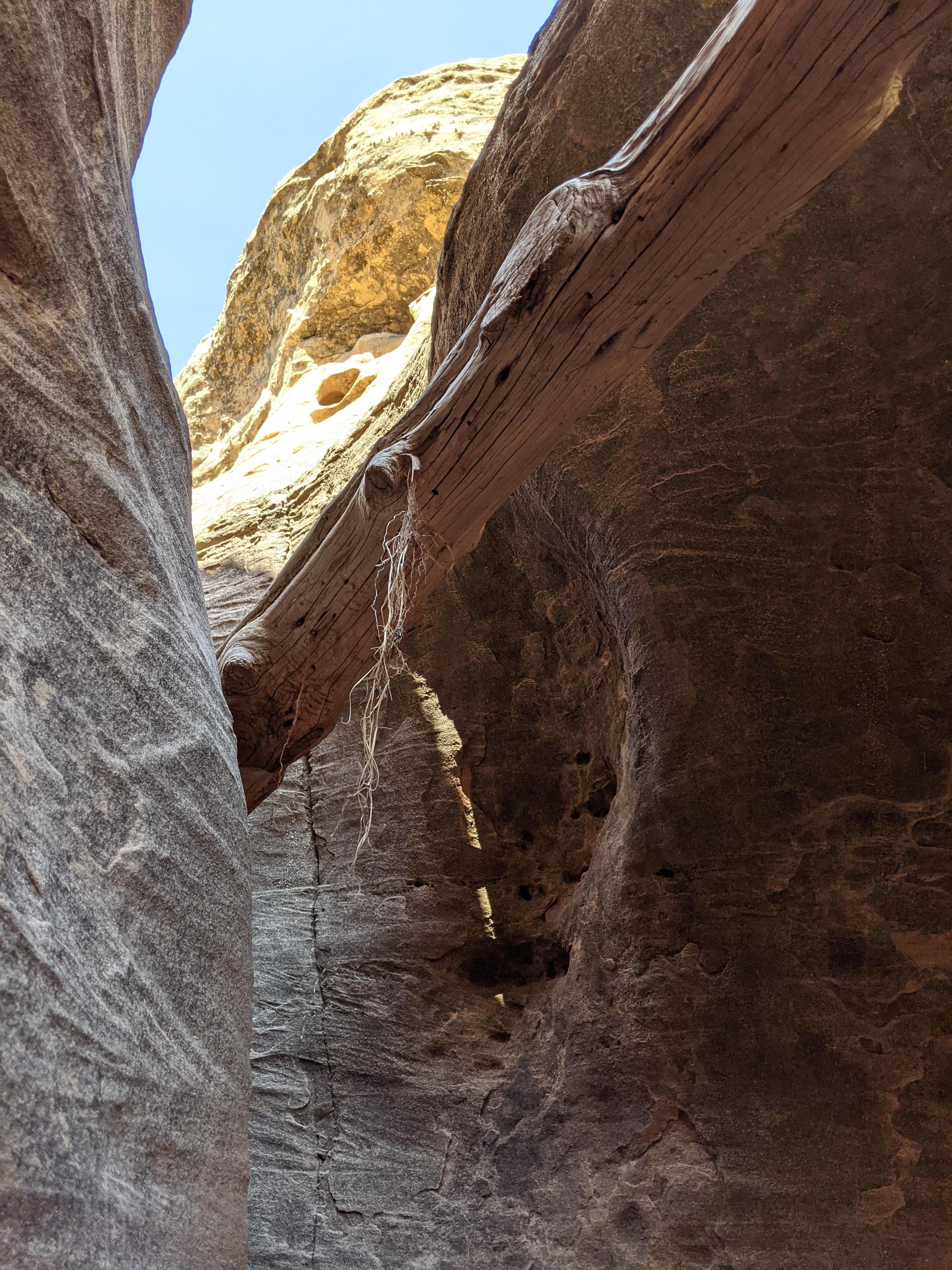
Heading up canyon, there is a rhythm of short, deeper, sculpted narrows interspersed with more open sections. A major junction in reached. Go left here (looking up canyon). This left fork is the longer of the two and has more sculpted narrows and open sections. At its head is a very tight curving up climb that is tricky.If the climb proves too hard, go back down canyon a couple of minutes, and look for an easy climb out on the right (looking down canyon). Once above the canyon, circle around the head of the fork and head south to the main road. Follow the main road back down hill to the trailhead. Or, for more fun, turn around and descend the canyon.


Videos

A walk through of Frog Canyon ryancornia

Maps

Route / 0.71 miles / Elevation Range 5,533 - 5,674 ft.
Printable Maps:
Frog Canyon Trailhead

12S 482505mE 4183907mN

N37° 48' 09" W111° 11' 55"

Entrance

12S 482456mE 4184005mN

N37° 48' 12" W111° 11' 57"

Drop

12S 482425mE 4184057mN

N37° 48' 13" W111° 11' 59"

Jct

12S 482587mE 4183964mN

N37° 48' 10" W111° 11' 52"

Canyon Head - Tight Up/Downclimb

12S 482858mE 4183971mN

N37° 48' 11" W111° 11' 41"

Comments

Want to make a comment? Login and let yourself be heard.