 Hiking
Round Valley Draw
Hiking
Round Valley Draw
Paria
Overview
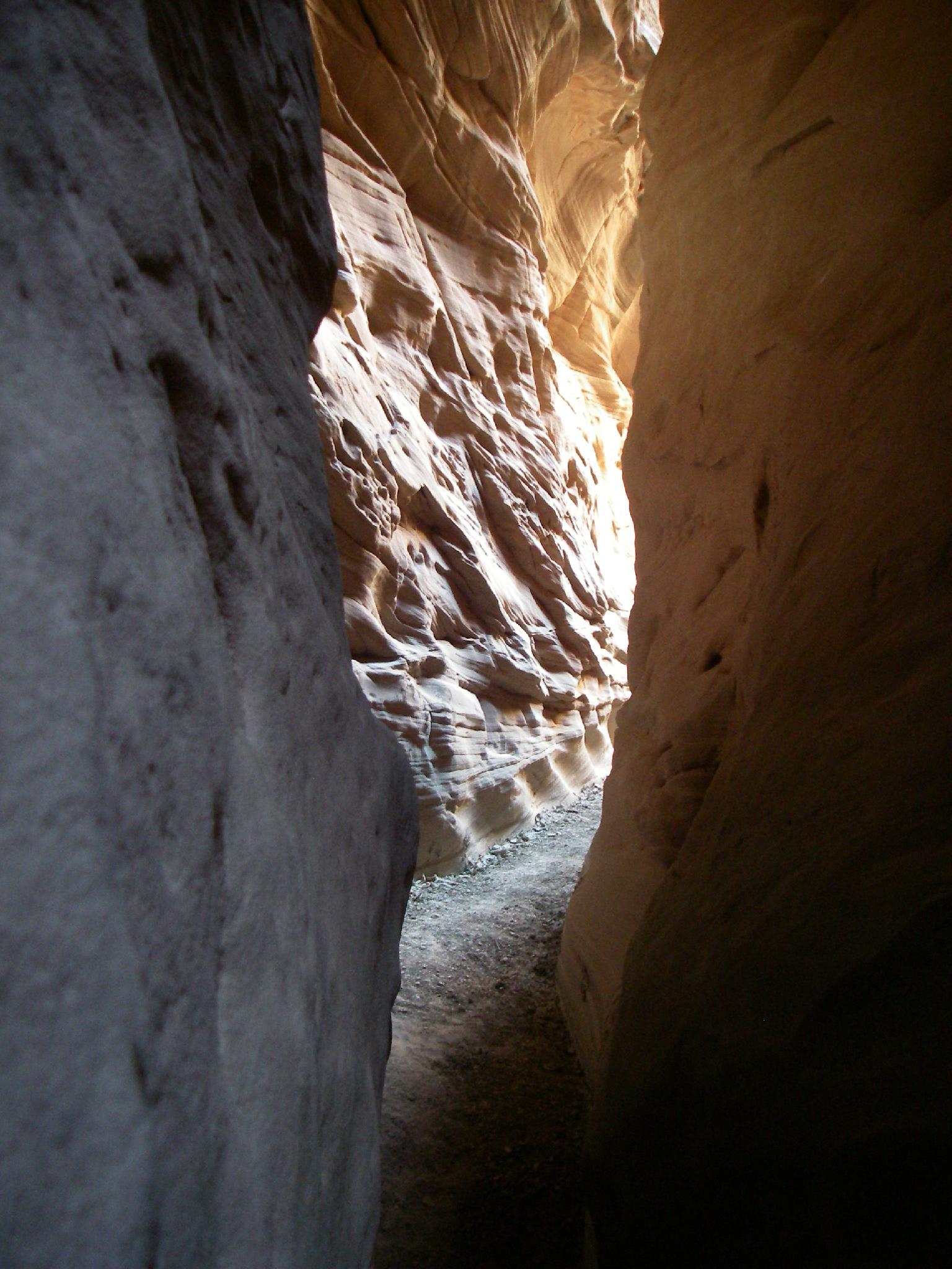
Round Valley Draw is one of my favorite easy slots. A short approach, combined with an easy exit make and very beautiful narrows make this a family friendly outing that most will enjoy. Getting into the slot requires a minor bit of scrambling, but most will not have a problem, especially if a little team work is employed. I would compare this in some regard to Little Wild Horse in the San Rafael Swell.
This makes a good hike to combine with Bull Valley Gorge and/or Willis Creek in the same weekend since they are in relatively close proximity. This also can be a fantastic winter outing if the roads are dry and passable. My last visit was during Thanksgiving weekend a couple of years ago and was absolute perfect weather for visiting. Summers are do-able, but can be hot.
Getting There
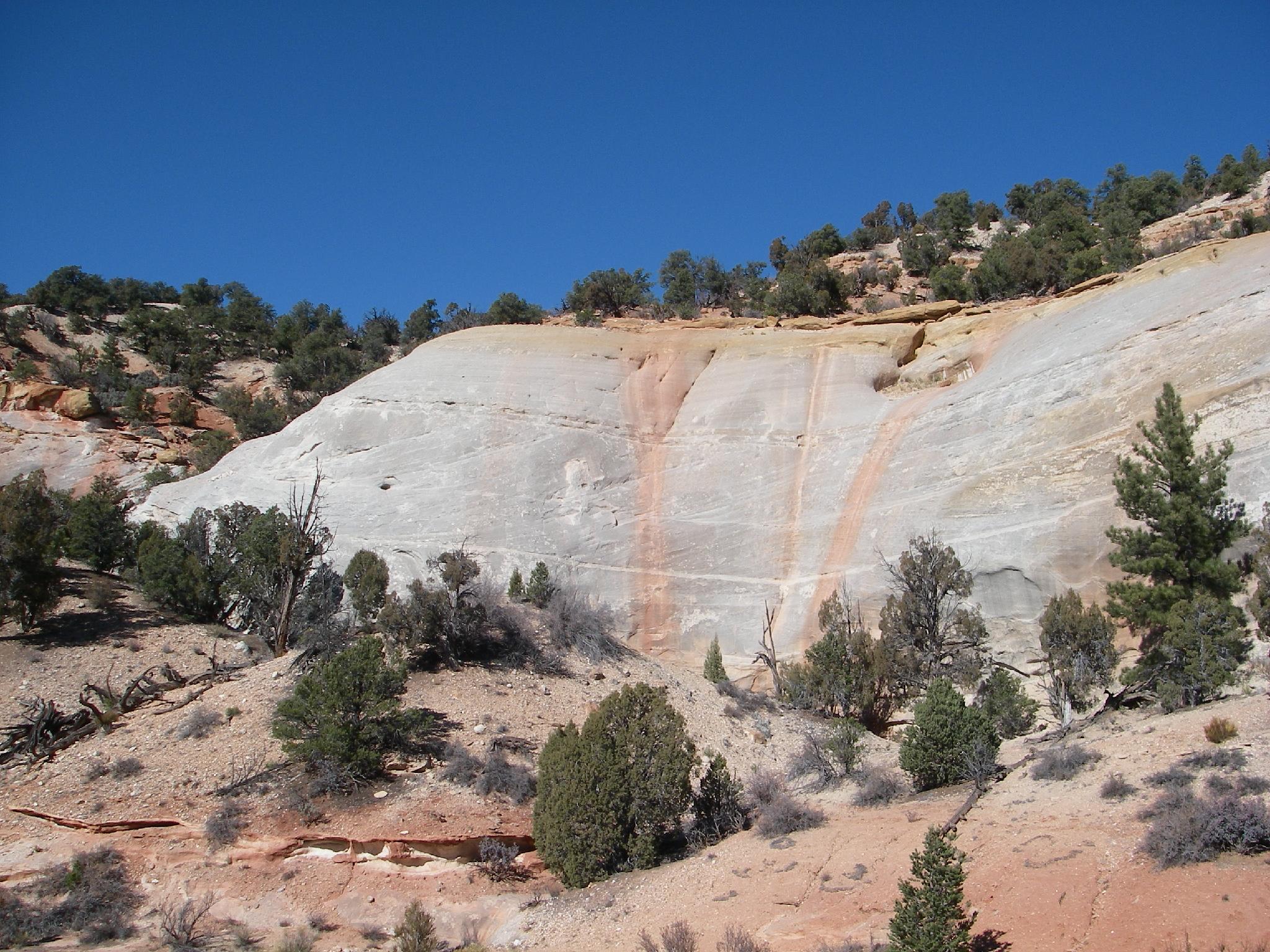
Reaching the trailhead starts in the small town of Cannonville, UT, east of Bryce Canyon on highway 12.
From Cannonville, go south on the well signed Cottonwood Wash Road. Follow the paved road, passing Kodachrome Basin at 6.4 miles, and the road turning to dirt at 6.6 miles. At 12.9 miles from Cannonville, Road #422 goes off the Cottonwood Wash Road on the right. Take it, resetting your odometer.
Follow the road down the wash. At 1.5 miles from the Cottonwood Wash Road is the trailhead. The 4wd road that contiued past here is now closed. Please respect the closure.
Route Description
Approach (15 minutes from the trailhead)
Follow the wash/old road 0.75 miles to what used to be a parking area. Continue a couple of more minutes in the wash to where it drops into the Round Valley slot.
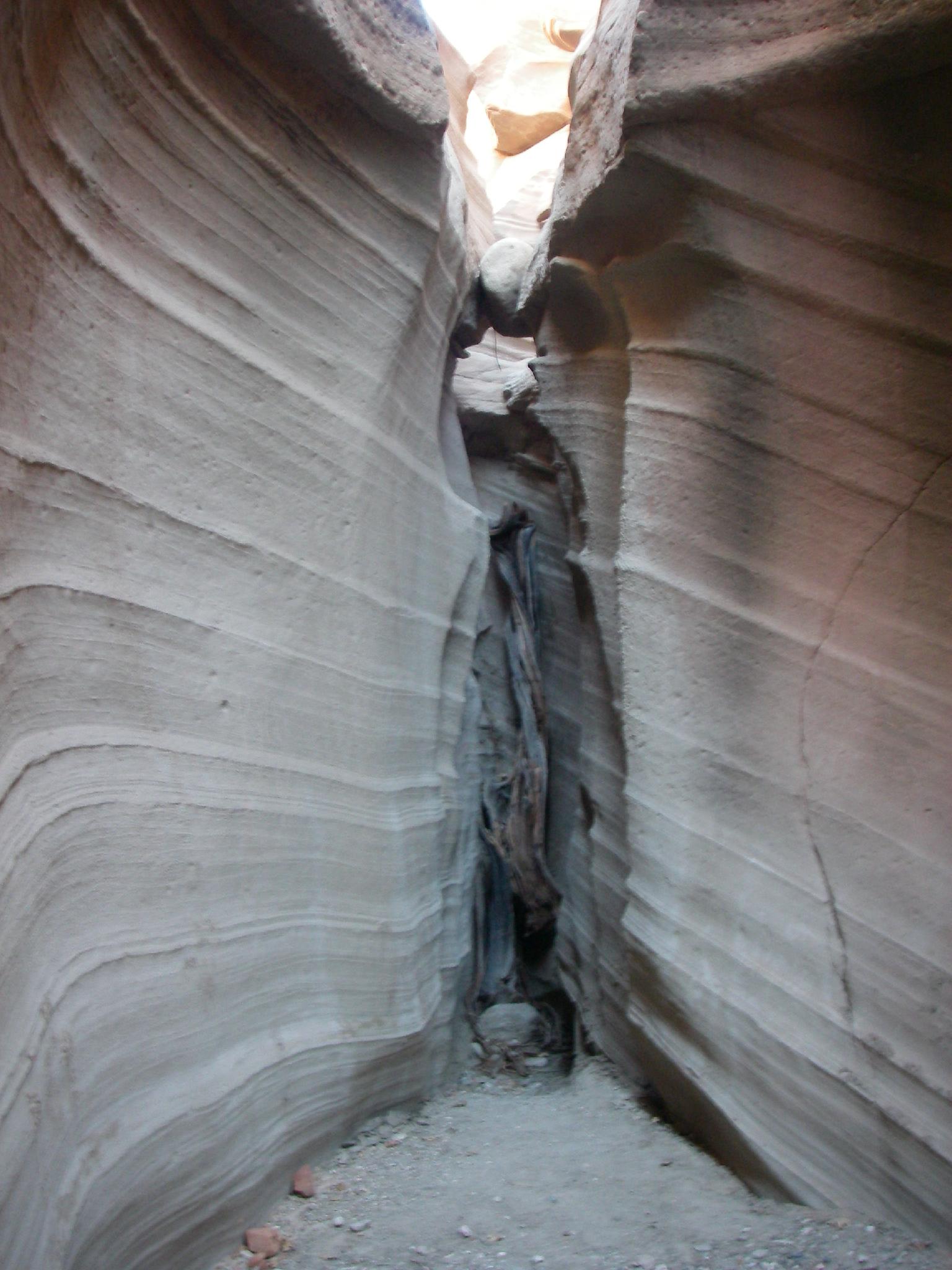
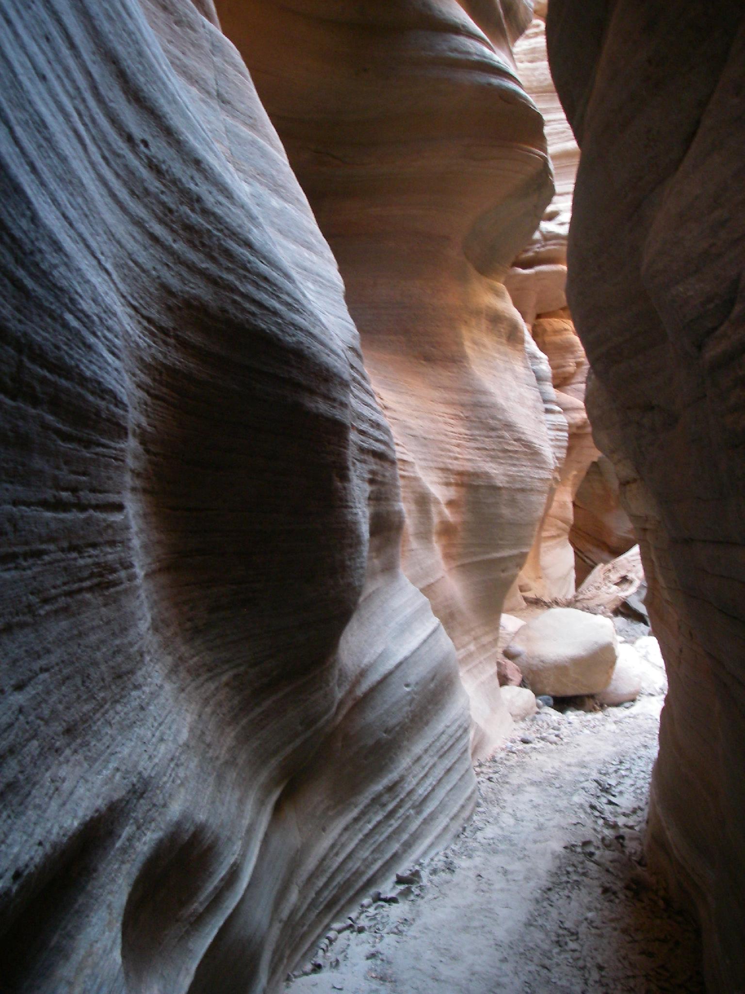
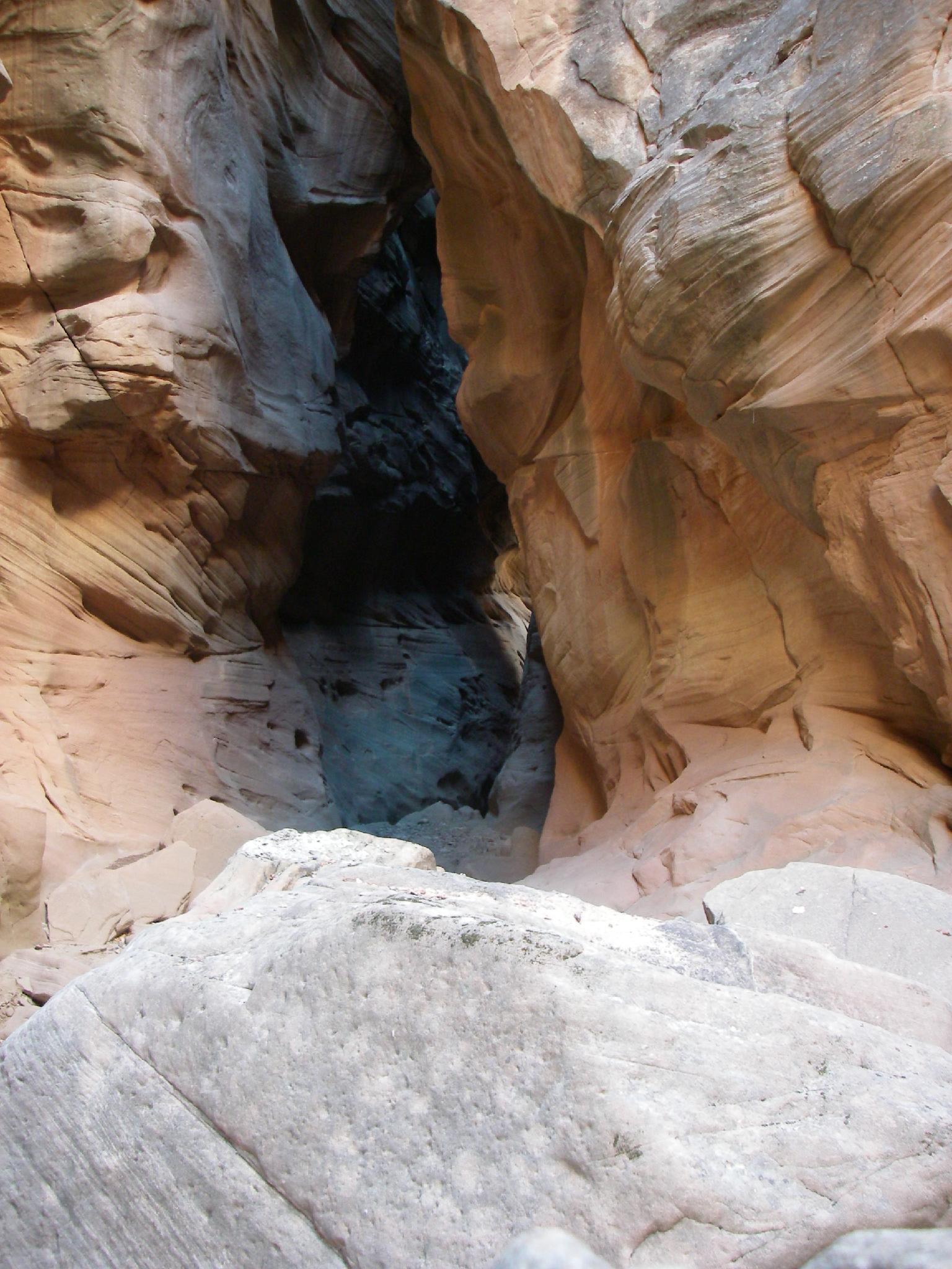
Canyon
The most difficult part of the trip is at the start of the slot where it drops about 2 m ( 7 ft. ), then about 5 m ( 17 ft. ) in quick succession. The first is fairly easy to help a person from below. The second, bigger drop is a good size, and most will be able to scramble down without difficulty. A short rope may be a useful hand-line for some here.
Round Valley the amazing! As you head down canyon, the slot opens and narrows a bit in several places. A few minor obstacles are encountered along the way, but it is generally easy going.
As the canyon opens, a side canyon comes in on the right, with large trees at the bottom. This is the exit canyon.
Exit (45-60 minutes) (updated 2024)
Go up the side canyon on the hikers trail, heading north. As you get higher, look for a social trail and cairns that head right. It is typically easy to follow and meanders mostly along the rim of Round Valley Draw back to the wash at the start of the narrows. There are several trails along the way, try to stay on the most used trail to minimize impacts. Once back in the wash above the narrows, follow it upstream to the trailhead. Track on the map is approximate, gps wiggles over into the canyon here and there, so line was cleaned up to match the route approximately.
Photos
Videos

Round Valley Draw
Maps

12S 420372E 4145943N
37°27'25"N 111°54'01"W
12S 419435E 4145539N
37°27'12"N 111°54'39"W
12S 418077E 4144609N
37°26'41"N 111°55'34"W