 Canyoneering
Middle Fork
Canyoneering
Middle Fork
Robbers Roost
Overview
Middle Fork of Robbers Roost is a hike with a rappel, not really a canyoneering adventure. Unlike its more technical neighbors, Mindbender and the South Fork of Robbers Roost, this route has a single 50 m rappel early on, then is mostly a deep walled canyon hike with few obstacles.
The route goes up and out the Moki Exit, shared with Mindbender Canyons, back to the mesa top. Those looking for a little longer adventure can start at the top of the Middle Fork (long route), as it meanders through a couple of narrow slot sections in the Navajo layer before reaching the first rappel.
If you have concerns, it is possible to place a rope on the exit from above before doing the canyon. Finding the spot is moderately difficult from above, but with good map skills it is reasonable to do. (Reverse the exit description, following the map closely.) If doing this option, take a 20 m ( 66 ft. ) rope to leave.
Shuttle: Two vehicles can reduce about 2 miles of road walking. Without a shuttle vehicle, the road is an easy/fast walk.
Getting There
Head south from Interstate 70 on highway 24 toward Hanksville.
Route Description
Rock art and historic sites are fragile, non-renewable cultural resources that, once damaged, can never be replaced. To ensure they are protected, please:
- Avoid Touching the Petroglyphs: Look and observe, BUT DO NOT TOUCH!
- Stay on the Trails: Stay on the most used trails when visiting sites, and don't create new trails or trample vegetation.
- Photography and Sketching is Allowed: Do not introduce any foreign substance to enhance the carved and pecked images for photographic or drawing purposes. Altering, defacing, or damaging the petroglyphs is against the law -- even if the damage is unintentional.
- Pets: Keep pets on a leash and clean up after them.
- Artifacts: If you happen to come across sherds (broken pottery) or lithics (flakes of stone tools), leave them where you see them. Once they are moved or removed, a piece of the past is forever lost.
Long Route - From the Top of the Middle Fork
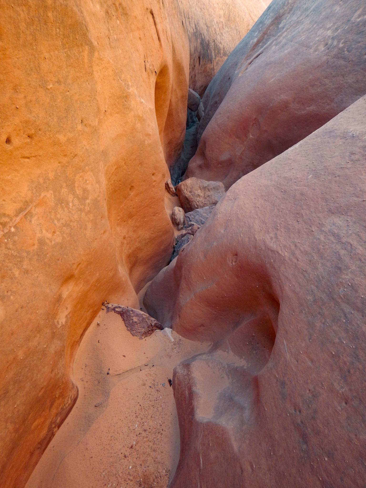
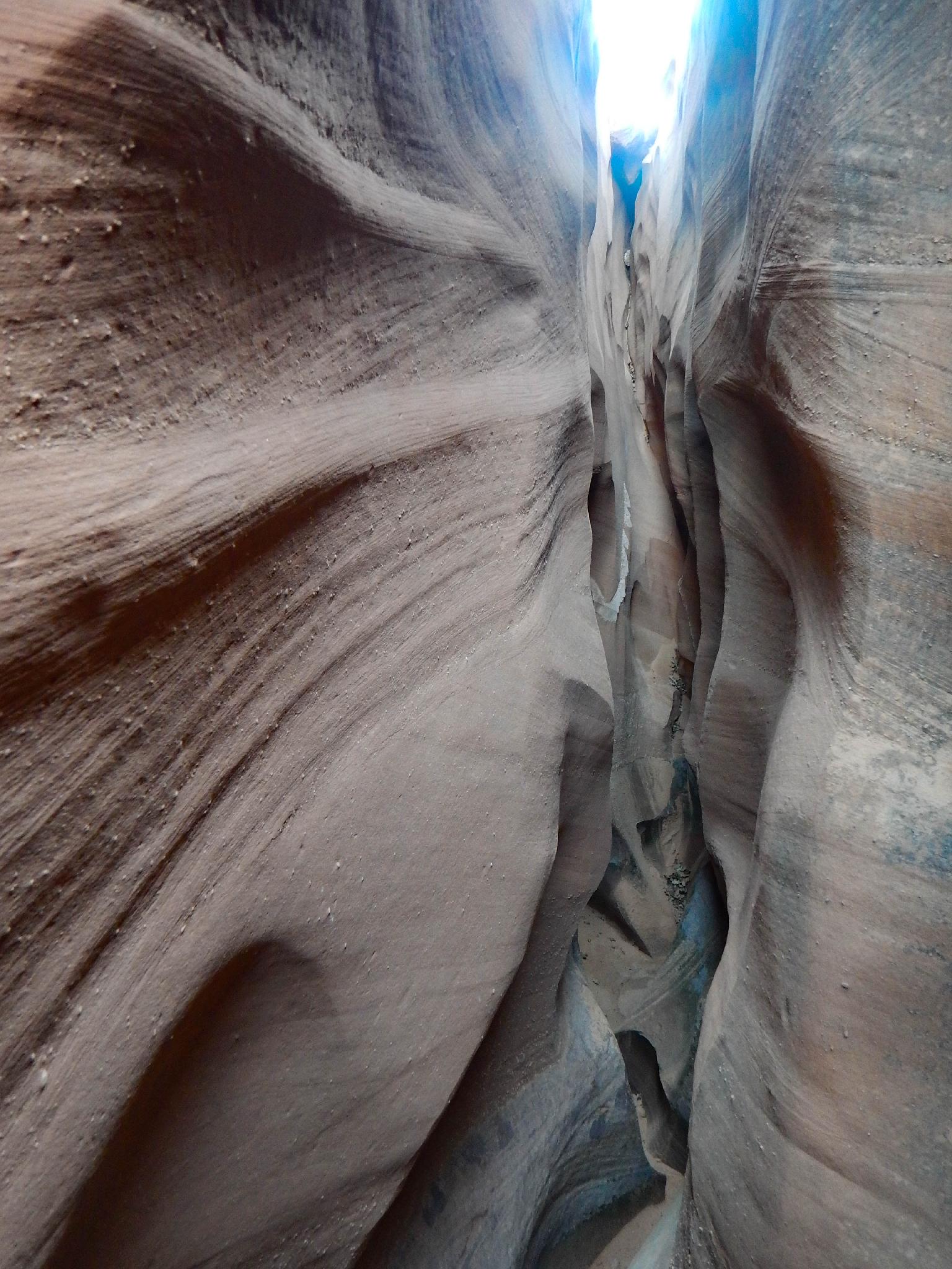
Hike east from the road to reach the rim of Middle Fork where it begins cutting into the Navajo Sandstone layer. Follow it down, passing a dryfall on the left before a couple of narrow slot sections. The canyon is open and wide where the Standard Route enters on the left a minute before the first and only rappel.
Standard Middle Fork Route
Work down into the bowl from the road. Many options here. The goal is to work all the way to the bottom and to Middle Fork. There is nothing harder than class III hiking with some route finding. If it seems hard, look around! Once in the bottom of Middle Fork, the rappel is just a minute or two down canyon.
Both Routes
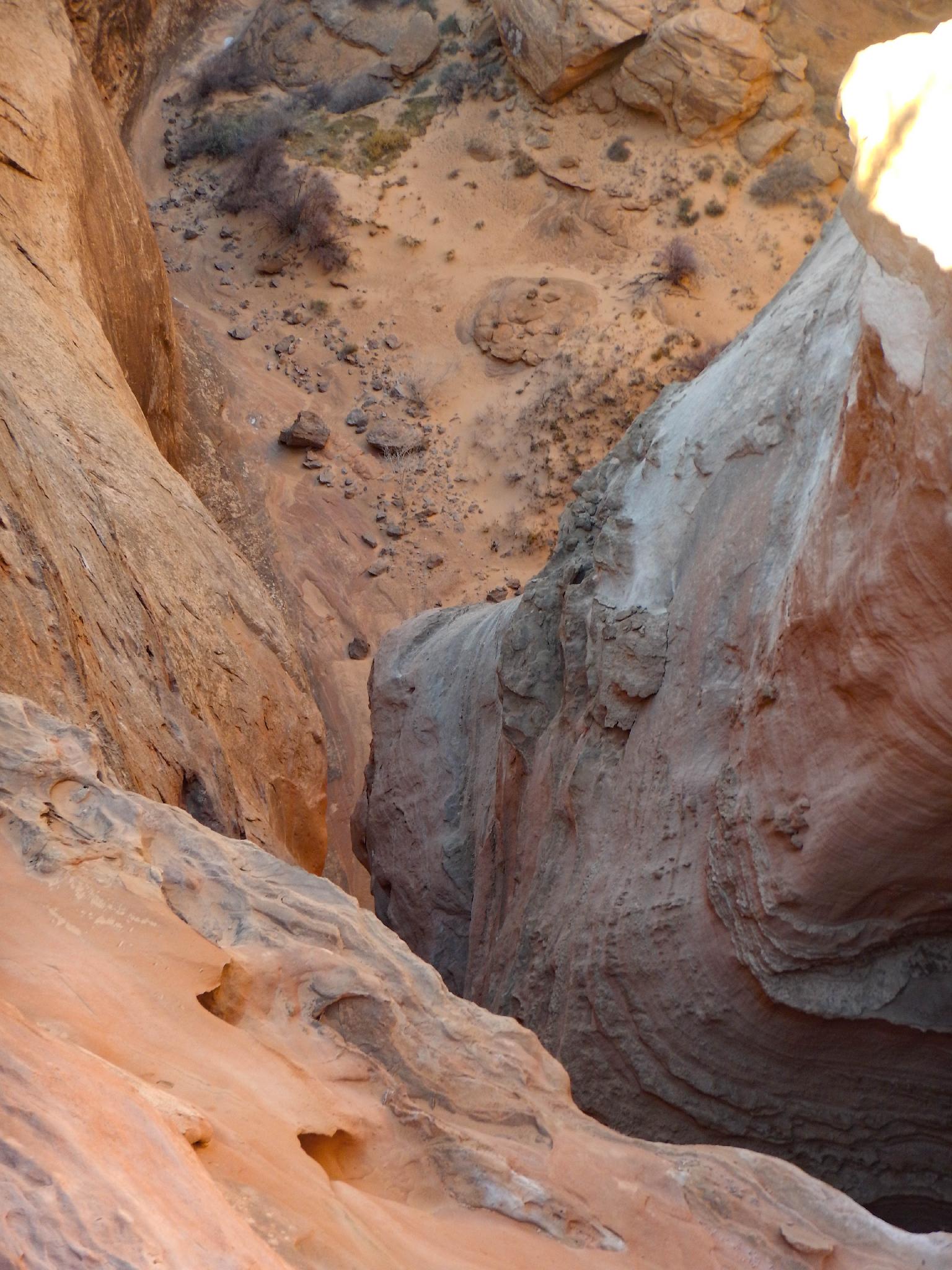
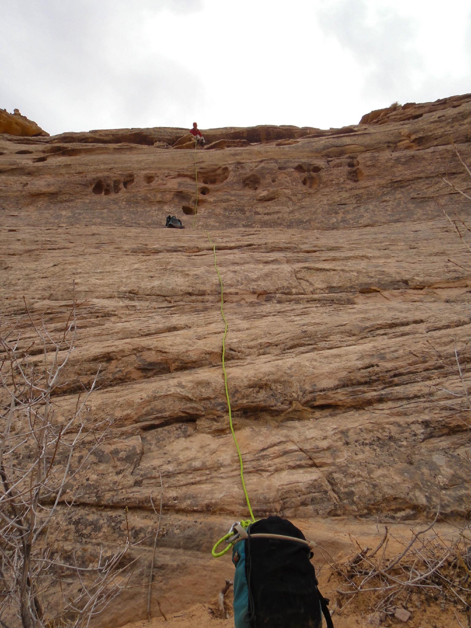
Rappel 1 (50 m ( 165 ft. )) - The first and only rappel is about 50m. Given the short approach using the Standard Middle Fork Route, some may choose to leave their rope here, and retrieve it at the end of the day on the way out. Picking the rope up at the end of the day took our group about 30 minutes.
Below the rappel, the deep walled Middle Fork is easy walking. Follow it until it opens up at a major confluence.
Go right at this confluence. This is the Mindbender Fork where Mindbender and Not Mindbender are. Hike up this about 1.0mile/20-ish minutes passing a side canyon that comes in on the left, and keeping an eye on the right for the first (and only) reasonable looking exit. This is the Moki Exit.
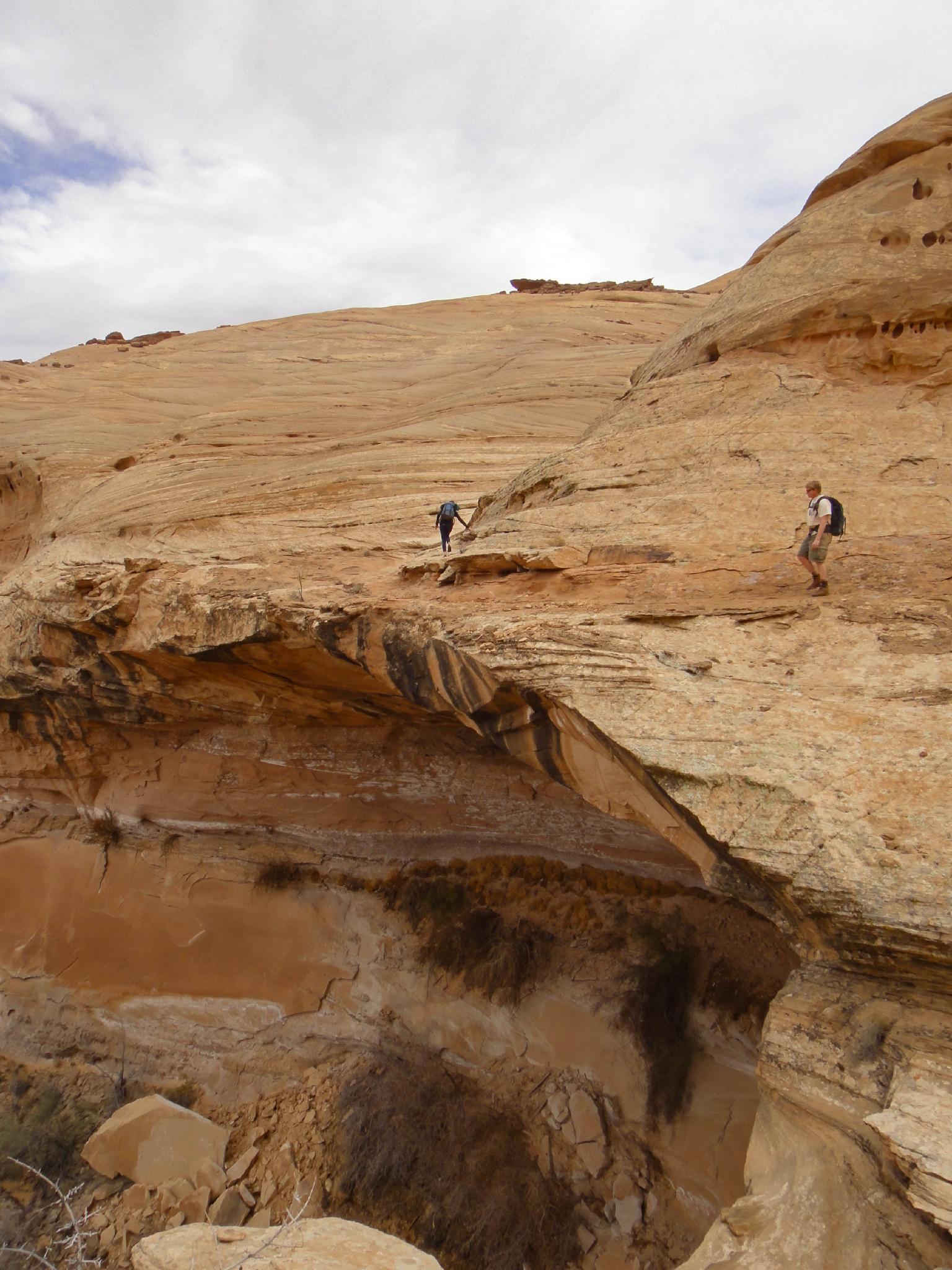
Moki Exit
There is a social trail that goes to the base of a slab. The short steep wall above the slab is the crux moki exit. It has an alcove/overhang to the left of it. The climb is easy, 5.5 / 10 m ( 33 ft. ), and has some enhanced holds. Beginners will want to be belayed.
Once up the climbing section, traverse left on a ledge above the alcove until you can climb lower angle slick rock. Just as you start this traverse, there is a petroglyph panel on the cliff wall to your right.
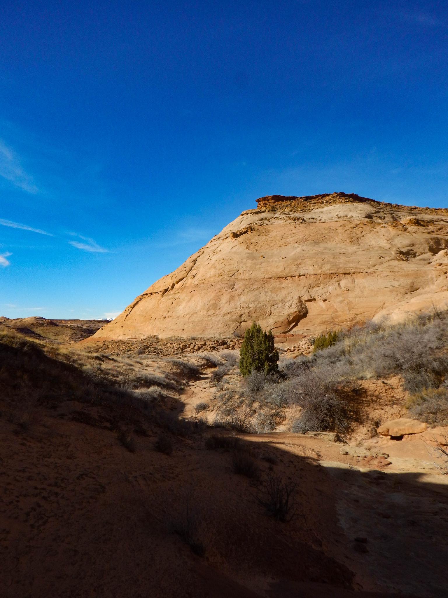
Climb the slick rock until you are below the final large cliff. Go right, around the corner of this large dome, and then up a boulder strewn gully. Work your way up and right until an easy way up the caprock is found. Your car will be visible on your left once on the caprock.
Photos
Maps

12S 553140E 4246575N
38°21'57"N 110°23'30"W
12S 552161E 4246638N
38°21'59"N 110°24'10"W
12S 551784E 4246033N
38°21'40"N 110°24'26"W
12S 552167E 4245901N
38°21'35"N 110°24'10"W
12S 552528E 4245765N
38°21'31"N 110°23'56"W
12S 552938E 4246115N
38°21'42"N 110°23'39"W
12S 548193E 4246800N
38°22'05"N 110°26'54"W
12S 549339E 4246836N
38°22'06"N 110°26'07"W