 Hiking
Kessler (Kesler) Peak
Hiking
Kessler (Kesler) Peak
Big Cottonwood Canyon
Overview
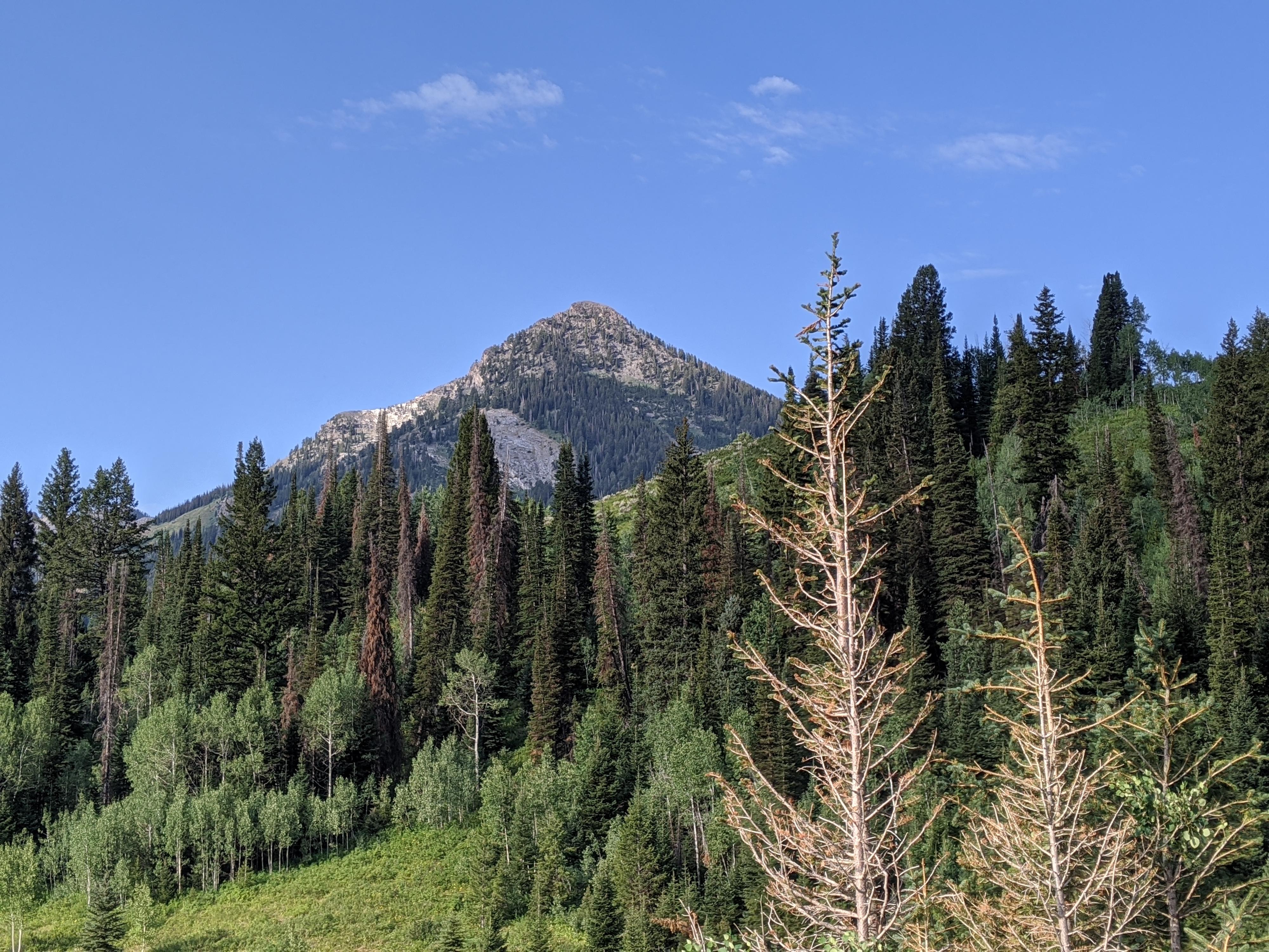
Kessler Peak, sitting on the ridge between Mineral Fork and Cardiff Fork, is one of the more prominent peaks visible from the road up Big Cottonwood Canyon. The peak beckons hikers to visit its lofty summit. The summit you can see from the Big Cottonwood Canyon road is not the true summit, with the true summit a little bit south along the ridge.
The peak was the site of mining activity in the late 1800’s. Today, a couple of ruins of shelters and tunnels near the summit are all that remain of the miner's efforts. The trail, up the north slope, was likely created and used by miners. It must have taken tremendous effort to find a route up the peak, ferry supplies, and begin a mining operation. I could not find any history on how successful the mining operations on the peak were, but given the small site, I assume they were not particularly successful.
This is a hike that will test your leg fitness! The route, although easy to follow and requiring no scrambling, is very steep. Expect about 2900’ feet of gain in just over 2 miles! Though strenuous, this was one of my favorites of the trails I have done in Big Cottonwood. The history and views from the summit are outstanding. It is a peak not to be missed by those that have the legs for it.
The USGS Topo map (and many maps) have spelled the peak name as Kessler. I go with the name Kessler since it is what is printed on USGS maps, It is interesting how the typo Kessler has become the most common name for the peak.
Getting There
Big Cottonwood Canyon is on the east side of the Salt Lake City Valley. Get there by taking I-215 to the east, taking exit 6 off the interstate and heading east.
Follow 6200 South which becomes Wasatch Blvd for 1.8 miles to the stop light and signs for Big Cottonwood Canyon.
Turn left at the light and reset your odometer.
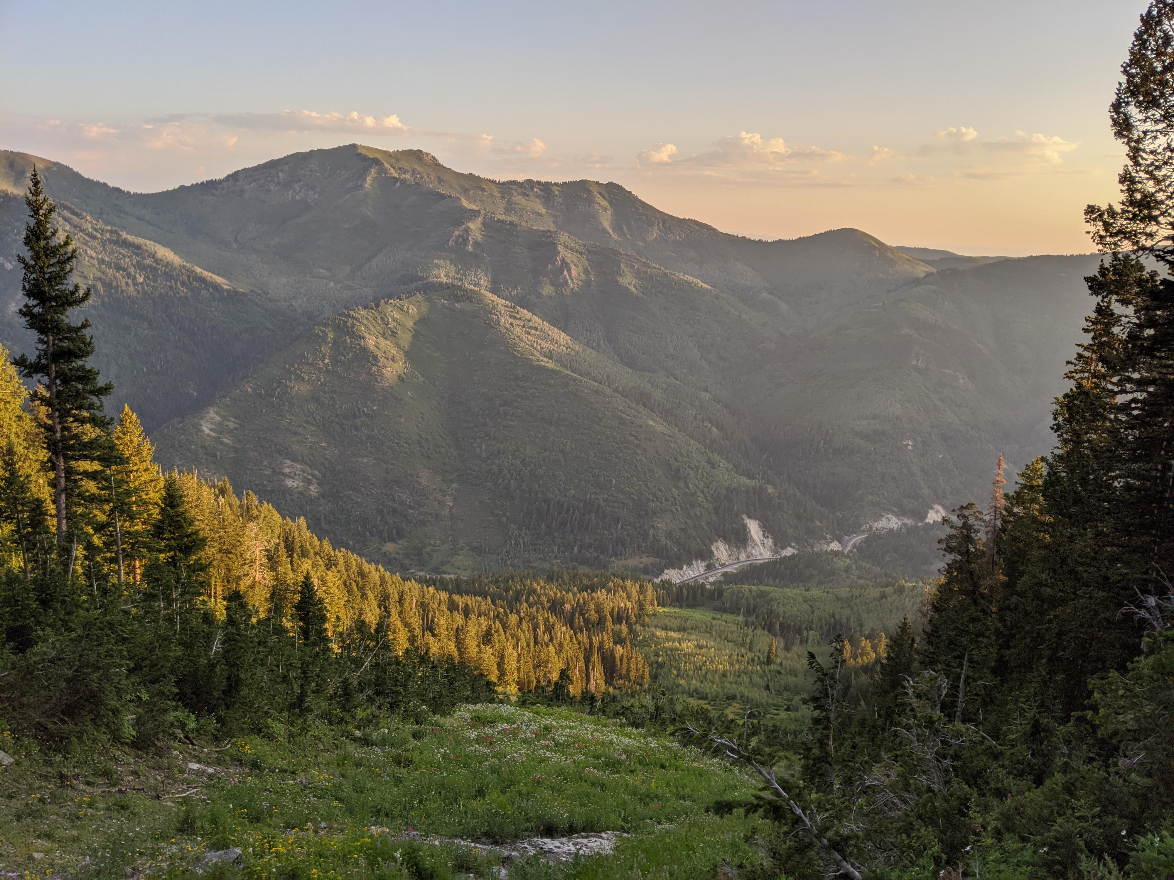
Drive up Big Cottonwood Canyon. The trailhead is at 8.9 miles, where there is a large parking area on each side of the road. Park on the right side of the road. There is a toilet here and gated road (open in the summer) that heads south to the Jordan Pines Campground and Forest Service Donut Falls Trailhead.
It is 0.8 miles down the road to the south to the Forest Service Trailhead. I do not recommend driving to the Forest Service Trailhead. It is constantly full in the summer. Walking from the Big Cottonwood Canyon road adds a bit of distance but makes for a more enjoyable day.
Route Description
To the Forest Service Trailhead (20-30 minutes / 1.3 miles)
Walk the main road south. It crosses the stream over a bridge. A new trail, signed Donut Falls 1.5 miles, leaves the paved road shortly after the bridge on the left. This is a more enjoyable route than staying on the road and what I recommend. Follow the winding trail as it passes the Jordan Pines Campground, then climbs a bit and soon (20-30 minutes from the parking lot) reaches a pit toilet and the Forest Service Trailhead.
To Kessler Peak (3-4 hours / 2.4 miles / 2900’ of gain)
From the Forest Service Trailhead, follow the dirt road west. It crosses the stream, passes a gate, and begins its ascent of Cardiff Fork. From the gate, it Is about 0.3 miles to a junction with a dirt road leaving on the left. This dirt road goes to the Donut Falls trail. Stay right and begin keeping a sharp eye out on the right for the Kessler Peak trail.
The Kessler Peak trail is unsigned but usually has a cairn at its base. It is about 0.2 miles from the Donut Falls side road junction. It is the only obvious trail leaving the road on the right in this section and has the appearance of being well travelled. A lone conifer tree on the left is a short distance up the road from this junction and is a good landmark to doublecheck. If you reach another side road joining on the left, you have gone too far.
Once on the trail, it quickly begins climbing. The trail is, to me, surprisingly well-defined and easy to follow. It clearly gets a lot of use. It climbs west to a ridge, then steeply climbs the ridge with a few switchbacks en route.
At about 9400’ in elevation, the trail crosses a major avalanche path. The winter avalanches make an impressive swath down the mountain here and allows for nice views to the north of Gobblers Knob.
Once across the avalanche path, the trail climbs even more steeply. A trail junction a few minutes past the avalanche area is important. Go left up the mountain here, which is easy enough and is the logical path, but make sure to go RIGHT here on your RETURN down the mountain!
An old log structure on the right is a good sign you are nearing the ridge. At the cabin, the views begin to open a bit more. The trail climbs steeply for a few more minutes to an old mining tunnel and second log structure near the ridge.
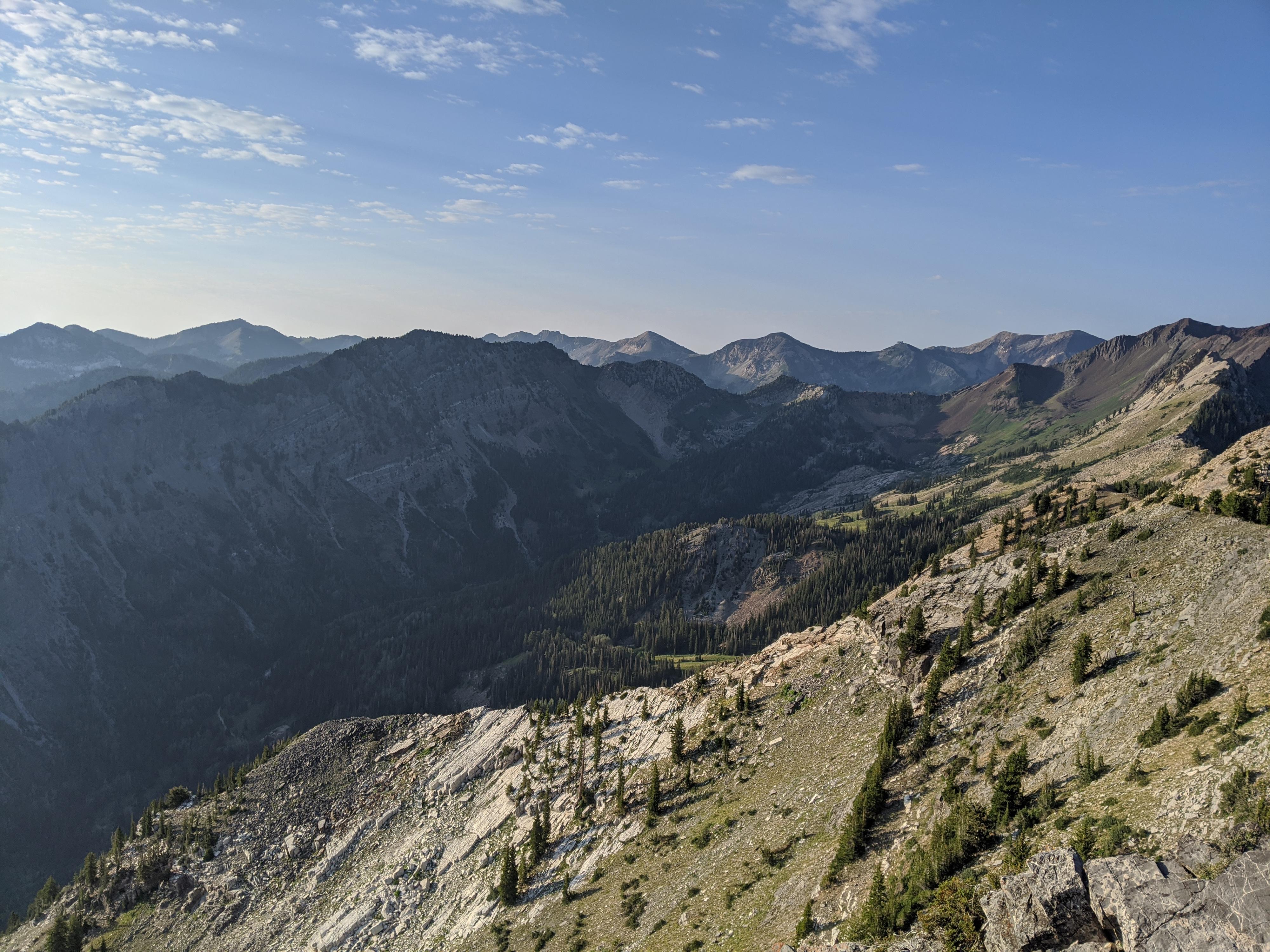
From the ridge, stay on the well-worn trail as it heads south. The most used path is just below the ridge on the west side and is the easiest path to the summit. Do not take the many minor foot paths to the ridge!
From the summit, the awe-inspiring Big Cottonwood/Little Cottonwood ridgeline and area beyond is visible to the south. The Salt Lake Valley comes into view to the west, and upper Cardiff Fork is due west below the ridgeline. Stunning views all around.
Return the same way, making sure to go right at the important junction below the cabin!
Photos
Maps

12T 445138E 4500051N
40°38'58"N 111°38'56"W
12T 444930E 4498952N
40°38'22"N 111°39'05"W
12T 444856E 4498971N
40°38'23"N 111°39'08"W
12T 444707E 4498540N
40°38'09"N 111°39'14"W
12T 444582E 4498296N
40°38'01"N 111°39'19"W
12T 443428E 4497982N
40°37'51"N 111°40'08"W
12T 443452E 4497760N
40°37'43"N 111°40'07"W
12T 443537E 4497619N
40°37'39"N 111°40'03"W
12T 443427E 4497357N
40°37'30"N 111°40'08"W