 Hiking
Chalk Creek Hieroglyphs
Hiking
Chalk Creek Hieroglyphs
Fillmore
Overview
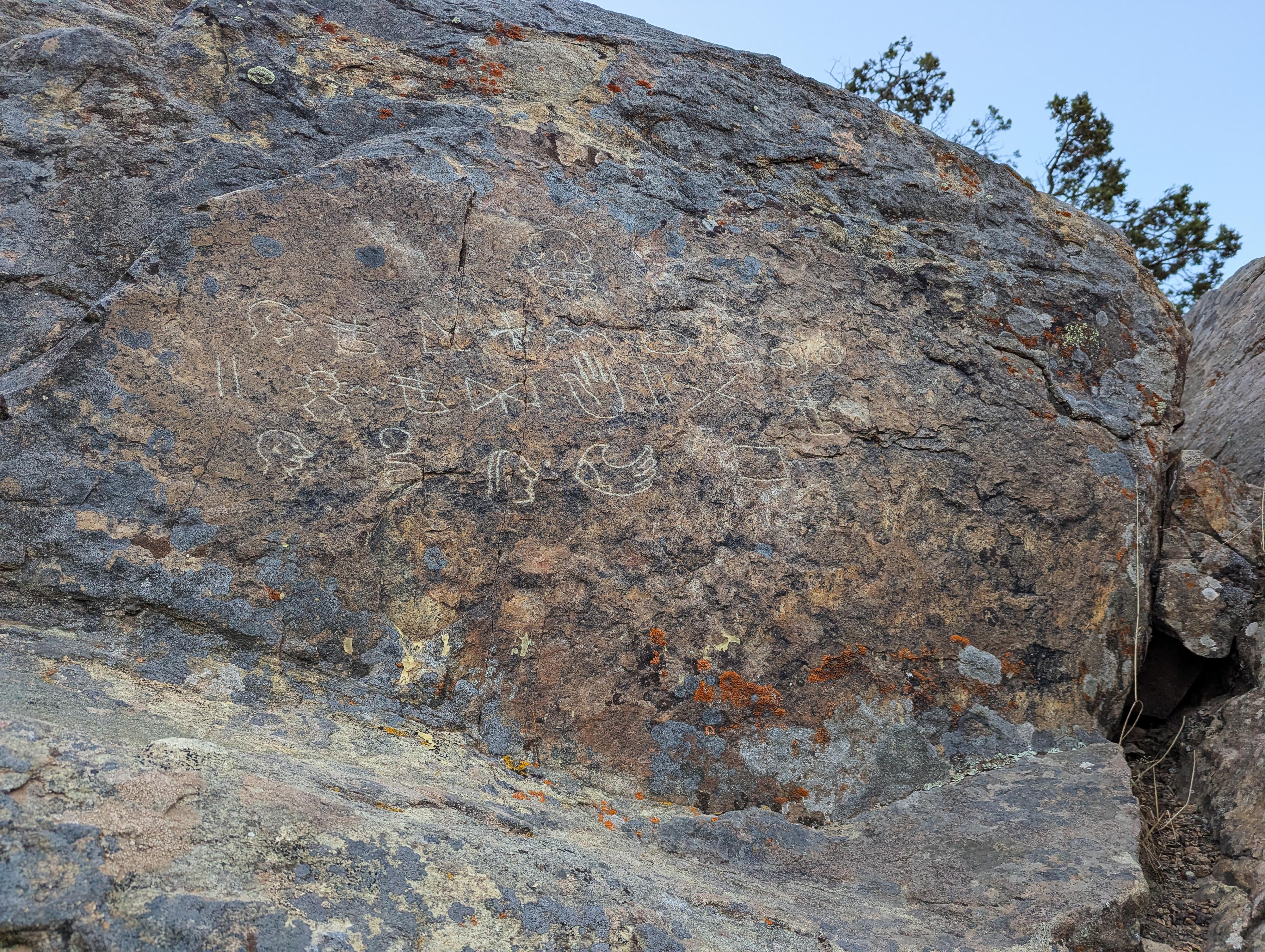
Hidden in the rugged walls of Fillmore Canyon lies an intriguing mystery - the Chalk Creek Hieroglyphs. Carved into the sandstone cliffs are strange symbols: circles, lines, figures, and markings that have puzzled explorers, scholars, and locals for generations. Were they left by ancient travelers passing through the Great Basin? Survivors of distant civilizations? Or are they the work of settlers searching for treasure and leaving their marks in stone? These are very similar to the Ogden Mystery Glyphs.
From the informational signs at the site:
Over twenty carved symbols decorate the cliff face here. The mysterious “Chalk Creek Hieroglyphs” have been a source of fascination ever since their discovery.
Discovery
Fillmore prospector Clifford Purcell was not looking for mystery when he and Rube Melville hiked up Chalk Creek Canyon in 1939. Searching for evidence of copper, silver, and iron ore, Purcell climbed down to check a ledge and spotted something strange.
“…there was four rows kinda like picture writing… full of lichen, full of green stuff… the sun was shining on it like a spot light.”
The Gold Tablets
Purcell’s discovery eventually caught the attention of many people, including Mexican archaeological guide José Davila. He believed that the symbols told of two sacred golden tablets that ancient refugees had buried in a chamber nearby. From 1965–1969, Davila and others excavated over 600 feet of tunnels near the hieroglyphs, searching for the chamber.
Tragedy Strikes
The numerous excavation attempts were marked by tragedy. In November of 1966, after attempts to blast through a layer of rock, locals Duane White and Kent Neely descended into the ground in search of the gold tablets. They were overcome by toxic gases, lost consciousness, and died. In 1967, claim owner Harold Huntsman met the same fate.
Signature Rock
The Signature Rock, once located to your right, fell during excavation activities and was salvaged by local artisan and rockhound Del Allgood who had a long-time interest in the hieroglyphs. It contains two symbols and is currently located for viewing at the Fillmore Ranger District office.
Theories of Their Origin
Aztec Refugees
Based on similarities between many of the symbols and Central American writings, some have theorized that the hieroglyphs were created in the early 1500s by Aztec refugees fleeing north with a great treasure, after the conquistador Hernando Cortés imprisoned Aztec emperor Montezuma.
Spanish Trails
Located near 18th century Spanish trails, the carvings may have been created by Spanish explorers, or by early American miners following the footsteps of Spanish explorers.
Mayan Waypoint
Because some of the symbols closely resemble Mayan hieroglyphs, some researchers theorize the Chalk Creek symbols could indicate a waypoint or gathering place along a trade route between Asiatic, Mayan, and Near Eastern people.
Asian Connection
In 1965, local hieroglyph enthusiast Del Allgood discovered a note written on a piece of wood and tucked into a hole under the glyphs. It is written in Pahawh Hmong, a “lost” written language that the Hmong say was supernaturally restored to them in the 1950s. They claimed the message referred to a golden treasure buried nearby.
Nephite Clues
The translation by José Davila in 1965 was based on his earlier work with symbols from a tomb in Mexico. Davila became convinced that the Chalk Creek symbols were carved by ancient refugees called Nephites (descendants of the prophet Nephi, in the Latter-day Saint tradition) fleeing northward from a great battle. Davila believed the writings, in conjunction with a nearby “map stone,” provide directions to a sacred treasure.
The Mystery Remains
The carvings are similar to sets found in California, Idaho, Nevada, and other Utah sites. Symbols within this “family” of glyphs overlap; the signs, the sizes, and position of the inscriptions are similar.
Getting There
From Main Street in downtown Fillmore, head east on 200 South / W Canyon Road (toward the mountains) for about 3.3 miles to a junction.
Turn left onto New Chalk Creek Canyon Road, then stay right at a minor junction in a few hundred feet. The road crosses Chalk Creek, and a side road leaves on the left, climbing the hillside shortly after the bridge.
Turn left onto the steep, rocky road. Follow it up. There are a couple of minor side junctions on the right as you go up; stay left at all of these.
The road makes a sharp bend and begins heading south with a junction on this bend with the White Sage PST. Stay right here. The road reached the trailhead in less than 1/4 of a mile from the White Sage PST side road.
Route Description
Rock art and historic sites are fragile, non-renewable cultural resources that, once damaged, can never be replaced. To ensure they are protected, please:
- Avoid Touching the Petroglyphs: Look and observe, BUT DO NOT TOUCH!
- Stay on the Trails: Stay on the most used trails when visiting sites, and don't create new trails or trample vegetation.
- Photography and Sketching is Allowed: Do not introduce any foreign substance to enhance the carved and pecked images for photographic or drawing purposes. Altering, defacing, or damaging the petroglyphs is against the law -- even if the damage is unintentional.
- Pets: Keep pets on a leash and clean up after them.
- Artifacts: If you happen to come across sherds (broken pottery) or lithics (flakes of stone tools), leave them where you see them. Once they are moved or removed, a piece of the past is forever lost.
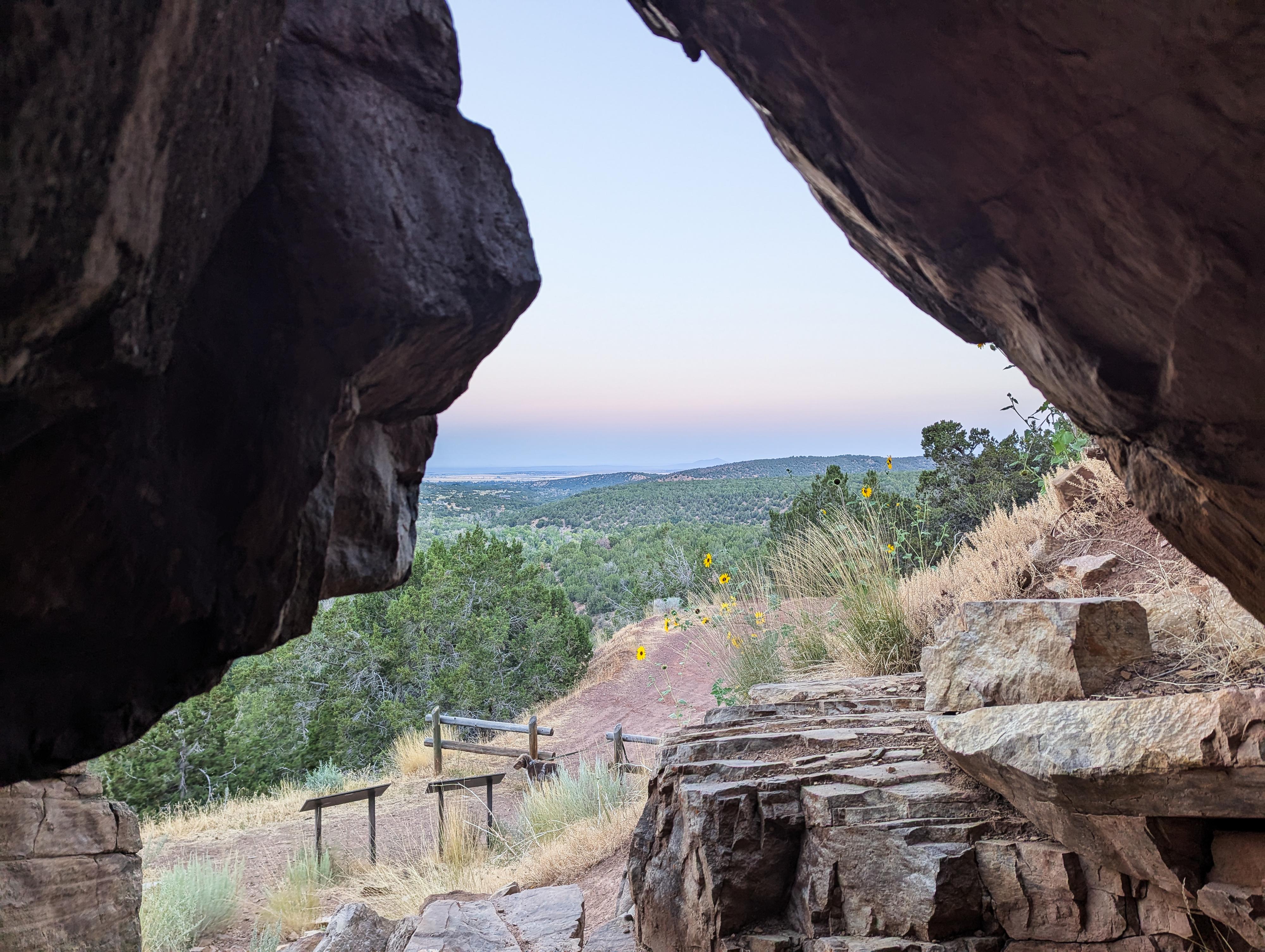
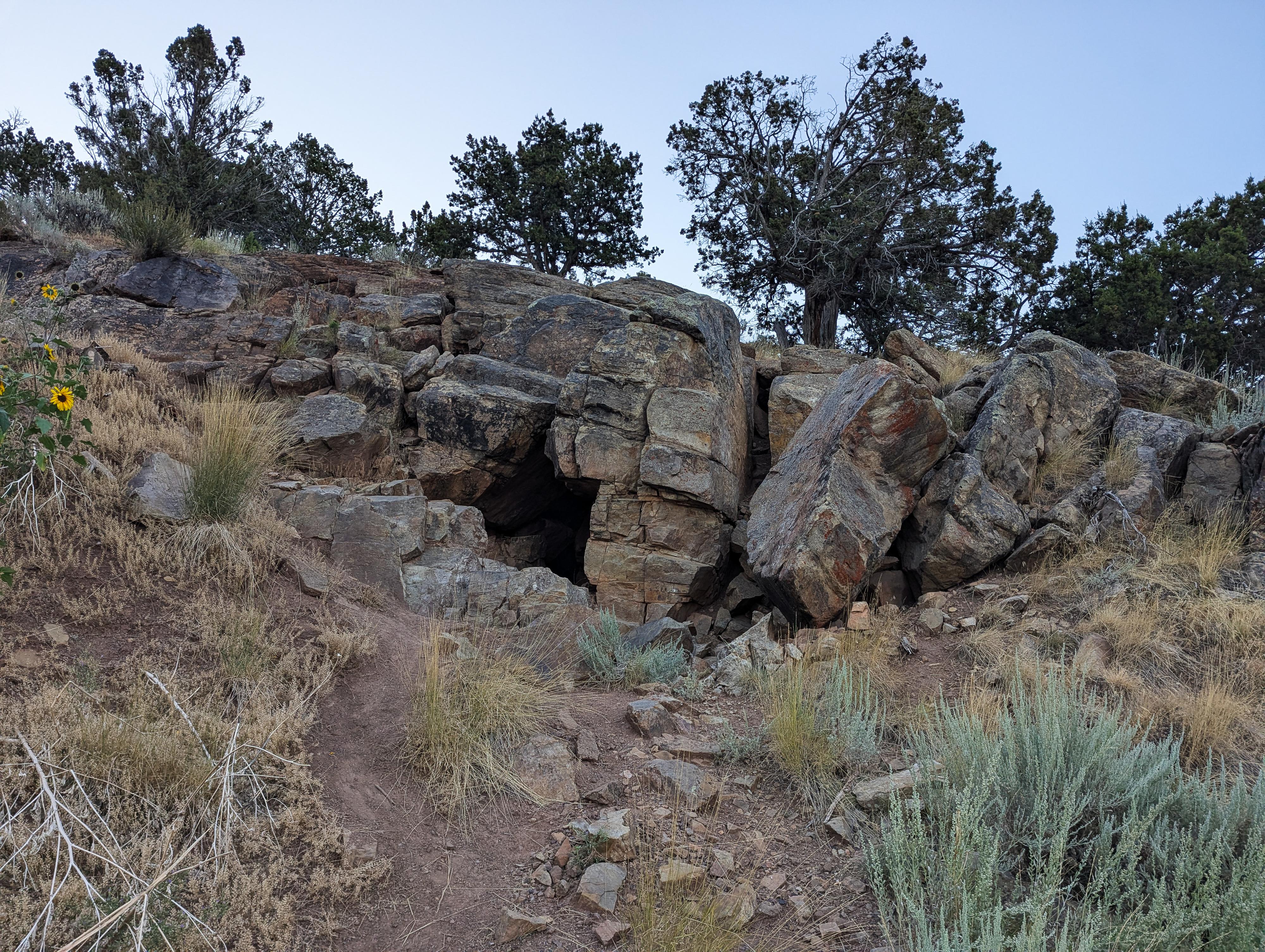
From the trailhead, follow the trail less than a minute to what looks like an old mine shaft going into the rock. The hieroglyphs are just above this hole.
Photos
Maps

12S 390317E 4311840N
38°56'55"N 112°15'57"W
12S 390712E 4311657N
38°56'49"N 112°15'40"W
12S 390723E 4311651N
38°56'49"N 112°15'40"W