 Hiking
Fool Creek Peak
Hiking
Fool Creek Peak
Oak City
Overview
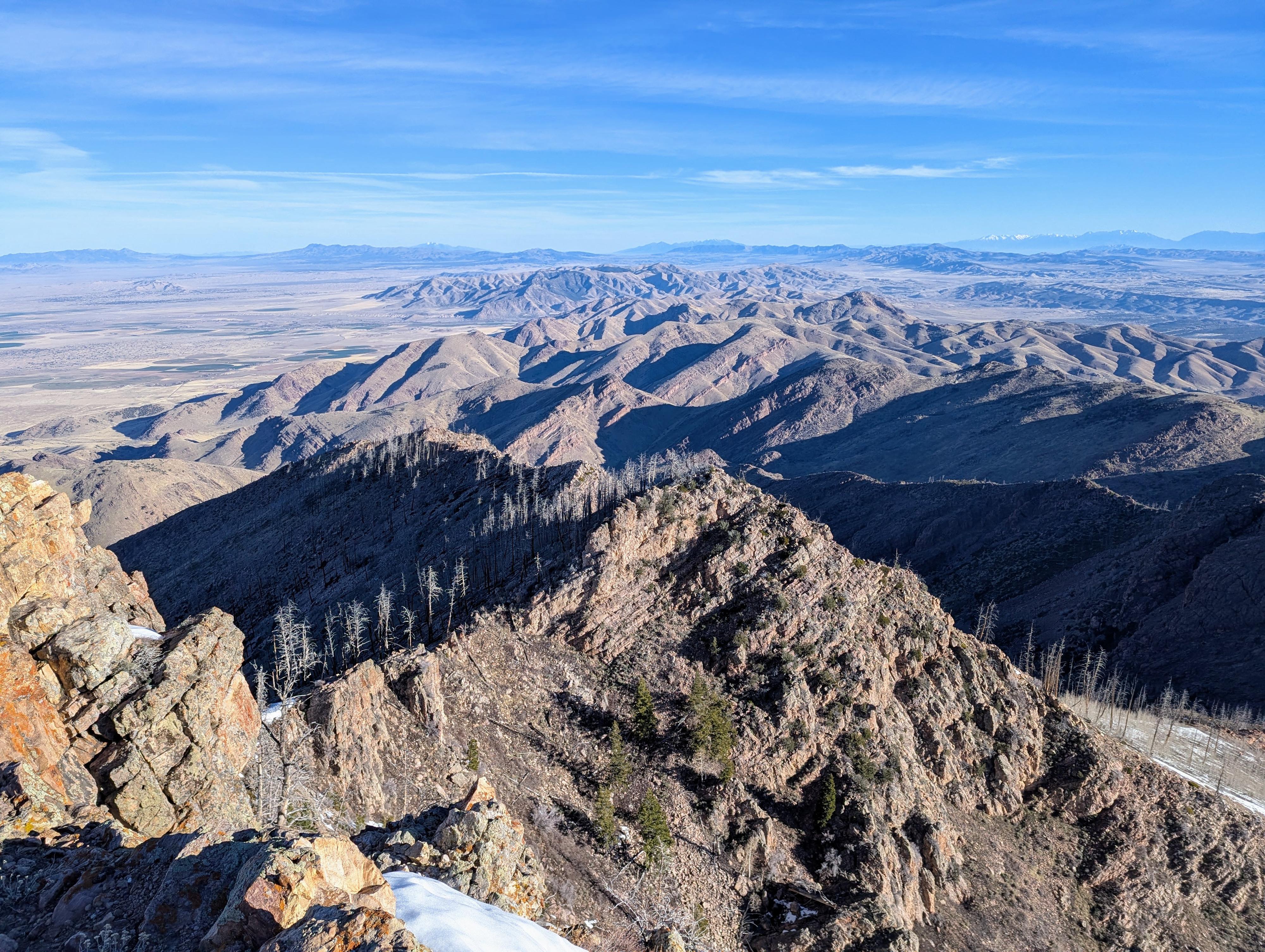
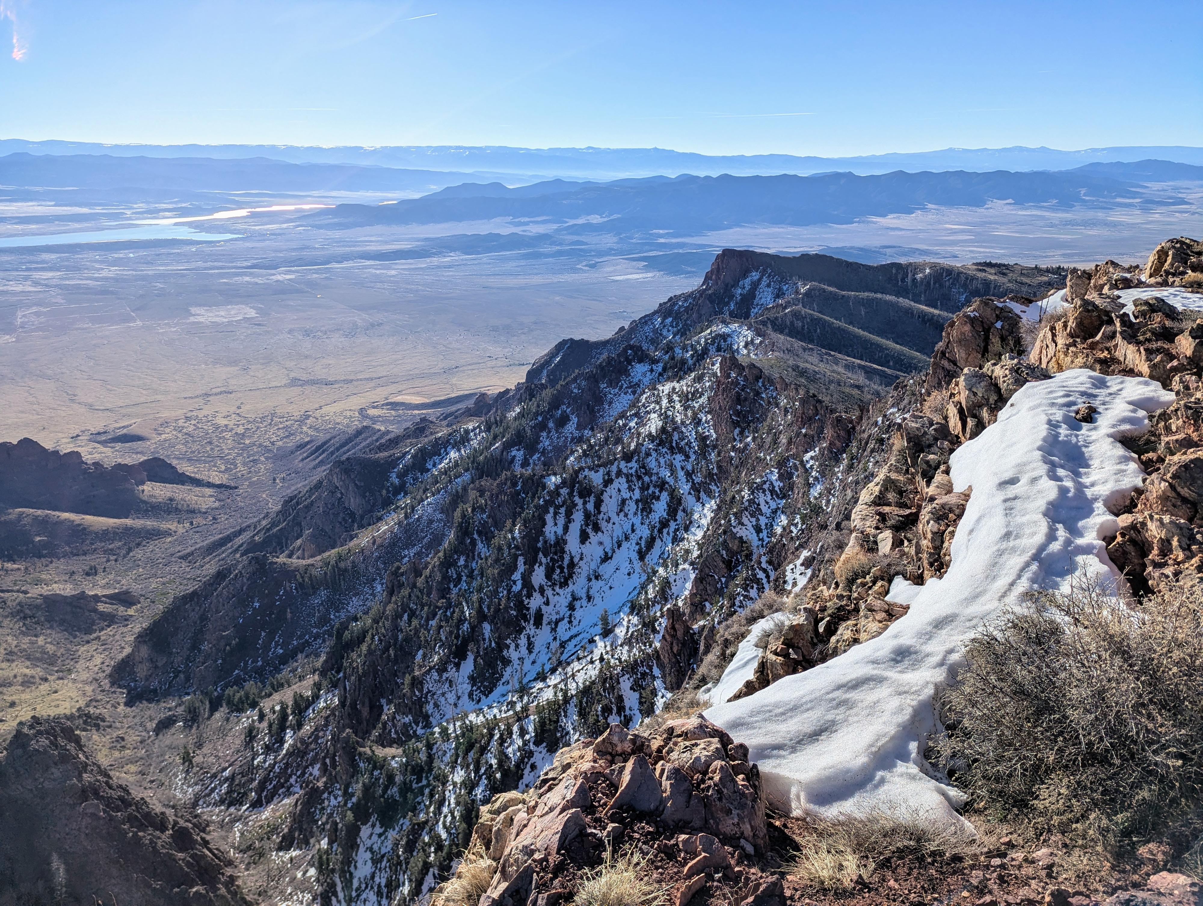
Fool Creek Peak is the highest point in the Canyon Mountains of Central Utah, standing at an elevation of 9,712 feet. Located within the Fishlake National Forest, it is a prominent landmark often visible from I-15 near Scipio. The peak is known for its expansive views of the Sevier Desert and the surrounding basin-and-range landscape, and even the distant Wasatch Front mountains.
This is a fairly strenuous hike, gaining about 3,000' over a little more than 3 miles (if you have a high-clearance vehicle, more with a low-clearance vehicle). The area, unfortunately, burned in 2012 in the Clay Springs Fire. The grasses and shrub oak seem to have recovered since then, but there is little or no shade on the hike, as all the trees are now standing dead timber. I would recommend this in spring or fall when temperatures are more moderate. If doing it in the summer, start early and bring plenty of water. The summit register shows a fair bit of visitation, but on any given day, I think you are likely to have the peak to yourself.
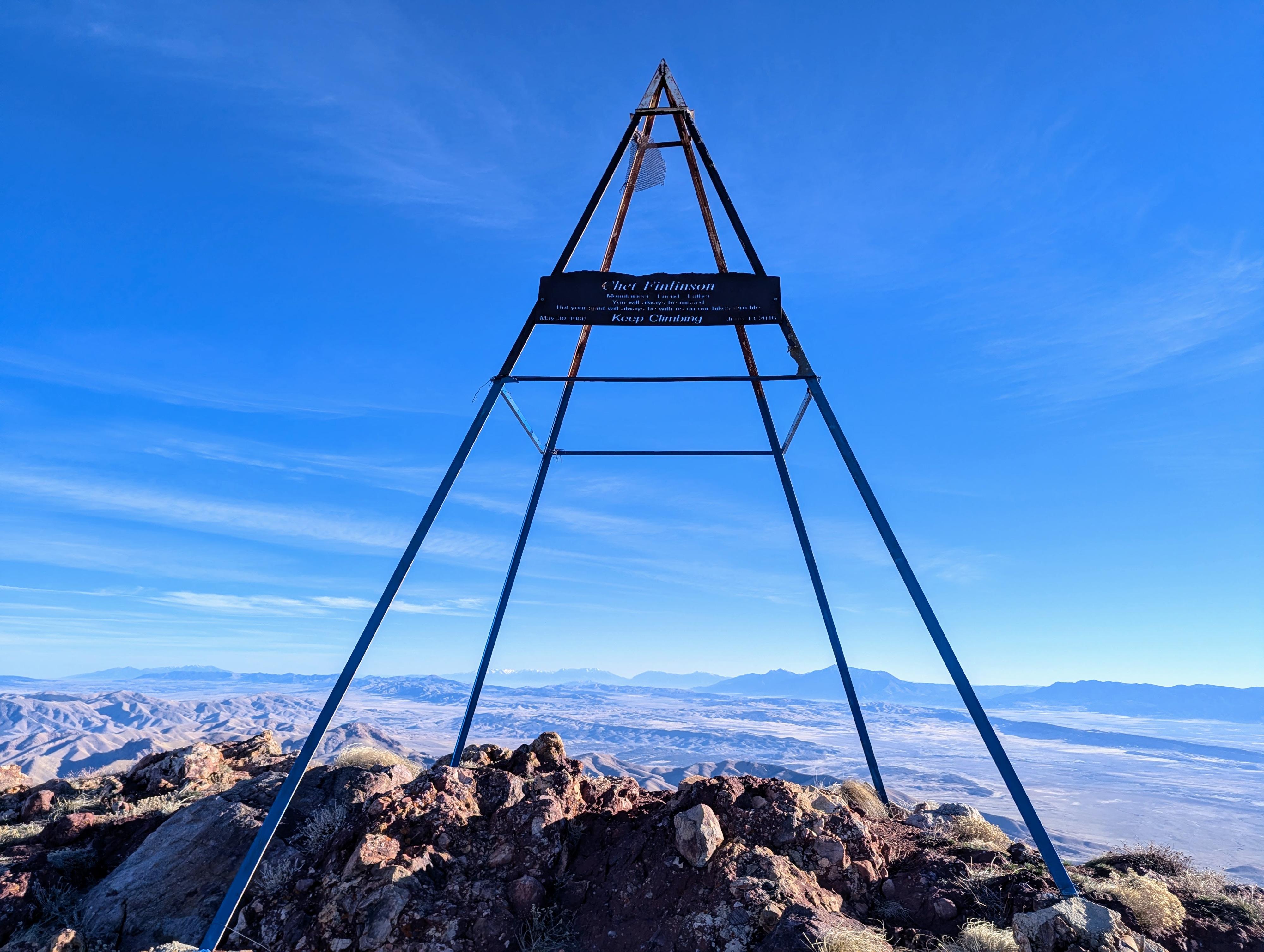
Fool Creek Peak played a fascinating role in 19th-century communications technology. It was a key station in the Heliograph Network established by the U.S. Army Signal Corps in the late 1800s (specifically during the 1890s).
The Technology: A heliograph was a wireless telegraph that used a movable mirror to flash sunlight at a distant station. By using Morse code, operators could transmit messages over vast distances much faster than a rider on horseback.
The Network: Fool Creek Peak was a critical "repeater" node. Because of its height and clear line of sight, it could communicate with other high-altitude stations, including Mount Nebo to the north and Mount Belknap to the south.
The Record: This specific network in the Southwest was famous for successfully transmitting a message over 2,000 miles through a series of mountain peaks.
What’s Left: While most of the original equipment is long gone, you can still find USGS survey marker and a metal structure I assume was part of the station.
Getting There
From Oak City, head east on Center Street (L Street). After about 1/4 of a mile, it bends south, then bends again back east as it starts up Oak Creek Canyon. The campground is on the right side of the road about 4.2 miles from Oak City. It is well signed and an excellent campground.
Continue on past the campground to about 6.2 miles from Oak City, where North Walker Canyon comes in on the left. A dirt road here descends, crosses the rocky stream bed, and heads up the canyon. Those in low-clearance vehicles will need to walk from here.
If driving, continue up the rutted two-track road as it heads up North Walker Canyon. About 1 mile from the Oak Creek Road, the two-track steeply crosses the creek and gets much rougher. I recommend parking on the left here before it descends and crosses the creek.
Route Description
To the Trail (0.75 mile)
From the preferred trailhead, continue walking up the road about 3/4 of a mile to its end. There are a couple of stream crossings along the way, but in most all conditions I suspect a little boulder hopping is all that is needed to keep your feet dry.
To the Ridge (1.25 miles)
The trail is generally easy to follow. It starts gradually as it ascends the craggy-walled canyon, then begins to climb in earnest up to the ridge from the canyon bottom. At the ridgeline the trail splits. North descends into Buck Hollow to the north. Go right (east) instead on the trail that heads up the ridge.
To the Summit (1.5 miles)
Follow the trail up along the ridge. It is mostly straightforward to follow but can get a little confusing as it crosses a couple of rocky spots; just keep a close eye.
There is a little up and down on the ridge at first, and then you begin climbing the final summit ridge. This section is now the remains of burned trees but must have been lovely and somewhat shady before the fire.
The final stretch has a couple of switchbacks on the open slope to the summit. Near the summit you can see a couple of dug-out flat spots. I assume these were the campsites for the heliograph team.
The top has an old metal structure and a couple of more modern solar-powered monitoring units of some sort.
From the summit you can see Yuba Lake to the east, along with Timpanogos and even Lone Peak to the far northeast. To the west is the vast Great Basin and ranges that dot it. It is a lofty view all around!
Return the same way.
Photos
Maps

12S 393500E 4357187N
39°21'27"N 112°14'10"W
12S 393757E 4358625N
39°22'14"N 112°14'00"W
12S 394409E 4359376N
39°22'39"N 112°13'33"W
12S 394477E 4360813N
39°23'25"N 112°13'31"W
12S 396044E 4361043N
39°23'33"N 112°12'26"W