 Hiking
Cable Mountain
Hiking
Cable Mountain
Zion East Side
Overview
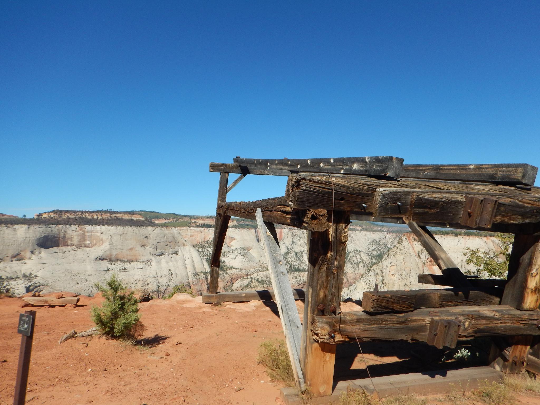
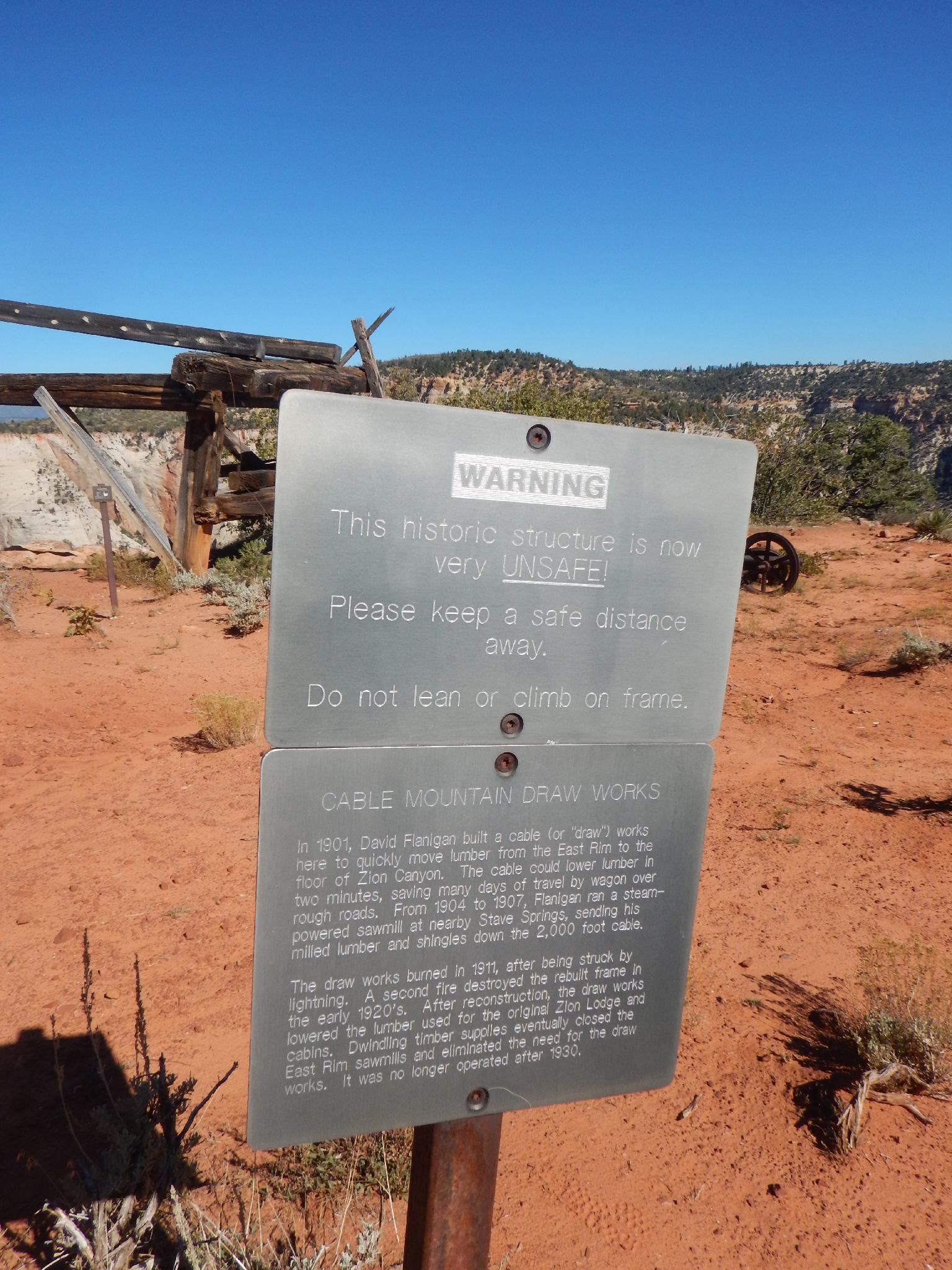
Cable Mountain towers over the Zion Main Canyon and offers endless views of the park. The mountain is named Cable Mountain because in 1901 David Flanigan began building, then operating a 2000' cable system to lower timber from the East Rim down to the Zion Main Canyon. Incredibly, getting lumber from the East Rim to the Main Canyon took ten days round trip before the cable system, and just a few minutes after the cable system was installed. A lightning strike destroyed the cable system in 1911, but it was re-built and used up until 1926. The cables have long since been removed, and all that now remains is the wooden foundation at the top of Cable Mountain.
Visiting Cable Mountain for the views alone would be a very highly recommended outing, but throw in a bit of fascinating history and this is one of my favorite hikes in the park. Note, you can visit Cable Mountain from the main canyon by starting at the Weeping Rock shuttle stop and following the Echo Canyon trail up to Stave Spring. Starting in the main canyon more than doubles the hiking distance to about 16 miles total and adds about 2000' of gain. Starting from Stave Spring (this description) offers the easiest approach and makes Cable Mountain a very moderate outing.
Getting There
The trailhead is off the North Fork road, which starts 2.2 miles east of the east entrance of Zion National Park on highway 9. It is signed.
Route Description
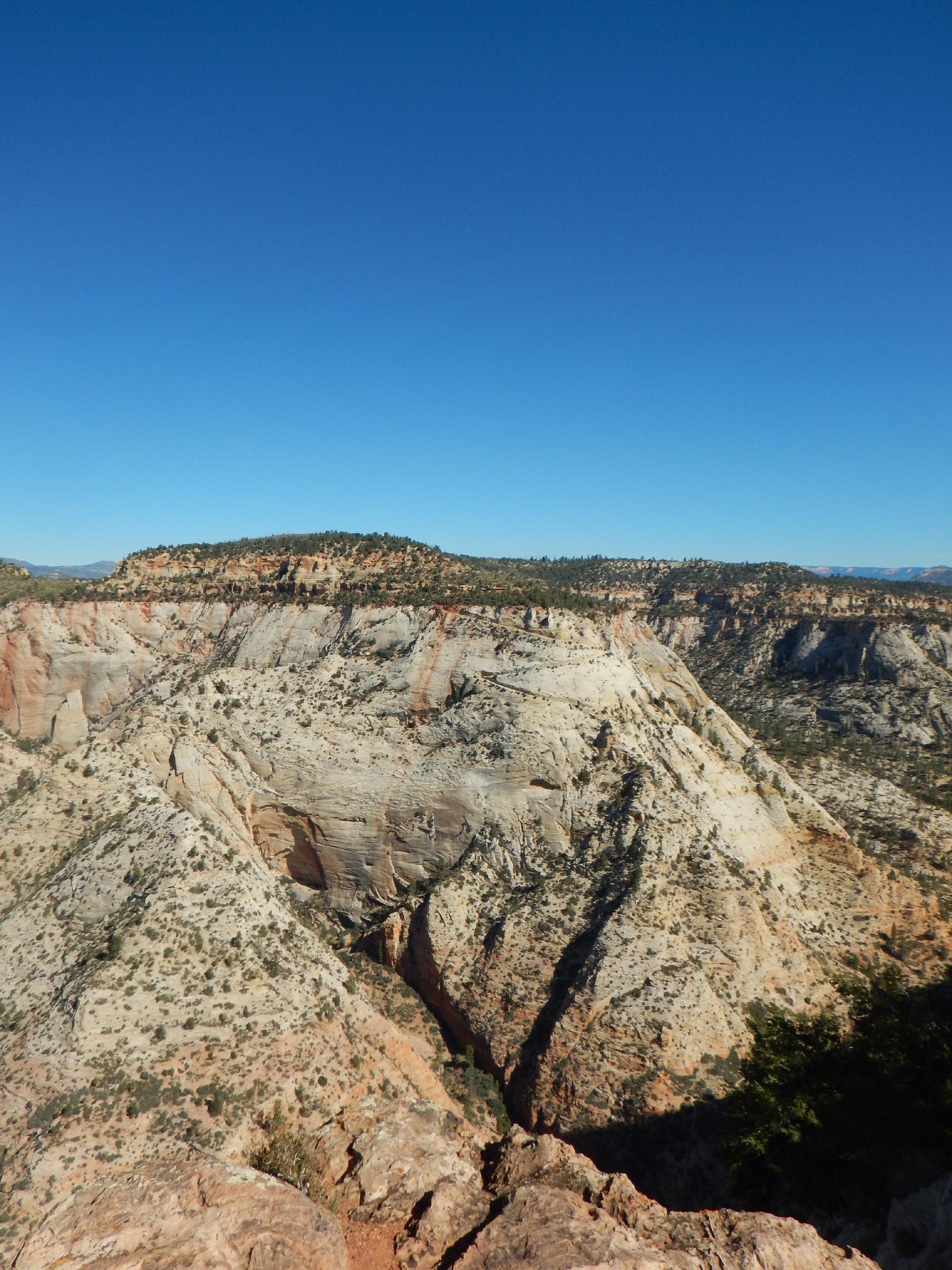
From Stave Spring Trailhead, follow the trail a few minutes to a signed junction. Go left here (right goes down to the Zion main canyon). The trail ambles across gently rolling terrain then reaches the Stave Spring junction. Go right here, climbing a bit up. At about the 1/2-way point, the final major junction is reached. Go right on the signed Cable Mountain Trail. The trail crosses and descends the mesas to the old Cable Mountain Draw Works foundation.
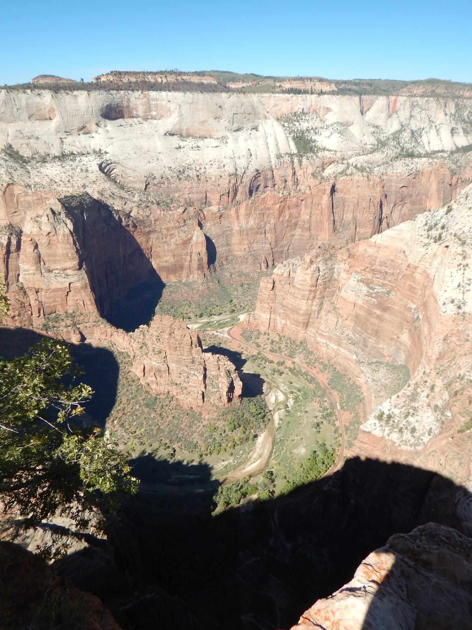
From the Cable Mountain Works foundation ruins, Observation Point is visible just to the north across Echo Canyon. You can see the trail cut in the steep sandstone heading up to the point. Below is the Zion Main Canyon and Big Bend, with Angels Landing across the main canyon to the West.
The large flat mesa across to the west above Angels Landing is the West Rim trail area.
Return the same way.
Maps


12S 331650E 4126274N
37°16'04"N 112°53'55"W
12S 330830E 4126091N
37°15'58"N 112°54'28"W
12S 330964E 4125650N
37°15'44"N 112°54'22"W
12S 329994E 4124625N
37°15'10"N 112°55'01"W
12S 328543E 4126397N
37°16'06"N 112°56'01"W