 Canyoneering
Icebox Canyon
Canyoneering
Icebox Canyon
Kolob Canyon Area
Overview
Ah, Icebox, the often overlooked and seldom done canyon in the Kolob Canyon section of Zion National Park. Reviews from the few I have known that have done it have been mixed. No glowing recommendations, but also no scathing reviews either. I finally got a chance to check it out in the summer of 2015.
My verdict? Well, at almost 13 miles and 2000' of elevation gain, the route has length (a plus in my book). It is definitely seldom visited and feels very off the beaten path (also a plus in my book). In hot times, it doesn't require a wetsuit, and is straightforward as technical canyon go (yet another plus for a casual, fun long day out in the back country). Looks like it is headed for a glowing recommendation? Not quite. There is a large amount of bush-whacking to reach the canyon and in several sections of the canyon that are a pretty big minus. I would give it a mixed review as well. Pretty, fun, and worth doing once, but not likely one I will repeat.
The length causes this canyon to take fast and fit groups 8-10 hours. Slow and less skilled groups often take 14+ hours. Yikes! I would recommend this adventure to only those that have a good fitness base and are competent at setting up rappels. Some do the entrance drops in as little as 2 rappels, but many (most) groups will take as many as 5, which can greatly slow down large groups and those without solid rope skills.
Contrary to what many others suggest, I would suggest trying to get a La Verkin Creek permit (a site between 6 and 10 or 11 would be good) and making this a light overnight backpack. A solid group can be to camp by mid-afternoon and spend the rest of the day or early the next morning hiking up La Verkin Creek before making the exit, giving the trip a bit more bang for the buck.
Getting There
This canyon is in the Kolob Canyons area of Zion National Park, which is just off of exit 40 on I-15. This is about 20 miles south of Cedar City Utah. If coming from the main part of the park, go west on highway 9 about 17 miles to the town of La Verkin, then go north on UT-17 about 5 miles to I-15. Follow I-15 north for 12 miles to exit 40.
From the visitor center just off the highway, go into the park on the scenic drive for 3.7 miles to Lees Pass. The trailhead and parking area are on the left.
Route Description
Approach (3 miles / 2 hours for a fast group)
Head down the La Verkin Creek trail. It is fast and easy walking. After a mile, it crosses a deep ravine. Go left, down the ravine for a minute to Timber Creek, turn left, and head up Timber Creek.
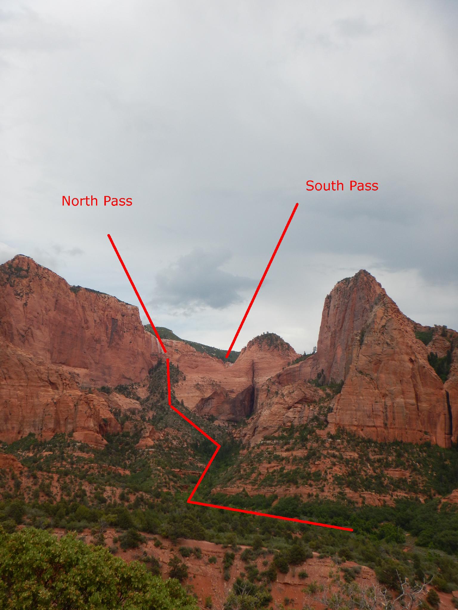
The hike up Timber Creek is a bit overgrown in spots. Social trails come and go. Stay toward the canyon bottom, especially as you get up higher, to avoid struggling with the steep brushy filled side slopes. Near the canyons head, it divides with a major dryfall a minute up the left hand (north) fork. Climb the dirt ridge between the two forks to the base of the cliff, traverse right, and work up to the dirt hill above. An emerging trail helps a bit here.
Continue up the ridge to the top of the dirt landslide. It feels like work, but with a decent start it will be shaded. The top, and slickrock bowl on the other side, mark the North Pass entrance.
The Canyon (3-4 hours for a fast group)
Rappels (1-2 or 5)
Heading down from the pass, the slickrock gully rounds and steepens. An initial bolt with an old homemade hanger seems dubious, and the scrambling easy, so I would recommend continuing to down climb. A lone bolt is encountered about 45 m ( 148 ft. ) lower.
This is a good place for most groups to setup their first rappel, though some may continue down climbing. 55 m ( 181 ft. ) below the first lone bolt is a second. Most will want to re-rig and do this as rappel #2 that goes straight down about another 55 m ( 181 ft. ) to another anchor, this one with 2 bolts. From this anchor, notice the tree down and to the right (looking DOWN canyon). Rappel or downclimb diagonally about 25 m ( 83 ft. ) to this anchor.
The tree is the spot for the first mandatory rappel. It is about 35 m ( 115 ft. ) down to a sloping ledge with bolts. Re-rig and rappel from the ledge about 50 m ( 165 ft. ) to the canyon floor. Phew!
The Rest Of The Canyon
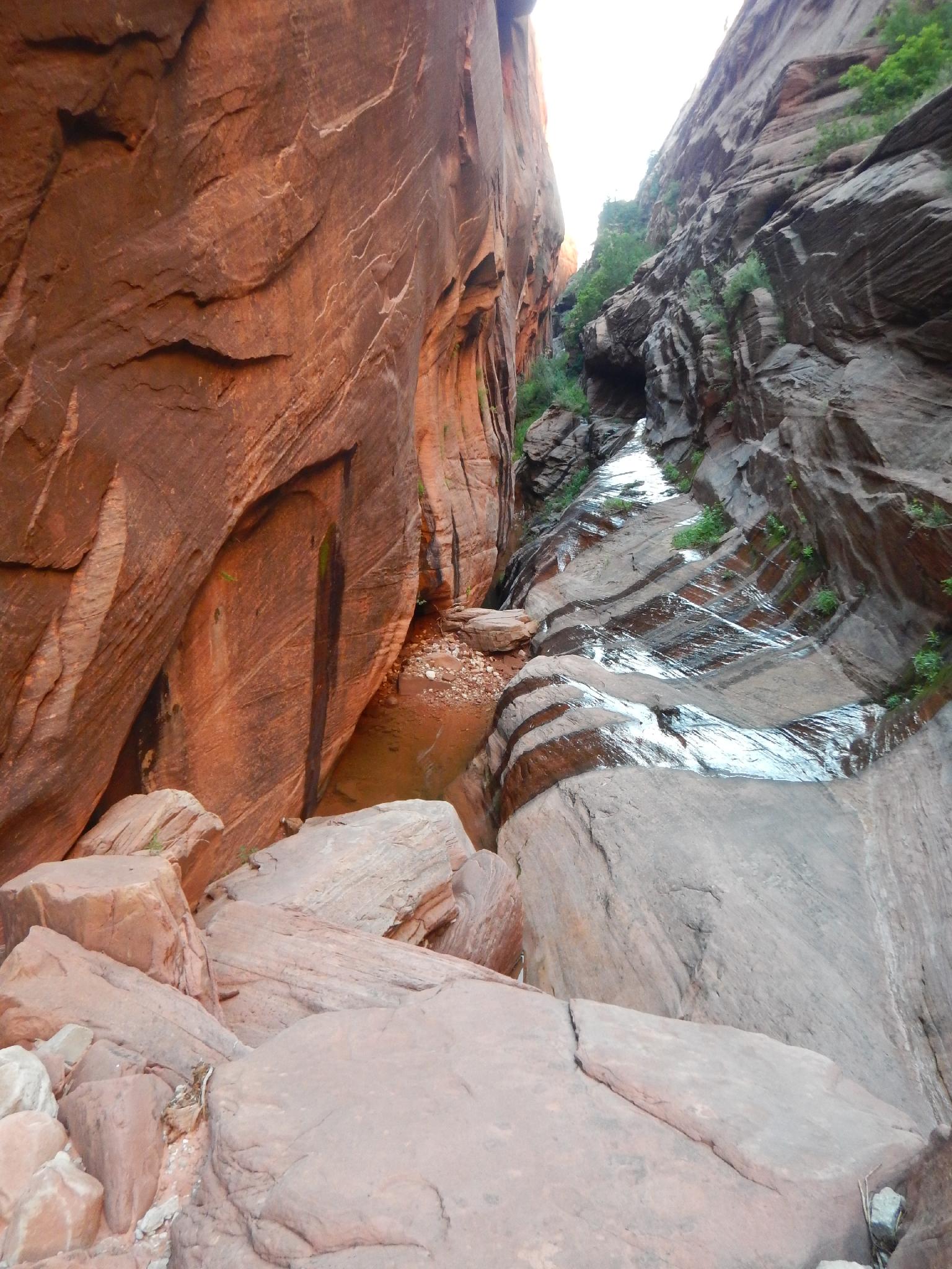
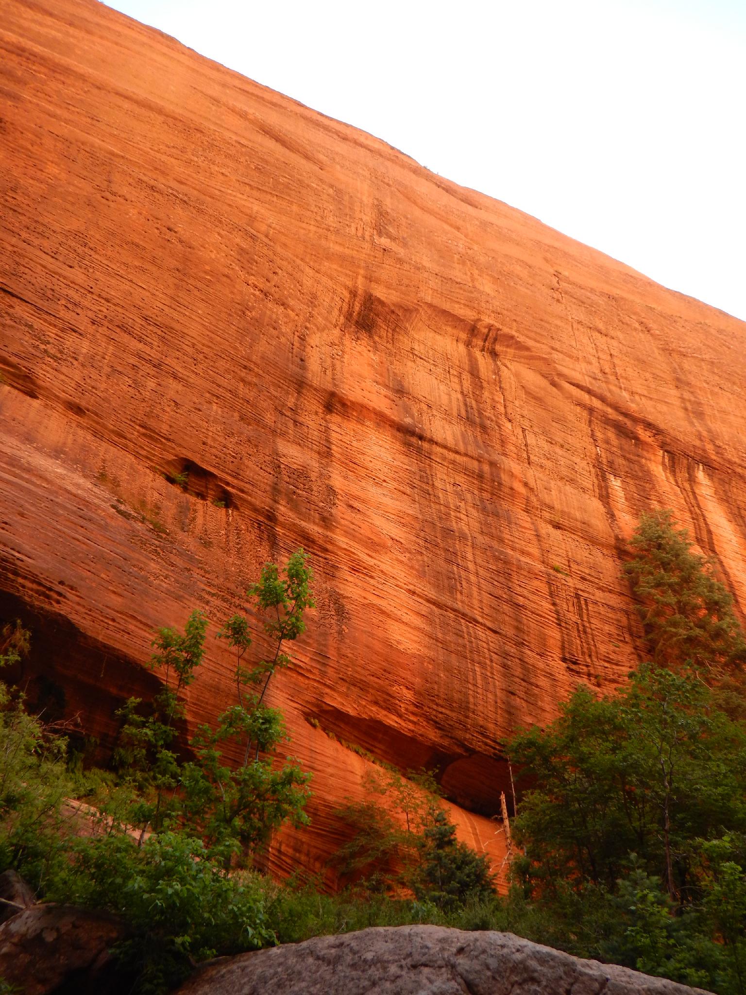
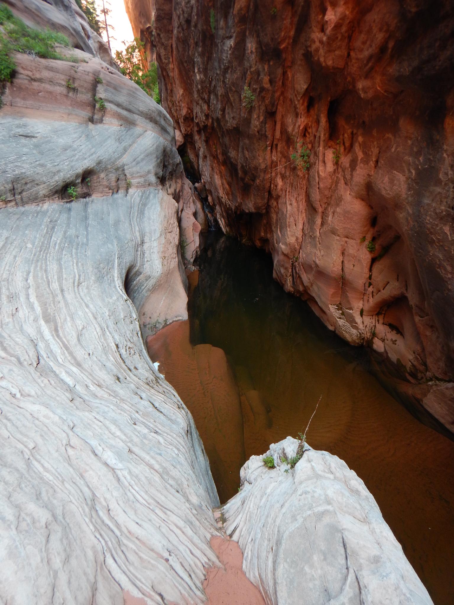
Phew, hard work is over...sorta... Head down canyon with much scrambling and a little bush-whacking. The glow of the canyons walls in this section during morning lighting is fantastic. About 20-30 minutes down canyon, the walls narrow a bit and the first drop into a pool is reached.
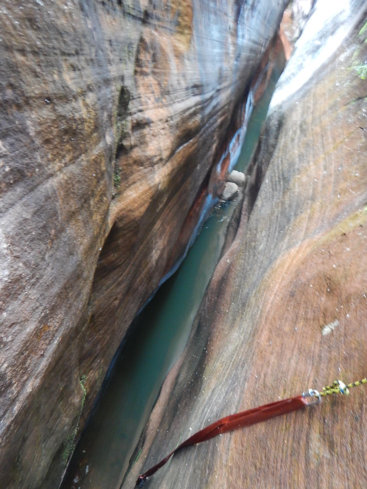
Rappel 1 (15 m ( 50 ft. )) is a traversing rappel to stay dry. Be VERY careful reaching the anchor if the walls are seeping, it can be slippery.
Below the first pool, it is a short hike to the second obstacle.
Rappel 2 (7 m ( 23 ft. )) is short, and can be down climbed by the highly skilled. Beware the anchor here, it was poor when I visited. Down climb or rappel into the pool, and continue down canyon.
The final obstacle is a series of two drop before the canyon opens greatly. There are a couple of options. Continue down the canyon bottom, likely making to rappels. (I did not choose this option, but both rappels are short.) Alternatively, follow the right hand bench a ways to a corner where a single old bolt provides an anchor for a short (10 m ( 33 ft. )) rappel down to the canyon floor below the final pool. This anchor looks dubious and should be inspected carefully before committing to it. Recommended only as a means to avoid getting wet if the group is cold.
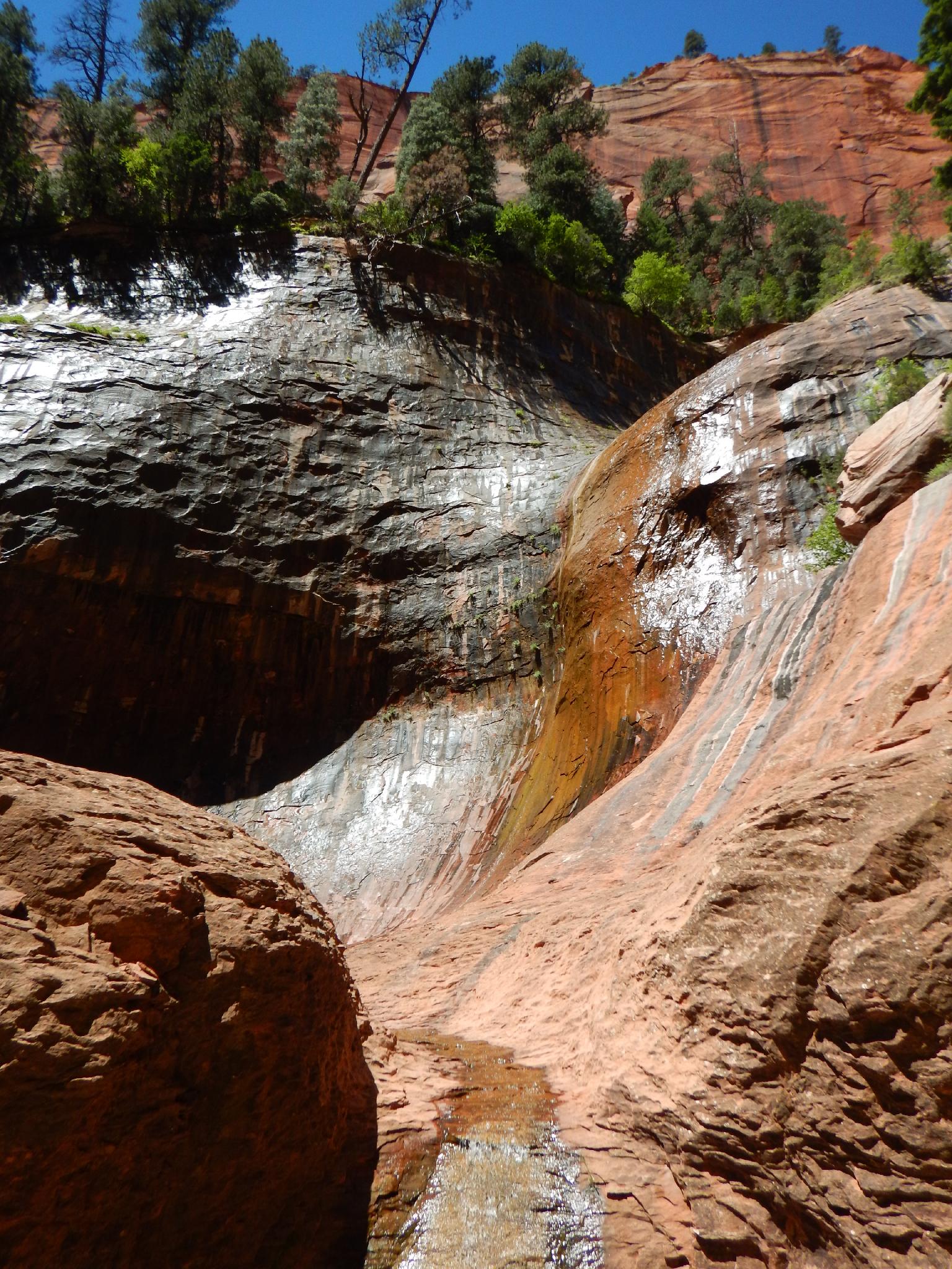
Take off the harnesses, and bag the ropes, the technical section is over. A couple of minutes below the final pool, the canyon begins dropping with huge boulders. A cairn marks an escape on the left here (looking down canyon), up a steep dirt slope. Take it, and follow a vague social trail that descends to the canyon floor below a stunning waterfall. Route finding is a little tricky here, but stay toward the left (looking down canyon) finding the easiest path.
Scramble down canyon about 1/2 a mile to where the Kolob Arch Trail and viewpoint are visible. You may get wet in this section, so if in wetsuits, keep them on to the viewpoint.
Exit (6 miles / 2.5 - 3 hours)
From the viewpoint, it is an easy to follow park trail. Follow it 0.5 miles to the junction with the La Verkin Creek trail, then turn right and follow the La Verkin trail about 6 miles and 800' of elevation gain back to the Lees Pass Trailhead.
Maps


12S 306136E 4147178N
37°27'04"N 113°11'30"W
12S 306140E 4145844N
37°26'21"N 113°11'29"W
12S 307601E 4146428N
37°26'41"N 113°10'30"W
12S 308406E 4146677N
37°26'50"N 113°09'57"W
12S 308893E 4146094N
37°26'31"N 113°09'37"W
12S 309476E 4144909N
37°25'53"N 113°09'12"W
12S 309552E 4143938N
37°25'22"N 113°09'08"W
12S 309649E 4143173N
37°24'57"N 113°09'04"W
12S 310069E 4143286N
37°25'01"N 113°08'47"W
12S 311859E 4144867N
37°25'54"N 113°07'35"W
12S 312686E 4145981N
37°26'30"N 113°07'03"W