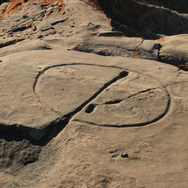
Took a trip to find another waterglyph, this one on Lost Spring Mesa south of Colorado City, AZ. The drive is about an 70 minutes from the road all dirt, 4x4 required with high clearance. Do not go after bad weather as there are a lot of low spots that will have deep mud in them.
Take Hwy 389 out of Colorado City East and turn right on Clayhole Rd (Rd 5). Stay on this road for basically entire trip. About 45-50 minutes later turn left at split. Follow road to the glyph on cliffs edge.
There is supposed to be another way out taking a left back at the split but we just returned the same way. Good luck. Found out later this is also called Suicide Point Waterglyph.
Turn From Highway: 36°56'48.19"N 112°57'21.38"W
Left Turn at Split: 36°58'3.24"N 113° 6'46.23"W
Waterglyph: 36°57'22.33"N 113°10'4.88"W