 Canyoneering
Gruver Slot
Canyoneering
Gruver Slot
San Rafael Desert
Overview
Gruver Slot had been on my hit list since Dave Pimental posted it in his mini slot guide. Unfortunately, it seemed every time I was in the area to do it, I was either running low on time, energy, or motivation. We finally visited in the winter of 2014, and I was surprised at what a short little gem this is.
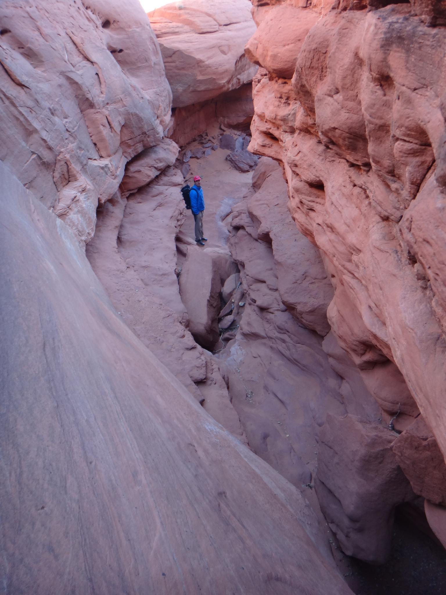
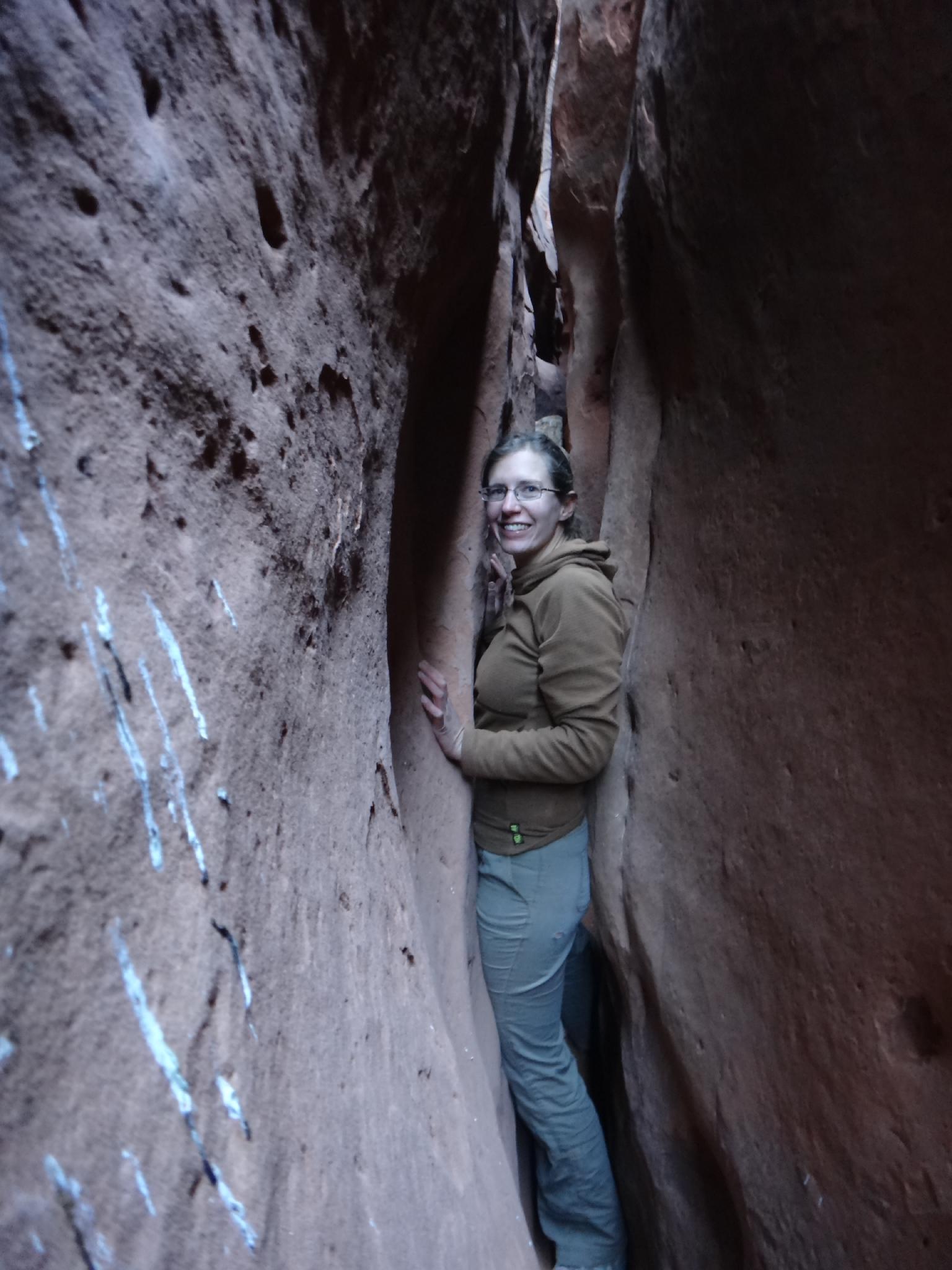
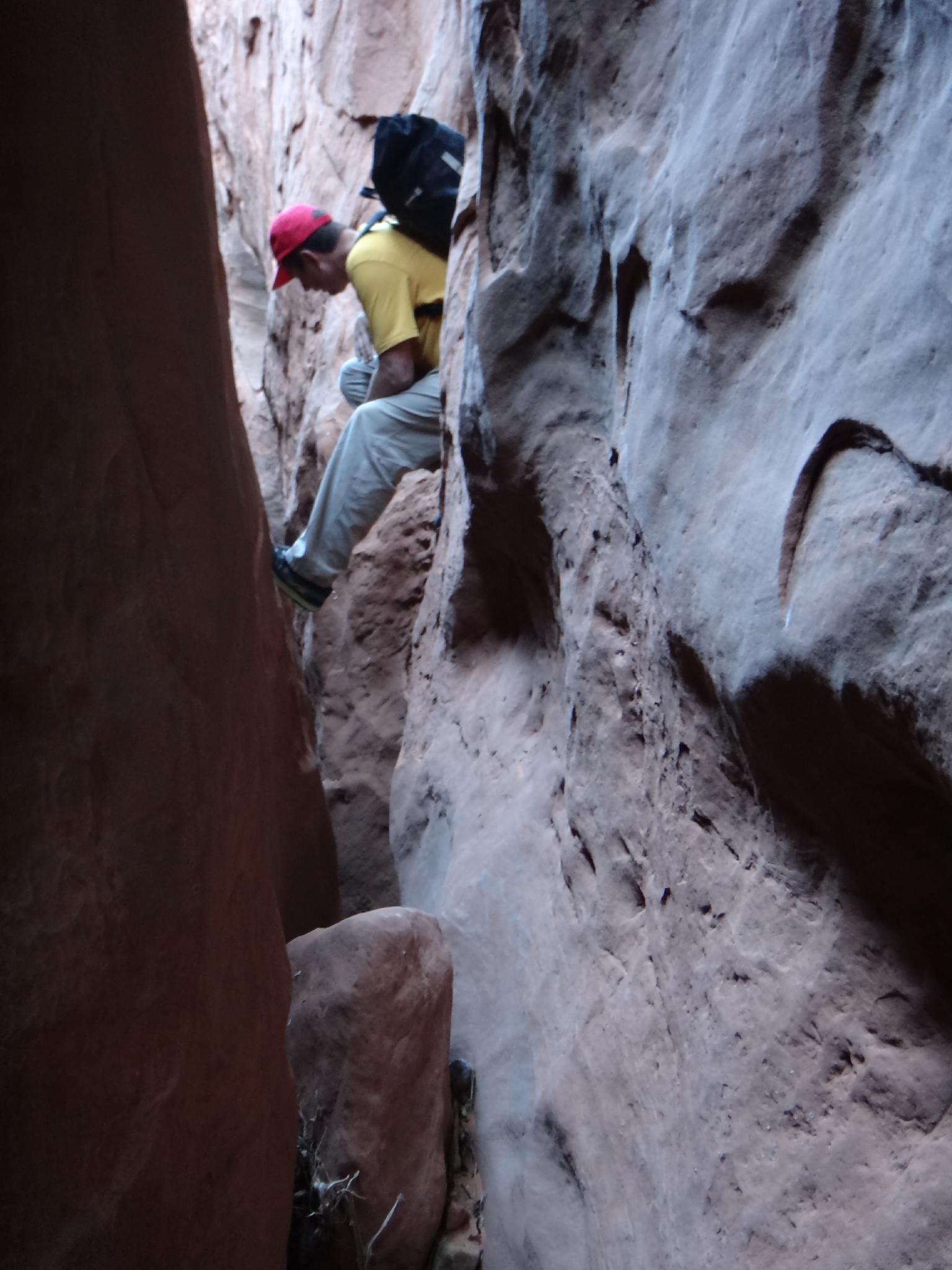
The canyon is very short, but VERY narrow and fun. Expect a fair amount of squeezing and tight down climbs. The rappels are both at the very end, and both short, but have difficult pulls. Be mindful of how you set up the rope to be able to make a clean pull.
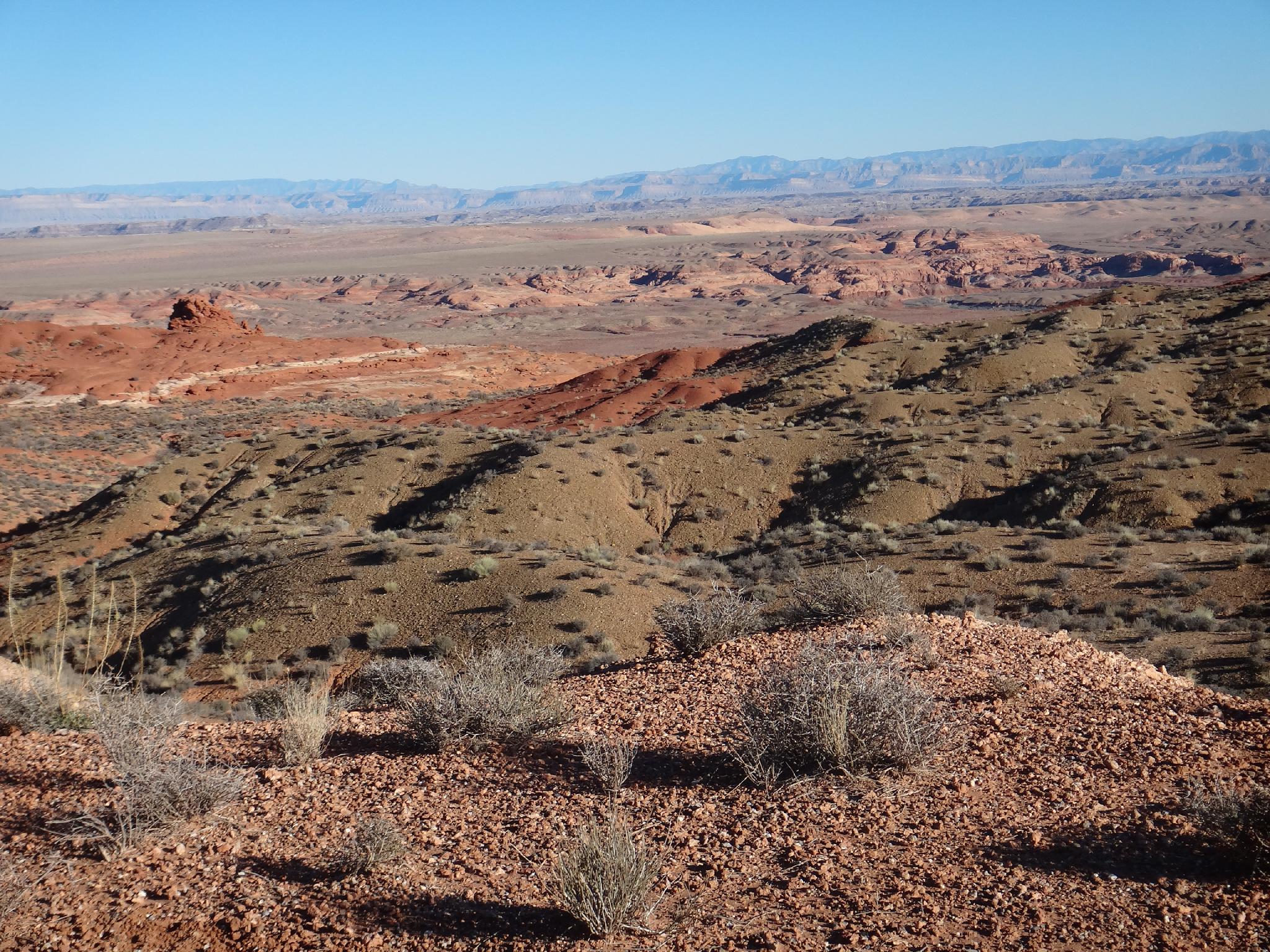
Off in its own corner of the San Rafael Desert, this would make a good addition to a Moonshine Canyon and/or Three Canyon trip. There is good camping at the trailhead, as long as it's not windy.
Getting There
From downtown Green River, follow the main road to the airport sign (Long Street). Go south on Long Street several blocks until its junction with Green River Avenue. Go left (east) on Green River Avenue a block to the junction with Airport Road. Follow Airport Road over the railroad tracks, and under the highway. Reset your odometer on the other side of the highway, as you cross the cattle guard.
Continue on Airport Road for 1.9 miles to a junction signed Horseshoe Canyon. Go left here, resetting your odometer. The road is now dirt, and usually passable by any vehicle when dry. There are many side roads, but continue to stay on the main road for 19.6 miles to where the road crosses the San Rafael river. Reset your odometer at the bridge.
Continue 10 miles past the bridge to a major junction (Saucer Basin). Go right here for 2.2 miles to a smaller side road leaving on the right. Follow the smaller side road 1.9 miles to another junction. At the final junction, go right and follow the road to its end on Gruver Mesa at about 4.5 miles. Park on the edge of the mesa at the most used parking area.
Route Description
Approach (10 minutes)
From the trailhead, head northwest. The small red dome in the foreground is just on the other side of Gruver Slot. Head down washes that coalesce and become Gruver Slot. A downclimb or two is encountered before the canyon drops and narrows quickly.
Canyon
Squeeze on down. It is narrow, then narrower, then a little wider, then narrower again. You get the picture. About 1/2 way through, an escape is available on the left. If you have doubts about fitting, you may want to take the exit. The final section is about the same as the upper section, though fairly short.
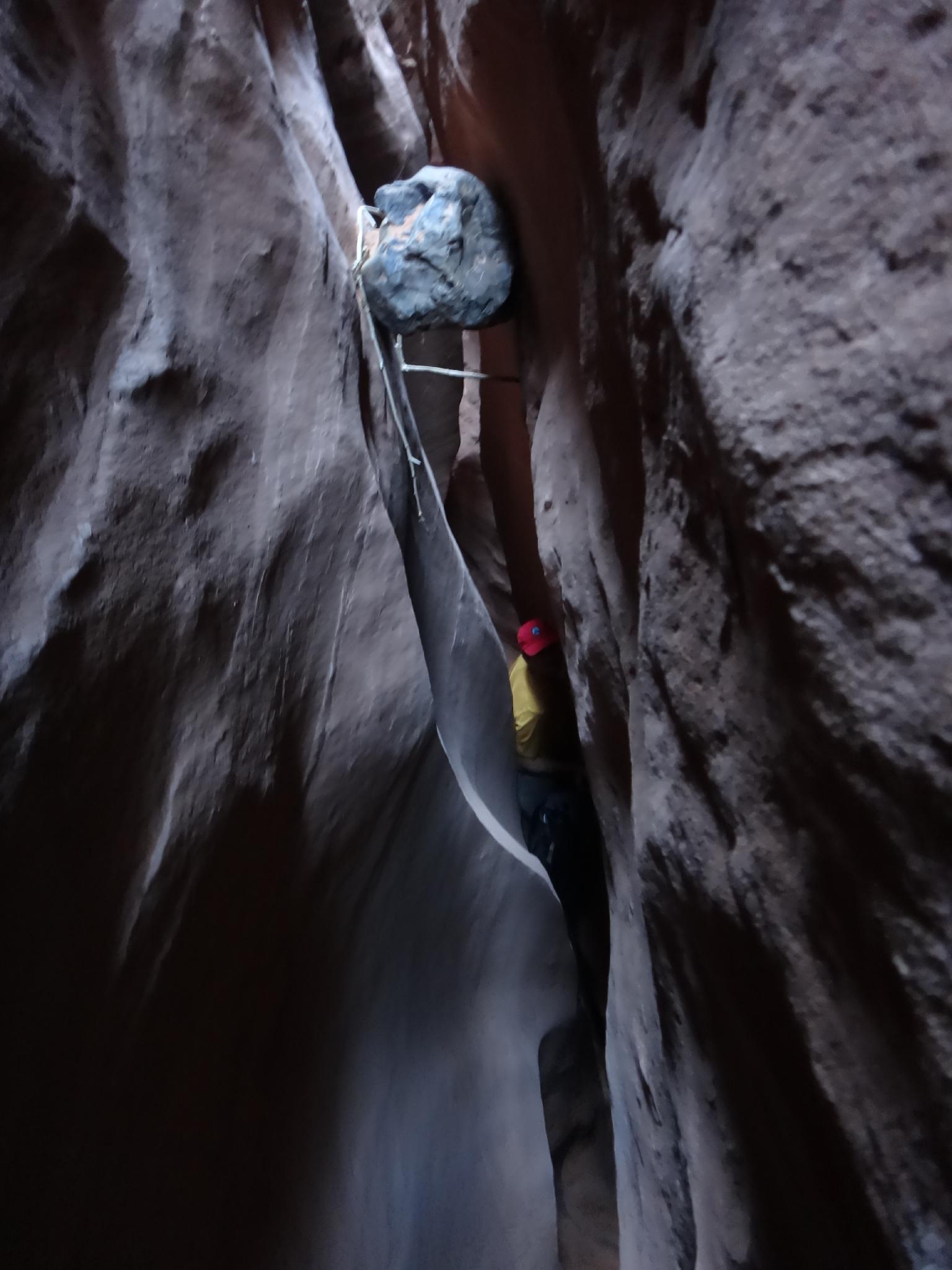
The final section ends with 2 rappels in quick succession. The first is about 7 m ( 23 ft. ), the second about 10 m ( 33 ft. ). They COULD be combined in one, but the rope would be very difficult to pull.
Exit (20-30 minutes)
Once down the rappels, the canyon is wide and open. Walk down it 1 minute or so until you can scramble out on the right side. Once up the first level, it is easy slickrock. Head up, roughly paralleling the canyon back to the approach wash which can be re-traced back to the trailhead.
Photos
Videos

Gruvers Slot
Maps

12S 570618E 4286596N
38°43'31"N 110°11'15"W
12S 570580E 4286472N
38°43'27"N 110°11'17"W
12S 570303E 4286036N
38°43'13"N 110°11'29"W
12S 570249E 4285645N
38°43'00"N 110°11'31"W