 Hiking
Stone Storehouse Trail
Hiking
Stone Storehouse Trail
Needles District
Overview
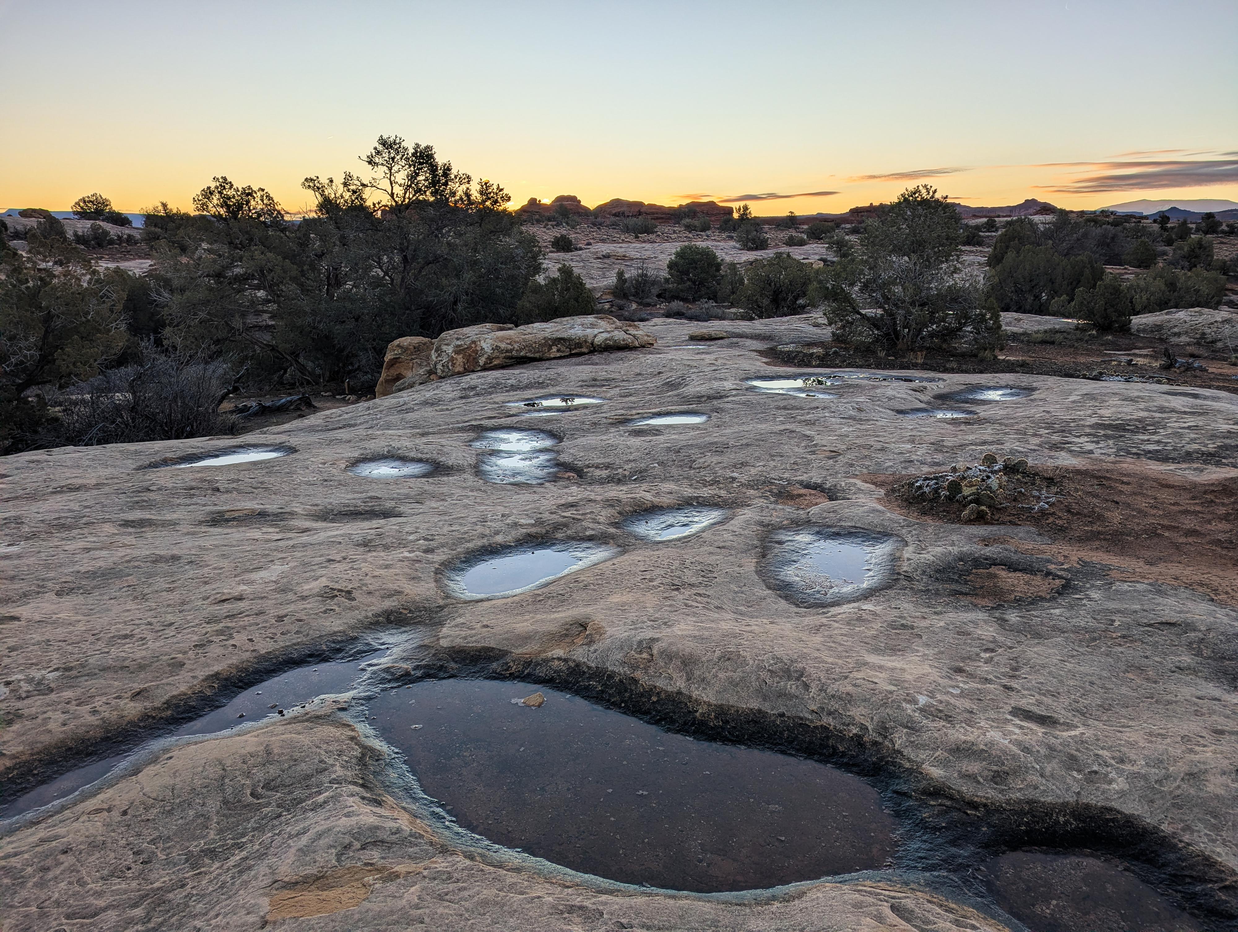
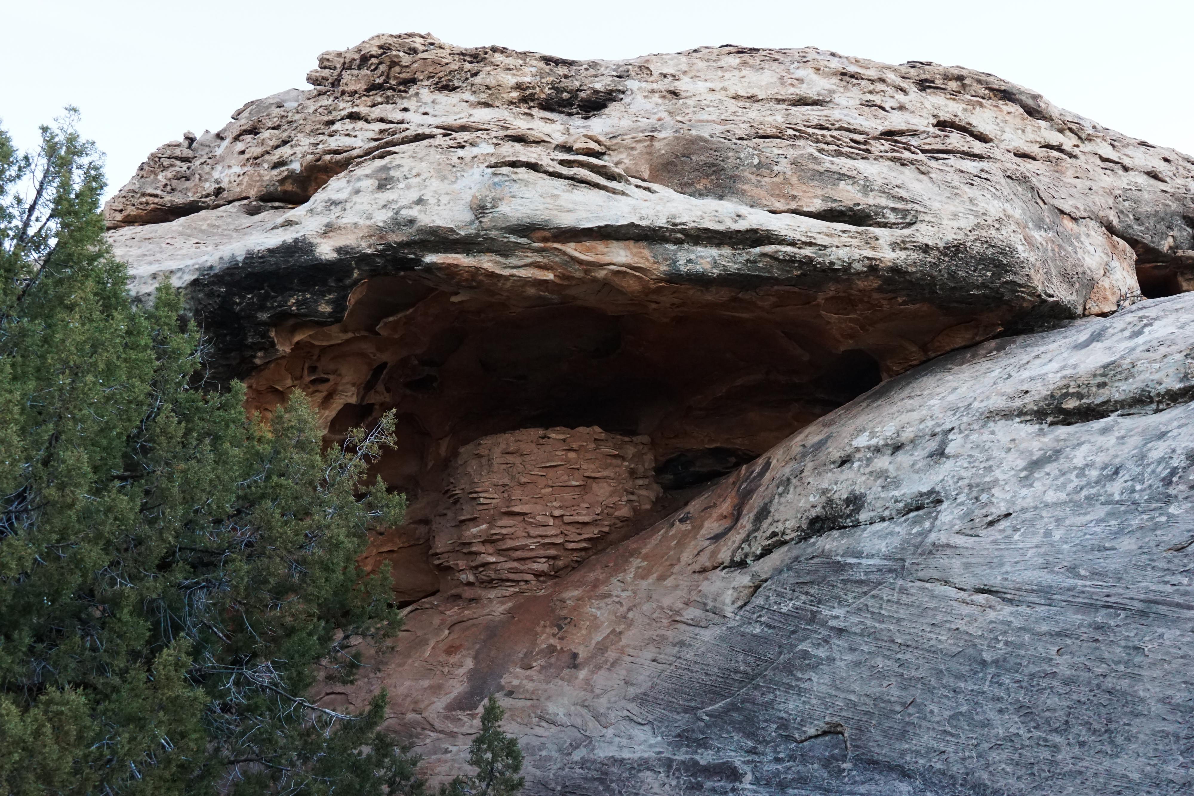
This is the first trail you come to after entering the park and passing the visitor center. It is a short but great introduction to the park. The 0.6-mile trail crosses open country before descending into a shallow wash and visiting an old granary. The trail then loops back to the trailhead. A lovely little hike.
From the NPS Informational Sign:
Indigenous people long survived here through hard work and ingenuity. Nearly 700 years ago, some built these small stone structures, possibly to use for storage or ceremonial purposes. In Canyonlands, even older structures still stand, but archeologists have found few villages. This suggests that early inhabitants farmed intensively, yet may have lived here only seasonally. Without human impact, these masonry structures can survive for centuries in the desert climate. Please help protect these places by not climbing up to or entering structures. Any contact can erode foundations and weaken walls.
Getting There
The two closest towns to the Needles District are Monticello and Moab. Monticello is closer, but Moab is larger and has more services.
From Moab to the Visitor Center - Total Drive Time: Approx. 1 hour 15 minutes and ~75 miles from Moab
- From Moab, head South on US-191 S (Main Street).
- Stay on US-191 S for 39.6 miles. Keep an eye out for the junction with UT-211.
- Turn Right onto UT-211 W. This is the scenic road that leads directly into the Canyonlands area.
- Follow UT-211 W for 34.4 miles.
- As you approach the park entrance, follow the signs and turn Right into the Needles Visitor Center parking area.
From Monticello to the Visitor Center - Total Drive Time: Approx. 1 hour and ~50 miles
- Head North on US-191 N (Main Street) toward Moab.
- Follow US-191 N for 14.4 miles.
- Turn Left onto UT-211 W. You’ll see signs for Canyonlands National Park.
- Stay on UT-211 W for 34.4 miles.
- As you approach the park entrance, follow the signs and turn Right into the Needles Visitor Center parking area.
From the Visitor Center
Continue into the park about 1/3 of a mile to the signed trailhead on the left side of the road.
Route Description
From the trailhead, the trail forks almost immediately. It doesn't matter which way you go, but I went counterclockwise. Go right at the junction.
The trail crosses open country, then descends into a wash and comes to a junction. Go right here a very short distance to see the granary tucked under an overhang.
On your return, go back to the junction and follow the return trail that loops back to the trailhead.
Maps

12S 608405E 4224641N
38°09'47"N 109°45'45"W
12S 608596E 4224700N
38°09'49"N 109°45'37"W