 Climbing
The Cheesebox
Climbing
The Cheesebox
Cedar Mesa
Overview
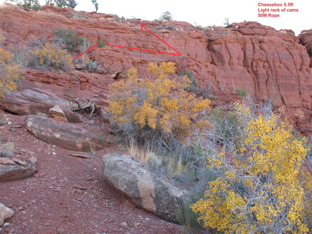
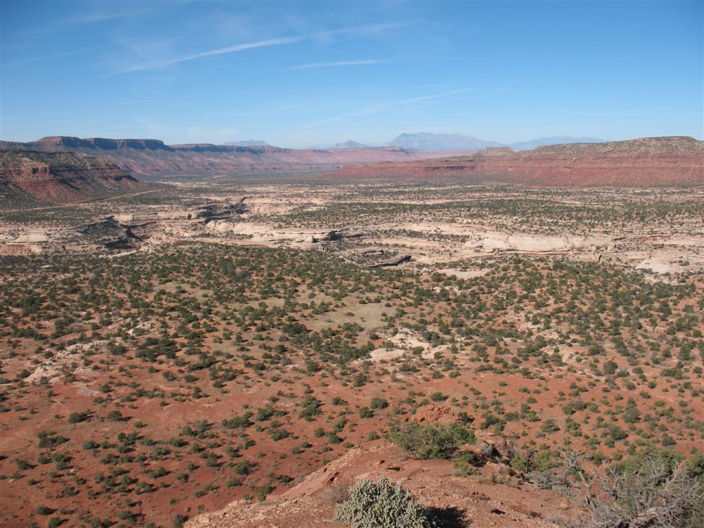
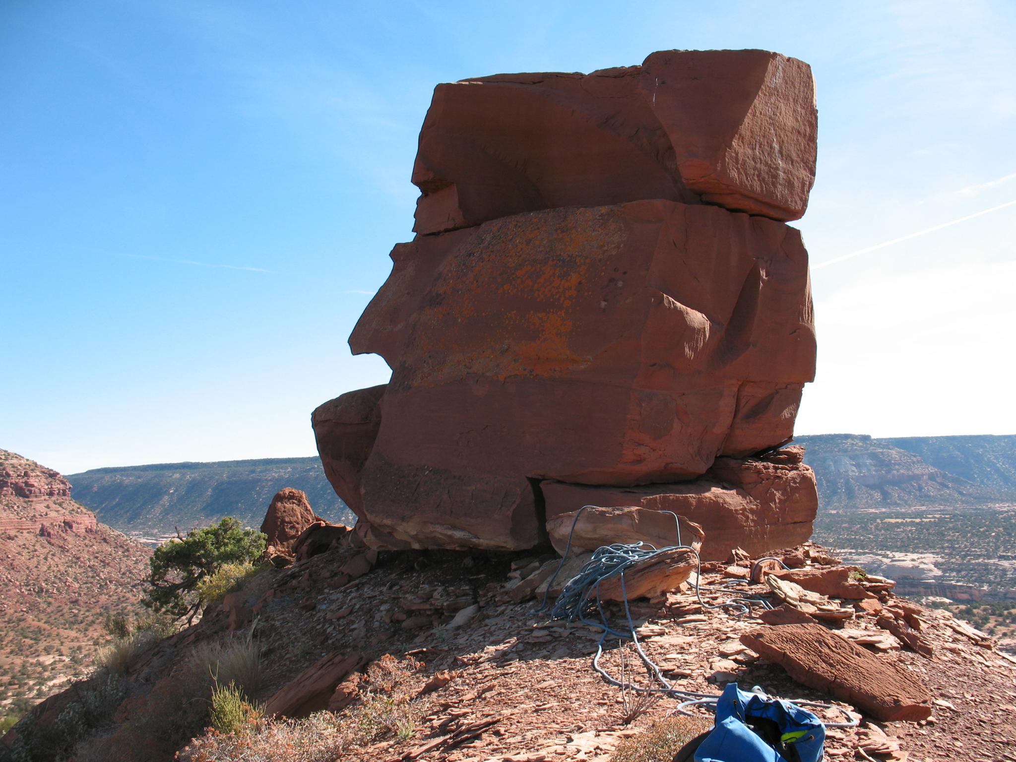
The Cheesebox is a proud tower visible for a long stretch of Highway 95, near Fry canyon. The tower, with it's Navajo sandstone summit block is very unique. The summit block is about 5 m ( 17 ft. ) high, split in two, with the top being about as large as a big kitchen table. Although the climbing to reach the summit is loose, and not recommended for it's own sake, the views of Cheesebox Canyon, White Canyon, and the surrounding area are the best around.
Getting There
The trailhead is 74.8 miles south of Hanksville on highway 95. At mile marker 74.8, there is a side road going off on the north side of the highway, almost directly across from The Cheesebox. Take this side road 0.4 to it's end overlooking White Canyon and Cheesebox canyon. There are several very good camp sites on this short road.
Route Description
From the trailhead, locate a cairned trail going down into White Canyon. The trail initially heads slightly right before traversing far left and working its way down the sandstone layers to the bottom of White Canyon. If on the trail, nothing should be more than 4th class.
Once in the bottom of White Canyon, hike up to the confluence with Cheesebox canyon. At the mouth of Cheesebox, on the right, there is a crack with a log at the base that is used to climb out. Climb this (5.1 - 4 m ( 14 ft. )), then traverse right and work your way up and out of White Canyon. Pay attention to the route you take, as you will need to find it on the return. Once out of White Canyon, head directly for the north west side of The Cheesebox. Please stay in washes and on slickrock as much as possible to protect the cryptobiotic soil.
At the base of The Cheesebox, find the easiest looking path up the cliff band. This is on the north/west corner and starts from a bush with an exposed, but easy (5.3) traverse to a corner with a ramp. The rock quality is very poor here, be careful. As you start up the ramp, there are some opportunities for a few cam placements, but the rock is dubious. (5.5R) Once up the first cliff band, it is a hike up loose rocks and dirt to the summit block that can be easily scrambled up and down.
To return, reverse carefully down to the cliff band, and rappel off any of the suitable trees down about 20 m ( 66 ft. ) to the base. Retrace your steps back to the trailhead.
Maps

12S 578371E 4167223N
37°38'56"N 110°06'42"W
12S 578765E 4167557N
37°39'06"N 110°06'26"W