Tusher Tunnel |

Moab

Roadside Attraction Tusher Tunnel - Moab Roadside Attraction Tusher Tunnel

Moab

Overview

RATING: Easy Walking
MAPS: Jug Rock, UT

Fri

Mostly sunny, with a high near 78. West northwest wind 5 to 10 mph.

78 | 50

Sat

Sunny, with a high near 76.

76 | 50

Sun

Sunny, with a high near 80.

80 | 49

Mon

Mostly sunny, with a high near 83.

83 | 52

Tue

Sunny, with a high near 82.

82 | 51

View Full Weather Details
SEASON: Any
GEAR: Standard Hiking Gear
WATER: None

Fri

Mostly sunny, with a high near 78. West northwest wind 5 to 10 mph.

78 | 50

Sat

Sunny, with a high near 76.

76 | 50

Sun

Sunny, with a high near 80.

80 | 49

Mon

Mostly sunny, with a high near 83.

83 | 52

Tue

Sunny, with a high near 82.

82 | 51

View Full Weather Details
Scenary around Tusher Tunnel

Scenary around Tusher Tunnel

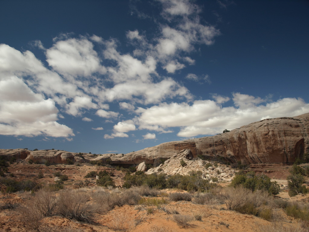
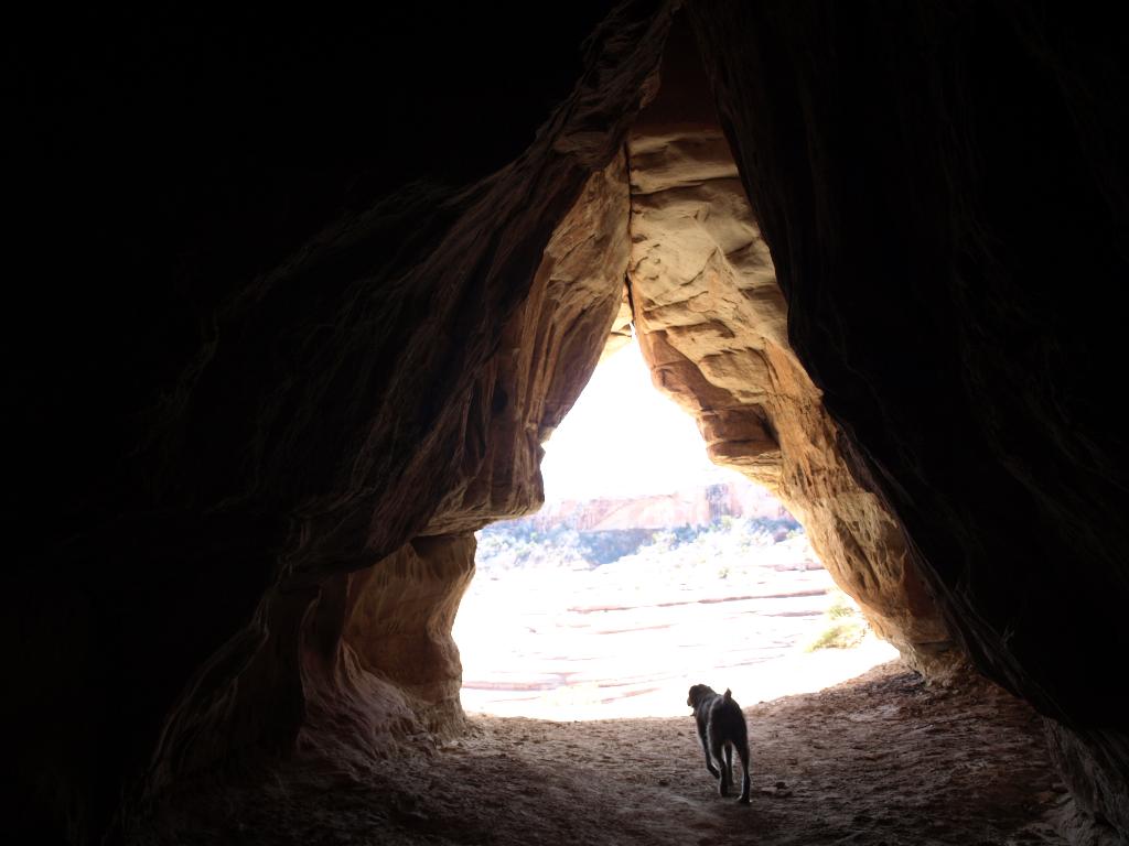
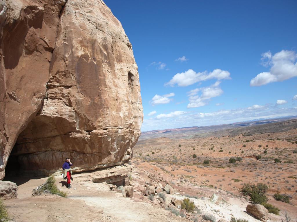
Tusher Tunnel is an interesting geological feature. A crack in the rock has allowed water to seep in until reaching a harder layer in the rock. Where it met the harder rock, it eroded a tunnel from one side of the cliff to the other. The tunnel length is likely 25 m ( 83 ft. ) or more in length, and high enough throughout to easily walk through.

Tusher Tunnel is a great roadside attraction for all, as the hike from the trailhead (with a high clearance vehicle) is less than 5 minutes.

Looking out the tunnel

Looking out the tunnel

Getting There

From the highway 191, north of Moab, turn off on the Blue Hills Road just south of the Moab Airport, at milepost 142.8 on the west side of the highway.

  • Reset your odometer as you turn onto the Blue Hills Road ( 12S 609646mE 4289625mN / N38° 44' 55" W109° 44' 18" )
  • After 2.3 miles, turn left at a major junction. ( 12S 606049mE 4289130mN / N38° 44' 40" W109° 46' 47" )
  • At 3.1 miles, go left. ( 12S 605610mE 4287990mN / N38° 44' 03" W109° 47' 06" )
  • 3.8 miles, go right. ( 12S 606481mE 4287270mN / N38° 43' 40" W109° 46' 30" )
  • 4.0 - Junction, go left. From here the road deteriorates a bit, drive as far as comfortable. ( 12S 606295mE 4287069mN / N38° 43' 33" W109° 46' 38" )
  • 4.8 - Road coming in on the right. Stay left. ( 12S 606020mE 4285943mN / N38° 42' 57" W109° 46' 50" )
  • 4.9 - Junction, go left, with the road dropping steeply to another junction. ( 12S 605964mE 4285776mN / N38° 42' 51" W109° 46' 52" )
  • 4.95 - Junction at the bottom of the hill, go right. The road here becomes very sandy. ( 12S 605998mE 4285710mN / N38° 42' 49" W109° 46' 51" )
  • 5.1 - Trailhead on the right. ( 12S 605820mE 4285411mN / N38° 42' 40" W109° 46' 58" )
Tunnel view - Tusher Tunnel

Tunnel view - Tusher Tunnel

Route

From the trailhead, follow the obvious short trail to the tunnel. On the other side of the tunnel is a photogenic and interesting area to hike around and explore. This is particularly fun for families and kids.


Photos

Maps

Printable Maps:
TusherTunnel

12S 605751mE 4285366mN

N38° 42' 38" W109° 47' 01"

TusherTunnelTrailhead

12S 605819mE 4285410mN

N38° 42' 40" W109° 46' 58"

Comments

Want to make a comment? Login and let yourself be heard.