 Canyoneering
Shillelagh Canyon
Canyoneering
Shillelagh Canyon
North Wash
Overview
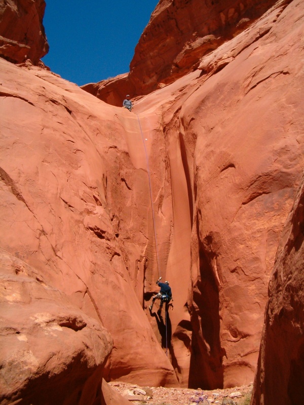
Shillelagh is a different animal than most North Wash canyons. The canyon boasts bigger rappels and a much more open feel than most other North Wash area canyons. If big raps are your bag, this is the place for you. Most of the rappels are straightforward, and Shillelagh doesn't hold much water even after recent rains. Easy and mostly dry make Shillelagh a good winter canyon or beginner friendly outing. Given the big rappels, all members of the group should be comfortable rappeling. This is not a good place to TEACH rappelling.
Getting There
From Hanksville, head south on Highway 95 towards Hite. About milepost 27.7, just after a culvert, is a spur road on the left going a short distance and ending next to a sandstone wall. This is the trail head.
Route Description
The trailhead is the same trailhead as Blarney. To get to Shillelagh, hike across Blarney and route find your way up the slickrock rib on the west (left) side. If you are careful with your route finding, nothing is above class 3. Staying on the top or right side of the rib seems to be the easiest path. Continue up until you are above slickrock on a flat dirt area. Once on top, there is an emerging trail you can follow to the head of Shillelagh. En route, you will have great views of Blarney (on your right) and Shillelagh (on your left). As you near the head of the canyons, the trail splits. Left goes to Shillelagh, right goes a short distance to the head of Blarney.
Right Fork
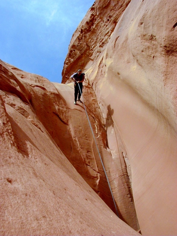
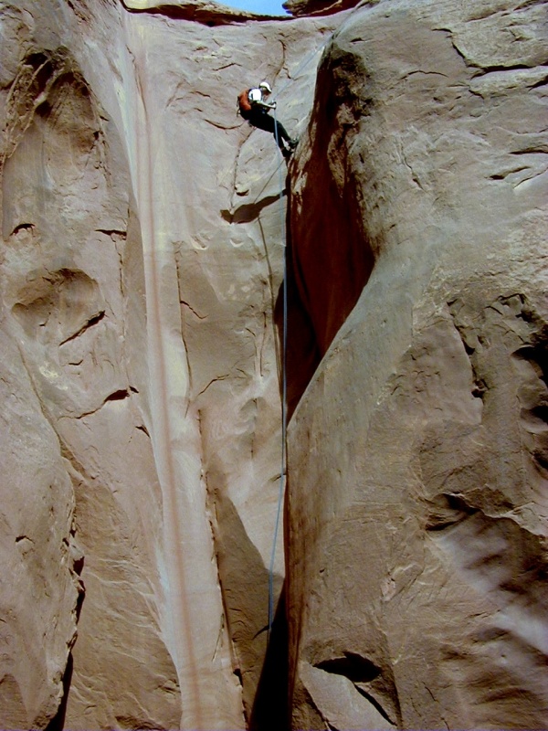
The right fork is the first fork you will reach on the approach. Follow the shallow drainage down to the first drop, a 15 m ( 50 ft. ) rappel. Shortly below this first rappel is the second and final rappel. The rappel height is almost exactly 30 m ( 99 ft. ) if you rappel off a slung boulder on the left. This is the most scenic section of the left fork. From here down, there are a few small downclimbs, but no real obstacles. Once you reach the junction with the left fork, simply continue down canyon until you reach the highway and follow it back to your car.
Left Fork
To reach the left fork, continue past the right fork on the approach, following the map closely. The left fork starts as a shallow dirt wash and quickly comes to the first drop, about 8 m ( 27 ft. ) off a boulder back from the edge. This is followed shortly by a second rappel of 20 m ( 66 ft. ) down a beautiful chute. Just below this rappel is another 10 m ( 33 ft. ) chute that some may downclimb, and some may wish to rappel. That marks the last of the technical difficulties. Continue down the canyon, with a few short downclimbs, before reaching the junction with the right fork. From here, it is a short walk down to the highway and back to your vehicle.
Photos
Videos
Leprechaun, Blarney, Shillelagh, and Hogwarts canyons

Shillelagh Canyon
Maps

12S 539970E 4208222N
38°01'15"N 110°32'41"W
12S 540078E 4209445N
38°01'55"N 110°32'36"W
12S 539665E 4209701N
38°02'03"N 110°32'53"W