 Hiking
Whiskey Island Lake
Hiking
Whiskey Island Lake
Western Uintas
Overview
The Mirror Lake Highway offers easy access to spectacular high mountain scenery as it crosses over the Uinta Mountains. While the landscape is dramatic, the crowds can be a bit overwhelming. On a busy summer weekend, the trailheads and lakes quickly become congested and busy.
Whiskey Island Lake is a rare gem. Though close to the Mirror Lake Highway and nestled against a high mountain ridge in a picturesque setting, the lake is difficult enough to reach that deter crowds. Even on a busy weekend, you are unlikely to see more than a group or two. We saw more elk than people on our 4th of July weekend visit.
So, what is the difficulty in reaching the lake? There is no trail to the lake, so excellent navigation skills are required. And navigation is only part of the problem. The approach road is also a big challenge. The road is a typical high mountain Uinta Mountains jeep road, with big cobbles, ledges, and boulders to maneuver around. You will need a real high clearance 4x4 to reach the trailhead. A stock Grand Cherokee made it, but several spots on the road gave us pause.
Getting There
From Kamas, UT, travel east on the MIrror Lake Highway (UT-150).
37.1 miles from Kamas, at mile marker 37.1, a rough dirt road goes off on the west (left) side of the road. This is the 4x4 road that some may need to walk.
0.6 miles from the Mirror Lake highway, a side road goes off on the left. Take it. The next section of road is about as rough as the first section.
0.5 miles from the last junction, the road crosses a small stream and a juntion in the road is reached. This is the recommended trailhead and labeled Trailhead on the map.
Route Description
If you were able to drive to the trailhead junction, the lake is only about a mile or so away. There are many routes, as you are generally heading cross country in a westerly direction. The map and description below follow a small loop which offers excellent views on the return. You can also return the same way without making the loop.
The Road Section (0.5 miles)
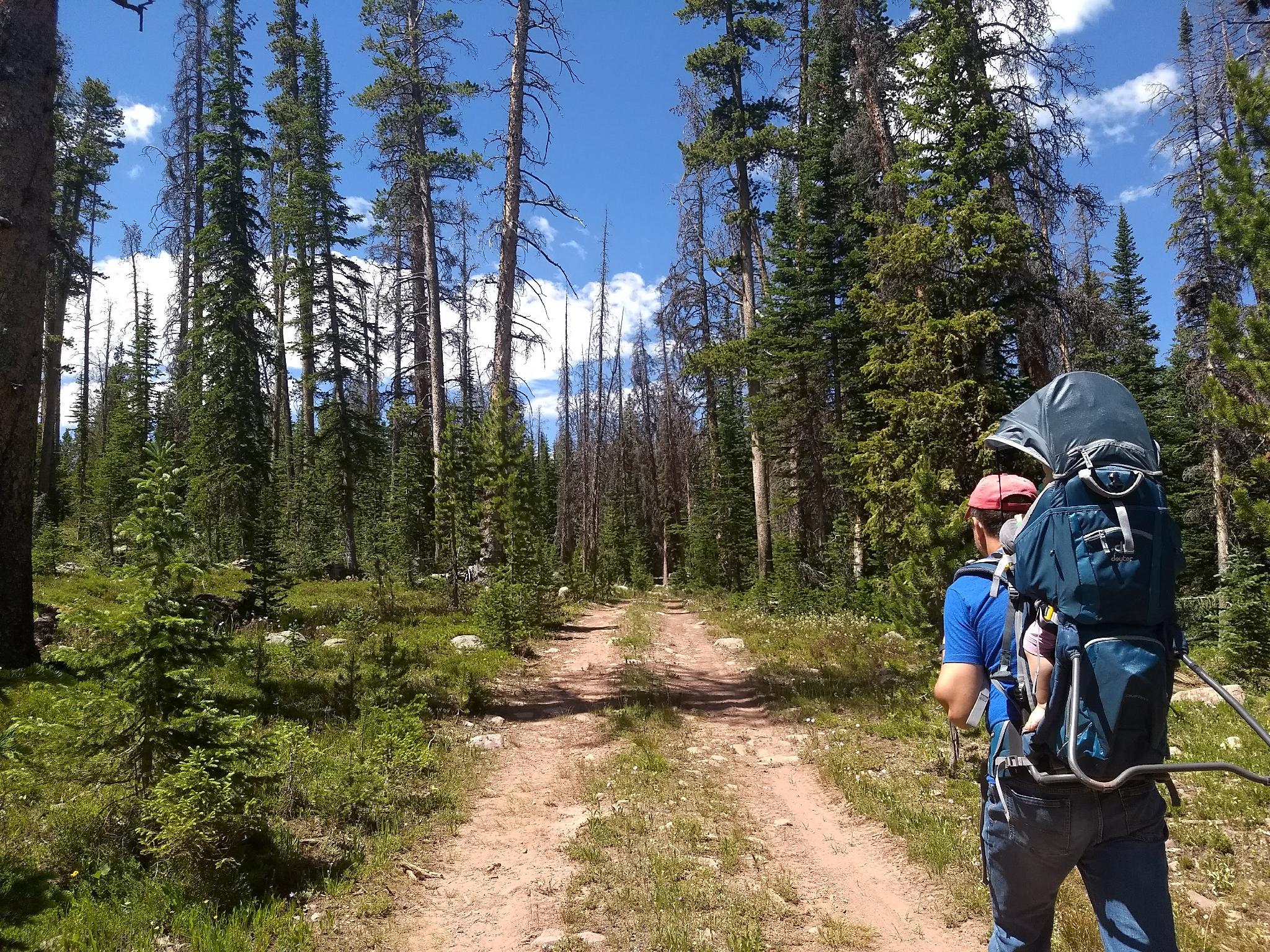
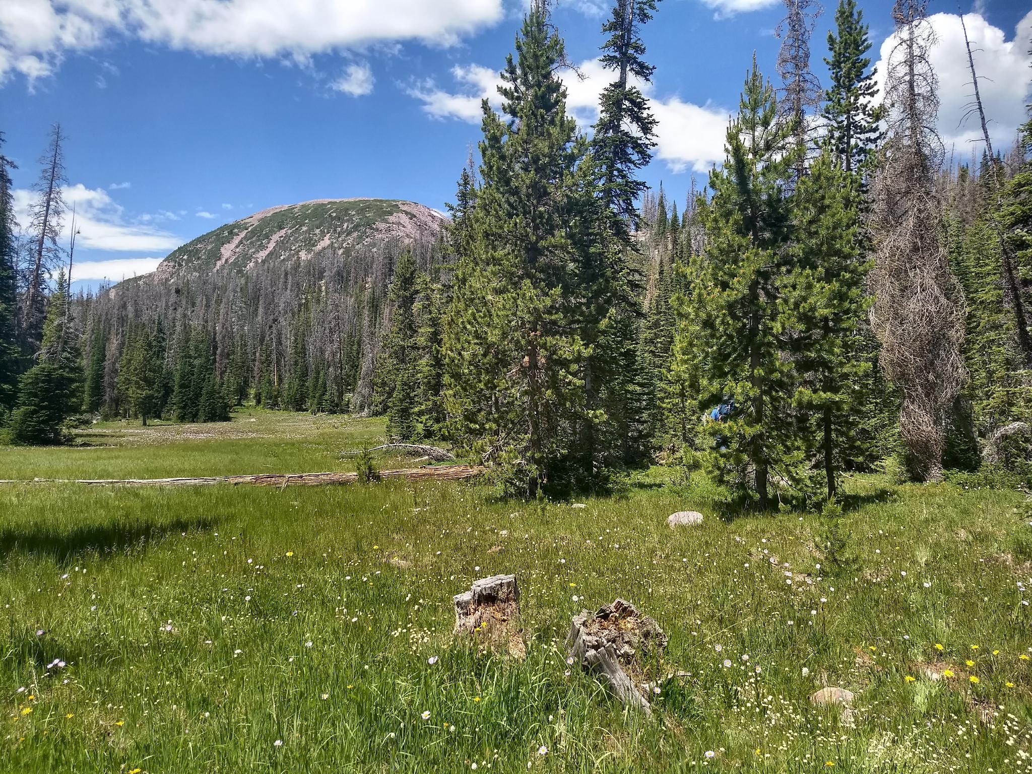
Just after the stream crossing, the road forks. Go right on FR7111. The road heads west and a bit south. Follow it for about 0.5 miles. At this point, it starts a little descent with a meadow to the right (west). Leave the road here and hike west.
From the Road To The Lake (0.65 miles)
There is no trail here. Head cross country. The first section is steep as it climbs the ridge. Zig-zag around deadfall on whatever seems the most natural path. Several game trails make this relatively easy.
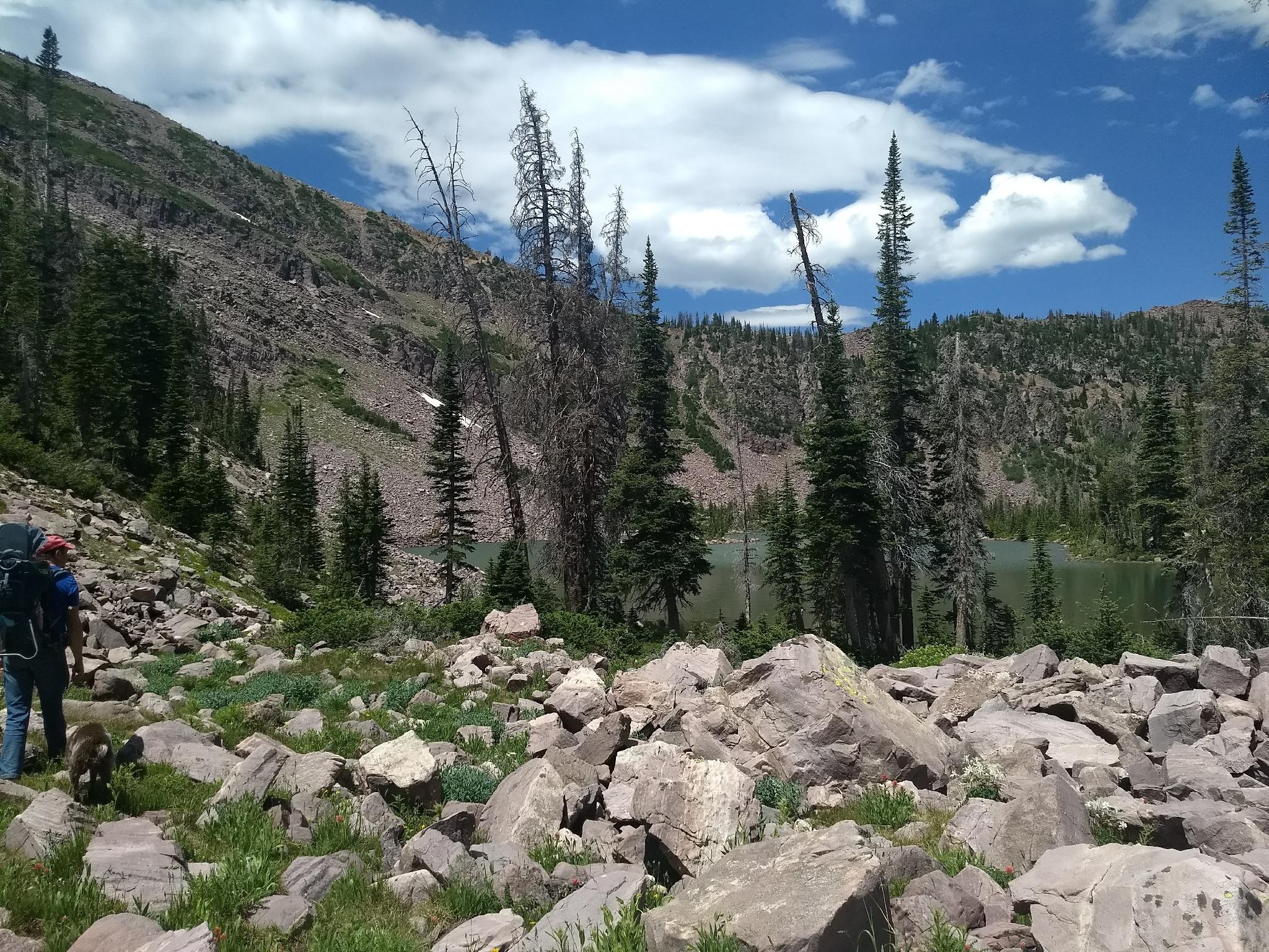
Once on flatter terrain, continue west. You can see the rocky ridge in the distance. The lake is at the base of the ridge. Work to near the base of the ridge, then due west to the lake.
Loop Return (1.5 miles)
On the return, follow the base of the ridge as on the approach, then head a bit more due south. Once on the edge of the steep hill, a careful eye will reveal an old logging road to the south-east. Head for the logging road, then go left (east) as it loops back to the trailhead. This section of road has excellent views of Kleeting Peak to the east. Stay left at the junction and then the trailhead will be a couple of minutes ahead.
Maps

12T 509930E 4512272N
40°45'41"N 110°52'56"W
12T 509517E 4513030N
40°46'05"N 110°53'14"W
12T 509325E 4512376N
40°45'44"N 110°53'22"W
12T 507940E 4512250N
40°45'40"N 110°54'21"W
12T 508464E 4511695N
40°45'22"N 110°53'59"W
12T 509334E 4512185N
40°45'38"N 110°53'22"W