 Hiking
Dude Benchmark and Ridge
Hiking
Dude Benchmark and Ridge
Salt Lake City
Overview
Dude Benchmark (BM) is a USGS benchmark above City Creek Canyon that is becoming a popular hike. The ridgeline melts out early in the spring when other hikes are still under snow and stays snow free late into the fall, making it a good early/late season hike. It can be hiked much of the winter as long as there isn’t too much snow.
Being one to enjoy long ridge hikes, the route I recommend below is longer than most, but sees a lot of terrain! It is a lovely amble along a seemingly endless ridge. It will test your fitness, clocking in at about 10-11 miles and 3000’ of undulating vertical gain, but feels rewarding to spend so much time on the ridge.
Getting There
The hike starts in North Canyon, Bountiful and ends at Ensign Peak. A car shuttle is required, or a lift services works well.
North Canyon Trailhead
To reach North Canyon take I-15 north to exit 312 / US-89 and soon merge onto Beck Street. After about a mile, go right onto Eagle Ridge Dr.
At the traffic circle that quickly comes up on Eagle Ridge Dr, take the third exit onto Orchard Drive. Follow Orchard Drive for 1.7 miles.
Turn right onto 3100 South. Follow 3100 South for 1 mile, then turn right on Indian Springs Rd. After 0.7 miles, turn right on 3700 S/Canyon Creek Dr. After about a mile, you will reach the forest boundary and the road turns to dirt. You can start here, or drive the road about a mile to its end.
Ensign Peak Trailhead
The Ensign Peak trailhead is in the neighborhood above the State Capitol. From downtown Salt Lake City, go north on State Street. When State Street ends at the State Capitol, go right on Capitol Blvd and follow it as it goes past the capitol. When it curves right, go left on Edgecombe Drive. Follow Edgecombe Drive, which becomes Ensign Vista Dr in a block. The Ensign Peak trailhead is on the left, well signed across from the park.
Route Description
To The Ridge (2.4 - 3.4 miles depending on where you park)
From the North Canyon Trailhead, either walk or drive the road about a mile to its end. The dirt road is quite good but has a rough spot or two near the end that may require high clearance.
At the end of the road is a small parking area, and the road turns to a single-track trail. The trail is open to hikers, bicycles and motorcycles. It is more gradual and climbs with long switchbacks to keep the grade minimal. Easy and enjoyable hiking.
The track climbs for about 2.4 miles to the ridge. Just before the ridge is a junction. Right climbs steeply and directly to the ridge. If visiting Rudys Flat, stay left. If just doing the ridge, go up the steeper, right trail directly to the ridge.
Side Trip: Rudy’s Flat
Once at the ridge, Rudy’s Flat is a short distance (less than 1/4 of a mile) to the east along the trail. The flat meadow area is a popular backpacking spot, though there isn’t usually water available particularly close.
The Ridge to Dude BM (about 1.75 miles)
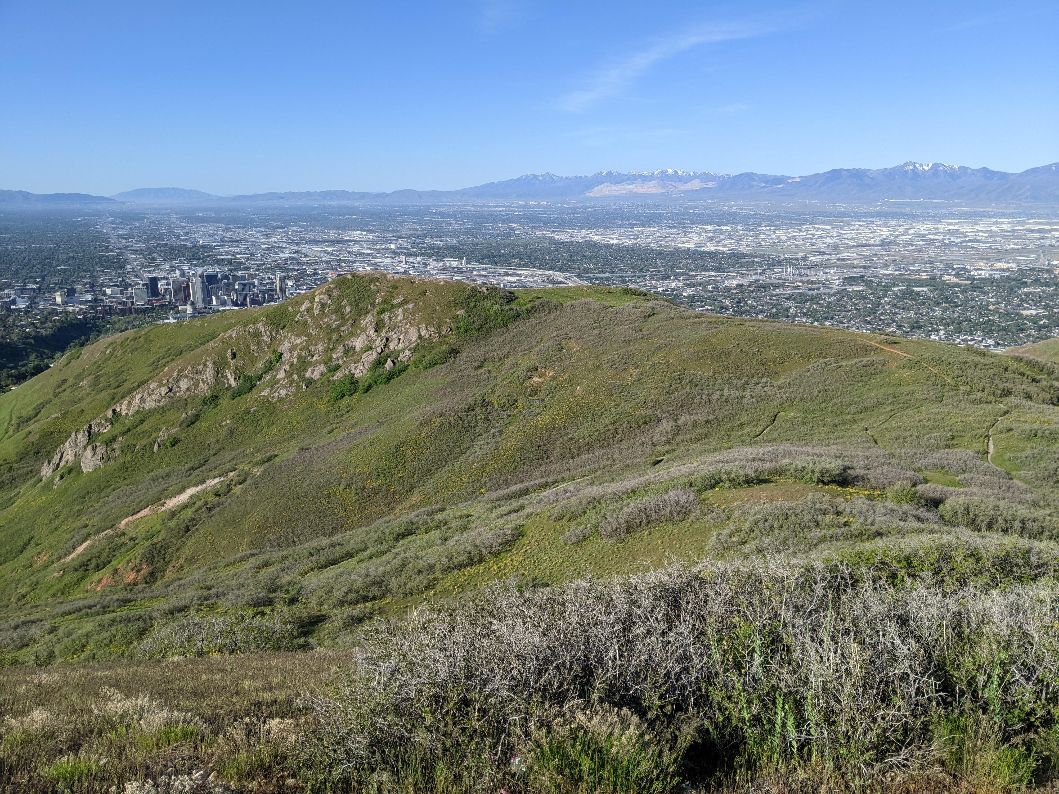
Once on the ridge, follow the social trail west along the ridge. The trail is a mix of social and animal trails. On my visit, it was sparsely marked, but easy to follow. The canyon to the south is City Creek Canyon.
As the trail follows the ridge, there are seemingly endless climbs up and down small peaks along the way. The trail partially bypasses many of these ups and downs by traversing below the summits. In spots, the trail can be a little hard to find. If you lose it, take the time to re-find it. As long as you are on the social trail, there is little to no bushwhacking.
The peaks get more and more pronounced as you near Dude BM. You leave the main trail and hike a minute to the top of Dude BM. To the south, the ridgeline might look a bit dauntingly long, but the hiking from here is quicker and easier than the previous section of ridge.
To The Radio Tower (about 3.7 miles)
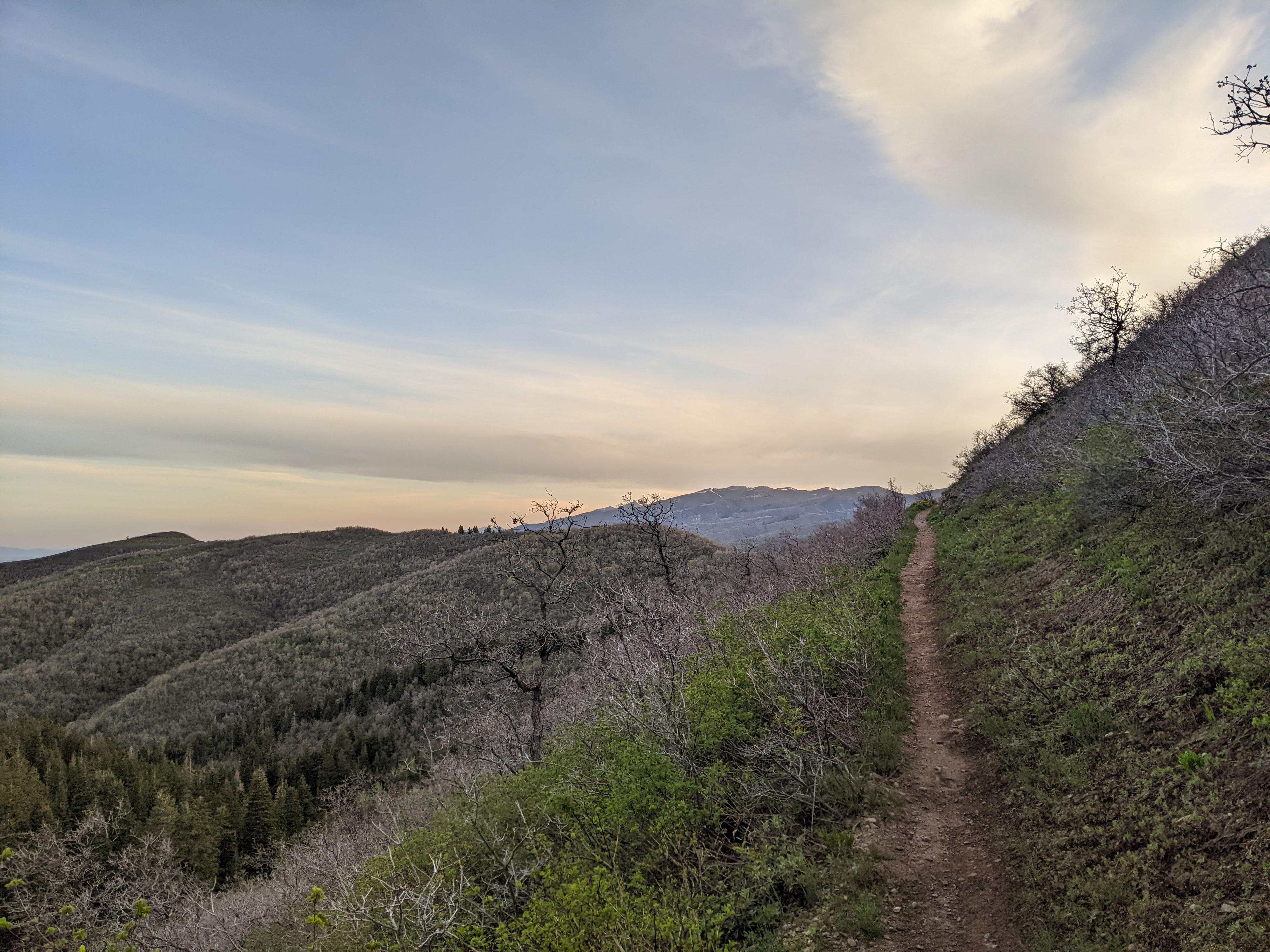
From Dude BM, go back to the main social trail and follow it just a few minutes to where it becomes an old road. Follow this old road as it heads west/south west. There are a few side trails and old junctions. Stay on the most used path close to the City Creek Canyon rim.
The road has a bit of up and down, but is much flatter than the previous ridge section and hikes quickly. The next goal, after Dude BM, is to reach a radio facility high on the ridge overlooking the valley. This is about 3.5 miles south of Dude BM.
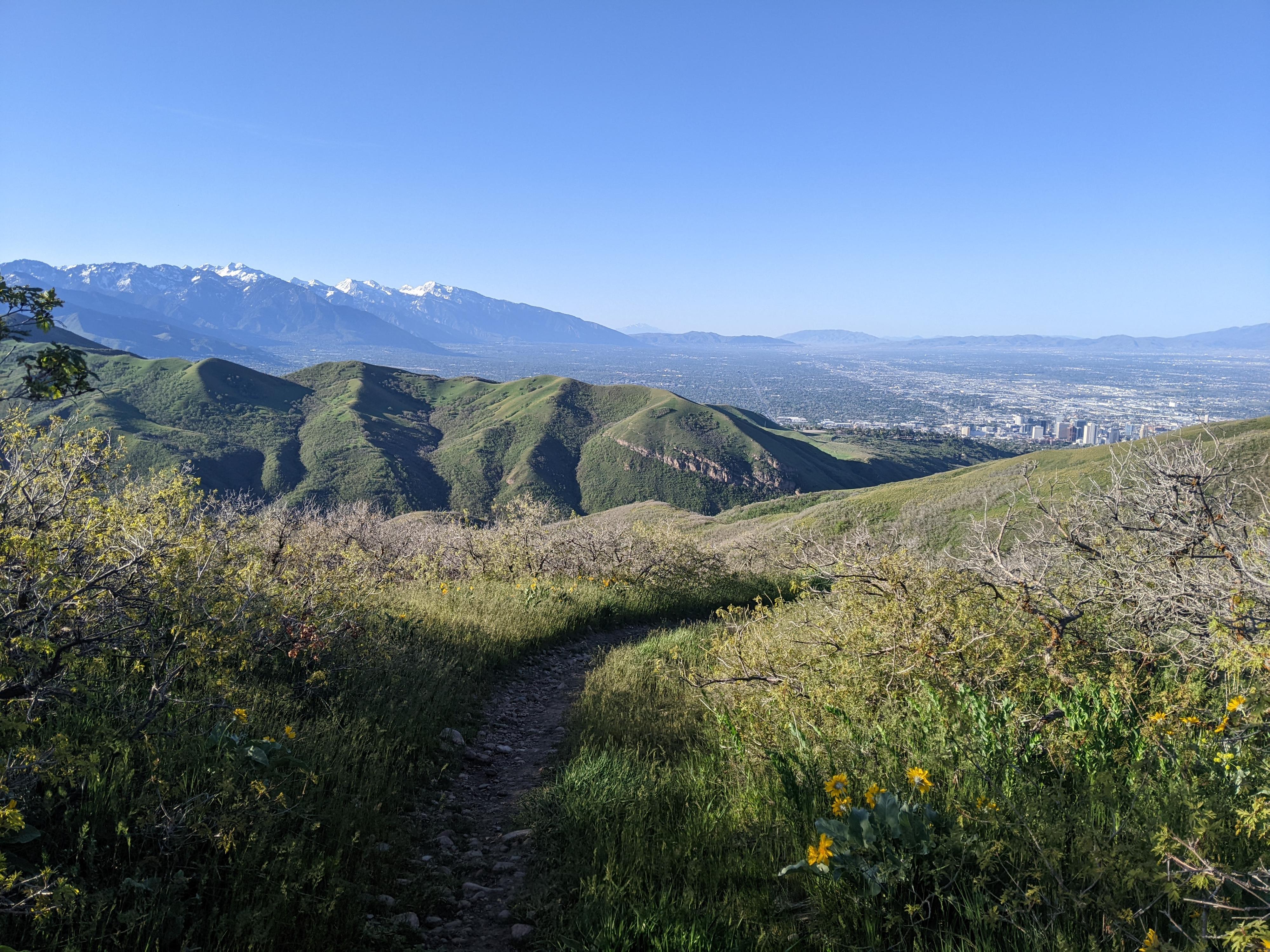
To Ensign Peak TH (about 1.7 miles)
At the radio facility, the route gets tricky and requires some route finding. At the tower, a trail leaves on the left (south/southeast side) that works down the ridgeline. Follow this old road that is now a trail as it works down the ridgeline. It climbs briefly, then descends again. After a third section of descent, part of the Bonneville Shoreline Trail leaves on the left. Don’t take this! Instead, continue along the ridge as it descends yet again, this time with the Ensign Peak marker clearly in view. You will intersect the Ensign Peak trail, go left, following this wide and well-worn trail down to the trailhead.
Maps

12T 428068E 4522041N
40°50'47"N 111°51'12"W
12T 429767E 4521517N
40°50'30"N 111°49'59"W
12T 431103E 4521184N
40°50'20"N 111°49'02"W
12T 431352E 4521222N
40°50'21"N 111°48'51"W
12T 431546E 4521264N
40°50'22"N 111°48'43"W
12T 429377E 4520297N
40°49'50"N 111°50'15"W
12T 425695E 4517735N
40°48'26"N 111°52'51"W
12T 424858E 4516450N
40°47'44"N 111°53'27"W
12T 425061E 4516020N
40°47'30"N 111°53'18"W