 Hiking
Ferguson Canyon
Hiking
Ferguson Canyon
Wasatch Front
Overview
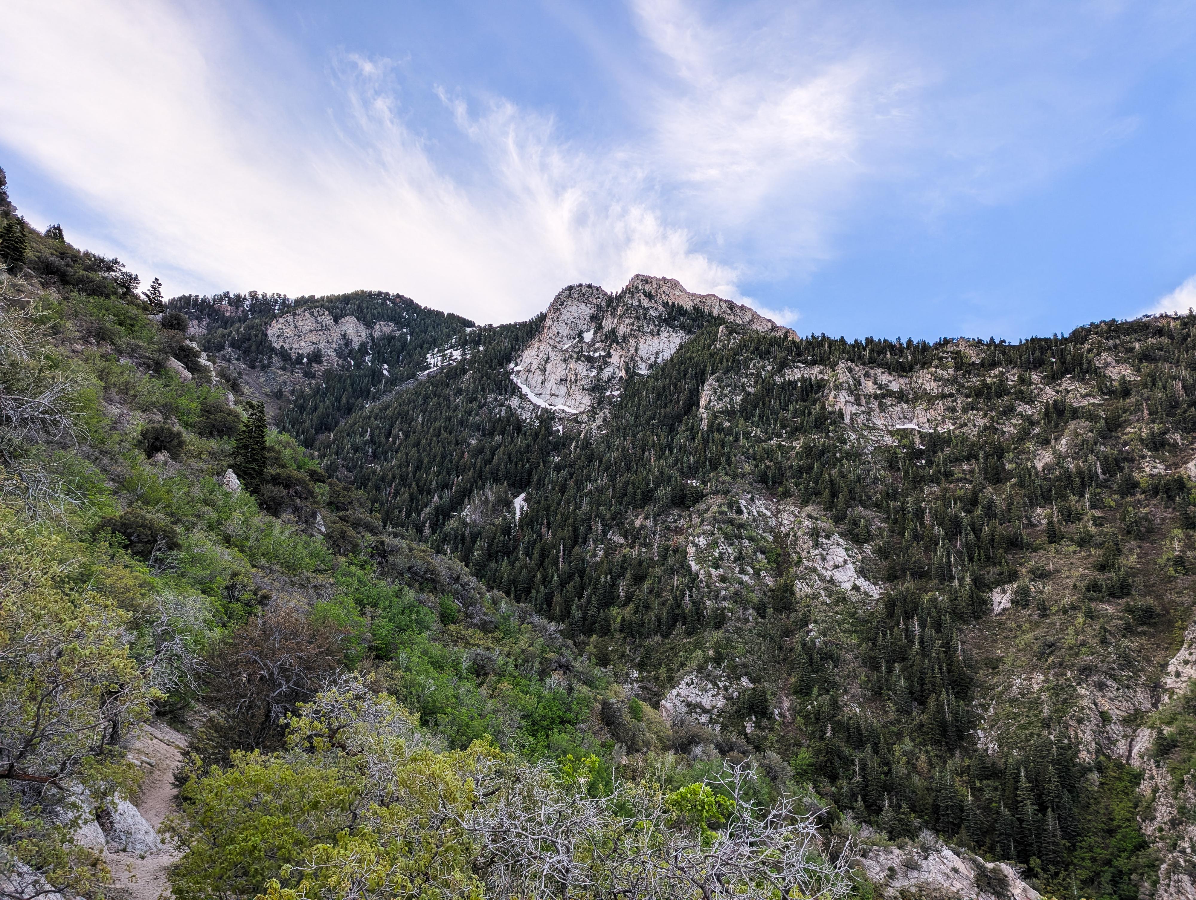
Ferguson Canyon is one of the lesser visited canyons along the Wasatch Front. Make no mistake, it is popular, but not nearly as trafficked as many of the trails in Big Cottonwood, Little Cottonwood, or Millcreek canyons. The canyon, just south of Big Cottonwood Canyon, is a steep granite-walled canyon with a small stream bubbling down from Twin Peaks and Storm Mountain high above. It is a lovely, shaded canyon to hike in and was one of my favorite places to rock climb back in the day.
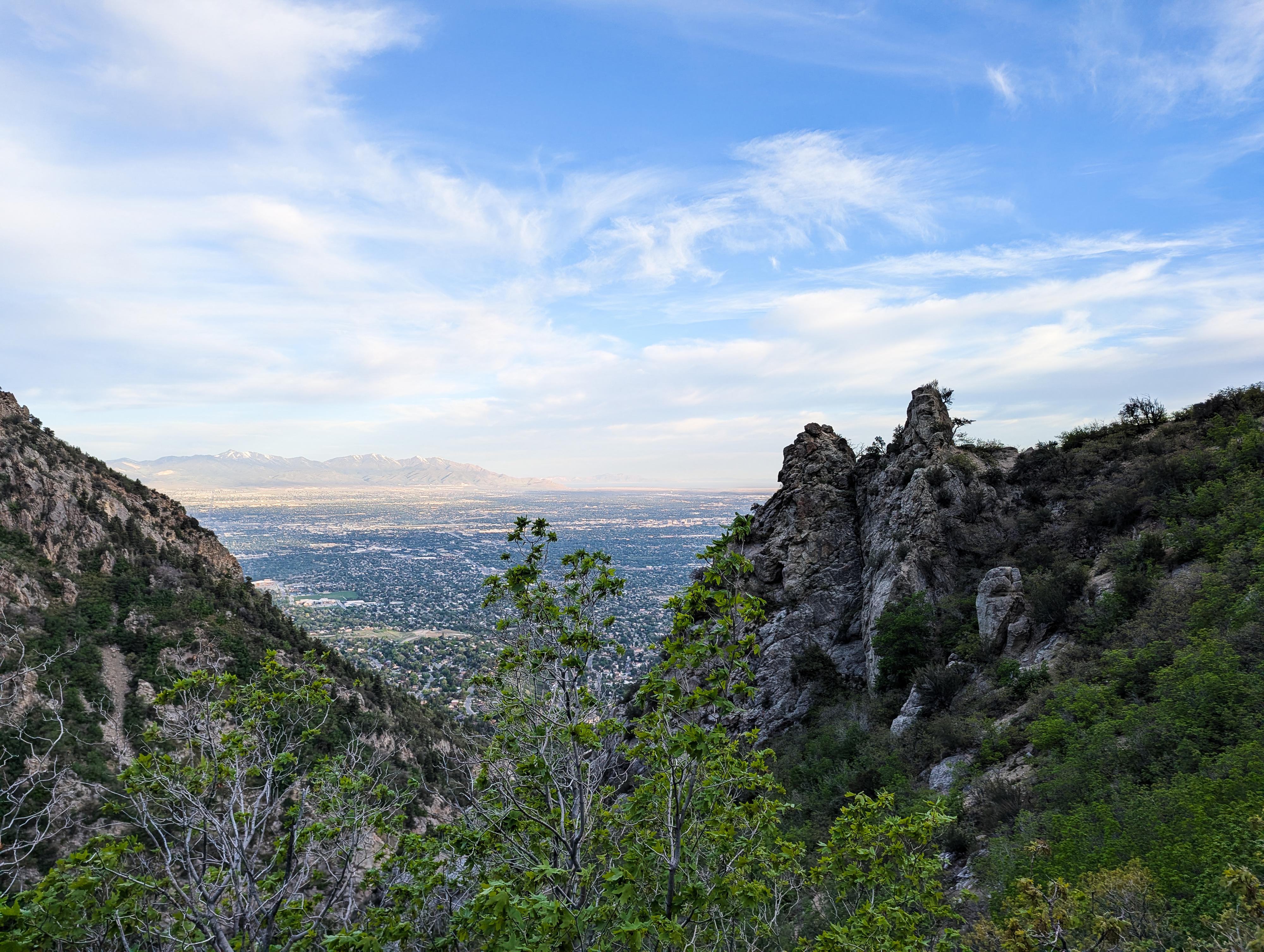
Hiking from the trailhead about 0.7 miles reaches the climbing area where sheer granite cliffs line the canyon. If you are looking for a short outing, this is a lovely one. The first part of the hike is exposed to the sun, but once in Ferguson proper, it is quite shaded and lovely. More motivated hikers can continue up Ferguson Canyon on a steep trail about 2 miles one way to an outstanding overlook of Big Cottonwood Canyon and the Salt Lake Valley. The overlook is definitely my recommendation for a good 1/2-day outing. The trail continues higher up the drainage to about 9,000' in elevation for those looking for more distance.
Getting There
Ferguson Canyon is on the east side of the Salt Lake City Valley. Get there by taking I-215 to the east, taking exit 6 off the interstate, and heading east.
Follow 6200 South, which becomes Wasatch Blvd, for 1.8 miles to the stop light and signs for Big Cottonwood Canyon. Continue straight at this light, toward Little Cottonwood Canyon.
0.3 miles past the light and Big Cottonwood Canyon, turn left (east) onto Prospector Drive, the first road on the left after the light. It enters a neighborhood and immediately comes to a T. Go right.
There are signs for Ferguson Park from here. It is about 0.1 to where Ferguson Park is on the right. This is the overflow parking if needed. Continue on Prospector Drive about 0.2 miles more to Timberline Drive. Turn left onto Timberline Drive and follow it a few hundred feet to the Ferguson Canyon Trailhead and two small parking areas on the right.
Route Description
From the trailhead, follow the dirt road to the large water tank when the road becomes a trail. Follow the trail as it makes a switchback down the hillside and comes to a major junction about 1/3 of a mile from the trailhead. Left is part of the Bonneville Shoreline trail and heads to Big Cottonwood Canyon. Go right instead.
The trail heads up Ferguson Canyon, passing a Wilderness Boundary sign in a few minutes. The canyon narrows as steep granite cliffs begin to line the canyon. This is a stunning area!
The trail stays on the right side of the creek through this section, with some smaller side trails going to climbing areas. Stay on the main trail; it reaches its first crossing at the base of a tall cascade. From this first crossing, there will be 2 more. These, except in very high water, are generally passable with dry feet and strategic steps on rocks.
The route steepens as it climbs the drainage. About 1.25 miles from the trailhead, the trail makes a left and begins climbing up and away from the stream. The trail makes a few switchbacks before reaching a final junction about 1.7 miles from the trailhead. Go left here as the trail levels out and traverses around to the overlook of Big Cottonwood Canyon, then ends. If you go right at the final junction, the right-hand trail continues up Ferguson Canyon another 2 or so miles to about 9,000' in elevation to where the trail ends in the meadow below Storm Mountain.
Return the same way.
Photos
Maps

12T 433322E 4495797N
40°36'37"N 111°47'17"W
12T 433632E 4496165N
40°36'49"N 111°47'04"W
12T 434799E 4495862N
40°36'40"N 111°46'15"W
12T 434751E 4496038N
40°36'45"N 111°46'17"W