 Hiking
James T. Saban (High Park Lookout)
Hiking
James T. Saban (High Park Lookout)
Bighorn Mountains
Overview
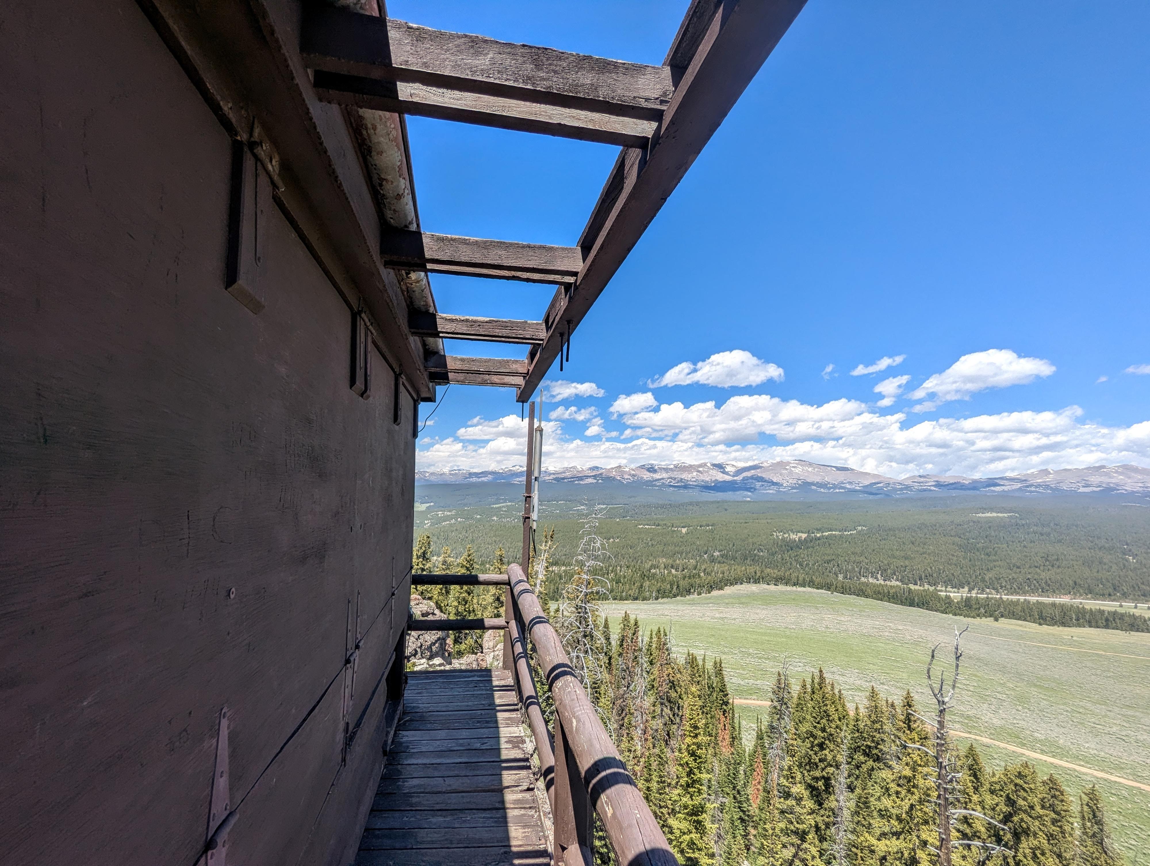
Perched at 9,477' in the heart of the Bighorn National Forest, the James T. Saban Lookout has sweeping views of the alpine scenery. This is a stone's throw from the highway between Ten Sleep and Buffalo. As one of three lookout towers in the Bighorn Mountains, I thought it was an interesting side trip while in the area and worth the short hike.
Reaching the tower requires a short but steep half-mile trek up Trail #070. I would rate it suitable for most, though it is a bit steep.
In 2015, the lookout was officially renamed to honor James T. Saban, a dedicated Wyoming forest ranger and CCC foreman who tragically lost his life alongside 14 other men during the historic 1937 Blackwater Fire.
FIRE LOOKOUTS
Fire detection and suppression have been priority work for the United States Forest Service from its beginning in 1905.
In the 1920s and 1930s, the Forest Service began building access roads, communication systems, and received equipment and manpower to effectively control fires. Suppression however, still depended on early detection. In the technology of the time, this required manned lookout stations on most National Forests.
The Civilian Conservation Corps built several fire lookouts in the Big Horn Mountains. Three of these remain today, but are only manned in seasons with the highest fire danger levels.
This is one such station. The lookout was the summer home of an individual or couple who kept watch for and reported signs of fire. They also had time for wildlife watching, and during summer storms watched spectacular natural "fireworks" as lightning struck the surrounding peaks. The station stood protected by grounded points that drained the static electricity from the lookout.
Getting There
At about milepost 48.4, signed St. Christopher's Chapel, turn south on the dirt road. Stay straight on this good, graded dirt road. At about 1 mile from the pavement, a major junction is reached. Go right, as the road bends and climbs to the trailhead 1.4 miles from the paved road.
Route Description
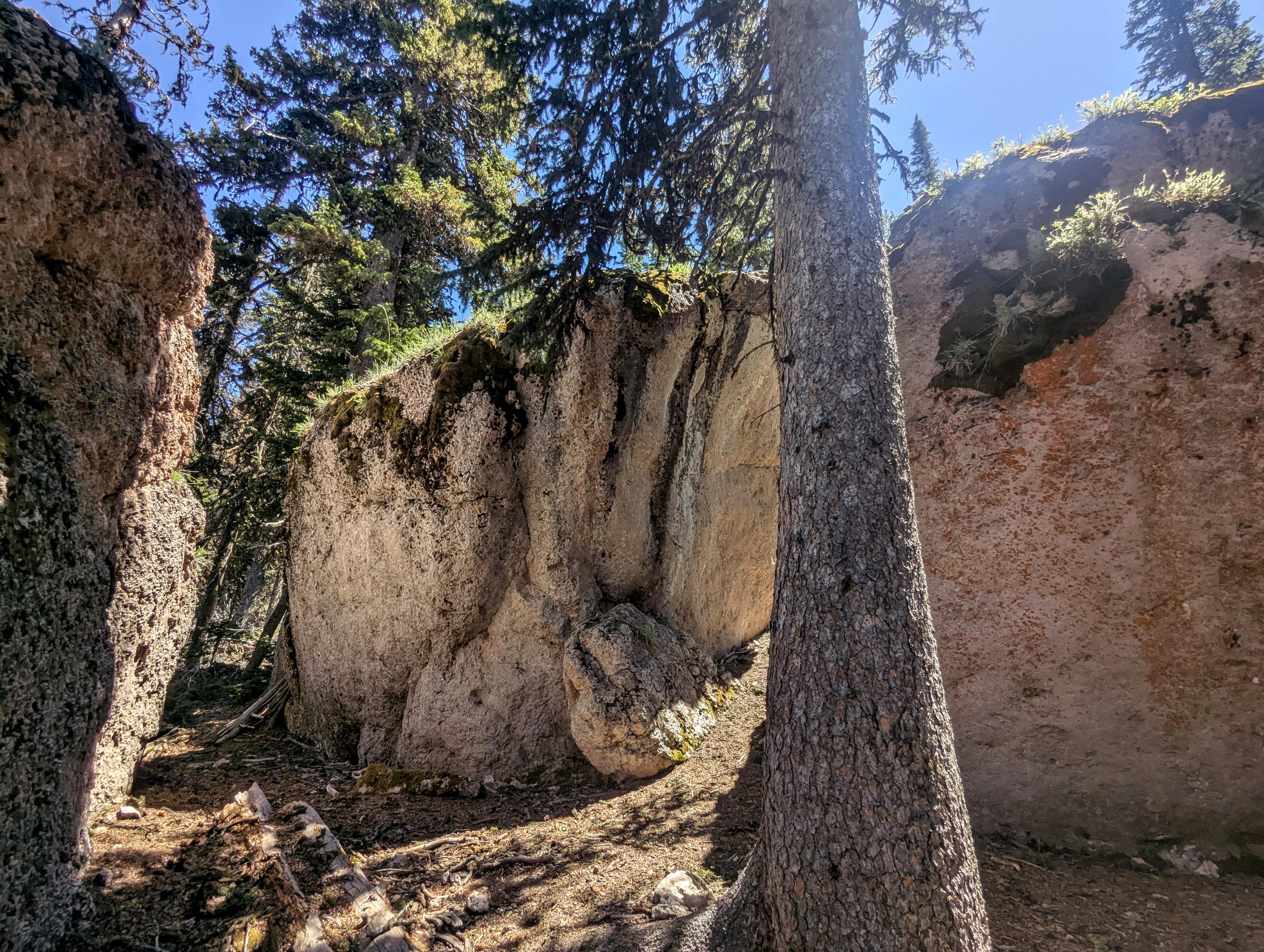
From the trailhead, follow the obvious, well-maintained trail as it meanders up through the forest, passing among some massive boulders en route and climbing a set of steps before reaching the lookout.
The trailhead sign says it is a 15-minute walk, which seems about right for most. By my device, it is about 0.4 miles and about 250 vertical feet of elevation gain.
The views from the top of the surrounding mountains and Meadowlark Lake to the west are spectacular. I couldn't quite pick it out, but I assume the Sheep Mountain Fire Lookout is likely visible if you know where to look and have binoculars.
Maps
13T 323944E 4891020N
44°09'04"N 107°12'05"W
13T 323871E 4890815N
44°08'58"N 107°12'08"W