 Canyoneering
Spry Canyon
Canyoneering
Spry Canyon
Zion Main Canyon
Overview
Spry is one of the popular and classic Zion canyons. This is one that it often done by beginners and intermediates getting started in their canyoneer careers. It has a bit of a rough approach, many rappels, and a couple of tricky downclimbs. Beginners should have competent leadership. In the summer, start very early, the approach and exit are HOT!
Given its popularity, Spry is one of those canyons that didn't make much of an impact on me. I found it fairly ho-hum, but possibly because I had done most of the other classic Zion canyons first (including Imlay the day before). I would recommend it, but not nearly as highly as I would recommend some of the other classics like Pine Creek , Mystery Canyon, or Echo Canyon.
This is also a canyon that I think fitness and experience both matter when it comes to how long it will take. From the feedback I have gotten, most experienced groups with moderate fitness will be in the 5-7 hour range. On the other end, beginners, larger groups, and those will less fitness have taken substantially longer. I know of at least one group that took over 12 hours!
Getting There
Exit Trailhead
From the west side park entrance (the main entrance near Springdale), follow highway 9 into the park. Stay on highway 9 at the junction at 1.4 miles from the park entrance, and park at 1.8 miles, where the highway makes its first switchback on the way up to the tunnel.
Trailhead
From the exit trailhead, follow the highway up and through the tunnel. Once through the tunnel, continue an additional 0.4 miles to a pullout on the left side of the road. (This is about 6.5 miles from the park entrance.)
Route Description
Approach (1-1.5 hours)
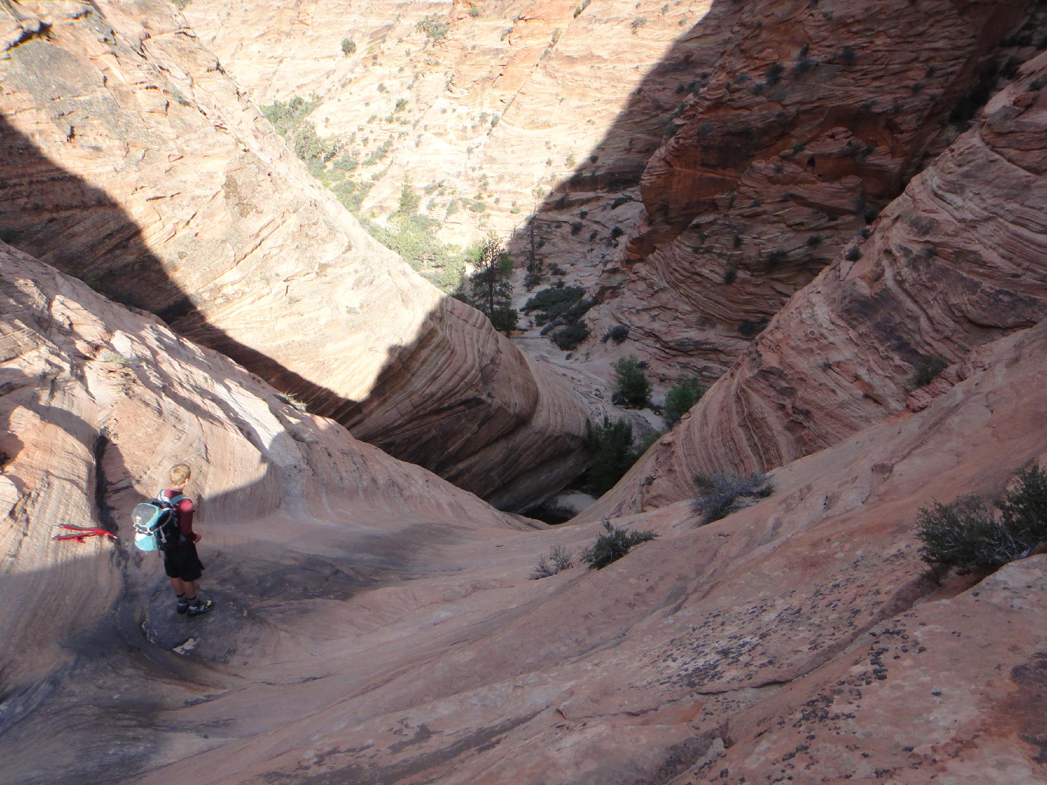
From the parking area, head north up the drainage. A use trail makes this easy. After about a half mile (10-15 minutes, before the drainage begins to narrow), the trail leaves the drainage and begins climbing up the slopes on the left. This starts out easy, but gets a little steeper the higher you go. Follow it up to a bench, then follow the bench north west to a bowl. Work up the bowl to the pass. Phew! The impressive mountain to the north is Deertrap Mountain.
At the pass, go right and down to the narrow slot. Follow the slot down until it is easy to descend the slabs to the bottom of Spry Canyon.
Canyon
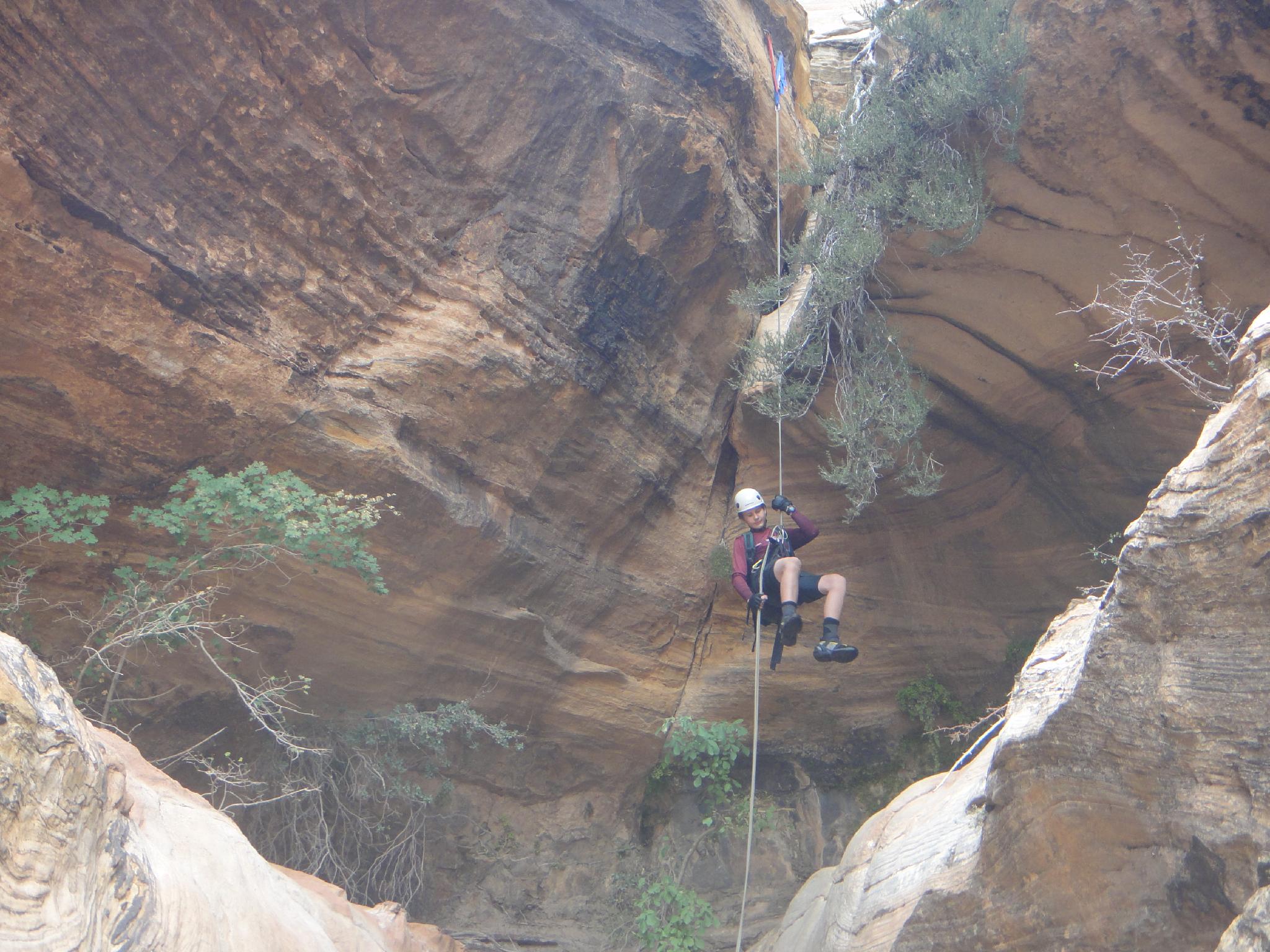
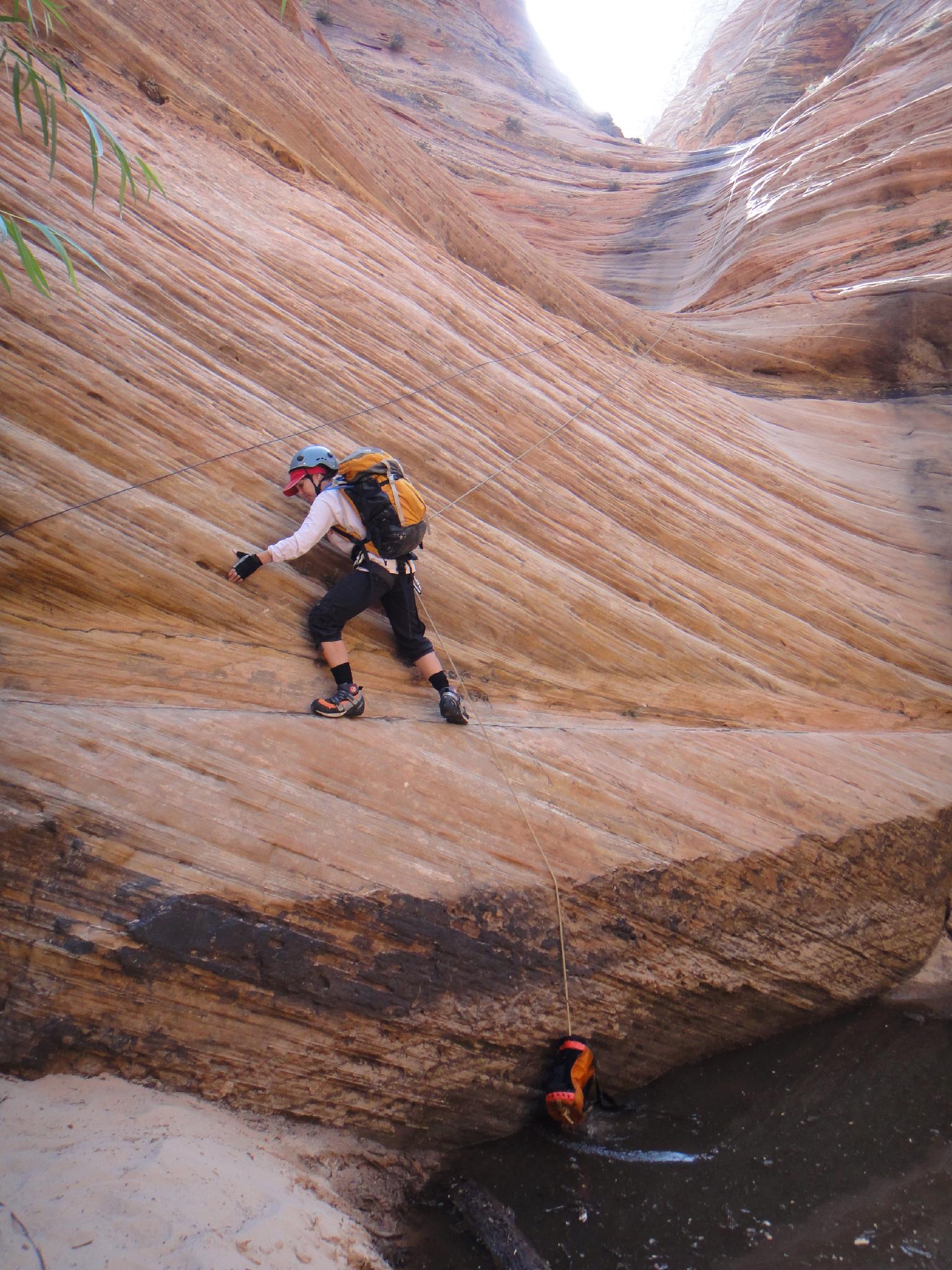
The hard part is over. Heading down canyon, it is 10 minutes to the first rappel.
R1 - 50 m ( 165 ft. ) down the slab. This is the biggest rappel of the day.
R2 - The canyon slots up and drops. Take the trail on the left and rap 15 m ( 50 ft. ).
R3 - A short 6 m ( 20 ft. ) drop can be downclimbed or rappelled.
R4 - Rappel of about 15 m ( 50 ft. ) into a slot.
R5 - A fairly big 30 m ( 99 ft. ) drop.
R6 - From chockstone 15 m ( 50 ft. ), followed quickly by R7.
R7 - 15 m ( 50 ft. )
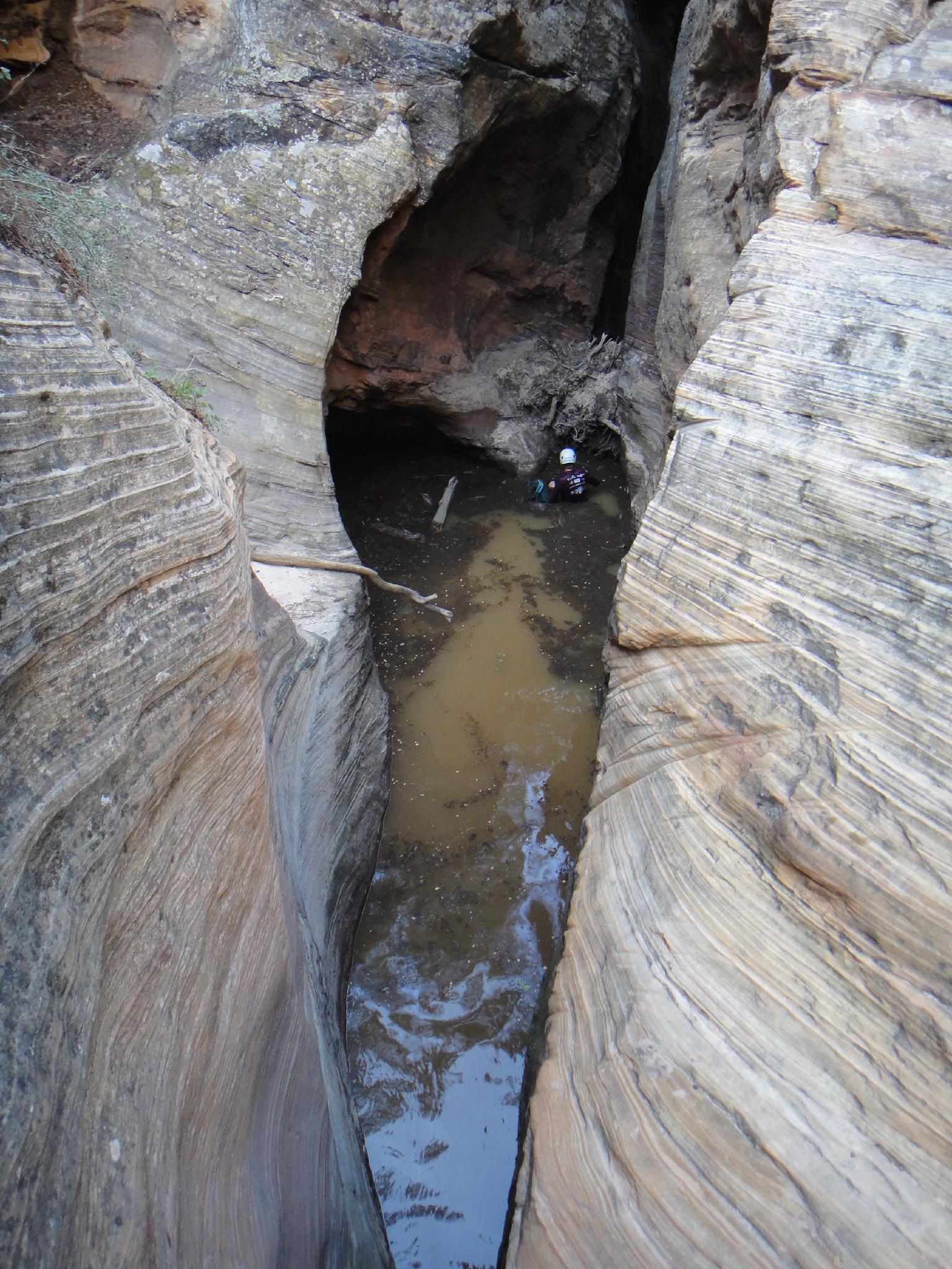
R8 - 15 m ( 50 ft. ), continue the rappel past the pool 1/2 way down.
R9 - 15 m ( 50 ft. )
R10 - 20 m ( 66 ft. )
R11 - 20 m ( 66 ft. ) the canyon is now open. Social trails avoid the next and final rappel, but please stay in the watercourse and do the final rappel to avoid further erosion.
R12 - 32 m ( 105 ft. ) down the cliff face.
Exit (20-40 minutes)
From the bottom of the final rappel, it is a short boulder hop down to Pine Creek. Once at Pine Creek, follow the social trail on the right to the exit trailhead.
Photos
Videos

Spry Canyon
Maps

12S 328220E 4120532N
37°12'56"N 112°56'10"W
12S 326926E 4121603N
37°13'30"N 112°57'03"W
12S 326074E 4121010N
37°13'10"N 112°57'37"W
12S 325610E 4120700N
37°12'59"N 112°57'56"W