 Canyoneering
Mystery Canyon
Canyoneering
Mystery Canyon
Zion East Side
Overview
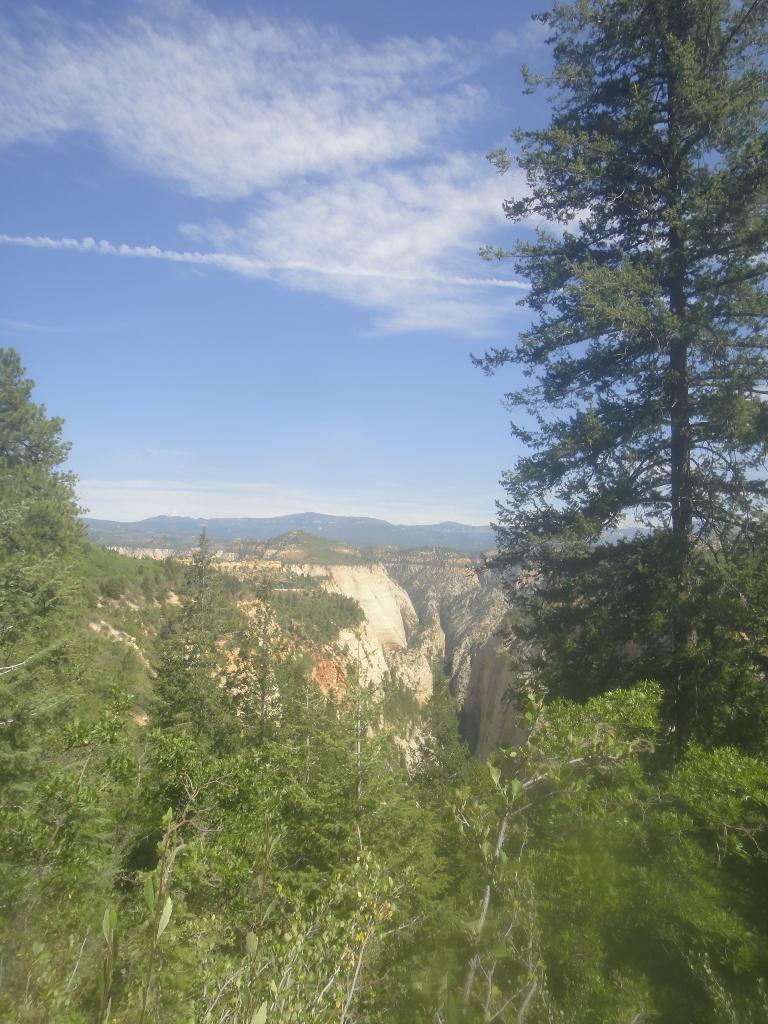
Mystery Canyon is touted by some as the best canyon in Zion, or at least their personal favorite. Perhaps I'm contrary, but I would rate Mystery fairly far down my personal list of favorite Zion canyons. It is likely rated a "classic" because the last rappel, into the Narrows, is scenic and almost always has a large group of tourists to cheer you down, giving it a unique ambiance.
The canyon itself is pretty and offers a short bit slot, a couple of scenic rappels, and even a cold swim or two. A good intro to Zion. Navigation is very straightforward, though a few groups have messed it up over the years, and anchors are all equally pretty straight forward, making it a beginner friendly canyon. The hardest part about Mystery these days is getting a permit. Be sure to apply early, the canyons popularity often makes a permit difficult to get.
If starting at the East Mesa Trailhead, you will need a car shuttle, leaving a car at the Visitor Center and riding the shuttle bus from the Temple of Sinawava back to the Visitor Center at the end of the day.
Getting There
Weeping Rock Start (No Car Shuttle Needed)
The trailhead is the Weeping Rock bus stop in the main Zion canyon. Only accessible via park shuttle in the Spring, Summer, and Fall.
End
The route ends and the Temple of Sinawava, also only accessible via park shuttle in the Spring, Summer, and Fall. Be sure to complete the route before the last shuttle of the day. This varies depending on season, but is usually after dark and hard to miss with a decent start in the morning.
East Mesa Trailhead
If doing Mystery with a car shuttle, the trailhead is the East Mesa Trailhead.
The first step is to get to the North Fork Road, which starts 2.2 miles east of the east entrance of Zion National Park on Highway 9. It is signed.
Route Description
Weeping Rock Approach (2-2.5 hours)
The big grunt! Head up the Observation Point trail. In about 15 minutes, it splits, with Hidden Canyon going off on the right. Stay left on the Observation Point trail. At 45 minutes, the trail flattens out as it enters Echo Canyon that can be a nice respite from the heat. The trail crosses Echo and begins climbing the north side.
Stay on the trail as it climbs out of Echo and contours along its rim. A bit over an hour another junction is reached, this one is signed Cable Mountain/Deer Trap. Stay left on the main Observation Point Trail. The trail steepens again and switchbacks up to the top. Once it flattens out, one more junction is encountered. Left got to Observation Point, stay right, watching the map carefully. In 20-30 minutes, the head of Mystery is reached. A huge cairn usually marks it. One minute off the trail and the deep head of Mystery should be visible with a steep dirt slope heading down.
East Mesa Approach (45-60 minutes)
From the East Mesa Trailhead, follow the East Mesa Trail 2.1 miles. Picking out the top of Mystery is a bit tricky from this direction. GPS recommended you do NOT want to drop into the wrong drainage. A large cairn on the right side of the trail generally marks the spot, where you need to leave the East Mesa Trail. One minute off the trail and the deep head of Mystery should be visible with a steep dirt slope heading down. If the East Mesa Trail turns south with a side canyon visible on the left, you have gone too far. Expect 45-60 minutes on the approach at a good pace.
Canyon 3-5 hours
Look for a use trail on the right that heads down into the canyon. It is steep, but well traveled. Follow it down to the first obstacle, a short rappel.
A couple more short obstacles (less 5 m ( 17 ft. )) are encountered that may be rappelled or downclimbed before the canyon makes a hard left and slots up. This is the start of the goods.
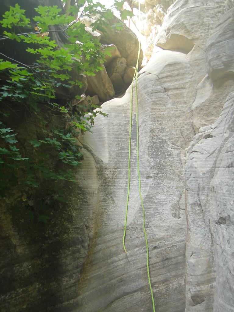
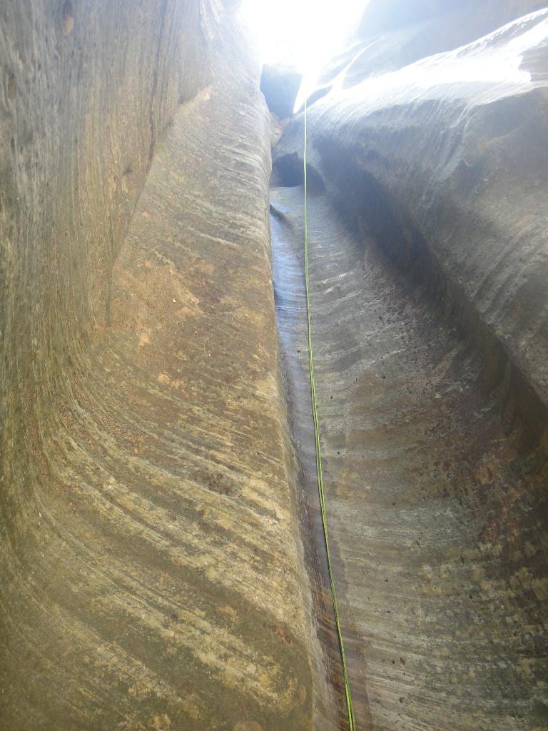
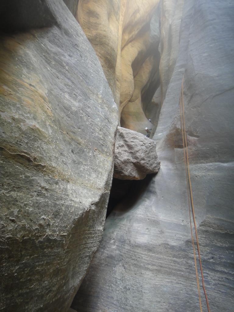
The first slot section
The rappel into the slot section is about 15 m ( 50 ft. ), followed immediately by 7 more rappels that are less than about 15 m ( 50 ft. ). After the last of these rappels, the canyons opens. This first slot section is amazing, and a brief taste of what many other Zion slots hold.
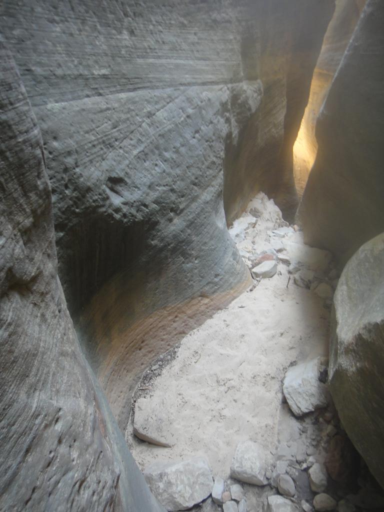
The middle
The canyon is open and easy going to where a landslide has created a lake. Cross the lake (which can be dry, but always seems to have water when I've done Mystery), and follow the trails up and over the landslide on the right.
A small 15 m ( 50 ft. ) is encountered in this section before the final series of rappels.
Mystery Springs
The canyon makes a left turn and drops 35 m ( 115 ft. ) into Mystery Springs, my favorite spot in the canyon. Stunning! The anchor is on the left and requires a bit of an exposed traverse to reach. A fixed line is often in place for safety, use it if it is there.
Rappel 35 m ( 115 ft. ) into the pool at the bottom of Mystery Springs. Be sure to go on the DOWN CANYON side of the chockstone to facilitate rope pull. Several people have stuck ropes on that chockstone, so be sure to pull with the rope angle away from the chockstone. Sometimes you can carefully traverse/swing around the pool to stay dry (or mostly dry), but many will take the plunge so be sure items are dry bagged before going in.
Just below Mystery Spring are a couple of short downclimbs and a pool or two before the canyon abruptly drops into the narrows.
The rappel into The Narrows is about 40 m ( 132 ft. ), and almost always has a mass of people at the bottom hiking up or down the narrows. Be careful not to drop anything over this rappel, and lower don't throw your ropes.
Exit (30 minutes)
From the bottom of the last rappel, head downstream. In just a few minutes, the paved River Walk trail comes in on the left bank. Exit the stream here and follow the throngs of tourists down the River Walk trail to the Temple of Sinawava and shuttle.
Photos
Videos

Descending Mystery Canyon, Pine Creek and Keyhole Canyon Zion
Maps

12S 331515E 4129483N
37°17'48"N 112°54'03"W
12S 328080E 4126743N
37°16'17"N 112°56'20"W
12S 328909E 4128652N
37°17'20"N 112°55'48"W
12S 328876E 4129235N
37°17'38"N 112°55'50"W
12S 327711E 4129830N
37°17'57"N 112°56'38"W