 Hiking
Jardine Juniper
Hiking
Jardine Juniper
Logan Canyon
Overview
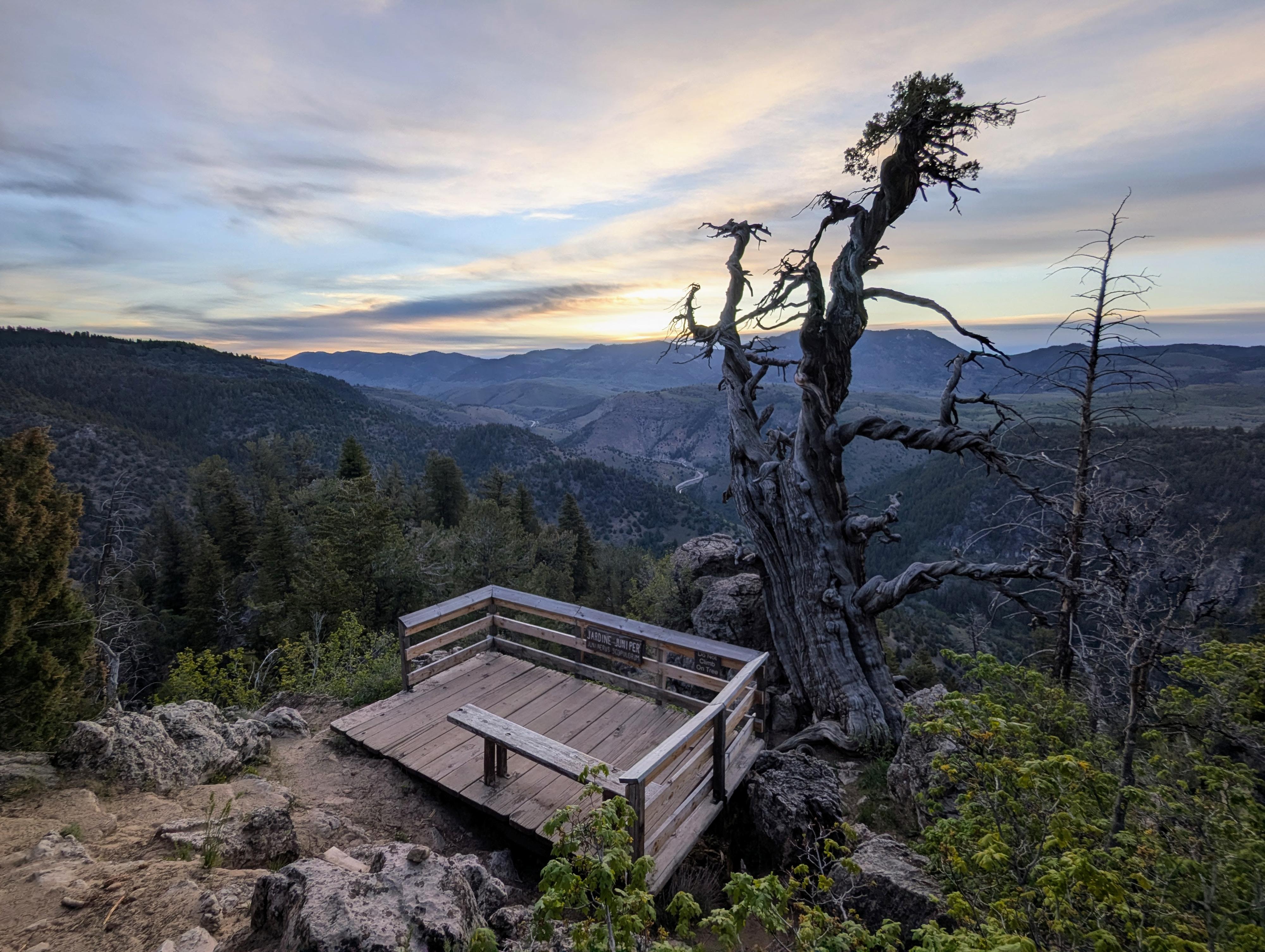
Tucked away high on a rocky ridge in Logan Canyon, the Jardine Juniper is the oldest-known Rocky Mountain juniper tree in the world. Discovered in 1923 and named after a former U.S. Secretary of Agriculture, this legendary tree is estimated to be around 1,500 years old. Though time and harsh weather have left it looking twisted and bare, it stands an impressive 40 feet tall with a massive trunk (and a little growth on the top).
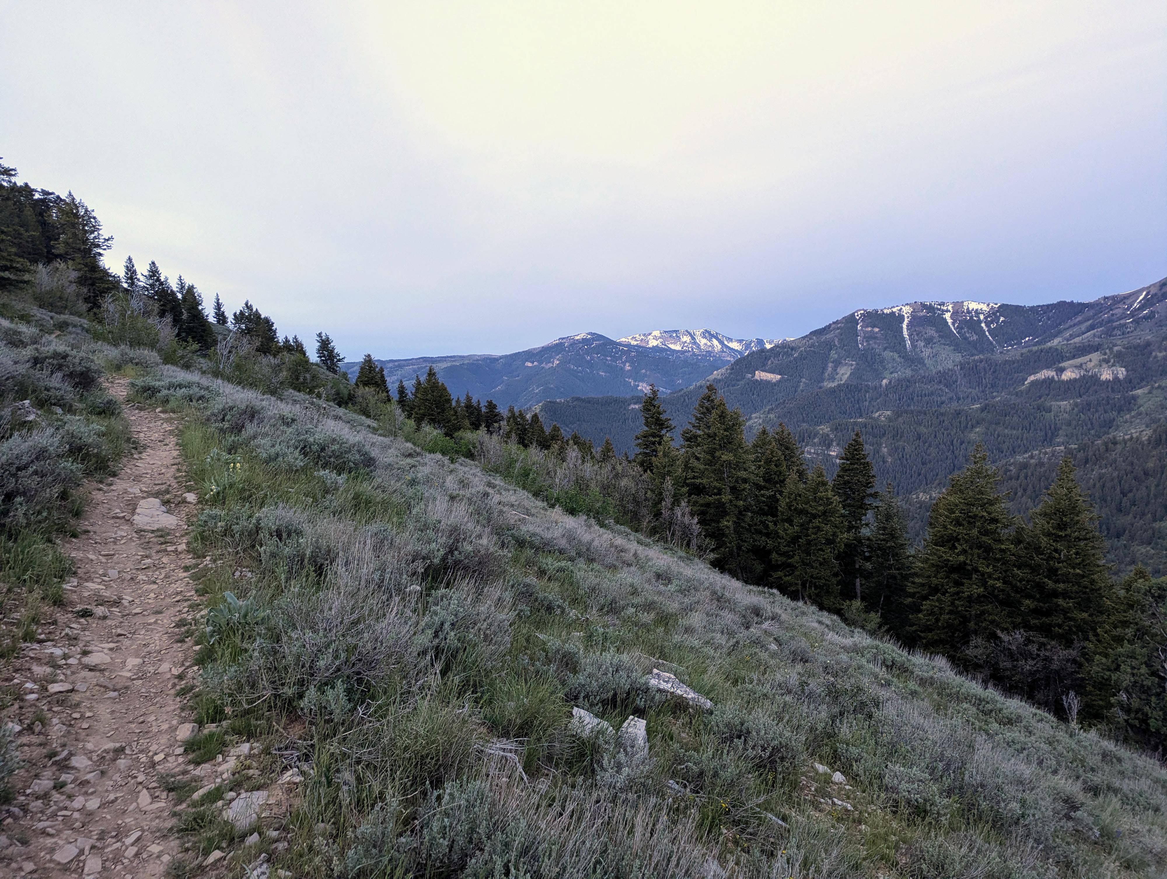
The standard hike to the tree is about a 10.5 mile round-trip outing with about 2,000' of gain. Though fairly strenuous, on my visits, I've also found the miles to pass easily. It is a hike I enjoy because it is long with open views and a relatively easy grade.
Getting There
The trailhead is about 10 miles up Logan Canyon on US-89 east from the canyon mouth at mile post 470.9. This is the same turnoff as the Wood Camp Campground. A wide side road leaves the highway, crosses a bridge, and goes a short distance to the trailhead. This last section is short, but surprisingly rough! If in a low clearance vehicle, I would conisder parking soon after the highway and walking the 100 or so yards to the trailhead. It is a short walk.
Route Description
Navigation is easy for this hike; head up the trail from the trailhead. Within a few minutes, a bridge crosses the stream. Above this, the trail braids a couple of times before reaching the Wood Camp Hollow side drainage and a second small bridge. At the braids, either works, but staying right on the most used trail is a little shorter. Stay right at Wood Camp Hollow on the main trail that continues up the wide, open drainage.
About 1.3 miles from the trailhead, the trail crosses back to the east side of the stream across a bridge. Not far after this, the trail begins to climb more steeply up long switchbacks to the ridge above.
One up, a trail junction is reached (about 3.5 miles from the trailhead). Left is the Cottonwood Trail. Go right here instead.
The trail now heads south, climbing a bit and reaching a junction about 0.7 miles from the Cottonwood Trail Junction.
Loop Junction
Decision time! The junction forms a loop. Right is signed the Scenic Way, and left is signed the Shady Way. I thought both were pretty and would recommend doing the full loop.
The Scenic Way trail is about 0.9 miles to the side trail to Jardine Juniper, while the Shady Side is about 0.65 miles to the Jardine Juniper Side Trail.
Jardine Juniper Side Trail
Once at the signed side trail to Jardine Juniper, the side trail descends several switchbacks about a 1/4 of a mile to Jardine Juniper proper and an informational sign. This spot has big views down into Logan Canyon. Return back up to the loop junction and either complete the loop or return back the way you came.
Photos
Maps

12T 446226E 4627472N
41°47'50"N 111°38'50"W
12T 446038E 4627593N
41°47'54"N 111°38'58"W
12T 446502E 4630694N
41°49'35"N 111°38'39"W
12T 446794E 4630137N
41°49'17"N 111°38'26"W
12T 447289E 4629460N
41°48'55"N 111°38'05"W
12T 447454E 4629542N
41°48'58"N 111°37'58"W
12T 445800E 4628085N
41°48'10"N 111°39'09"W
12T 445914E 4629024N
41°48'40"N 111°39'04"W